2025 Scandinavia
A Tour of Northern Sweden and Norway….and a wedding

Day 1 Home – Beauvechain (B)
Saturday 17th May
Up at 5.45 and leave the house 6.15. Apart from the dazzle of the rising sun, we had a good journey to Dover arriving just after midday. We were offered an earlier ferry to Calais but decided to wait for the ferry at 2.pm. Once on board we sat at the front of the boat in the cafe. Here in the sun and watched the French coast approaching. It was very chilled.
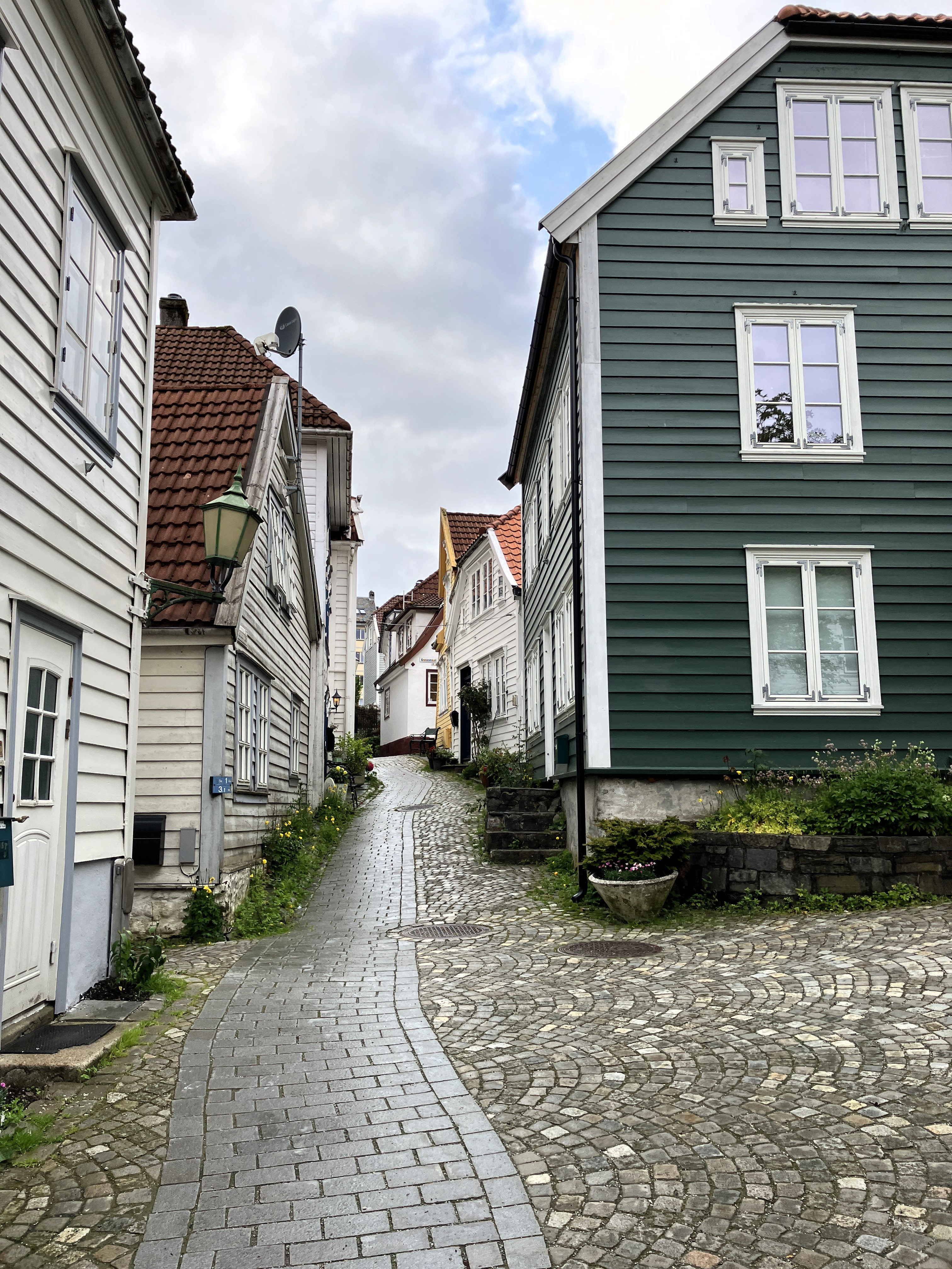
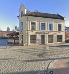
We got off the boat without any problems. We arrived at our previously used Park-4-Night (P4N) area in the village of Beauvachain around 7pm. There were no other campers in the small car park just a market type tent. We parked in one of the camping car bays and walked straight to the Bar La Renaissance.
It was smoky outside from the cigarettes of customers. We went in to a busy bar restaurant with lots of locals eating and a lovely atmosphere. We are unsure whether to speak Walloon or French. We see that the menu is in French. Speaking French seems like a good bet.

A good meal, pork knuckle and scampi cassoulet.
As the sun set, we walked around the lanes. We were amazed at the variety of old, new, and architecturally designed large buildings. There is also a modern horse riding centre.
Back at the van we spent time sorting the toilet and getting used to the van etiquette before sleeping.
Day 2 Beauvechain – Middelfart (DK)
Sunday 18th May
It was an all right night. We were both pleased that we didn’t have to go outside. Using the loo had worked fine.
The weather was grey and it was raining slightly as we packed up within the constraints of the van. We drove back towards Brussels and then north to Leuven. Finally, we turned northeast through the Netherlands.
As we drove into Germany, the SAT NAV map in the van disappeared. We realised that the guy who had uploaded the updated version had only put on Central Europe!!
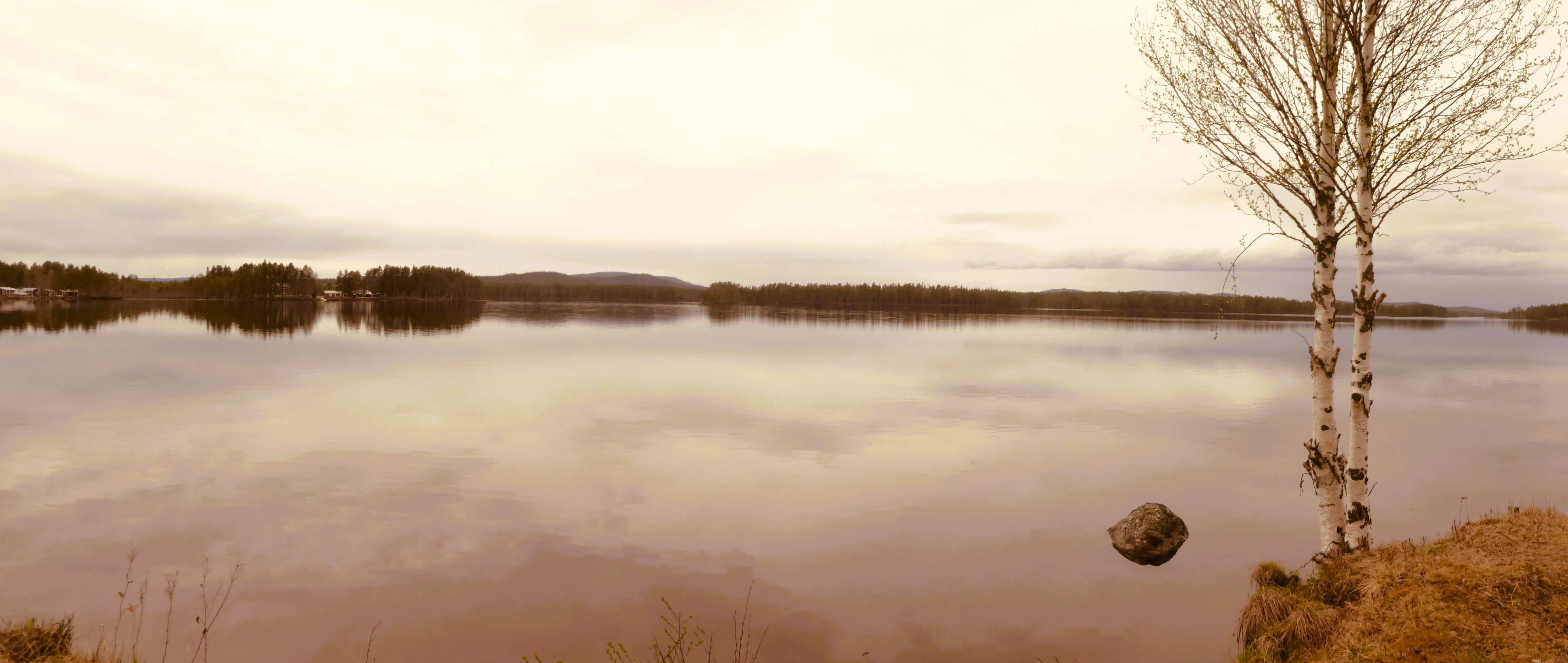
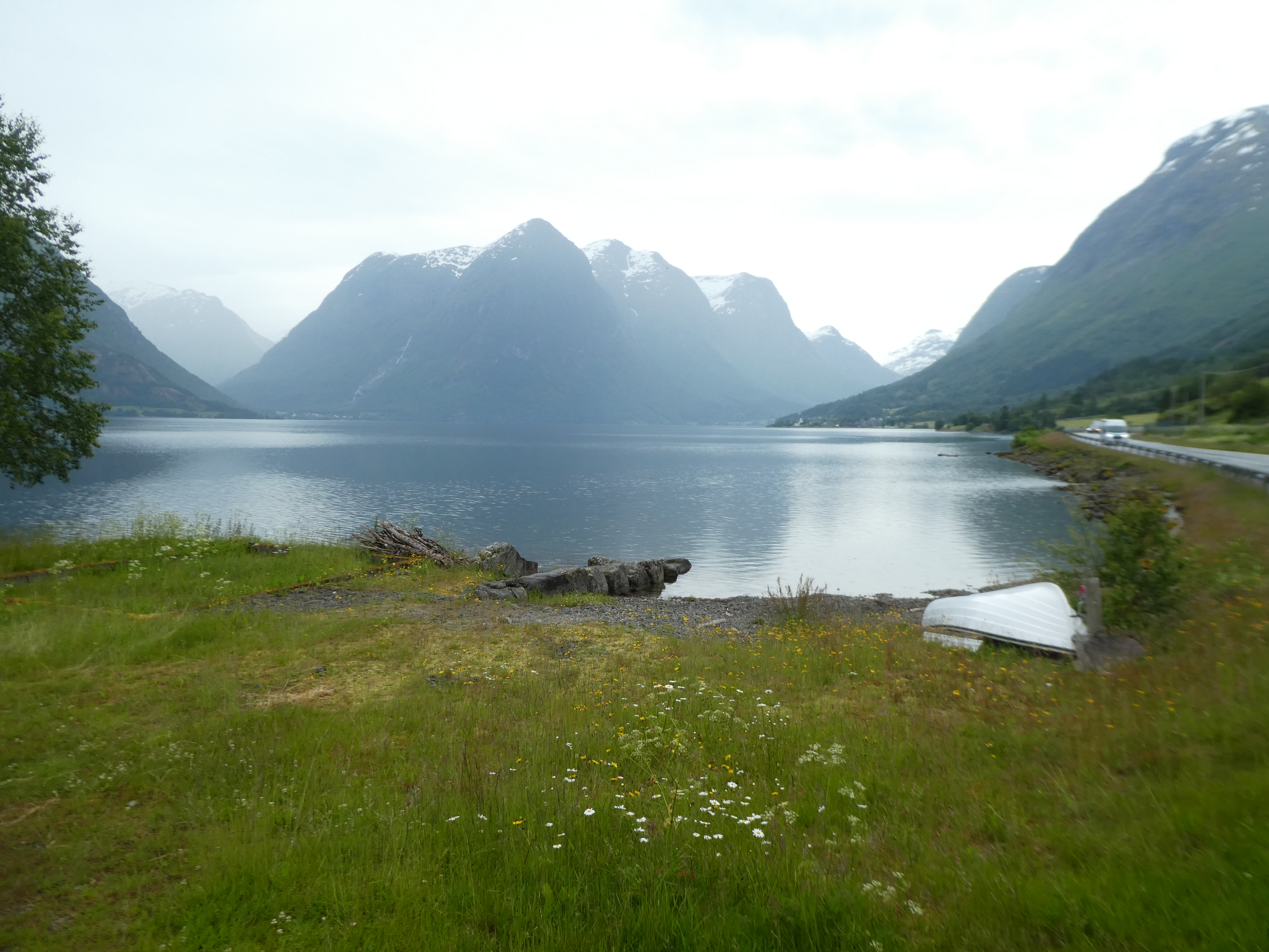
We had two phones using Google Maps. This helped us cope with the German conurbation around Essen and Dortmund. We eventually reached Brennan around 2pm. There, we had a quick walk by the lake where we had camped many years before. For lunch we ate some bread and cheese in the van.
The journey had been busy and we still hadn’t got past Hamburg! We set off again slightly revived. We were heading away from Bremen when a serious accident occurred a few hundred metres in front of us. This accident brought the traffic to a standstill.
Ambulances, police vehicles, and breakdown vehicles rushed through the solid lanes of traffic. This made it obvious that we were going to be there for a considerable time. Two hours later, as we moved slowly forward, the sight was sobering. We saw an old motorhome lying on its side with other knocked cars.
The journey on to Hamburg was not too bad after that. However, crossing the river and going through the centre took time.
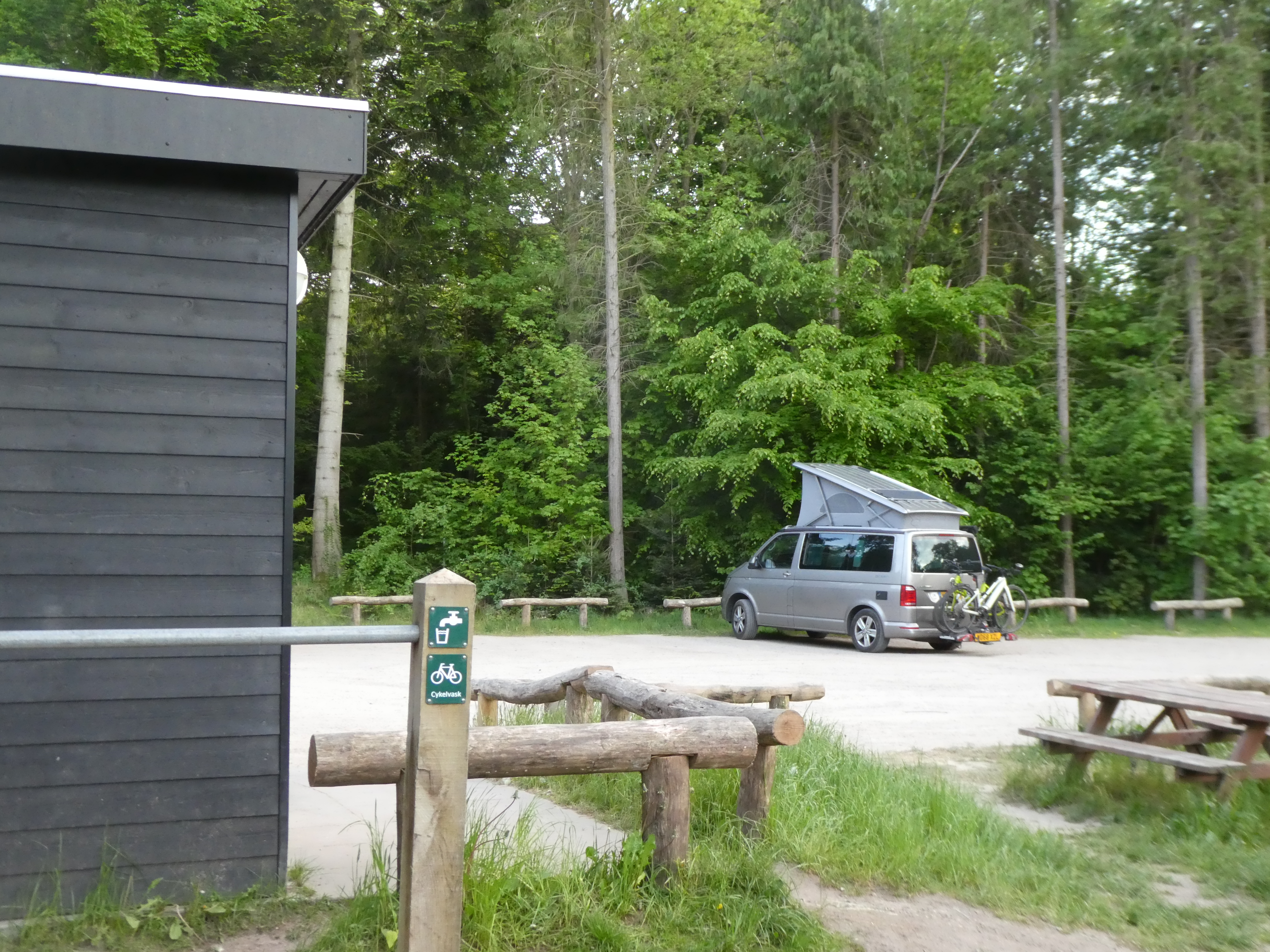
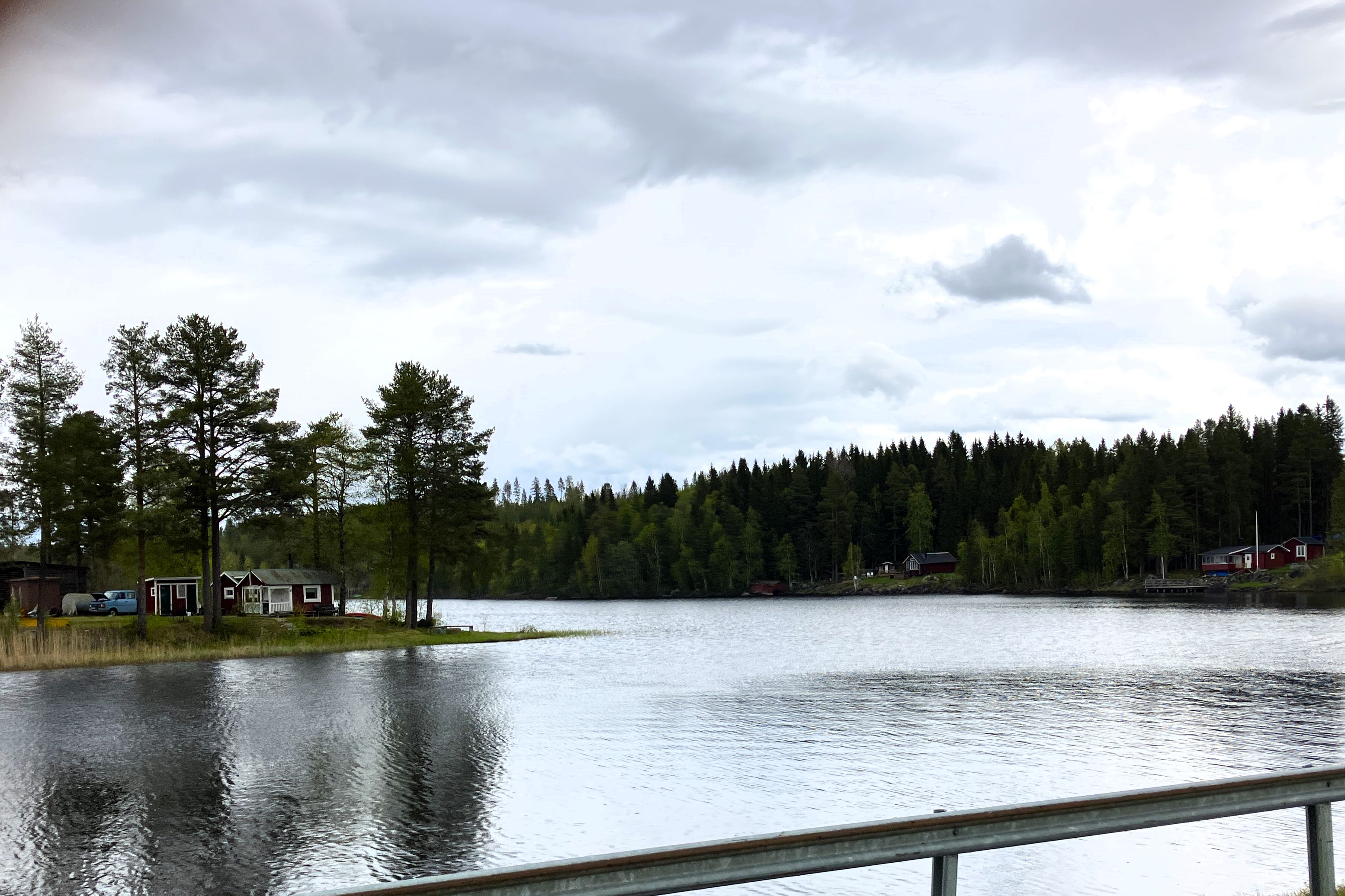
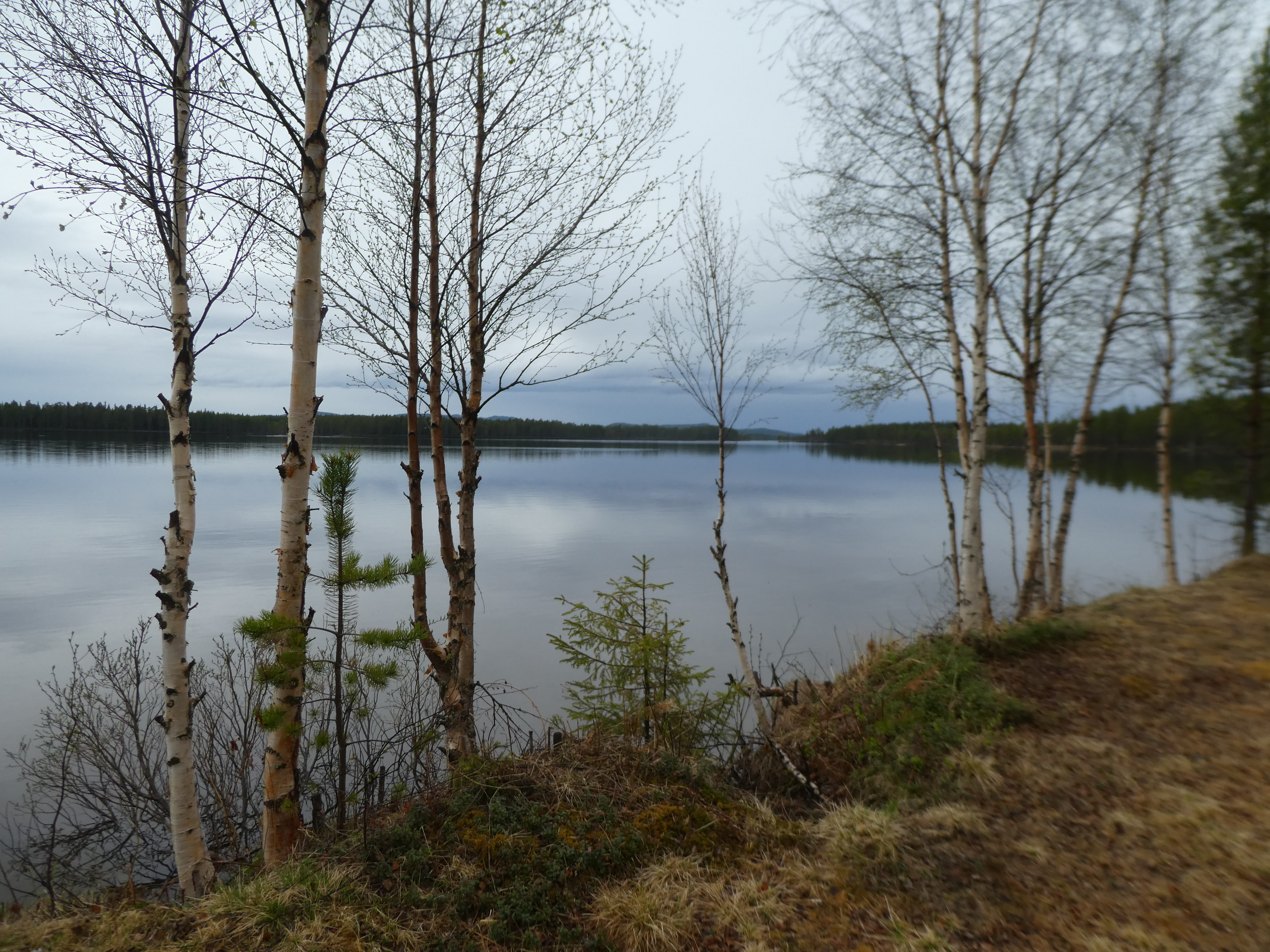
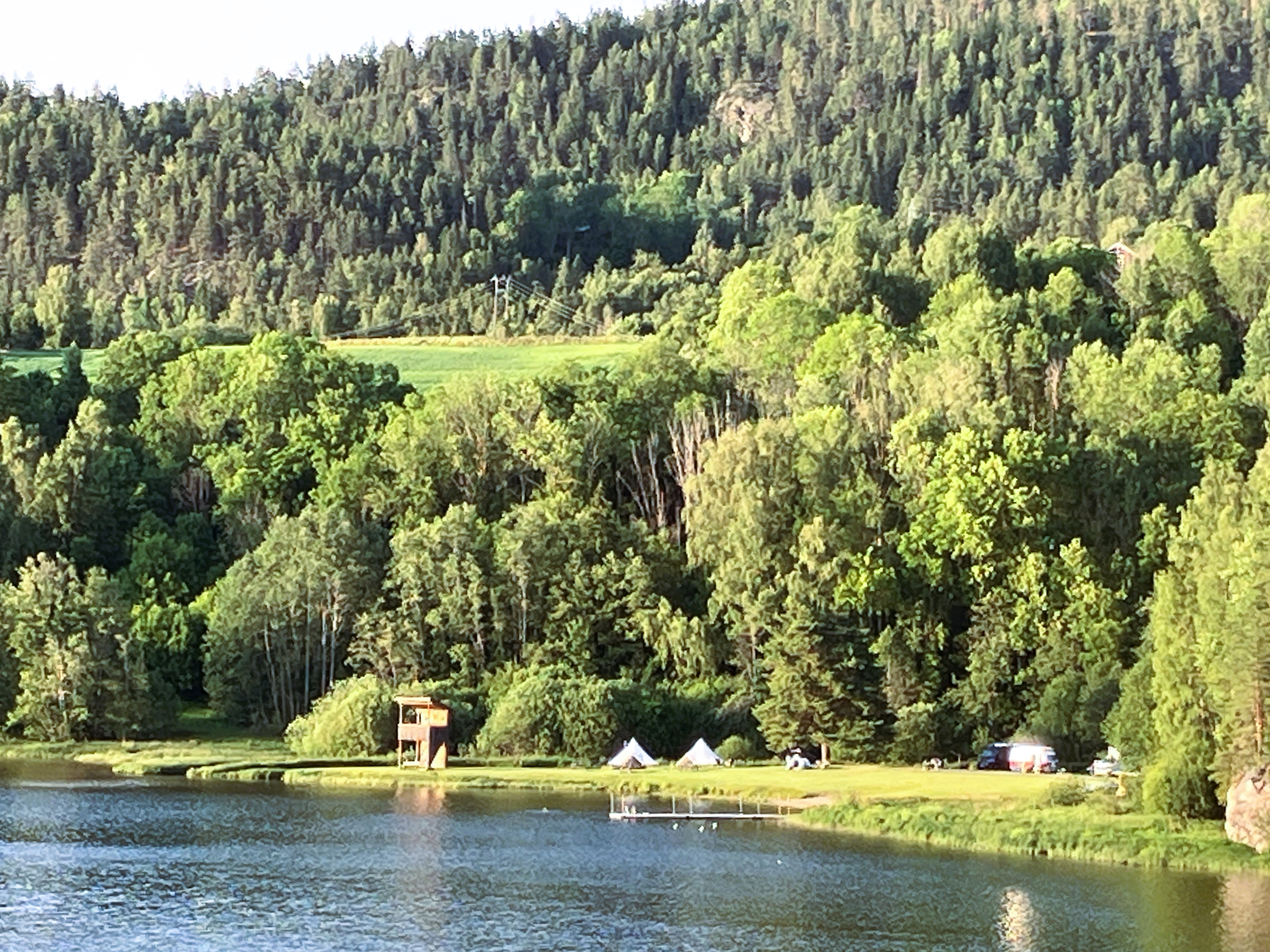
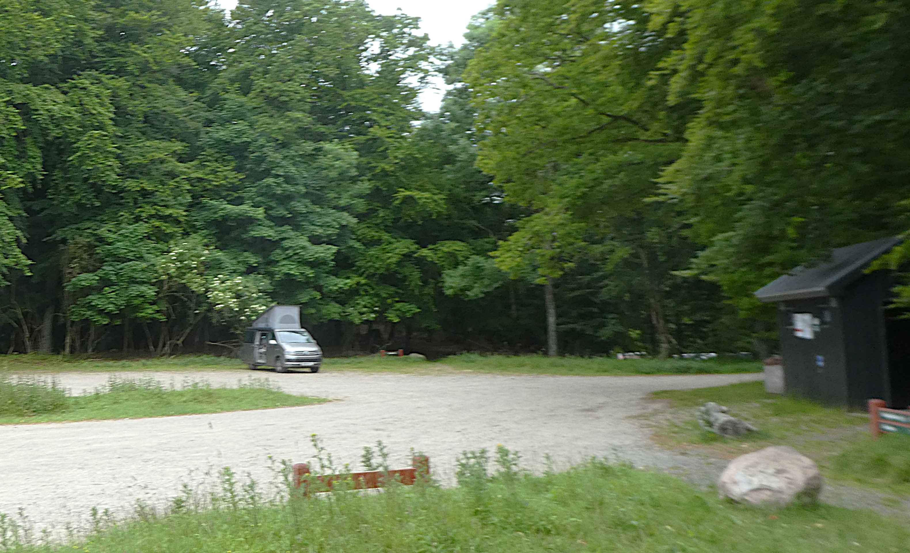
We passed Flensburg once we were through and heading north as fast as we could. The traffic dissipated. We arrived at our P4N site around 8.15pm, a famillepladsen in the forest near Middlefart.

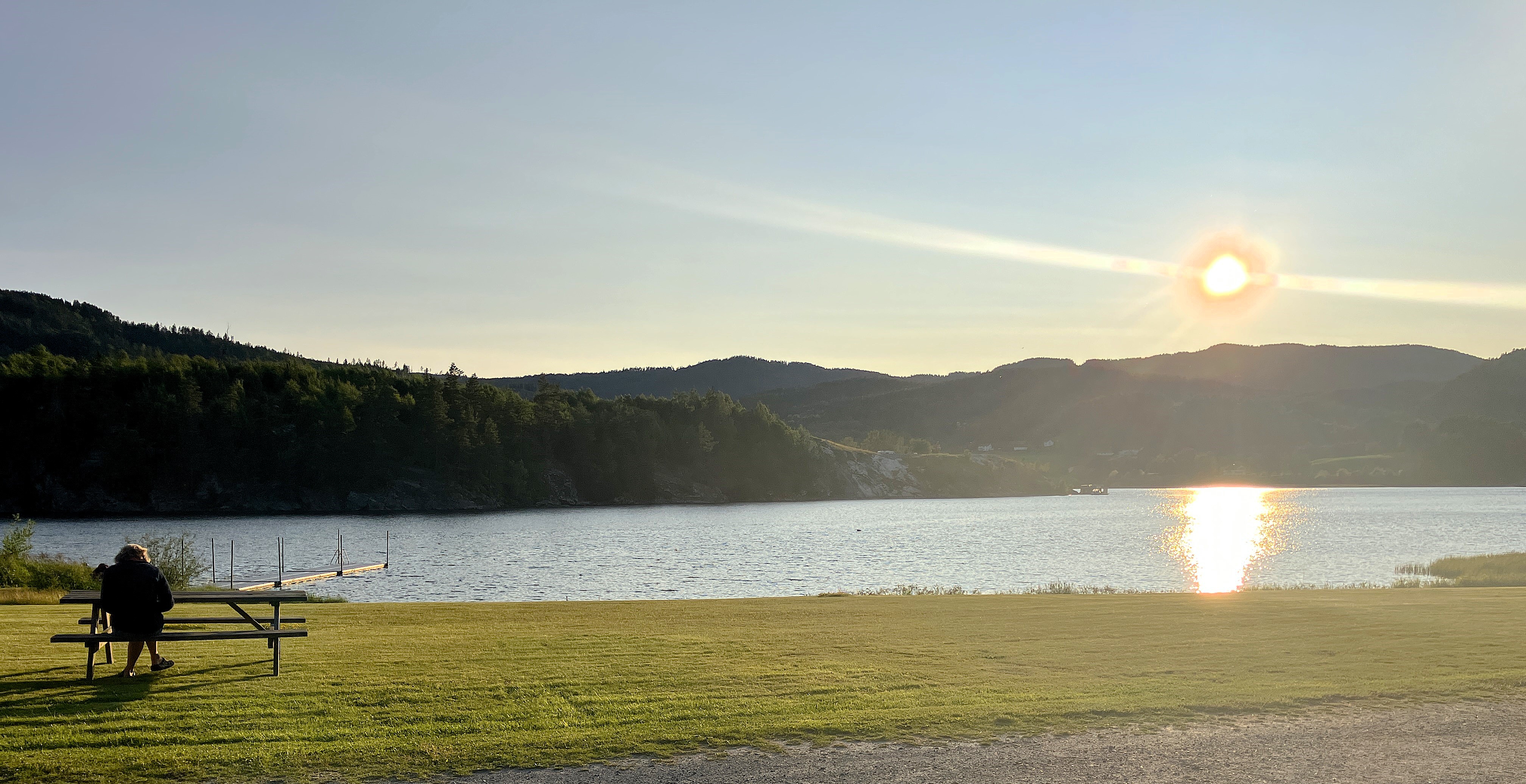
It was a good spot with only 5 other vans and a clean heated toilet. Janet made tea while Graham went for a short well-earned walk down to the lake.
After tea we both wandered down there and watched the sun slowly set.
Day 3 Middelfart – Flitbovagen (S)
Monday 19th May
With the sun shining we were up around 7am and did an exploration of our surroundings. There were amazing facilities. We found a small child play climbing area and a trim trail with a zip wire. Hidden amongst the trees was an orienteering trail and Frisbee golf.
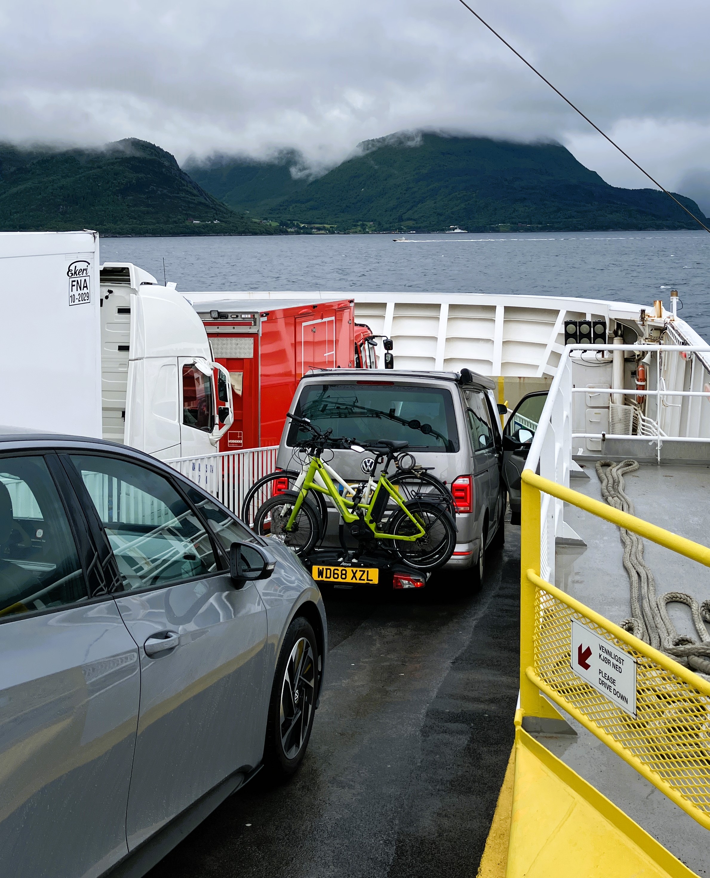
We left around 8am and,having booked the Helsingor Ferry for 10.30, were in good time. Traffic had been heavy but moving. The ferry was so civilised and the twenty minute crossing allowed time for a Fika of instant coffee and pastry.

We drove on a relatively empty road to Jonkoping. We had identified a place to eat in the town. So parking in ICA in the heat of the afternoon sunshine we walked across the town to it. We had the lunch menu, in this very Swedish eatery.
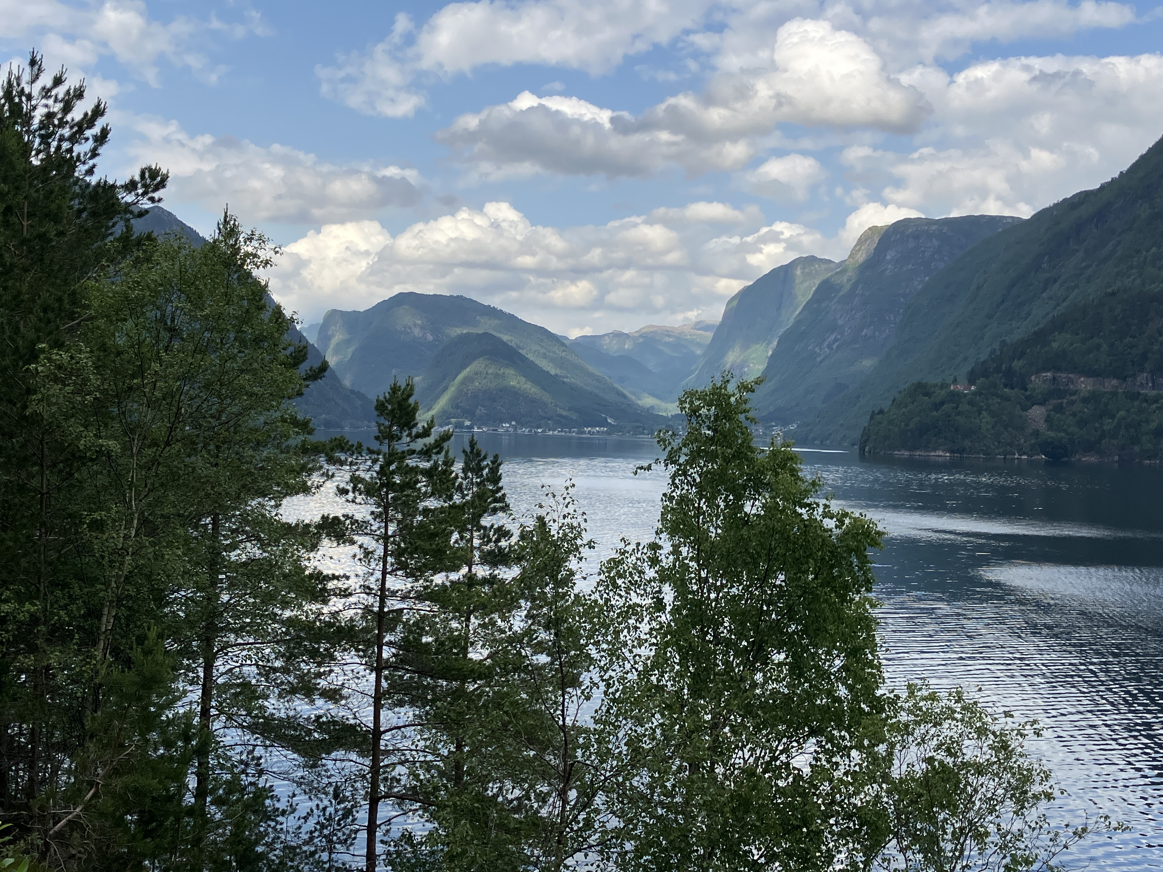
We walked back through the town catching glimpses of the huge Lake Vattern to the north. We headed around the lake to Orebro and then to Västerås. We arrived at Anna’s house in Flitbovagen at around half past six. It was so nice to chill out in beautiful surroundings having just travelled 1,522 miles in 3 days ……

Martin arrived later having spent the day working in Finland. With lots of talk we shared a meal before bedding down in the guest room in the outside annex.
Day 4 Flitbovagen
Tuesday 20th May
The sun was high and hot as we had breakfast. Martin was working pacing around in different parts of the house and garden.
We hunted out the tools we needed for our gardening jobs. Graham to spray and weed kill and Janet to prune the roses.
The day heated up and we were soon down to shorts and tops. Graham extended his remit. He worked on clearing the stone paths from the car parking to the house and on to the guest annex.

In the meantime, Martin had sorted out and ordered a new SAT Nav card for us. He had been to Vasteras collected ash for work and bought some lovely salads. We had for lunch in a, nearly too hot, garden.
In the late afternoon Martin went off back to Bromma and we walked down to the lake.
It was the hottest day of the year so far in Sweden !!
Day 5 Flitbovagen
Wednesday 21st May
We awoke to heavy rain. Our attention focussed on the wedding in three days’ time.
Sarah’s accommodation bothered us. We phoned AirBnB about a message we had received. It said that we wouldn’t be able to use the apartment because there was a leak. We registered our concern. They were happy to chase it up and get back to us.
We drove to VW dealer in Vasteras and picked up the new SatNav card. It worked immediately and we drove back to the supermarket and picked up some food. We decided to use the new Sat Nav’s instructions to return to Anna’s. This was not a good idea.
We drove down a narrow track to a locked barrier!! We then had to reverse back up the track before returning to a more regular route along the roads. A lesson to remind us to check routes carefully not rely totally upon Google or the SatNav.
It continued raining, so we pottered about. We talked to Sarah, who was just leaving Totnes. We also spoke to Martin, who had mislaid his glasses. We soon found them on the BBQ.
Day 6 Flitbovagen to Frans Kriegs Vag Bromma
Thursday 22nd May
Still damp, awoke to find a reply from Airbnb that the host had cancelled. They gave us other options, none that were suitable. Martin went to Ulvsunda Slott, the castle that was the wedding venue, and fortunately managed to get a room for Sarah and the boys. We told Airbnb and they said they might be able to give us some financial compensation.
We cleaned the apartment and packed up. Then, with a shopping list from Martin for a meal for that evening, we set off for Stockholm. En route, we heard that the Webb wedding party from the UK were in disarray.
Amelie and Kelly were on the right plane to Stockholm. Ellis was on another which was fortunately the one that Martin’s friend Lawrance was on. Peter, Sarah and the boys were having to get a taxi to Heathrow and a flight to Copenhagen and then on to Stockholm arriving 10.10.pm. All because they had arrived late at Gatwick.
We felt a bit overwhelmed by all this news. We shopped using the photo of a shopping list before arriving at Anna and Martin’s. Kelly and Amelie were there and recounted the dilemma facing them at the airport, nightmare!
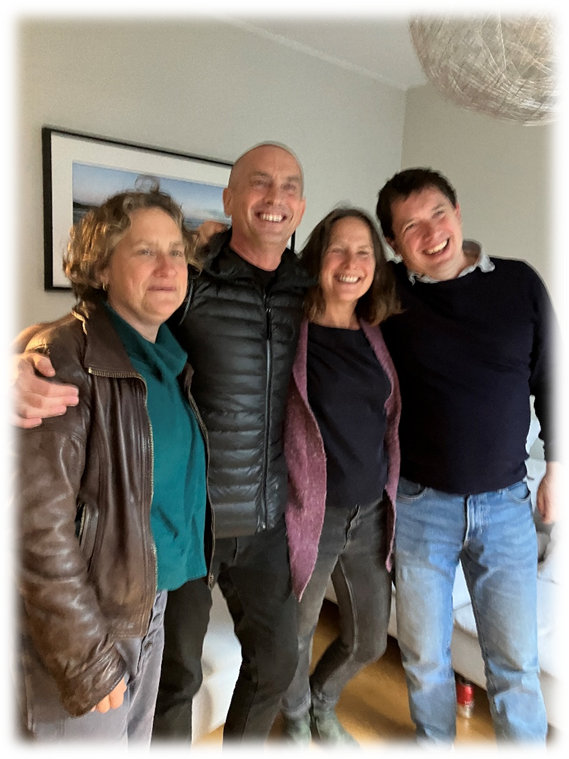
We booked Sarah in at the castle. We helped Anna prepare a meal. This was just before Martin arrived with Jessie, Chris, Lawrence, and a very proud Ellis. He had coped with the trauma of being a solo passenger, abandoned by his parents. Luckily as Lawrance was on the same flight so he could pretend to be Ellis’s appropriate adult!
We had a lovely meal together. It was so good seeing Martin with his oldest mates. We walked back with Kelly, Amelie and Ellis past the allotments to their apartment.
Back at the house, Anna was helping Finn with his maths for a test in the morning. Then, we cleared up. We went early to bed with the rest of the house having heard that the rest of them had safely arrived in Sweden.
Just as we were going off to sleep Sarah phoned to say that the Castle had double booked her room. We were in a dilemma whether we should sneak out and help. We phoned the castle and ten minutes later they had them sorted out, phew!
Day 7 Frans Kriegs Vag Bromma
Friday 23rd May
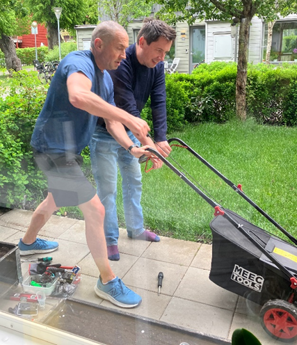
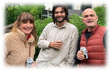
EvEveryone was up early. Peter had arrived and together he and Martin were trying to get a borrowed lawnmower to start. After much adjustment and consultation with on line instructions they got it going!
Shears were also applied to the hedge. Martin’s neighbour Halvard brought around some seating. Martin and Anna went for a run and Finn went to school.
While Graham tidied up Janet went and found Sarah and the boys at the Castle. Sarah had been offered and given a choice of rooms and they had had a good breakfast.
We all decided to walk around the lake and see the Bristol lot in their Air BnB. We were nearly there when Peter phoned to say they were chilling. We returned to the hotel and bought some food from the garage for lunch for us all.

Around 2pm we heard that the Bjerregaard’s had arrived safely. We then went and helped Anna and Martin set up for the ‘Mix and Mingle’.

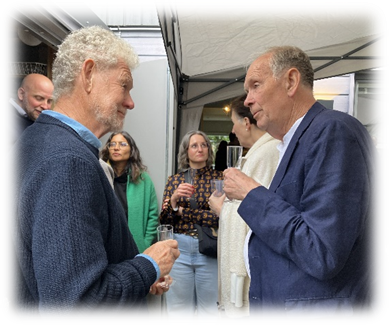
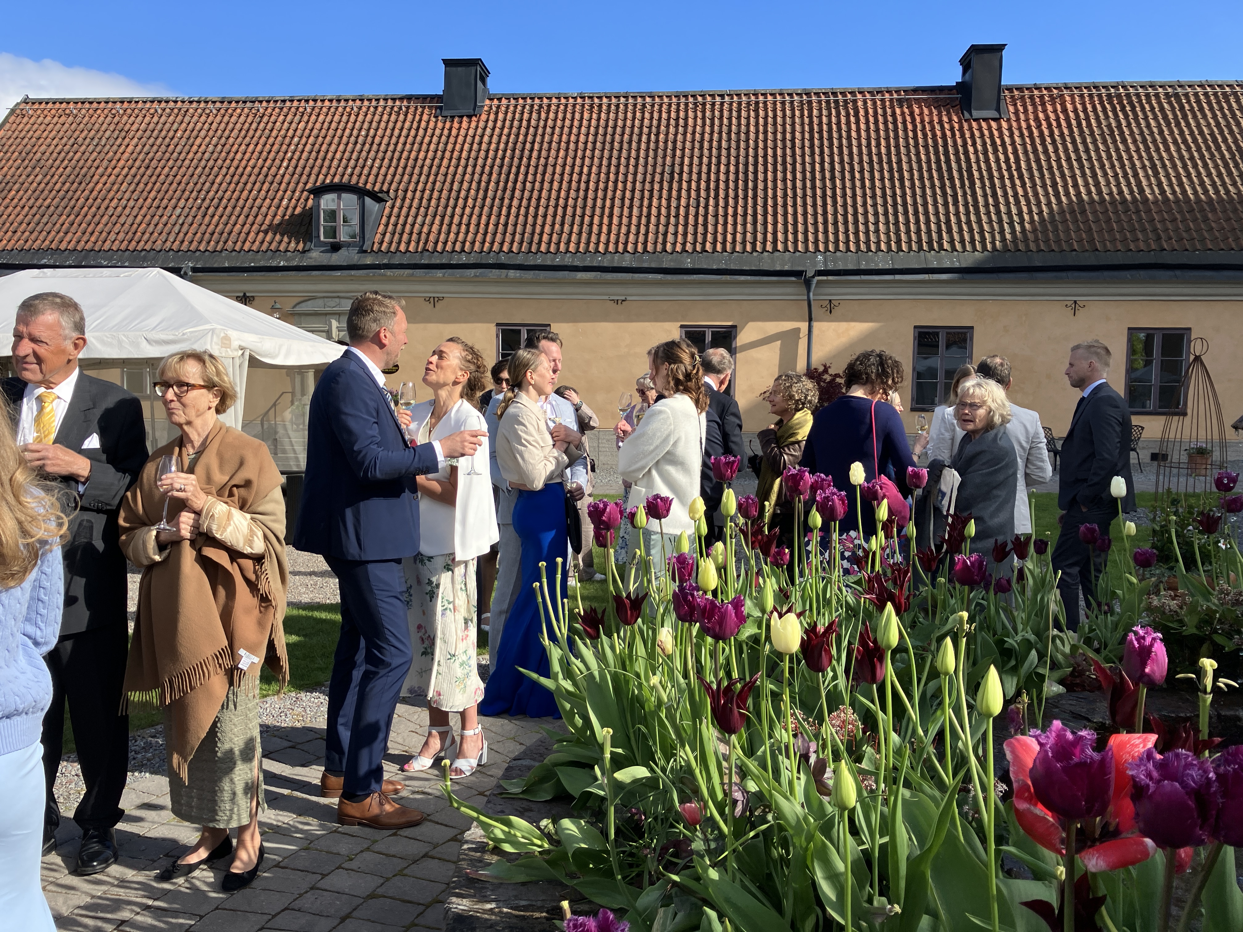
At exactly 4pm people started arriving and for the next four hours we certainly mixed and mingled.

It was lovely meeting all Anna’s family and friends as well our siblings who had travelled across with no drama!
Our families mingled amazingly, chatting to everyone helped. It was helped by the Anna’s Friends and family’s excellent command of English.


General clearing up started at 8pm.
Most had left by 9pm leaving us to finish clearing up. There was then opportunity to chill out with Olly before an early bed.
Day 8
Saturday 24th May
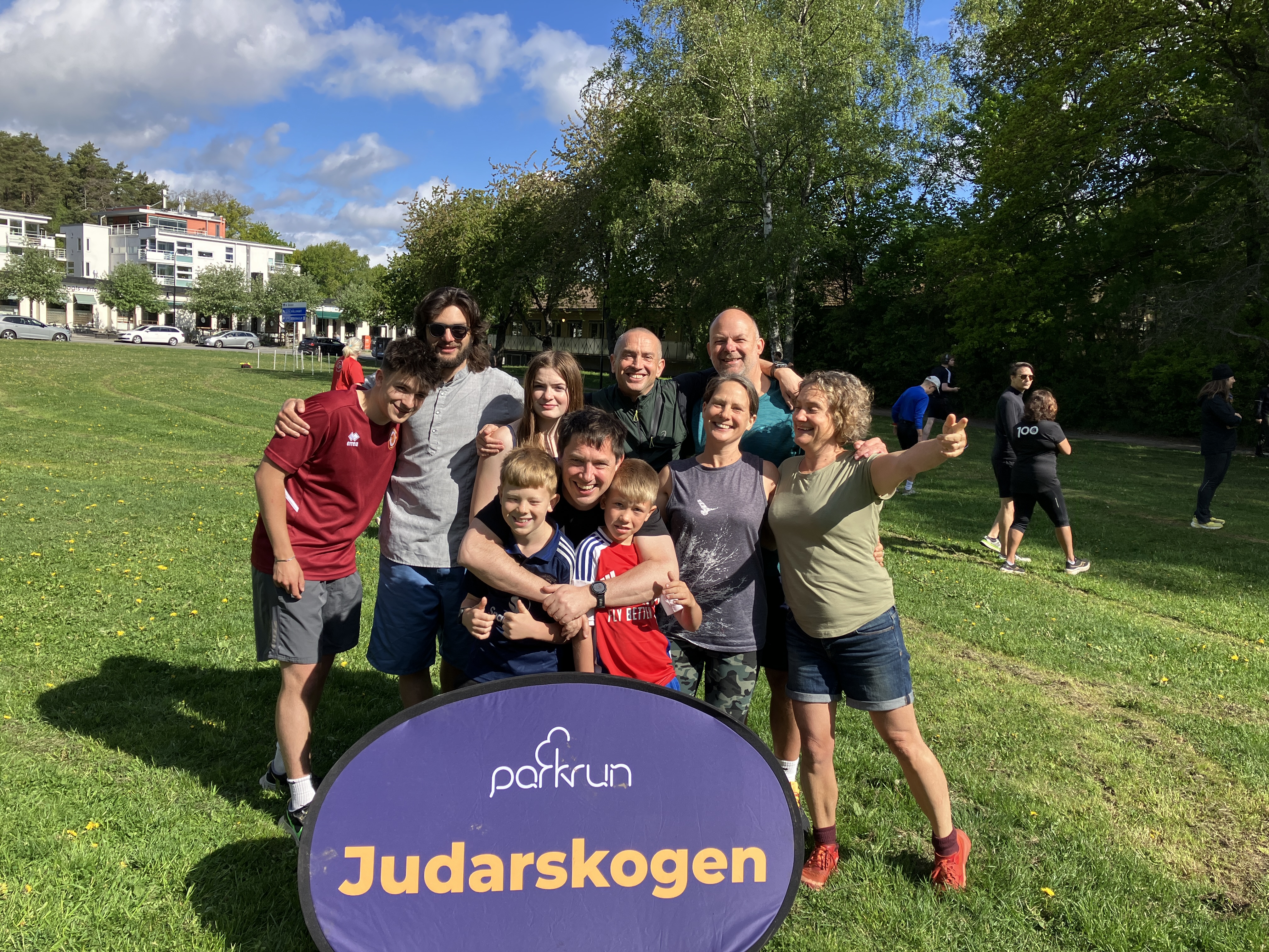
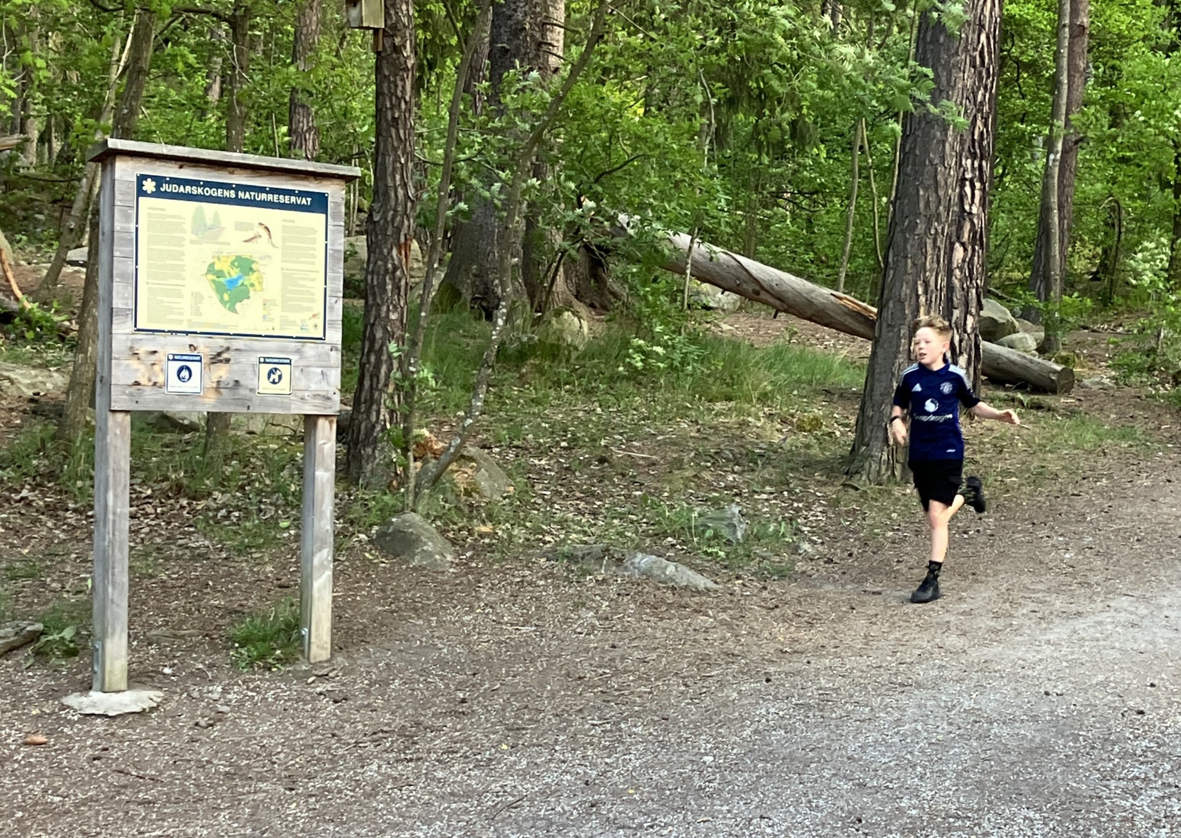
We celebrated Peter’s 47th birthday by many of the family doing a park run. Peter, Martin, Sarah, Torrin, Otter, Kirstien, Mox, Leon, Kai and Frida all got there by the start of 9.30.am.
While we walked the five kilometres to the start and cheered on as they all completed. It was a lovely event with Torrin doing the best time with no effort.

After the race we all parted. Peter and Martin returned to celebrate with his family. The Bjerregaard’s to walk across the park to a cafe and get the Metro home. We walked back to Peter’s to join the birthday celebration. It was nice seeing their apartment, it reminded us of others, Martin had lived in over the years.
Returning to Martin’s we grabbed something to eat and then went for a sauna at the castle. We had often wondered what the sauna was like as we walked past. It was great to experience. It had a trap door in the floor that you could dip into the lake or swim from!
Janet collected her wedding stuff and joined Sarah, Frida and Kirstien getting ready. The focus was good and sharing thoughts on looks helpful. Frida was especially expert on little bits of makeup. Graham went and met up with the grandsons at the castle.
As more and more people arrived, the excitement grew and the celebration started.
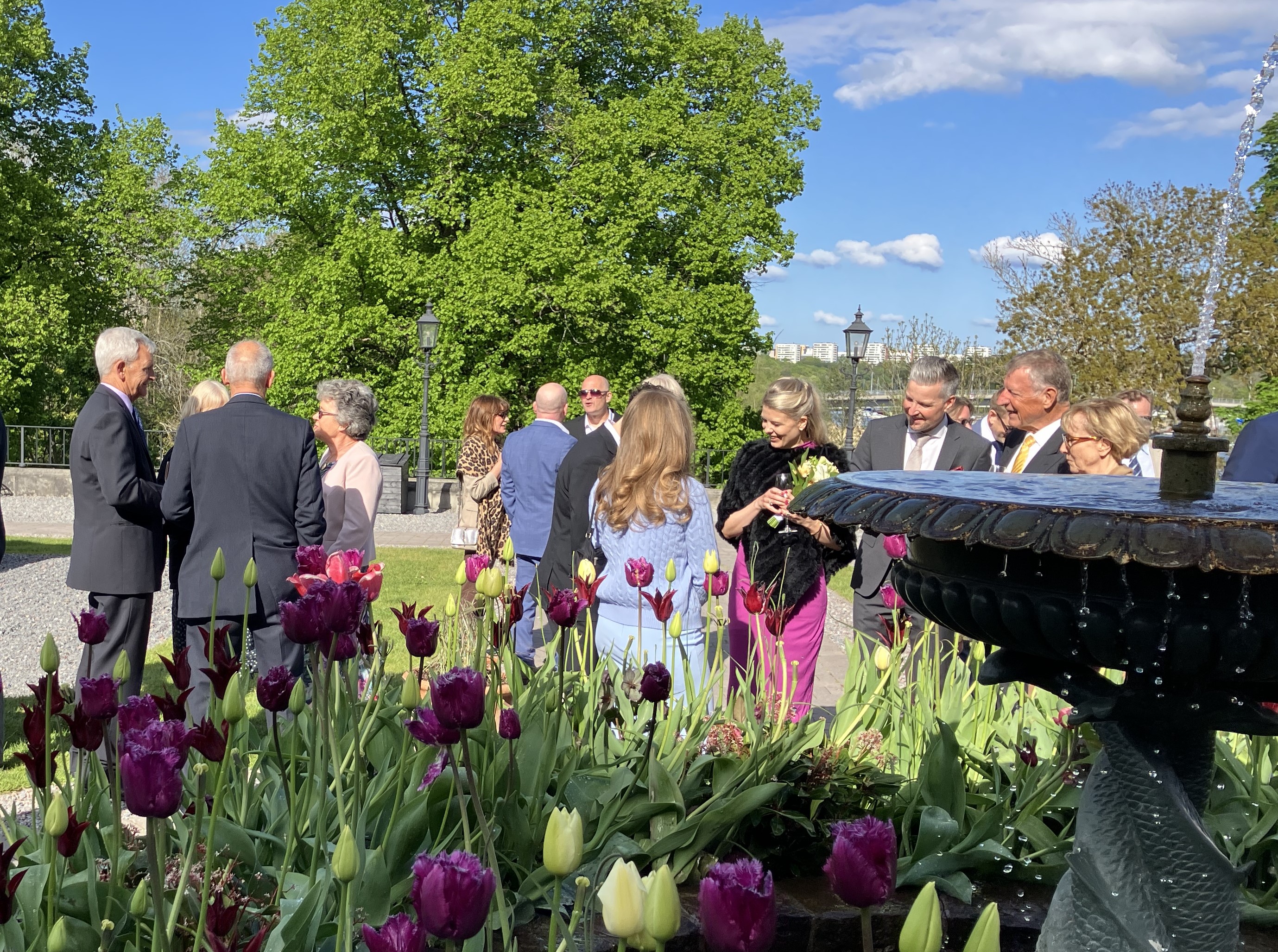
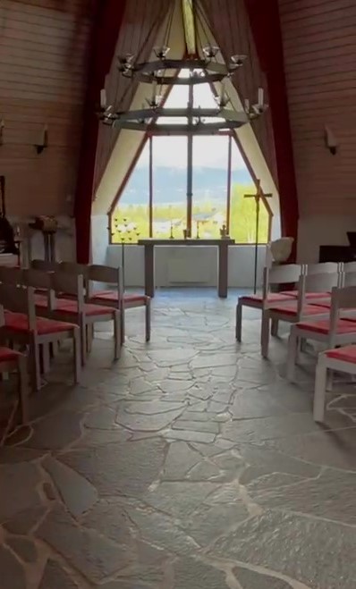
We all sat on wooden benches facing the castle with Marie, Emil, (Anna’s sister and nephew) James (the Master of Ceremonies) and the celebrant Peter, awaiting the couple.
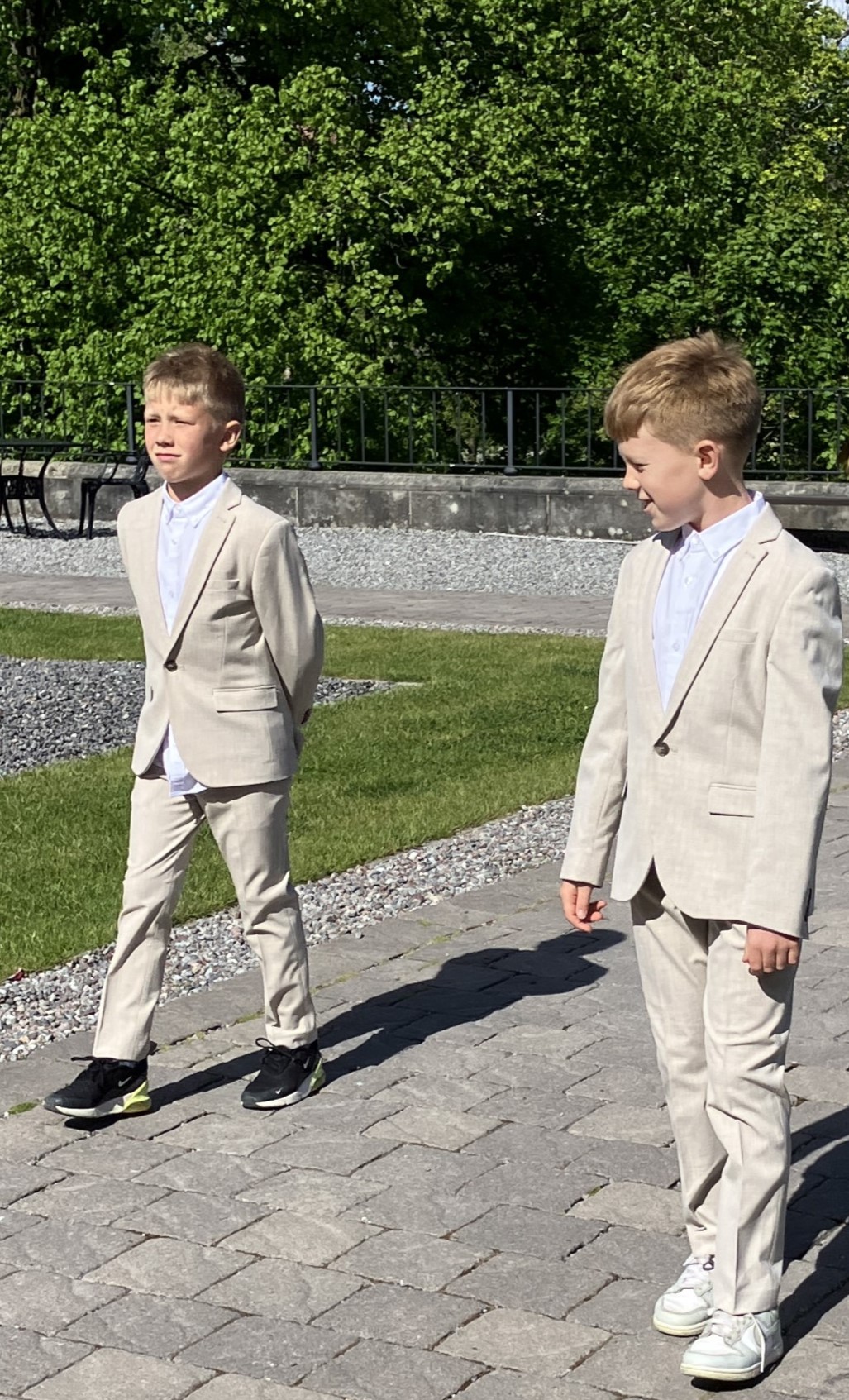
With Torrin and Otter leading them as page boys , Martin and Anna came up the steps. They walked around the fountain, past where we were all sitting to the front of the castle, where they turned to face us.
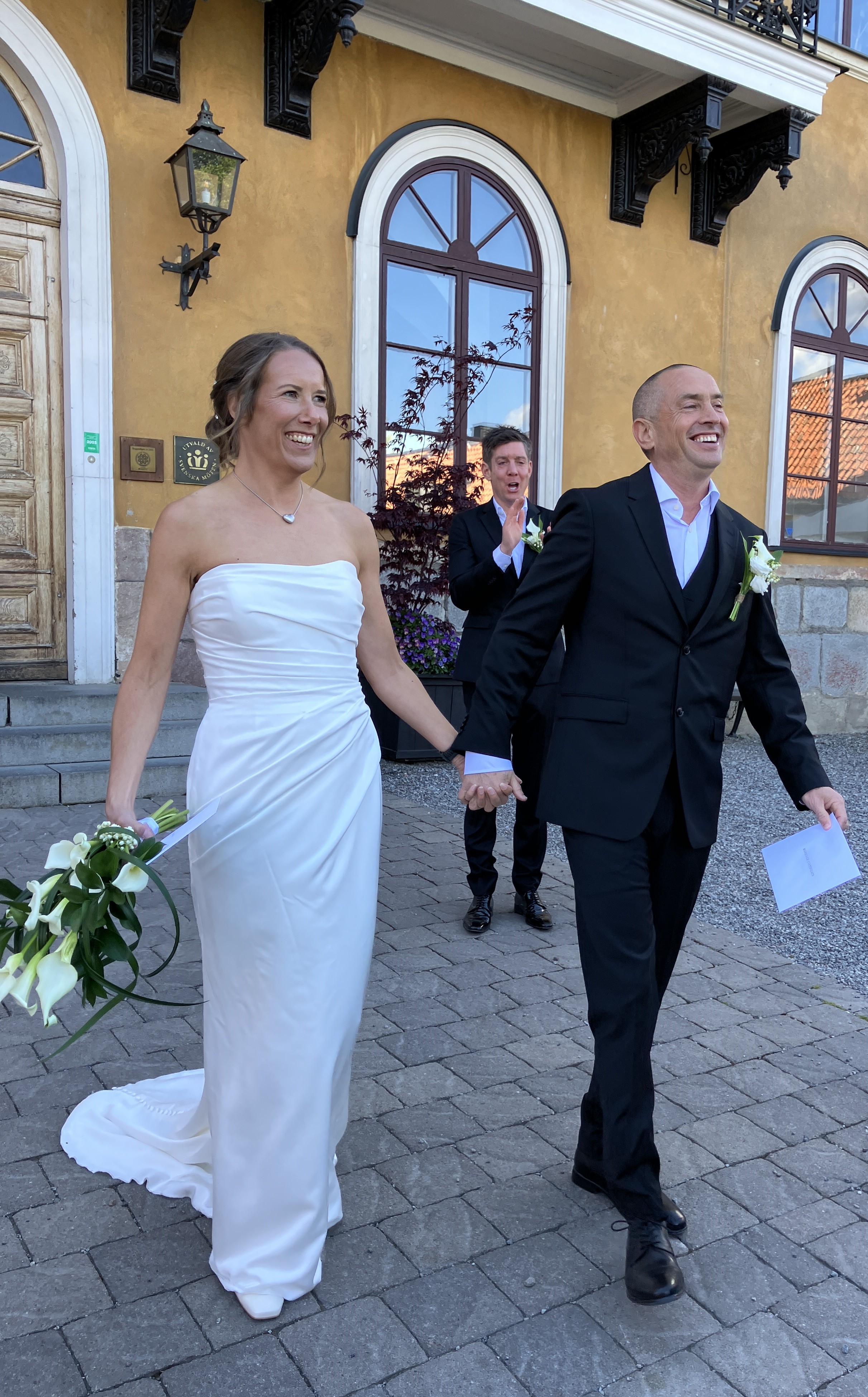
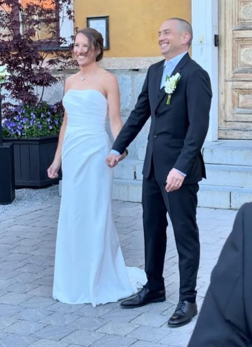
Anna looked lovely and Martin very smart. Peter the celebrant introduced them and gave us a brief history of the castle. Anna’s sister, Marie, played the guitar and sang with her son Emil accompanying her on the double base. Anna and Martin said their vows and presented each other with rings. We all cheered and celebrated with champagne.

The sun was shining but it was cold. Luckily the hotel produced rugs that those who were cold so they could drape them around to keep warm.
Photos were taken and we all went into a small marquee out of the bitter wind. At until six o clock when we went upstairs to the top floor and the banqueting suite. Here people found their tables, partners on the same tables but not together, fully mixed with friends and families.

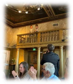
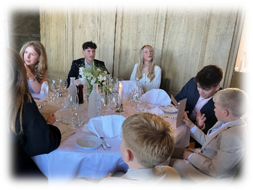
The Wedding Banquet began and under James’s direction speeches were made. Anna’s father Yarn, her sister Marie, Graham, Finn, Olly, the best men, Peter and Chris, Agnetta and Halvard. All were good, but Finn’s really stood out. The emphasis being on the love of Martin and Anna
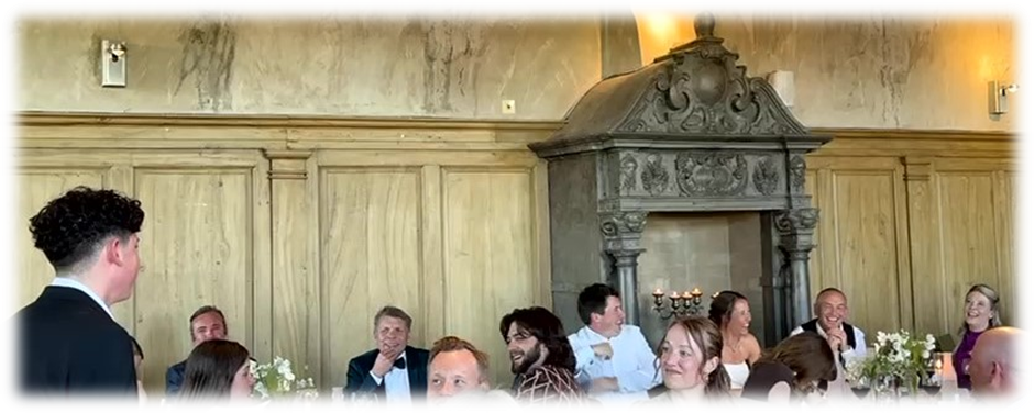
The food and drink were good. The informality of the timing of the speeches and the variety of their focus made it a very special occasion. At 10pm the room was cleared and dancing began until after 1am.
An unforgettable wedding full of laughter and love.
Day 9 Frans Kriegs Vag Bromma
All a bit jaded we had breakfast and wandered to the hotel where we joined our lot sitting outside chatting and discussing their journeys home. Sarah woke the boys who collected their own breakfast and while they all cleared their rooms. There was a lot of informal chat sitting outside in the sunshine, before Sarah and the boys and Kirsty and Mox got taxis.
Peter and Kelly went and picked up their bags from the house and got their taxi.
Anna and Martin went for a walk with Chris, Jessie, and Lawrence around the lake, before they went to the airport.
We spent time with Olly and Finn before they went off to see Andrea as it was Mother’s Day.
Eventually Anna and Martin went off to Vasteras and Janet walked to Alvik while Graham sorted out the van.
Finn was up for cooking. Using the numerous tomatoes, and other goodies left over from the Mix and Mingle on Friday, made a great pasta dish. We sat around chatting for a bit before we all went to bed.
Day 10 Frans Kriegs Vag – Docksta
Our Adventures Begin
Monday 26th May
In rain we left Martin’s and shopped at Bromma ICA. We then headed north out of Stockholm. We went past Arlanda Airport to Uppsala, Sodderhamn and then across the amazing Hogakustenbron Bridge to the High Coast.
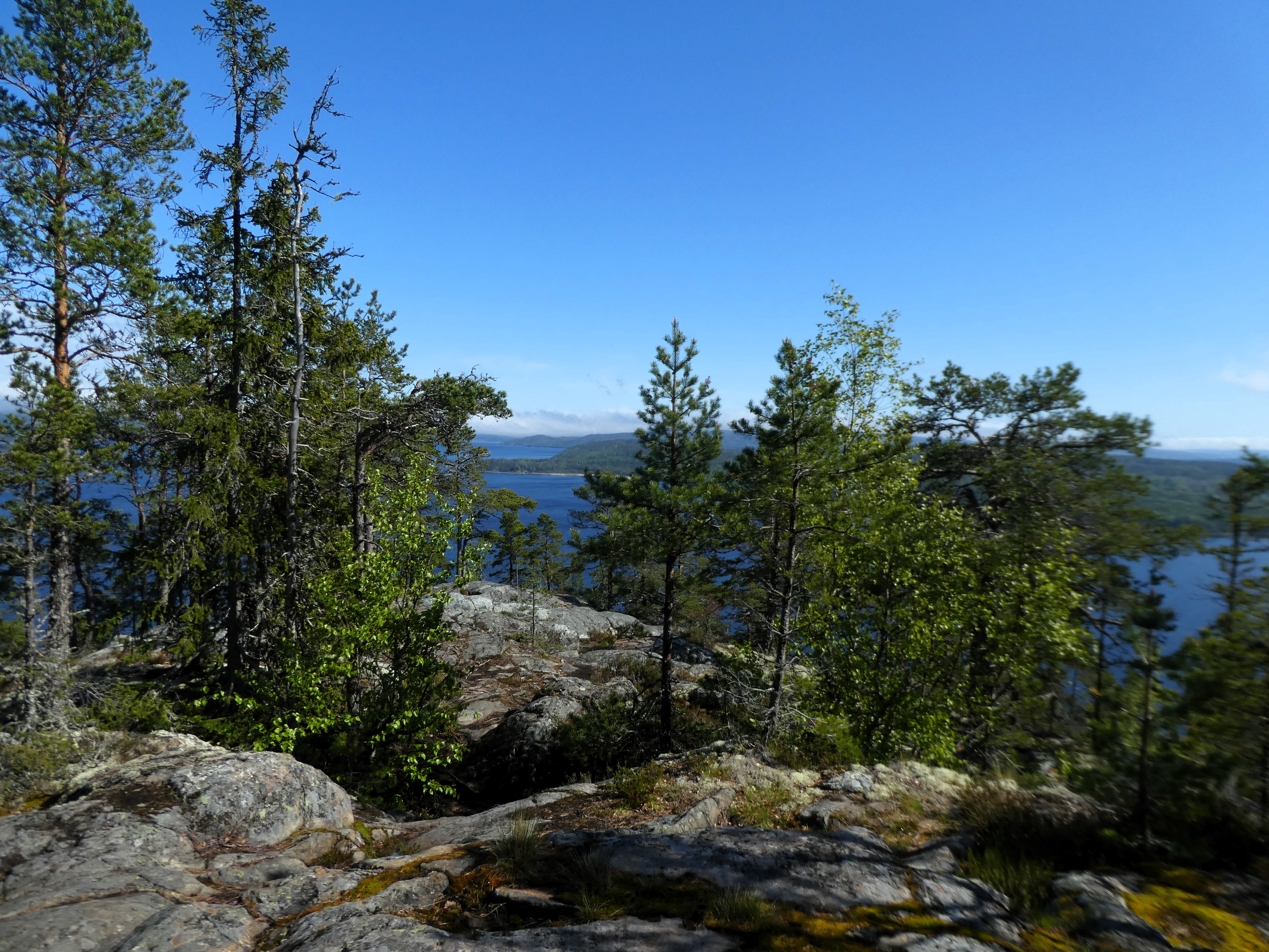


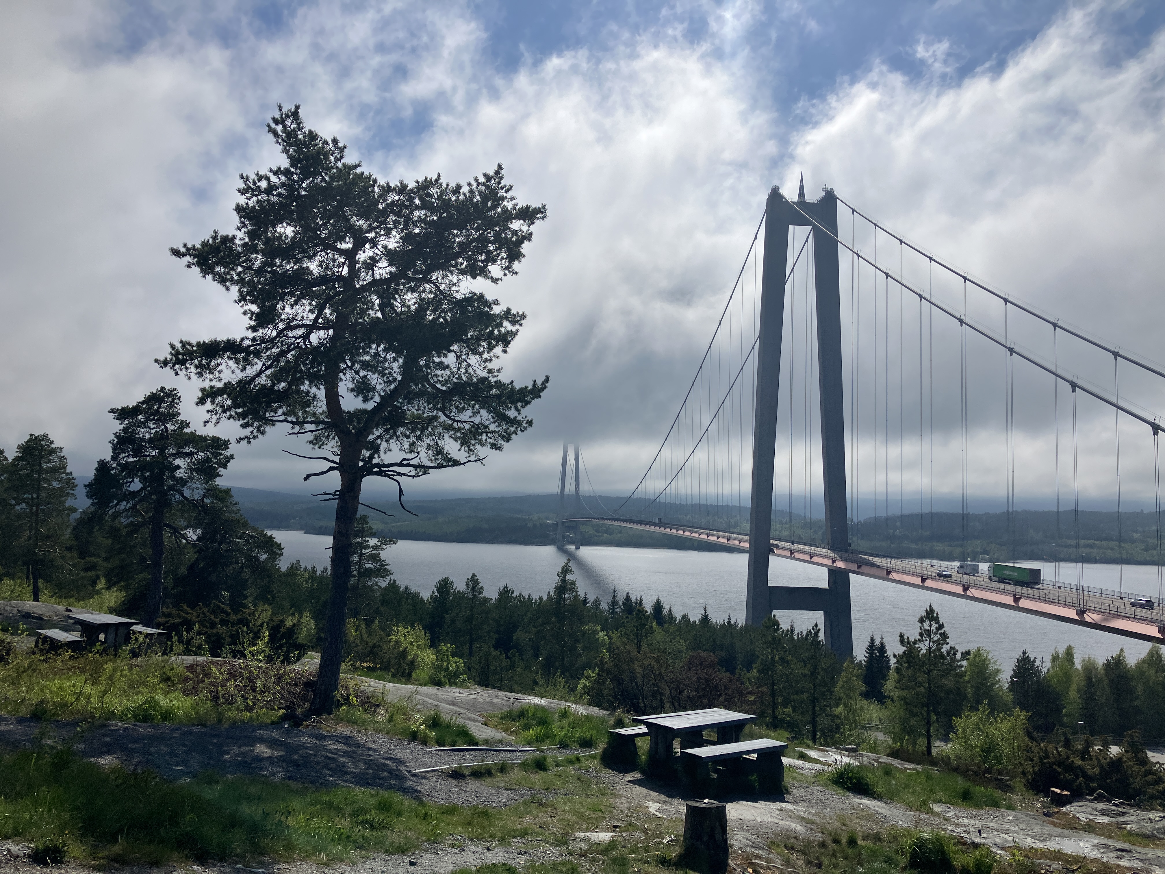
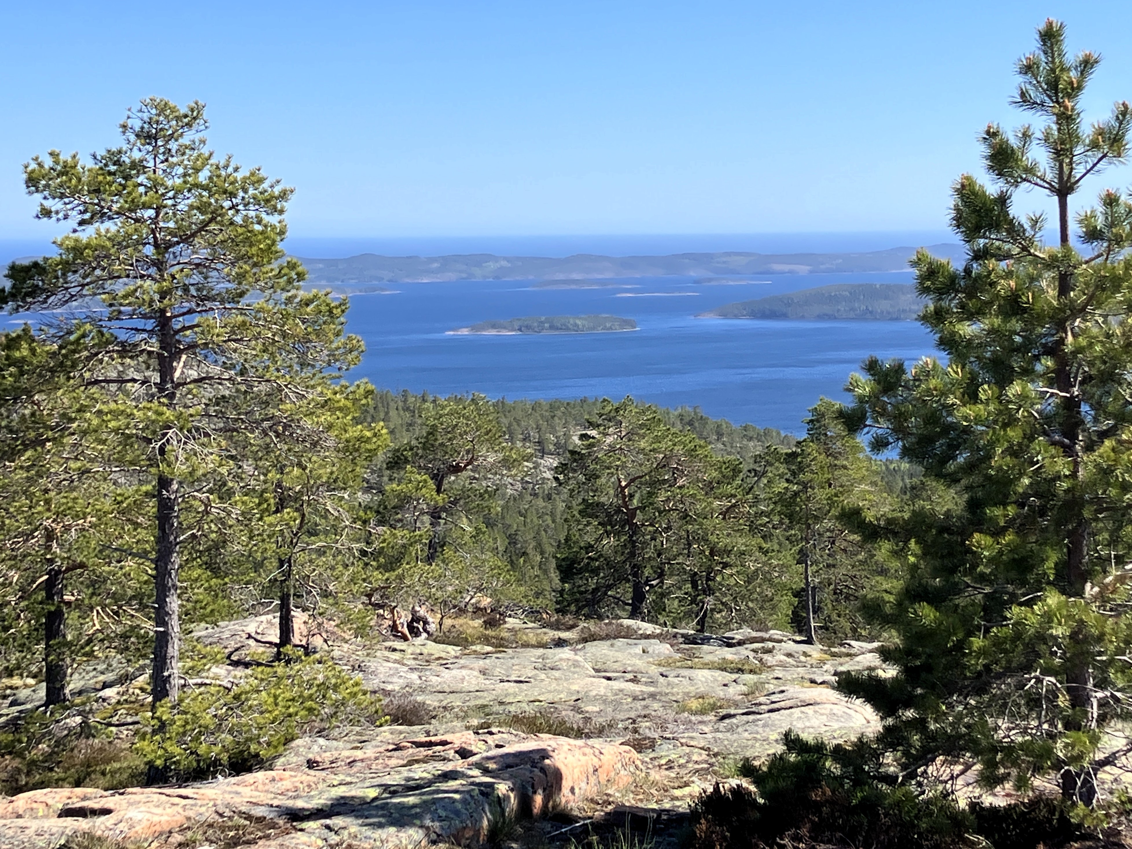
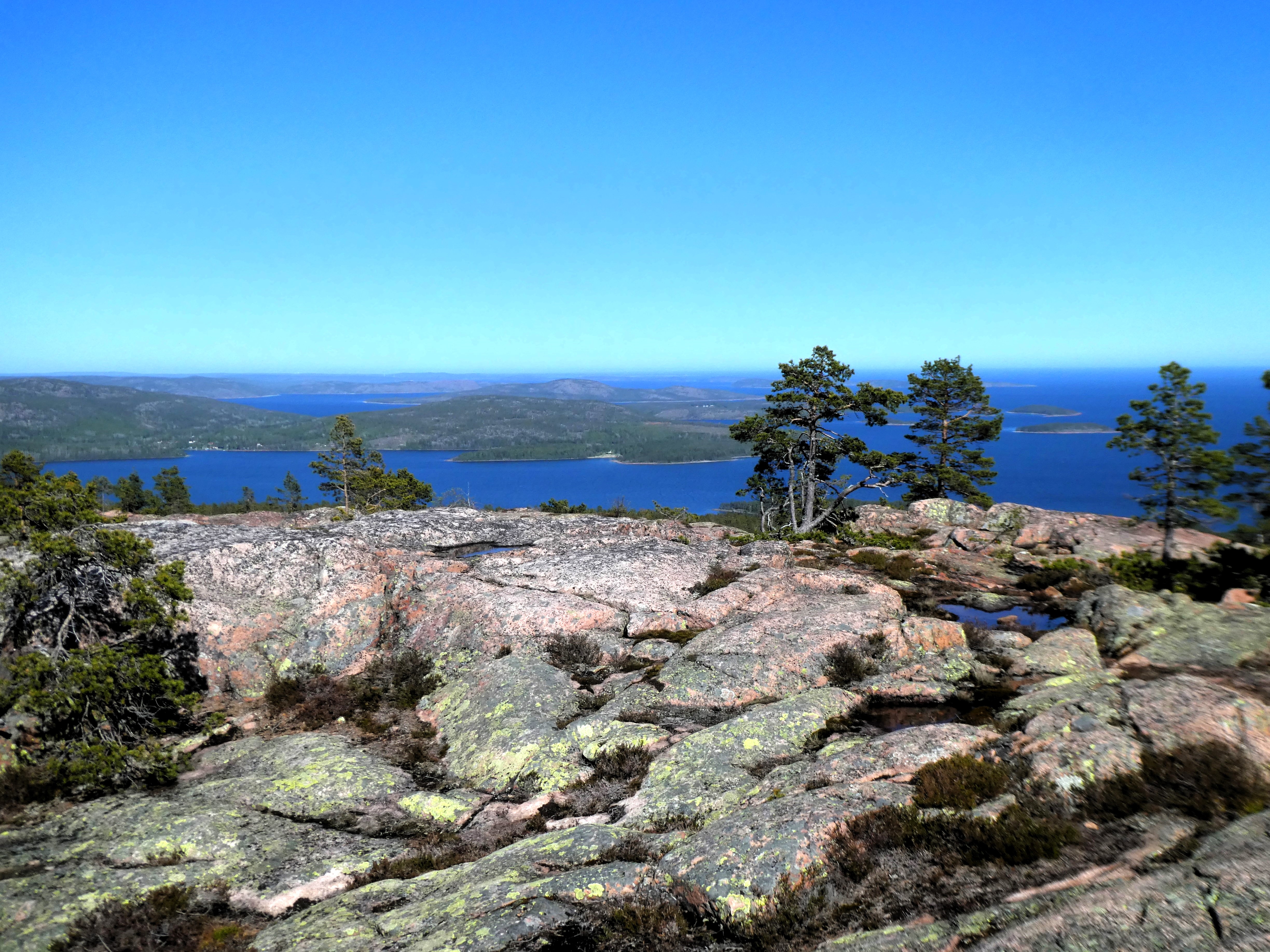
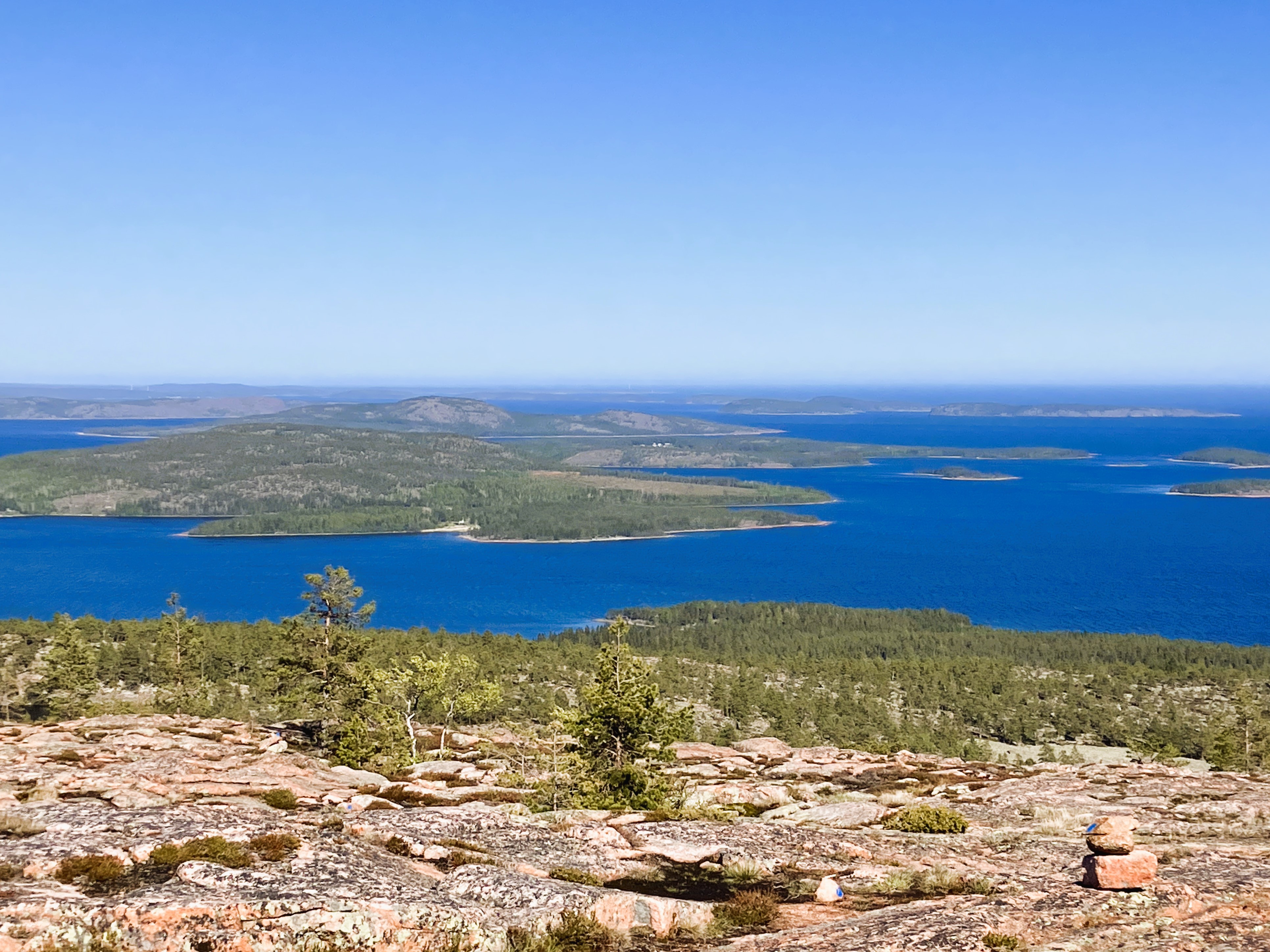
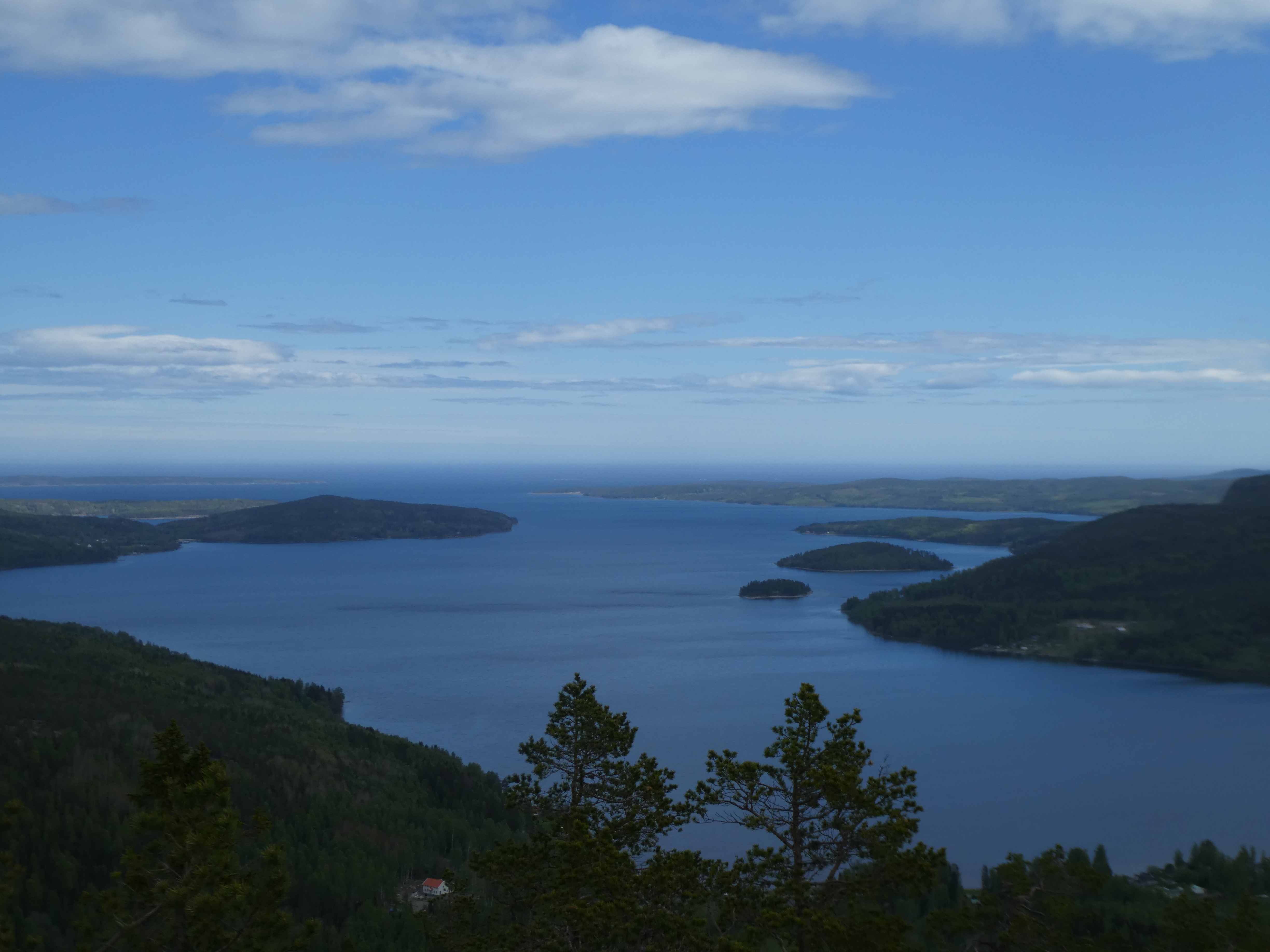
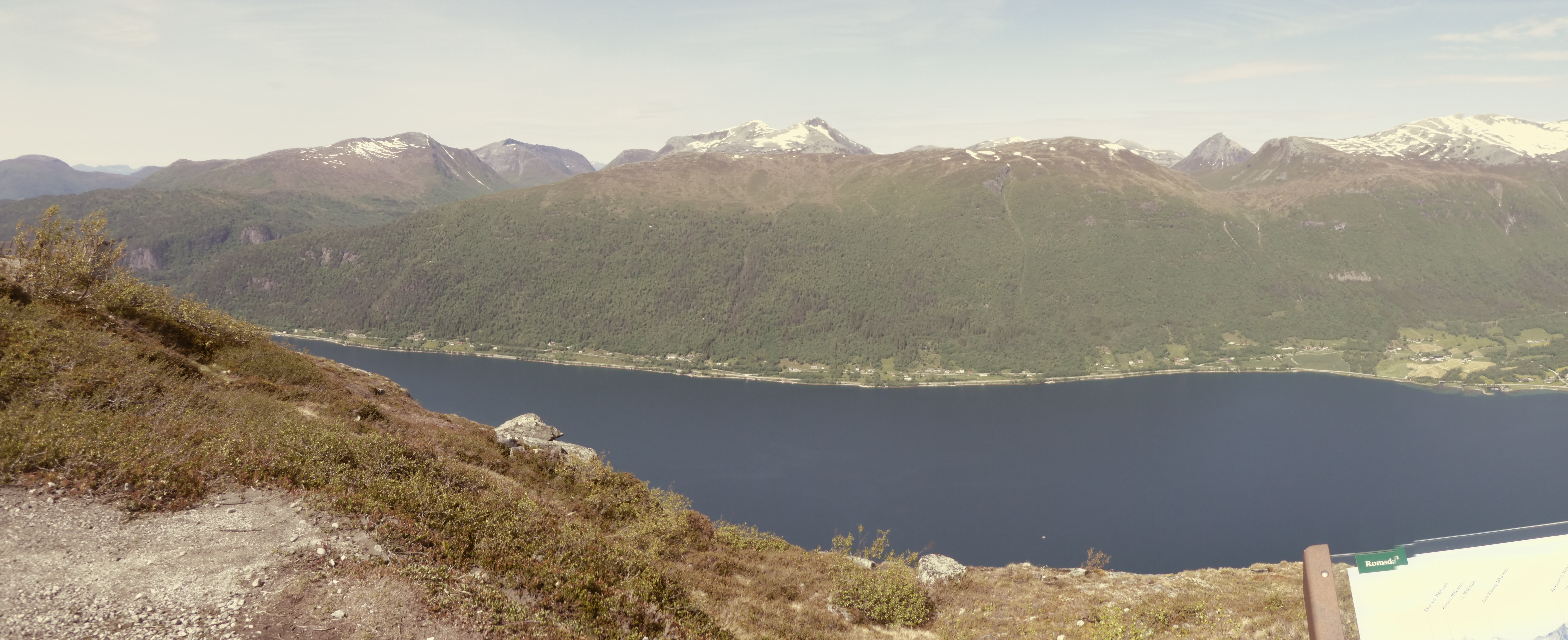
We stopped at the view point beyond the bridge. We clambered up to the several view points. These points allow a view looking east across to the Islands and hills. There were interpretation boards informing us about the High Coast.
The High Coast land mass which is a World Heritage Site, has risen more than anywhere else in the world. The land was originally covered with a three kilometres thick ice sheet that was so heavy that it pressed the land downwards.
10,500 years ago, when the ice had melted, the High Coast was covered by sea, not ice. As the weight on the land reduced it started to rise. The land rose from 100m below sea level to 286 metres above. It continues to rise today at a rate of 9mm a year.
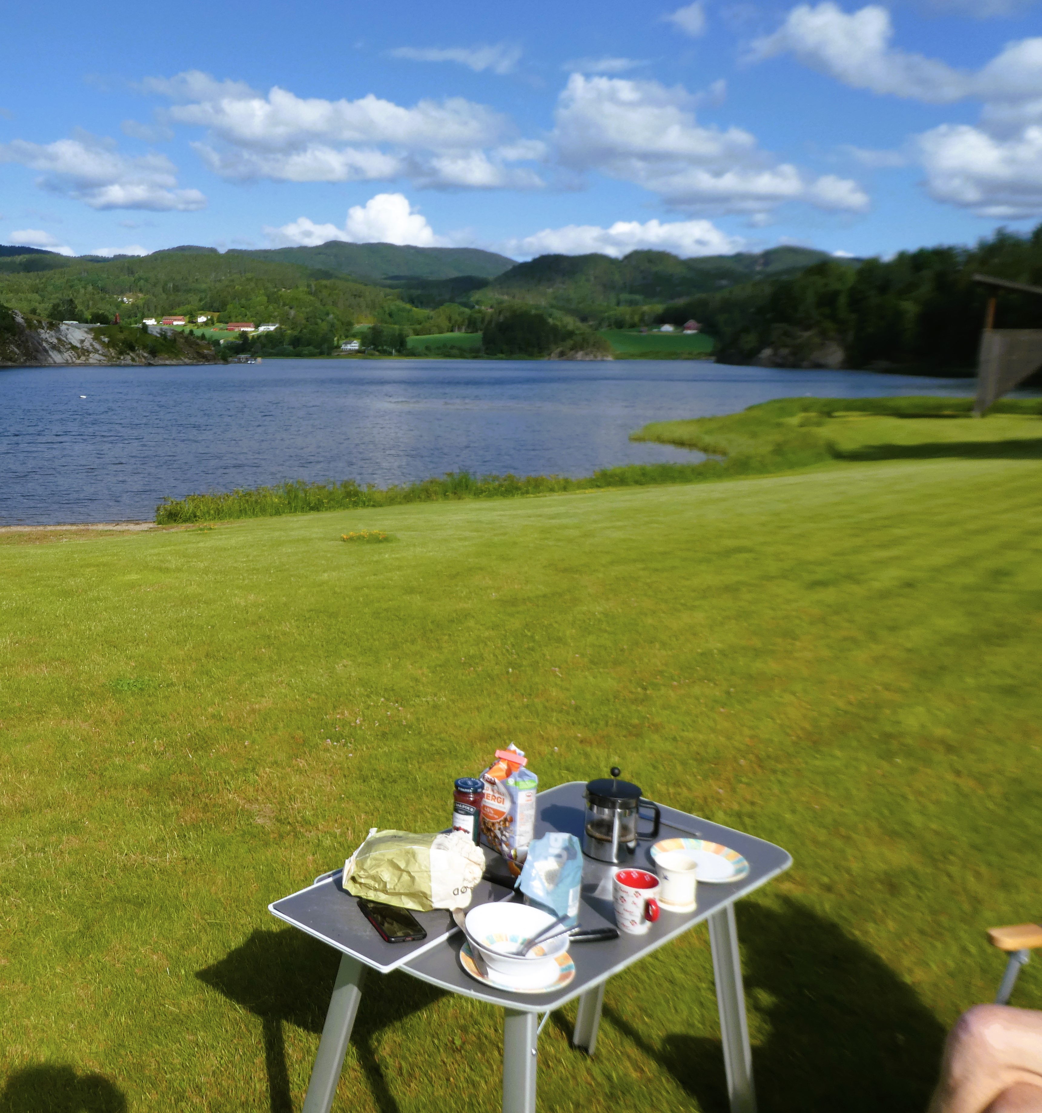
We were very pleased and settled in. We explored the area wandering up and down the road finding none of the local cafes and information places open. There were signs of them in the process of opening. We returned to the van. Magpies and Cuckoos serenaded us as we had tea inside. It was too windy and cold outside.
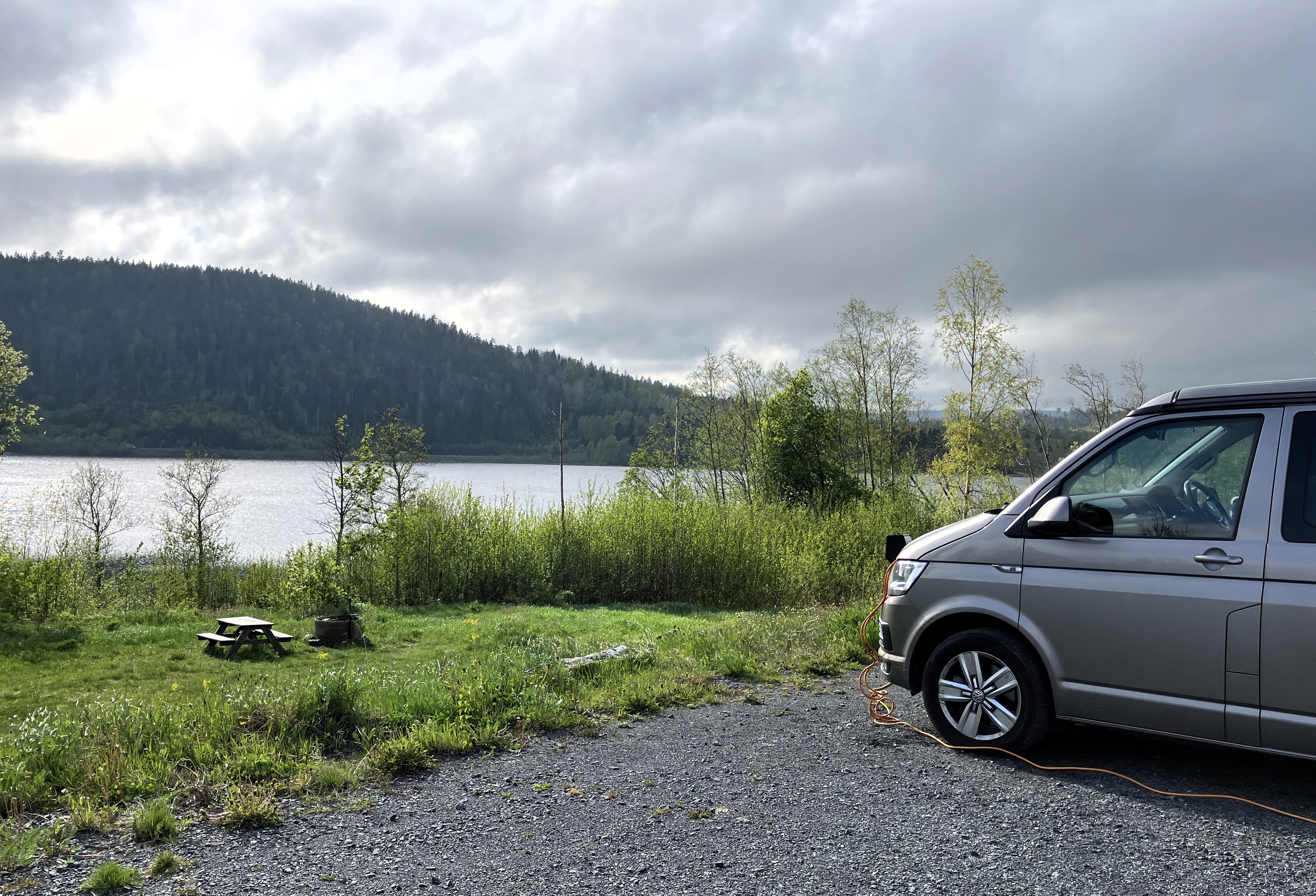
We travel on to the small town of Docksta and find a camping van parking area, which overlooked a lake. Here you paid by credit card to register your vehicle accurately and buying a ticket.
We bought a ticket which gave us a code to use the toilets, kitchen and electricity. All were lovely and clean, and well maintained.
It was cold that night. Janet, used hot water from the kitchen to fill a hot water bottle. We made up a warm bed and had a good night’s sleep.
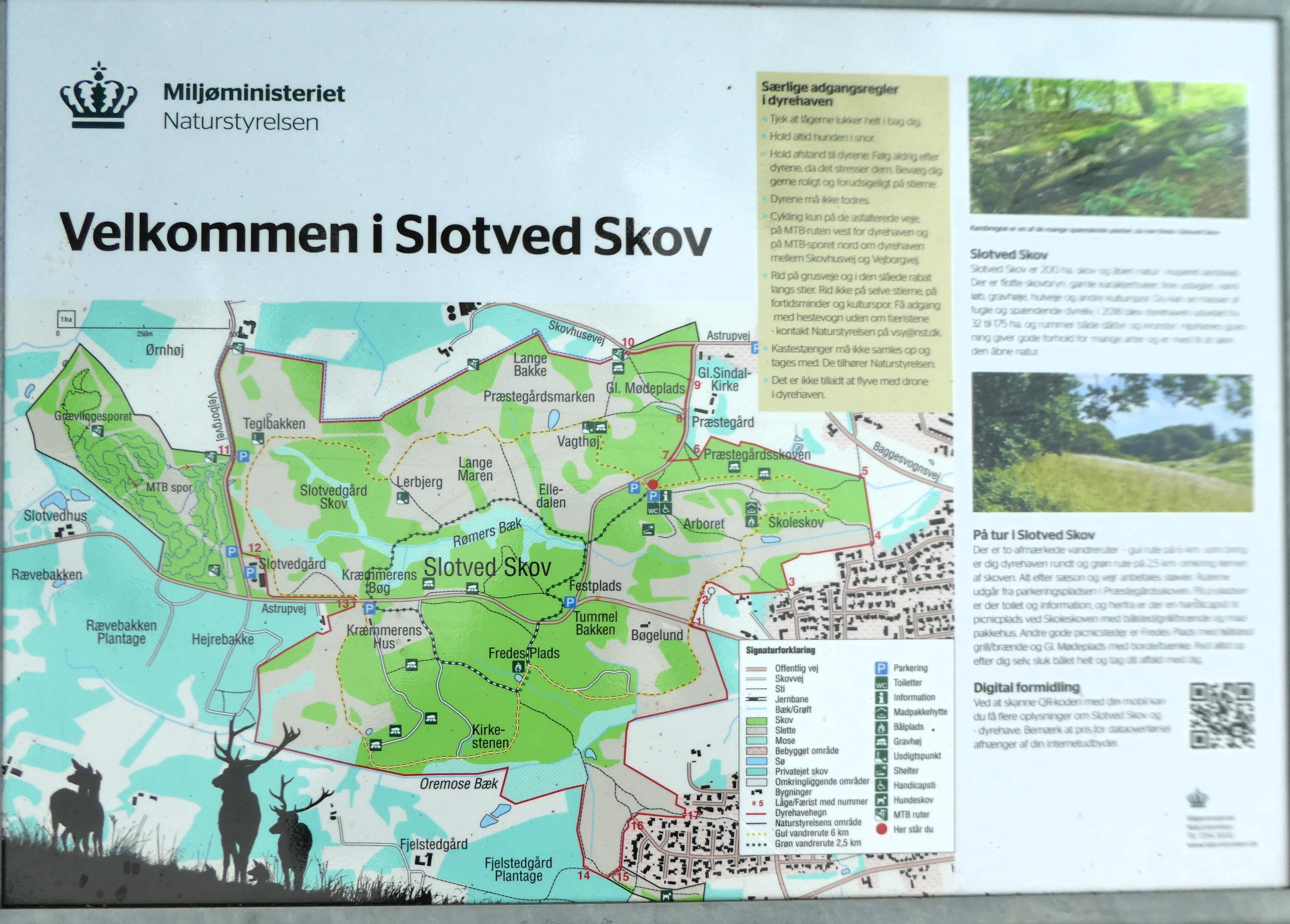
Day 11 The High Coast and Skuleskogens National Park
Tuesday 27th May
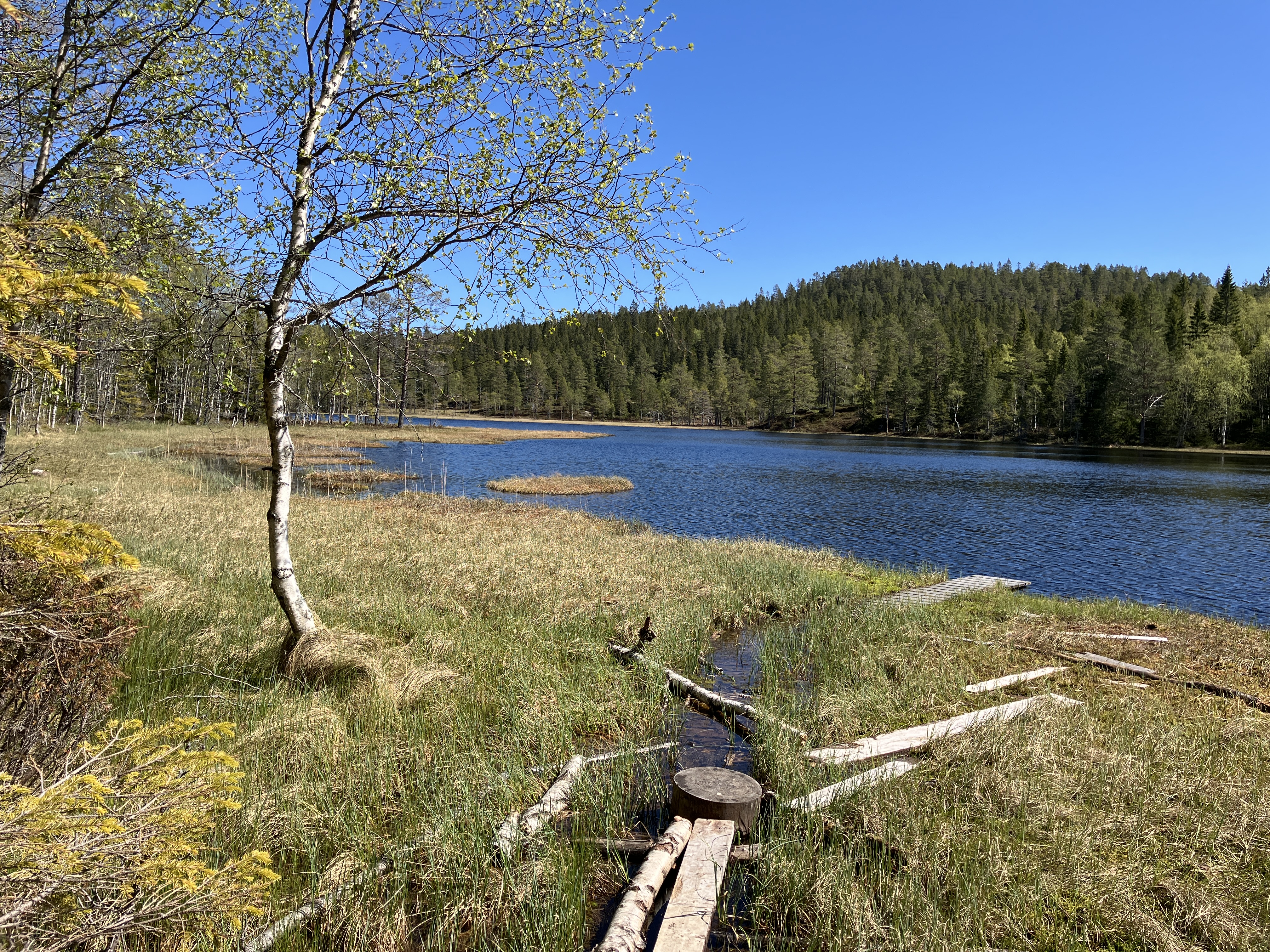
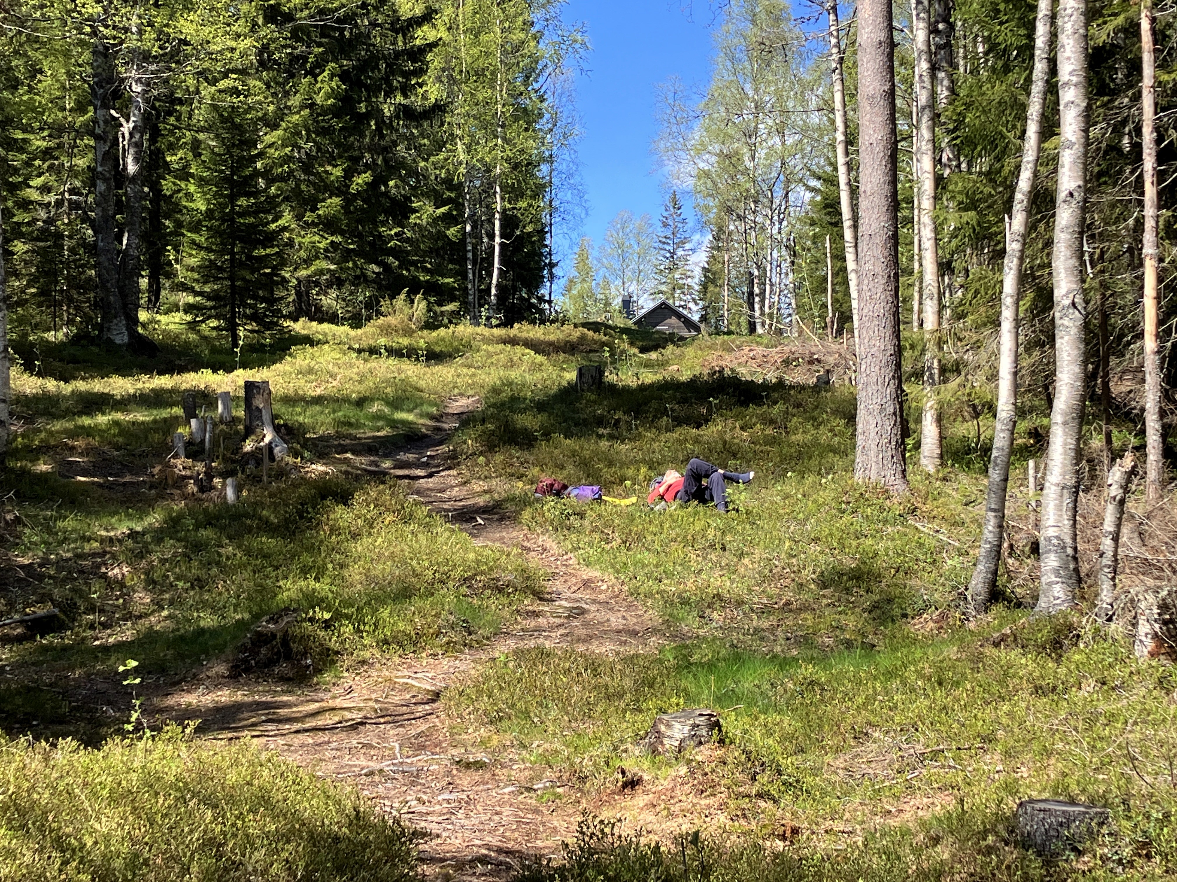
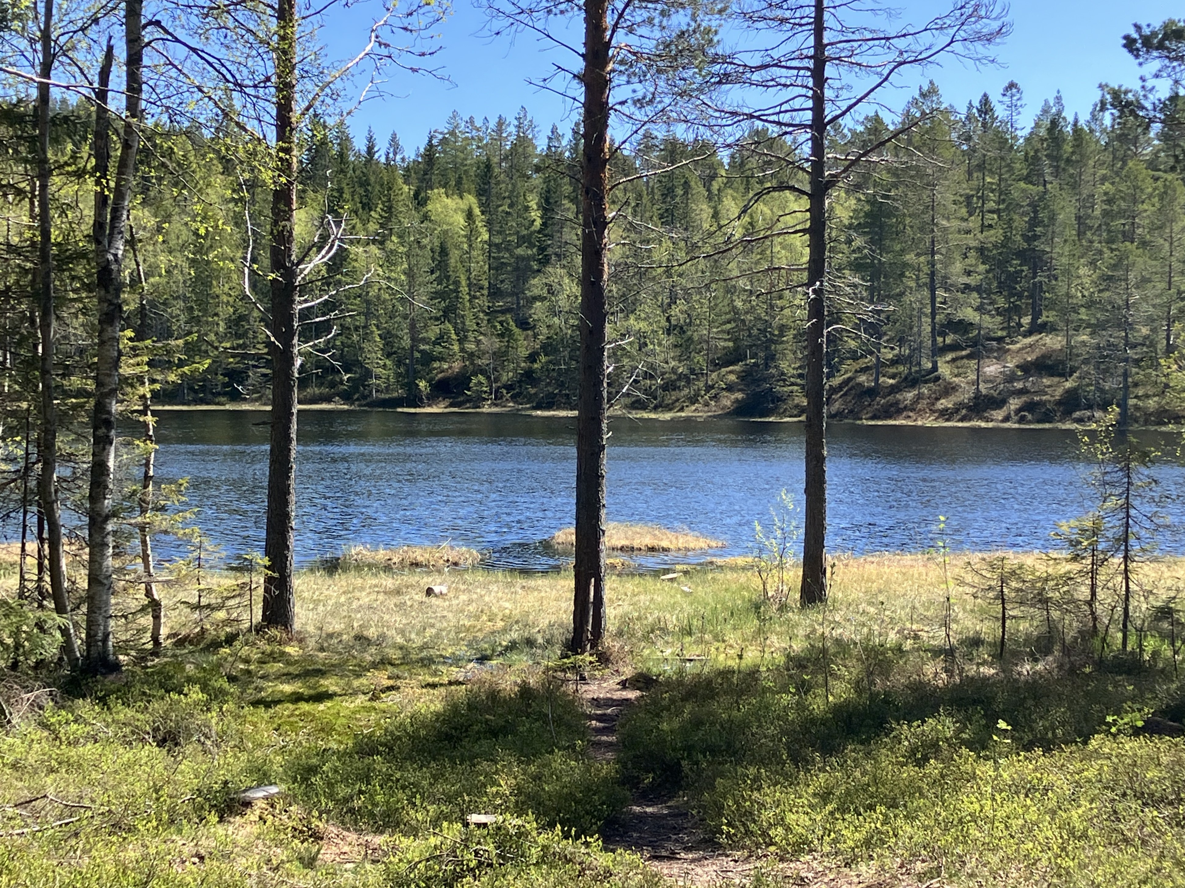
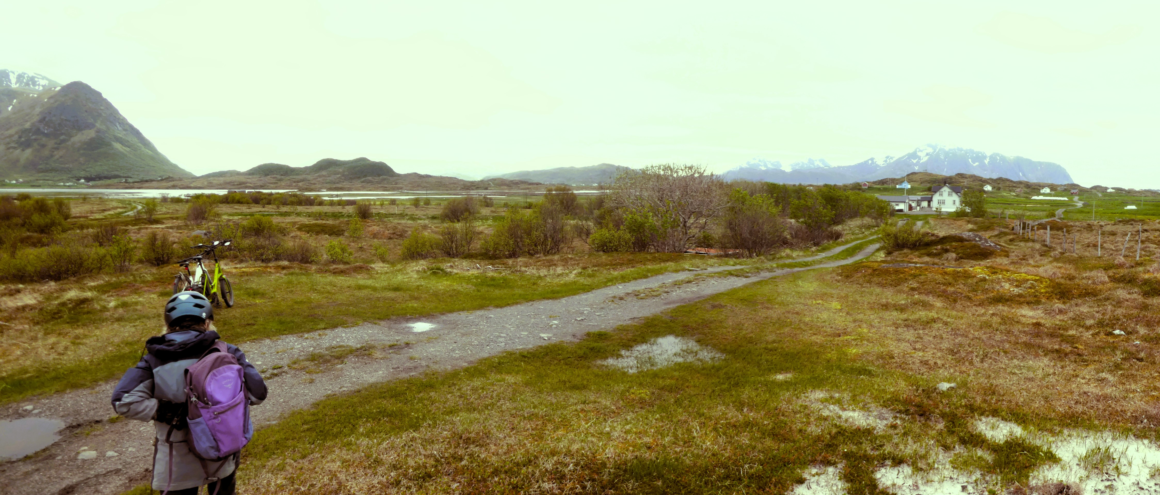
After a slow breakfast by the van in the morning sunshine we cycled about the south entrance of the Skuleskogens National Park. It took us forty-five minutes and we left our bikes there. We followed a well-marked track walking steadily uphill through lovely forest to Skrattabborry Tjarnen, a lake.
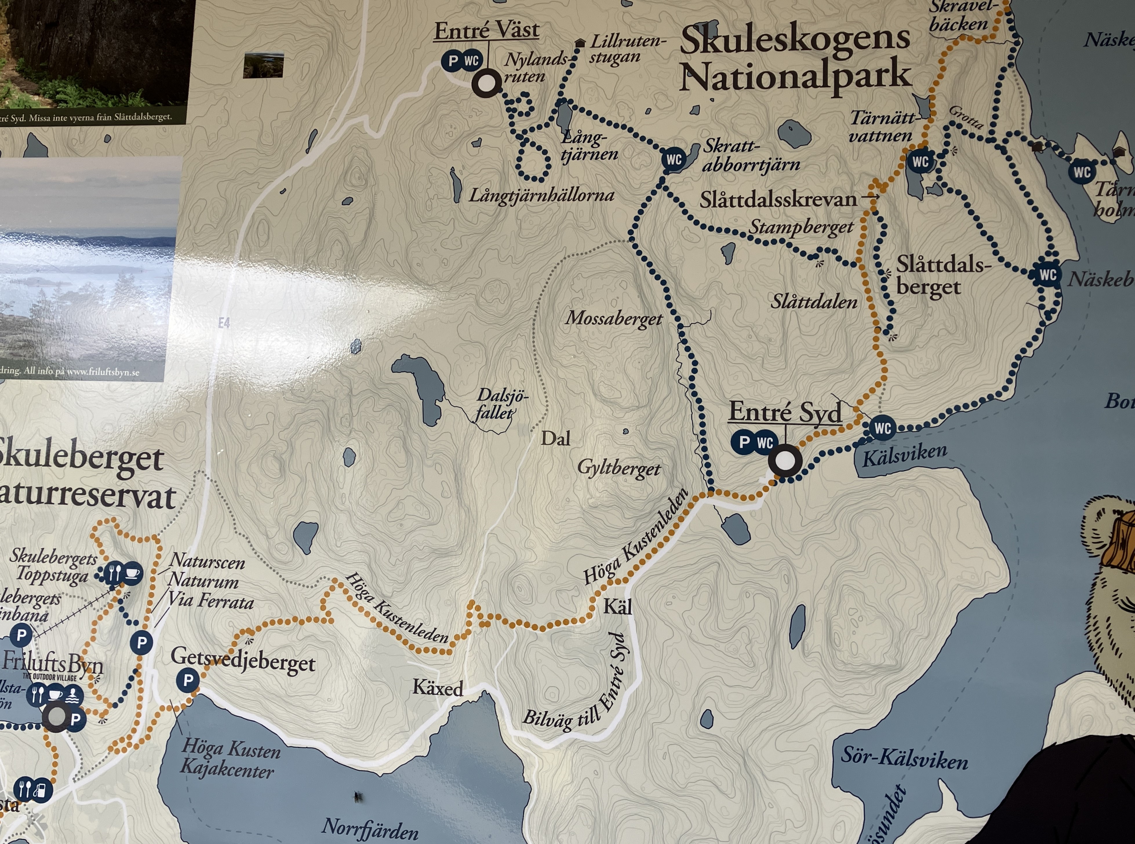
We wanted to eat lunch by the lake but soon found it was too squelchy. So, we moved to higher ground nearer to the camping area. Afterwards we inspected the camping chalets before making our way across the boulder strewn granite landscape of the hill Lillratjarnen.
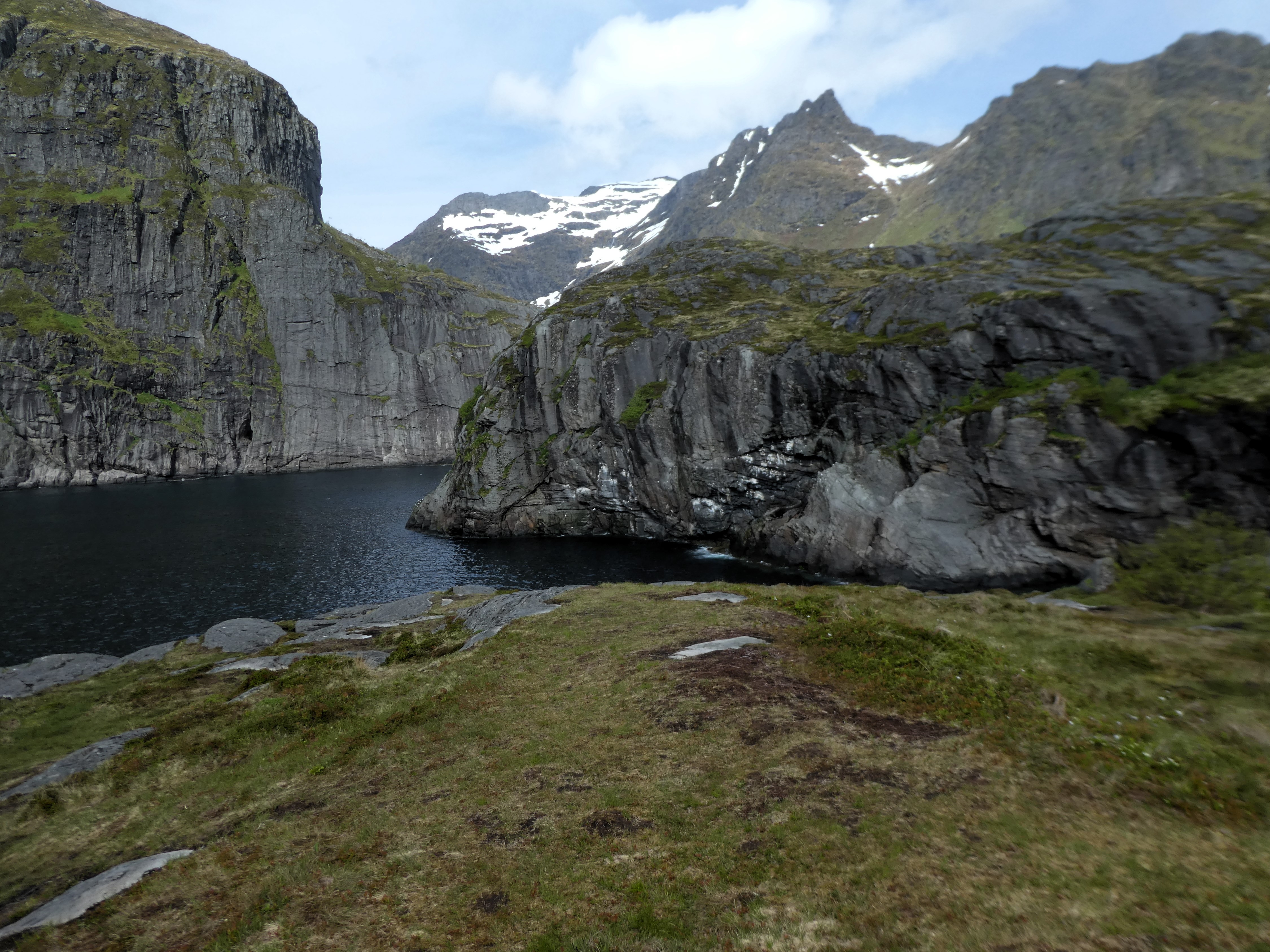
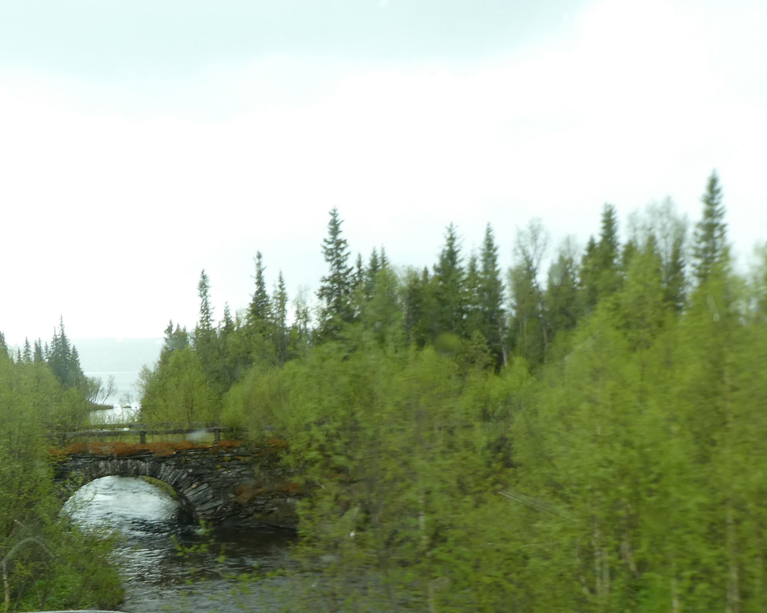
From here, we walked north through a ravine. Huge boulders hung perilously above it. We headed to the famous gorge Slattdalsskrevan. Here there was an amazing cut-through in the rocky landscape that was chained off but could be looked into.
We retraced our steps. With the aid of wires, we climbed up onto Slattdalsberget a ridge running parallel to the sea. It offered wonderful views out to the cliffs and the archipelago beyond. Thankfully, the ascent wasn’t as steep. Soon, the path led us back to the Park entrance along partially boarded tracks!


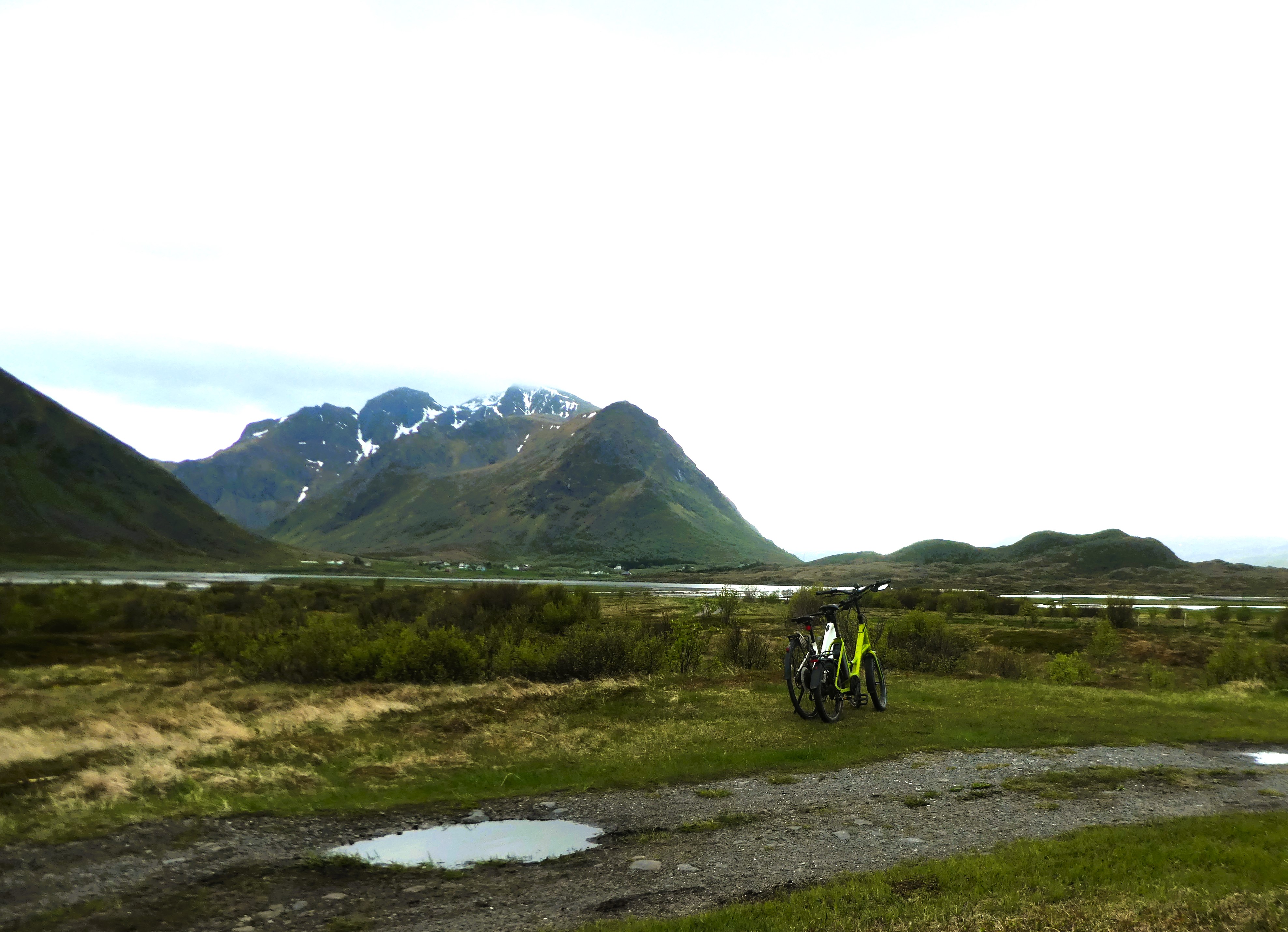
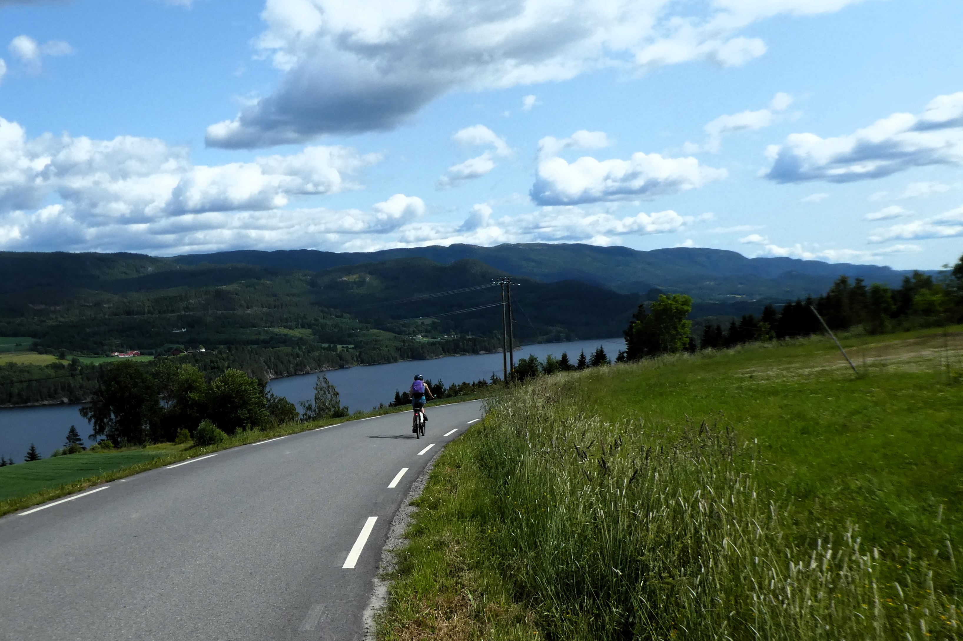
When we got back, we put the bikes on charge through the electric hook-up to the van. It was then we realised that Graham’s bike had a flat tyre and we would need to get it repaired. We were fortunate. It hadn’t let us down. We enjoyed the ride along the road to and from the Park.
We were unable to get the tyre off the bike. We decided to leave it until we could get to a bike shop in Umea.
Well exercised, and with a mission for tomorrow, we enjoyed sitting around having a meal and a good night’s rest.
Day 12- Docksta

Wednesday 28th May
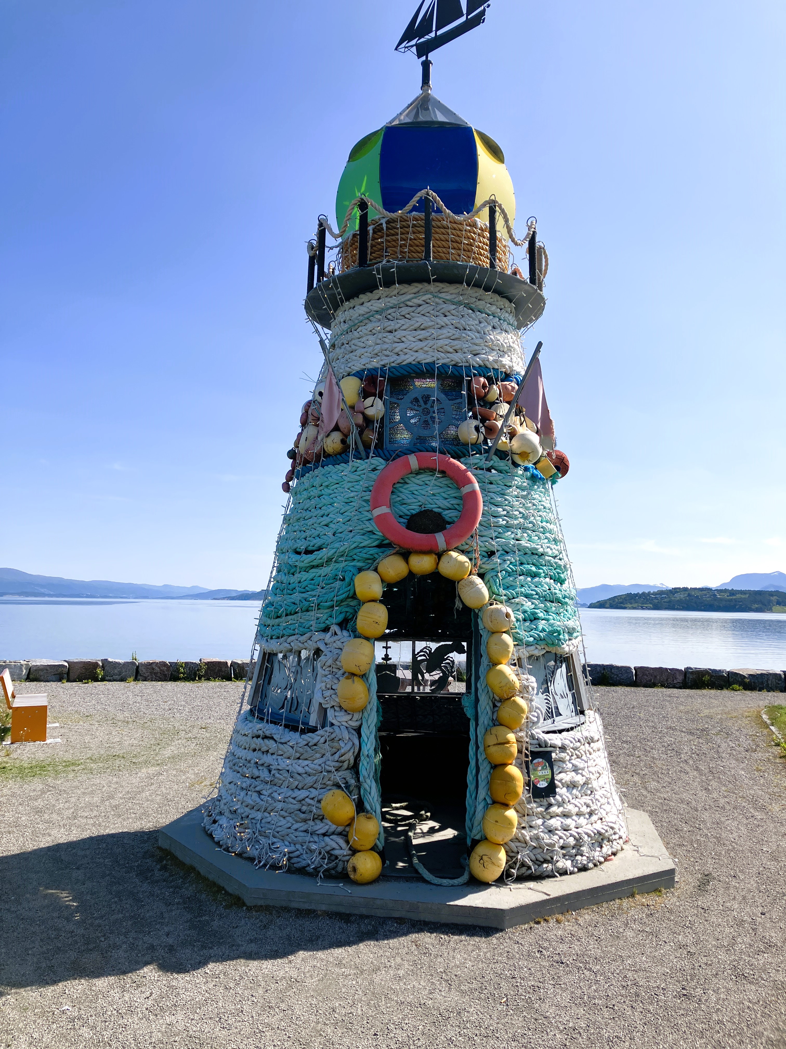
It was a bit grey and cold when we get up and have breakfast. We decided to spend the morning exploring Docksta. We took a flowery path around the lake that led into the village.
The path was bordered by models depicting the various local legends.


They were beautifully decorated with natural materials. These decorations told the story of how the nearby mountain of Valaberget got its distinctive striped marking.
The legend was that a troll and her troll husband were skiing down a steep slope. They were so heavy and going so fast that the skis dug through the snow and tore into the mountain itself.
We walked into Docksta. It was now a truck stop for traffic on the main coast road. It also served as an important port for the Islands off the High Coast. In earlier times furs were exported from the inland to markets further down the coast.
We walked down to the water’s edge where the history of Docksta was displayed on interpretation boards. We went back into the town and did some shopping before taking Fika in the café next door.
In the afternoon we climbed up Skuleberget Toppstuga the mountain above the camp site. Our route took us back towards Docksta and then up and around the southern end of the hill.
It was not easy with lots of boulders and rocky ledges. Eventually we made it to the first peak, and then up to the summit with its viewpoint. A man with three girls then appeared having just climbed up the ferrata track on the other side of the mountain.
We spent time here working out where we had been the day before and wider views beyond. Following the steep gravelly track down criss-crossing under a chair lift we arrived back at the lake below.
At the van the heavy drops of rain, that had started as we climbed down, cleared and we sat outside in the sunshine enjoying a beer with our dinner.
Day 13 – Docksta to Umea
Thursday 29th May
It was sunny and hot as we breakfasted outside. We reluctantly packed up the van and bikes before leaving this very pleasant site.
We travelled up the coast on the main road through Ornskoldsvik and Nordmaling to Umea
When we were in Umea, two hours later, we found the bike shop. As we had half expected, it was shut. It was a public holiday in Sweden for Ascension Day. The sign on the door clearly stated it would be open the next day early so we weren’t totally disheartened.
We had a spare day in Umea! It was hot. There was little buzz to the place. From experience elsewhere, we know this is the effect that public holidays have on busy working towns.
The city is built on one side of a broad river bank. The more upmarket housing is on the other bank.
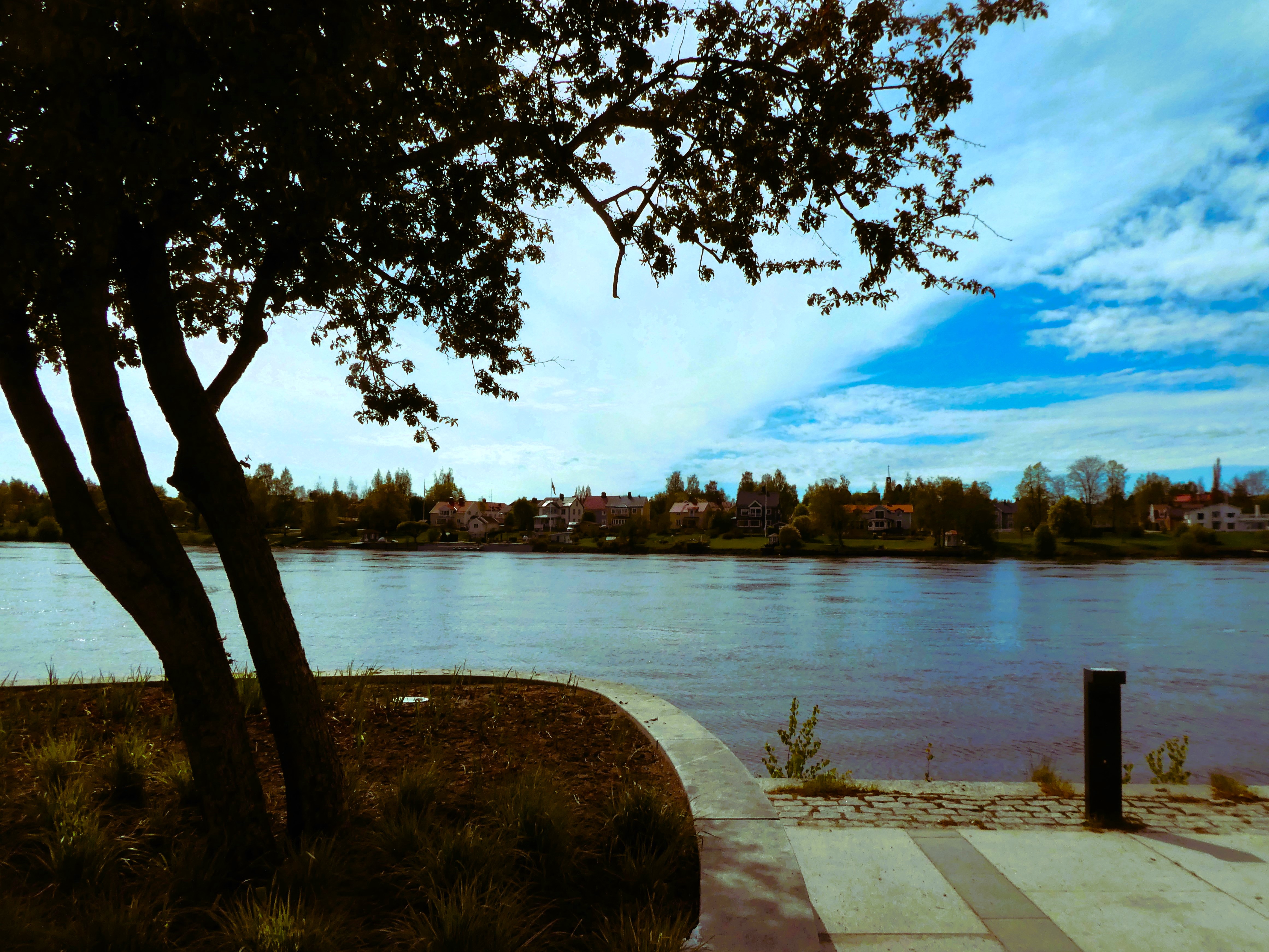
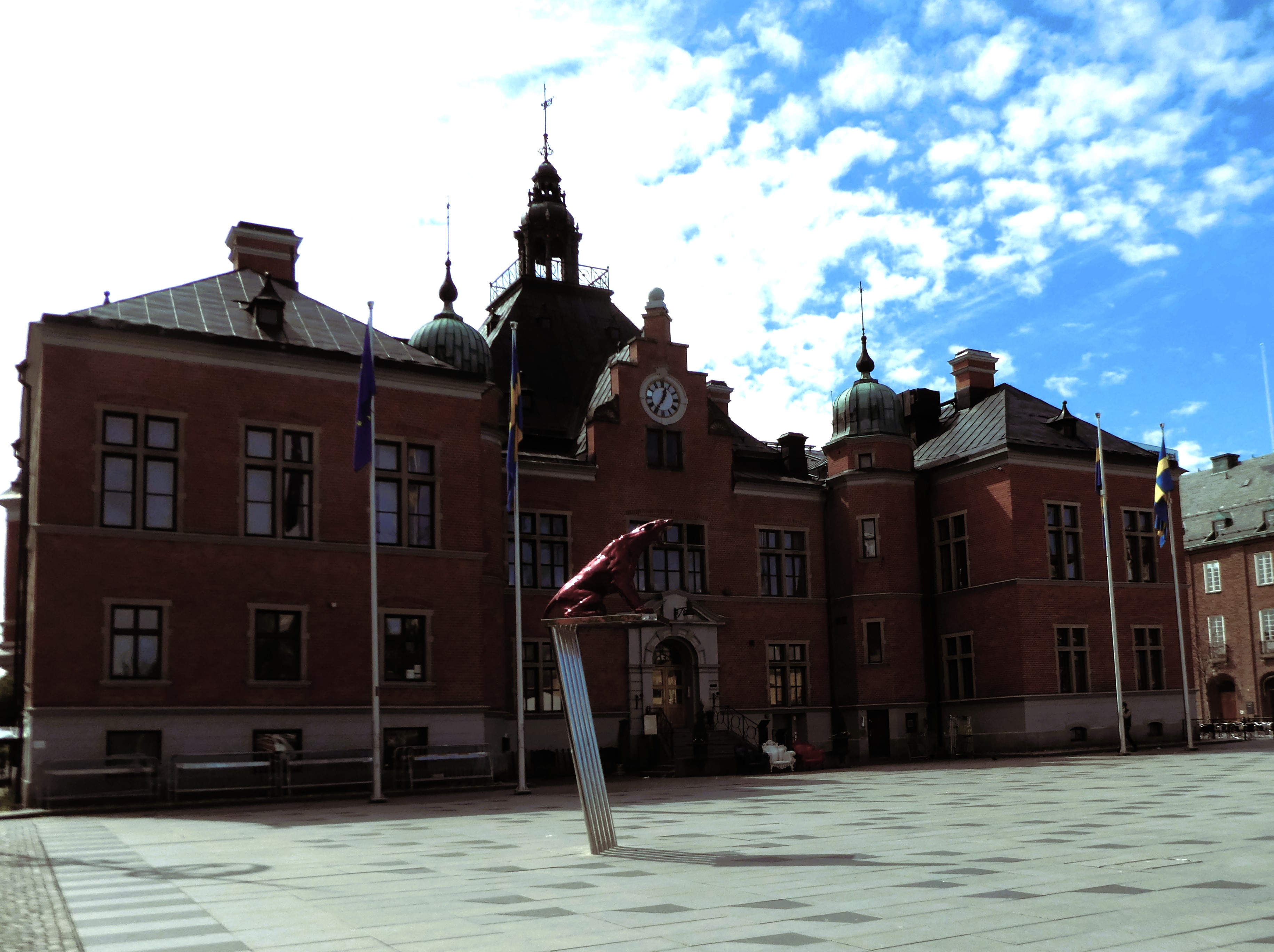

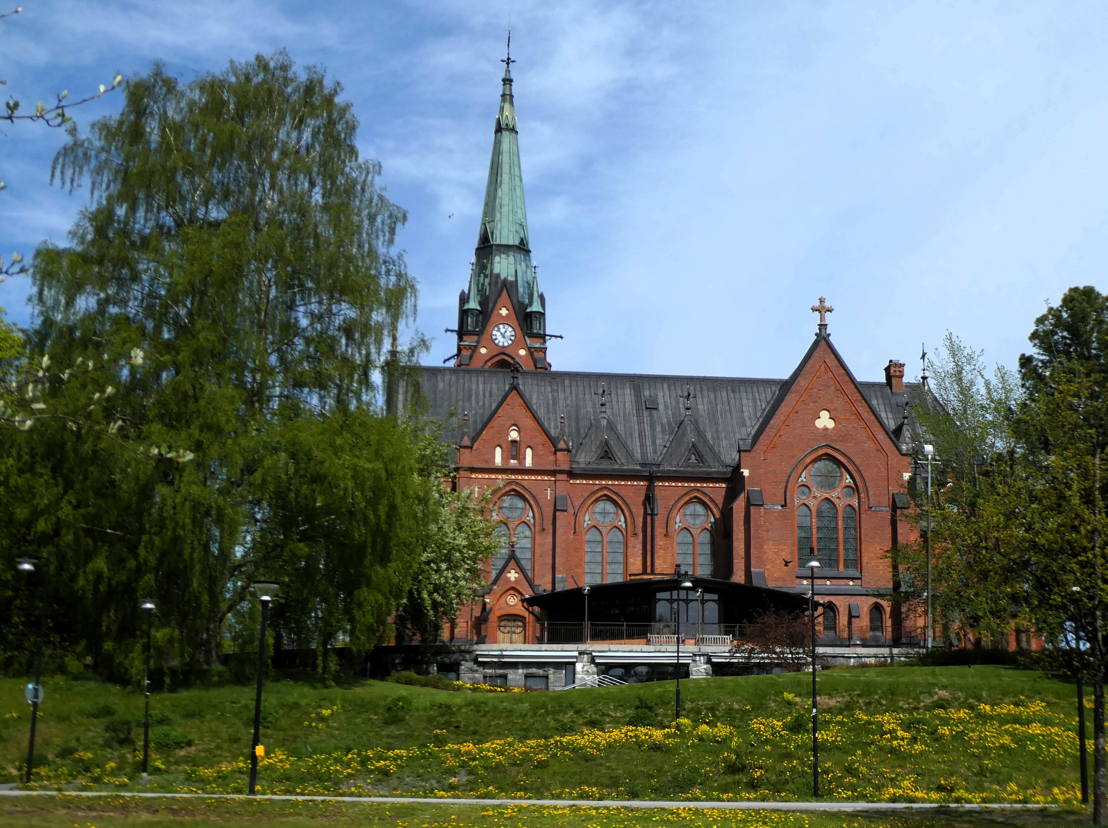
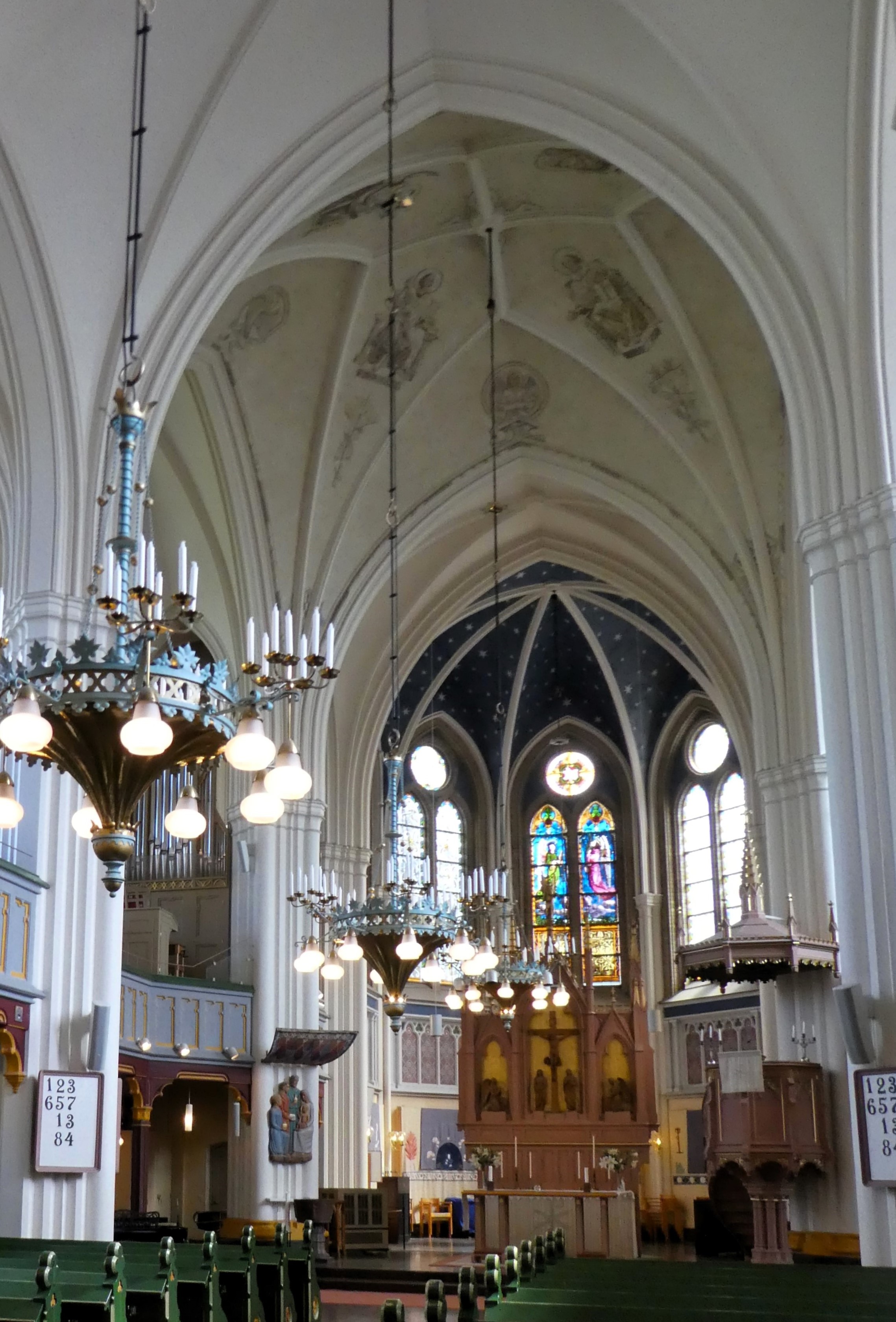

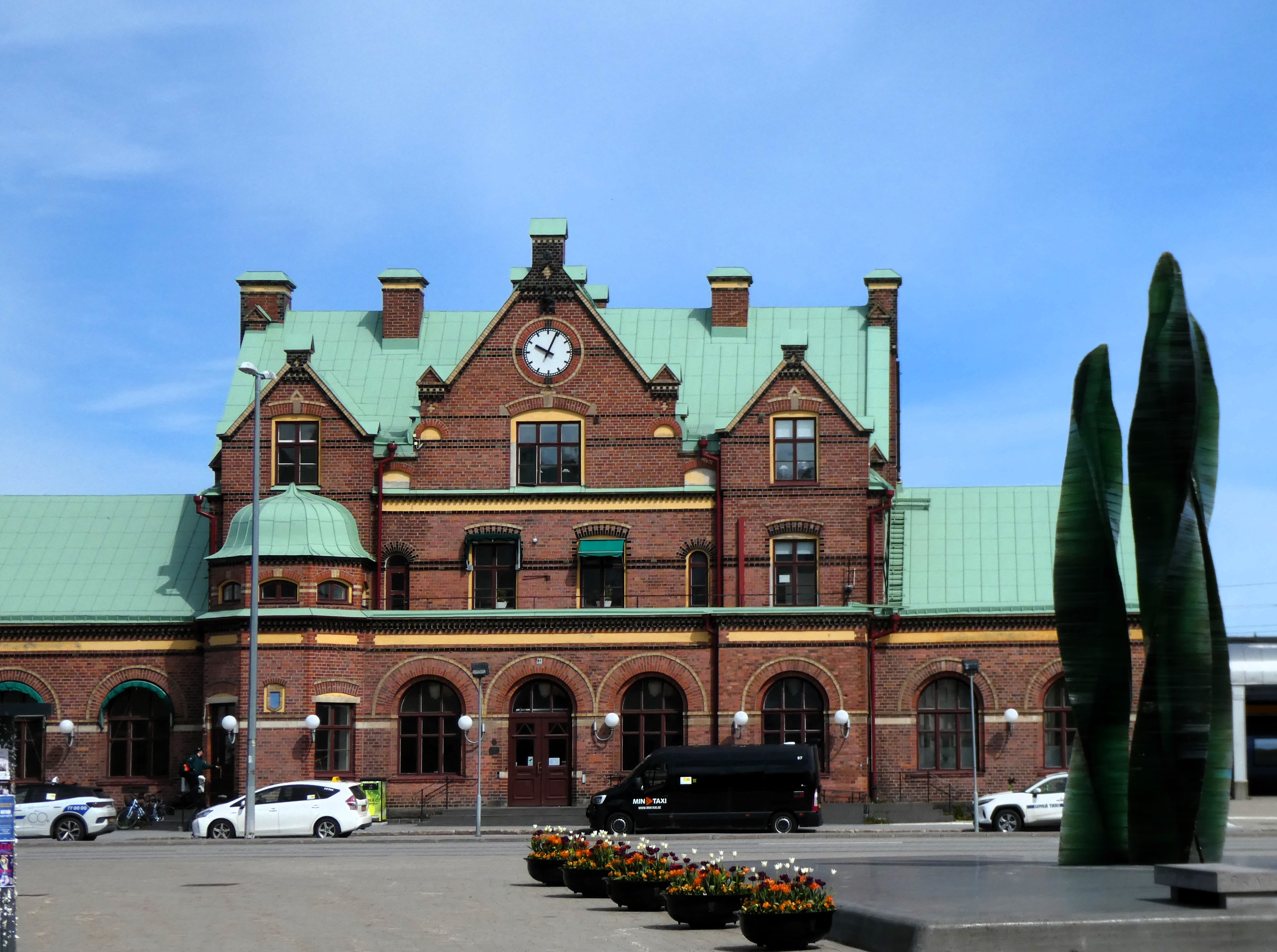
We wandered along the river bank and explored this very modern city. We went up to the Station and back to the Town Hall and Church, before going through open parks and wide city streets.
The city had been burned to the ground in 1888. There were no old buildings standing in the city centre. There were a few on the outskirts.

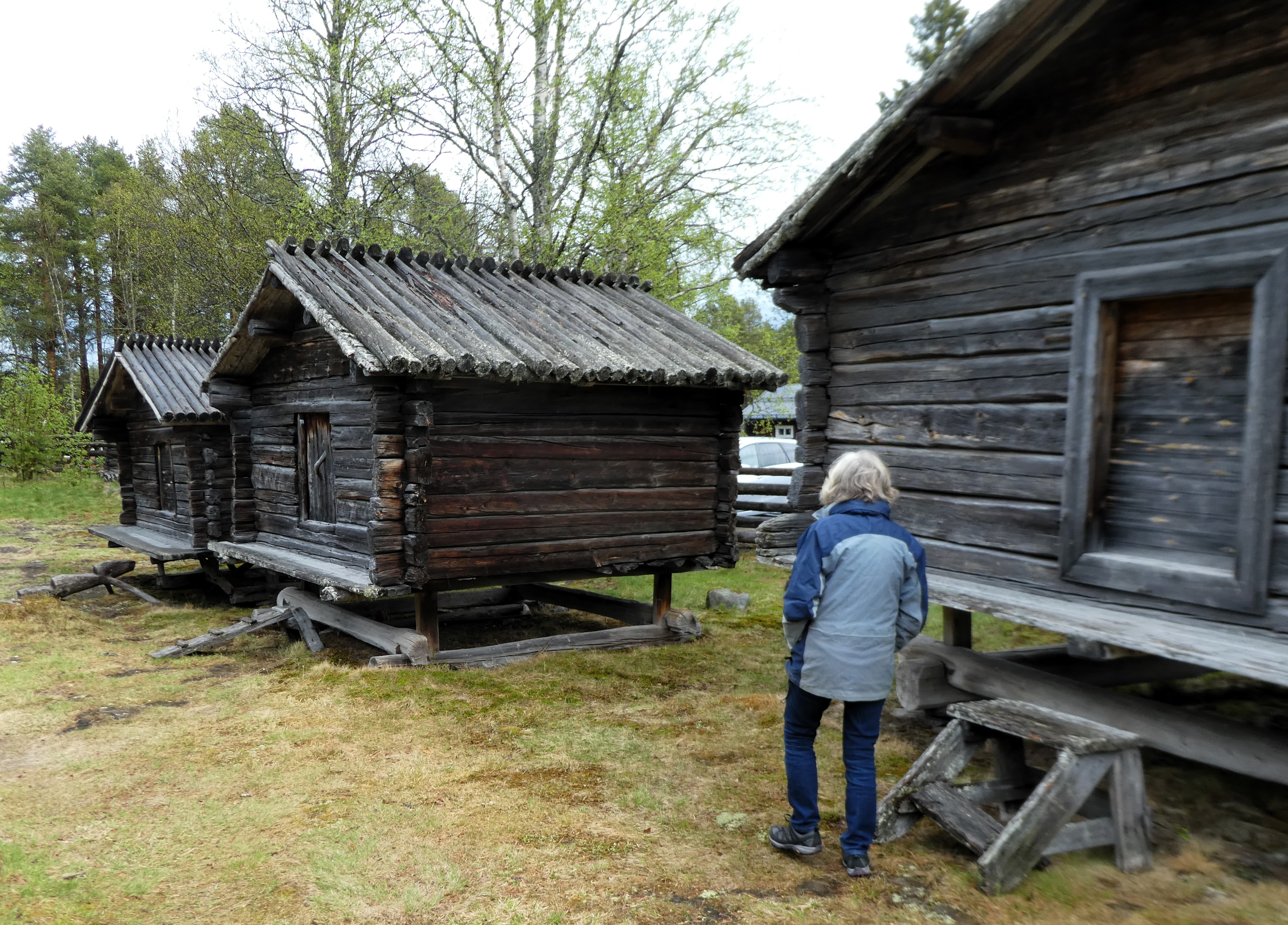
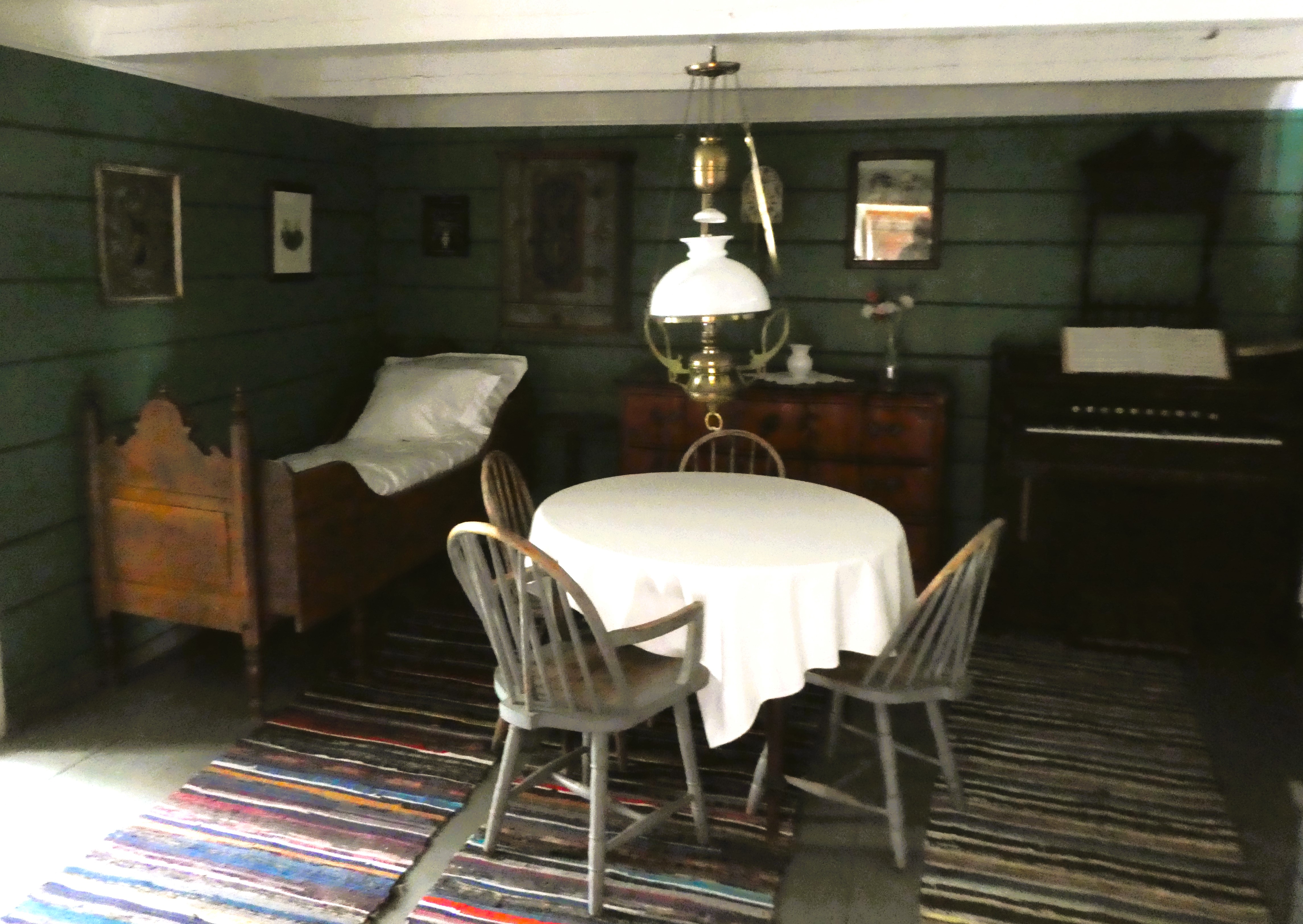
We found the Vasterbottens Museum. It featured a mixture of cultural exhibits in a parkland area. Several relocated old wooden buildings, gathered from around the area, were showcased. It presented traditional building types. This served as an introduction to what we were to see in coming days.


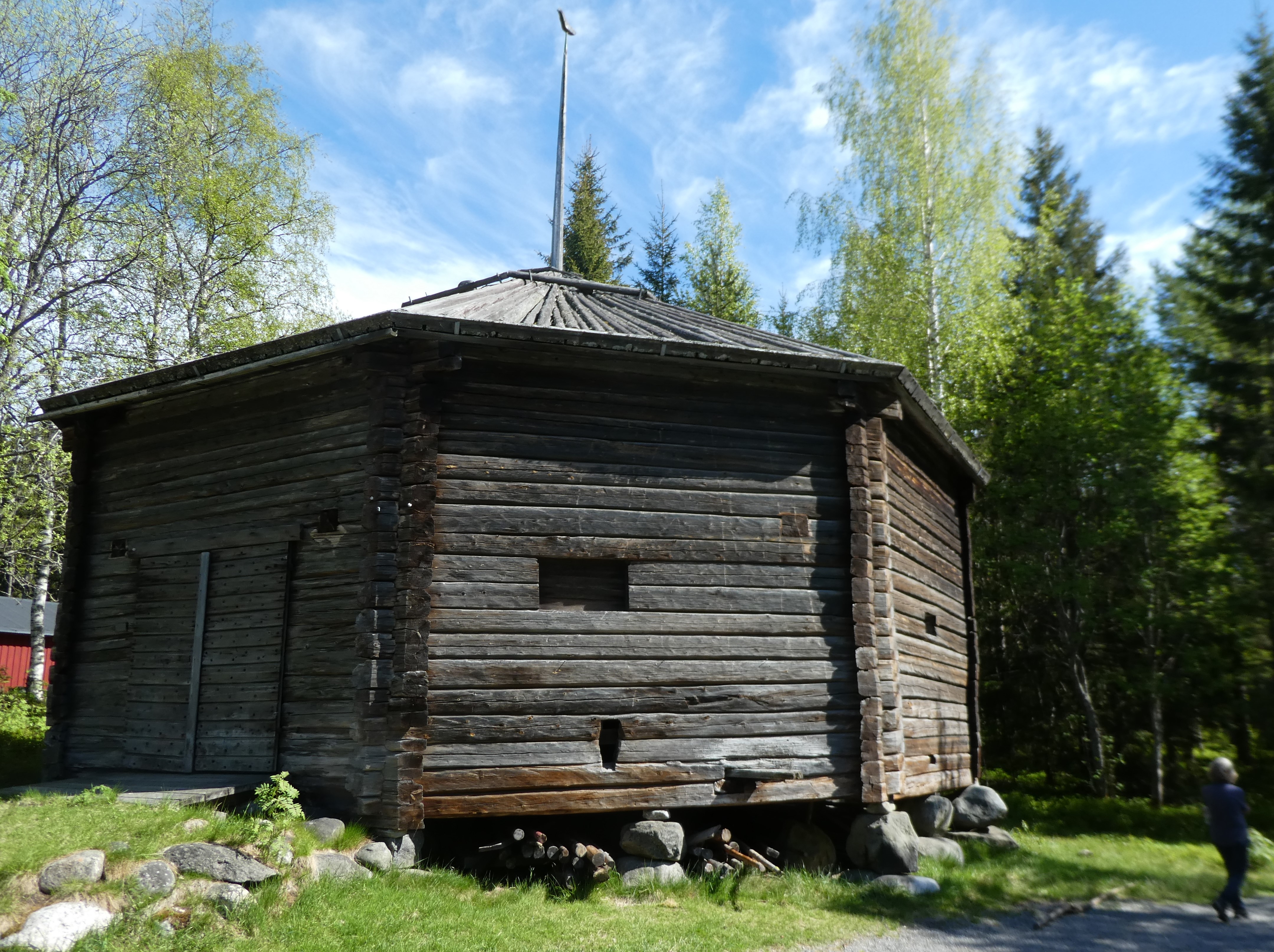

None of the interiors were open but it was interesting to wander around and read about them. It also provided a cooler, interesting place to have lunch.
At around 4pm, we started our drive to our P4N spot. It took ten minutes to reach the woods east of the city, near Nydalasjon Lake. The car park was fine so we parked the van and walked to a small lakeside beach, Karleksviken. Here a few families were enjoying the sunshine. Others were using the plentiful BBQ areas beside the lake for their late afternoon meal.

Back at the car park we had some tea. In the evening, we wandered through the woods. We found a Forest School site close to a new area of housing. It was not far away.
There were four other vans parked up for the night there. French, German and ourselves, all very civilised.
Day 14 Umea to Jokkmokk

Friday 30th May
We slept well and were up early to breakfast and before walking to the toilets at the beach. The water on the lake was silk like, beautiful.
We then drove to the bike shop who were open at 8.30am and left the bike for them to fix. We walked into a quiet early morning city and did some shopping. We found ourselves a café for Fika before returning to find the bike mended, phew!


We left Umea about 10.30am and travelled on lovely empty roads to Arvidsjaur. We travelled through undulating pine and birch forest and scrub, lakes and swamps and the occasional hill. Small settlements or groups of cabins by lakes contained a very sparse population. All along the way so far we have heard cuckoos and today was no exception in spite of the cold.
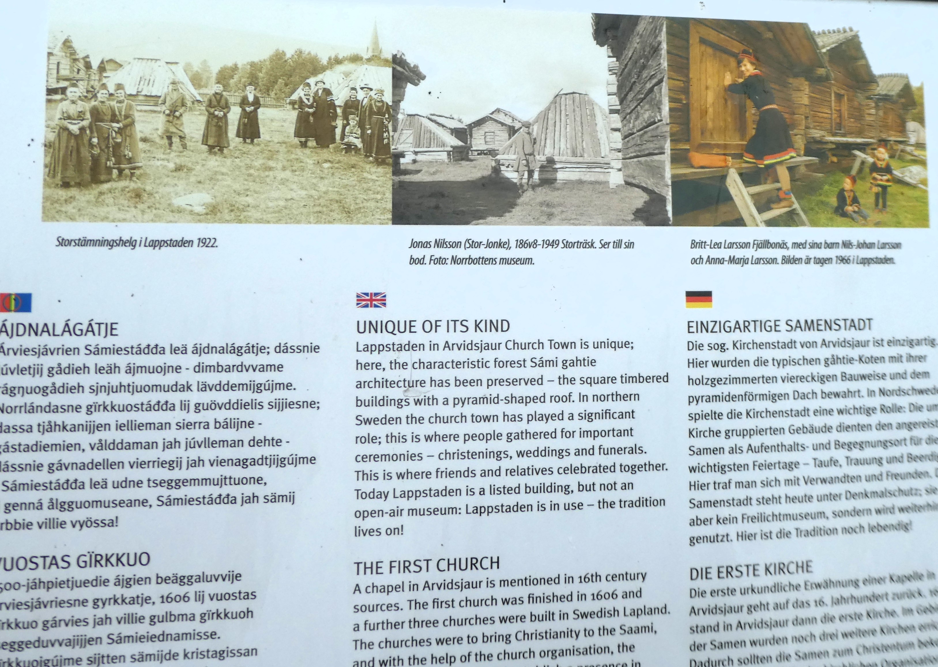


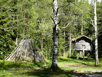
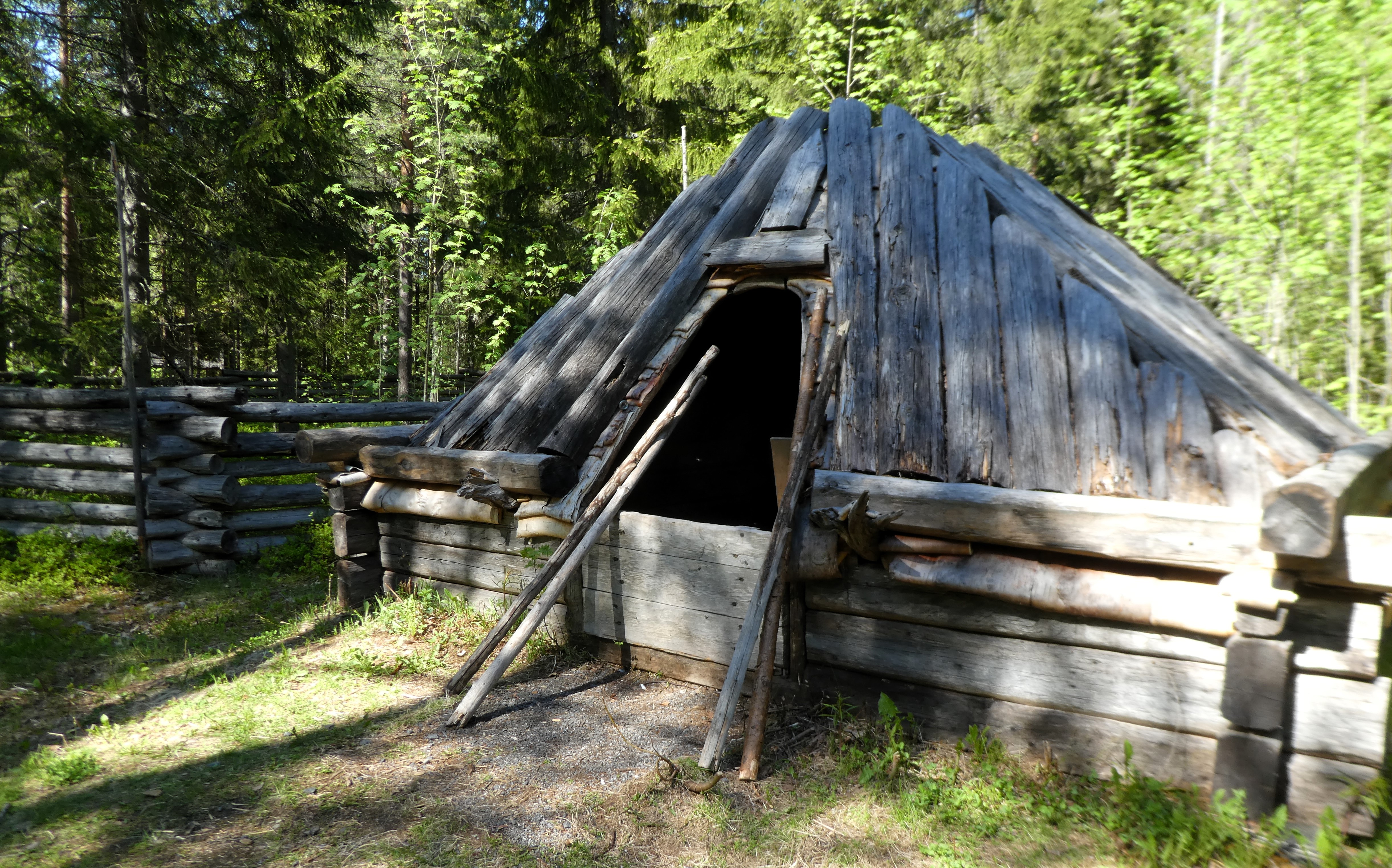
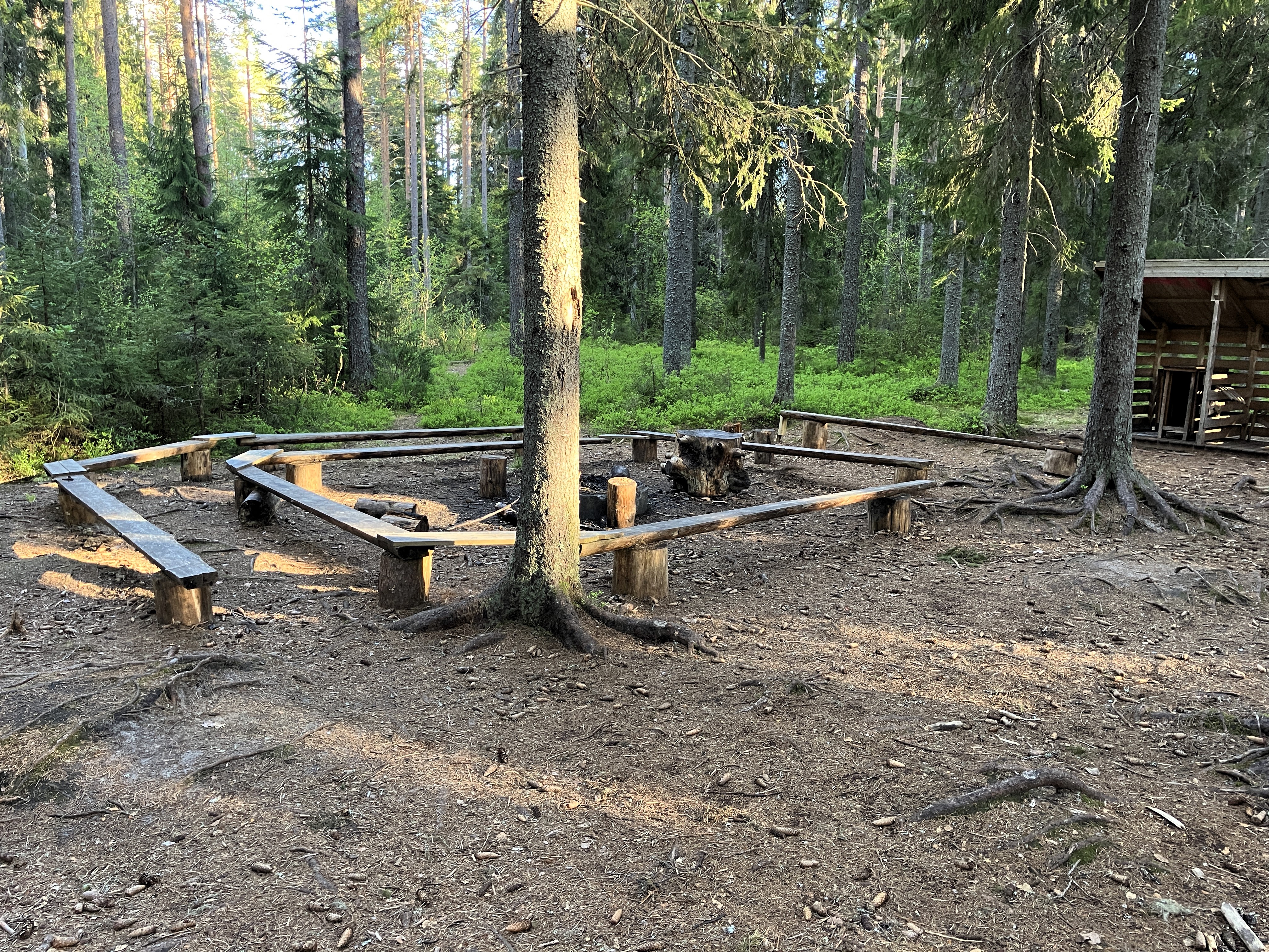
At Arvidsjaur Church Town we stopped to look at the unique Lappstaden. This is a group of 18th century huts. They were built in the traditional forest gahtie architecture for the nomadic Sami. Churches provided a centre of Christianity where people gathered for ceremonies like christenings, weddings, and funerals. This is where friends and relatives celebrated together.
Lappstaden is a listed building. It is not an open-air museum. The building is still in use as the tradition lives on.
We can’t go in any of the huts. They are listed buildings, not museum pieces, and still in use. However, we can see the intricacies and simplicity of their structures.
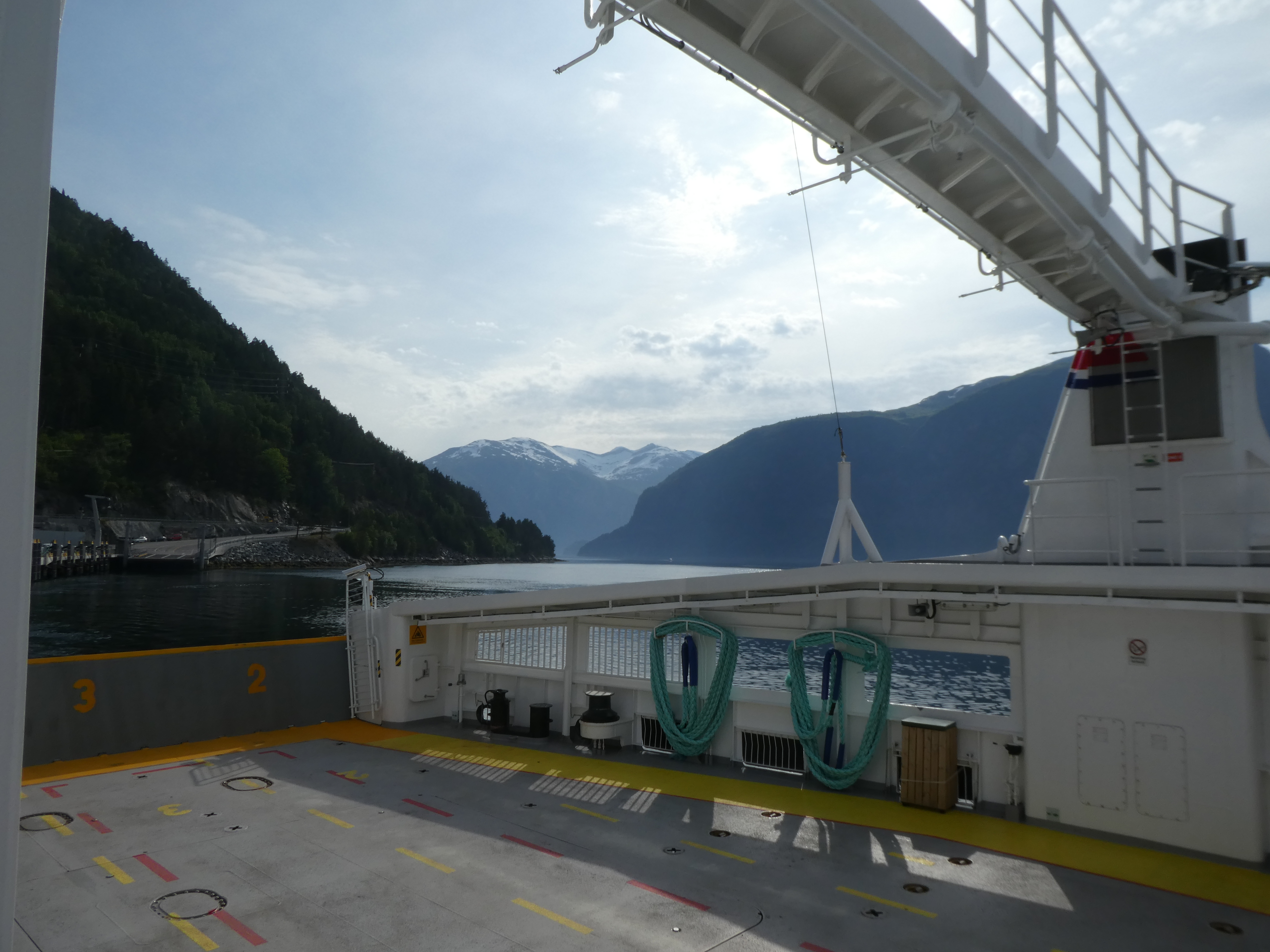
We filled the van up with diesel. Soon, we were driving on to Jokkmokk and Arctic Camp.
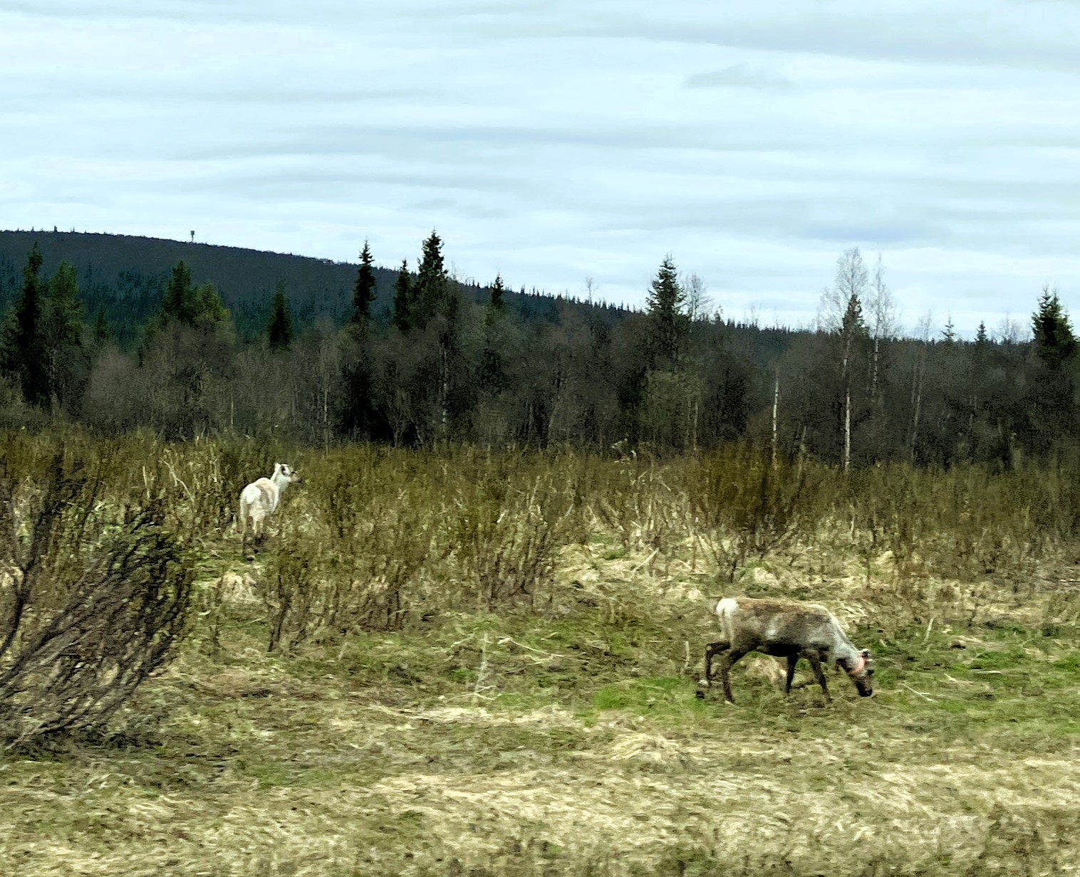
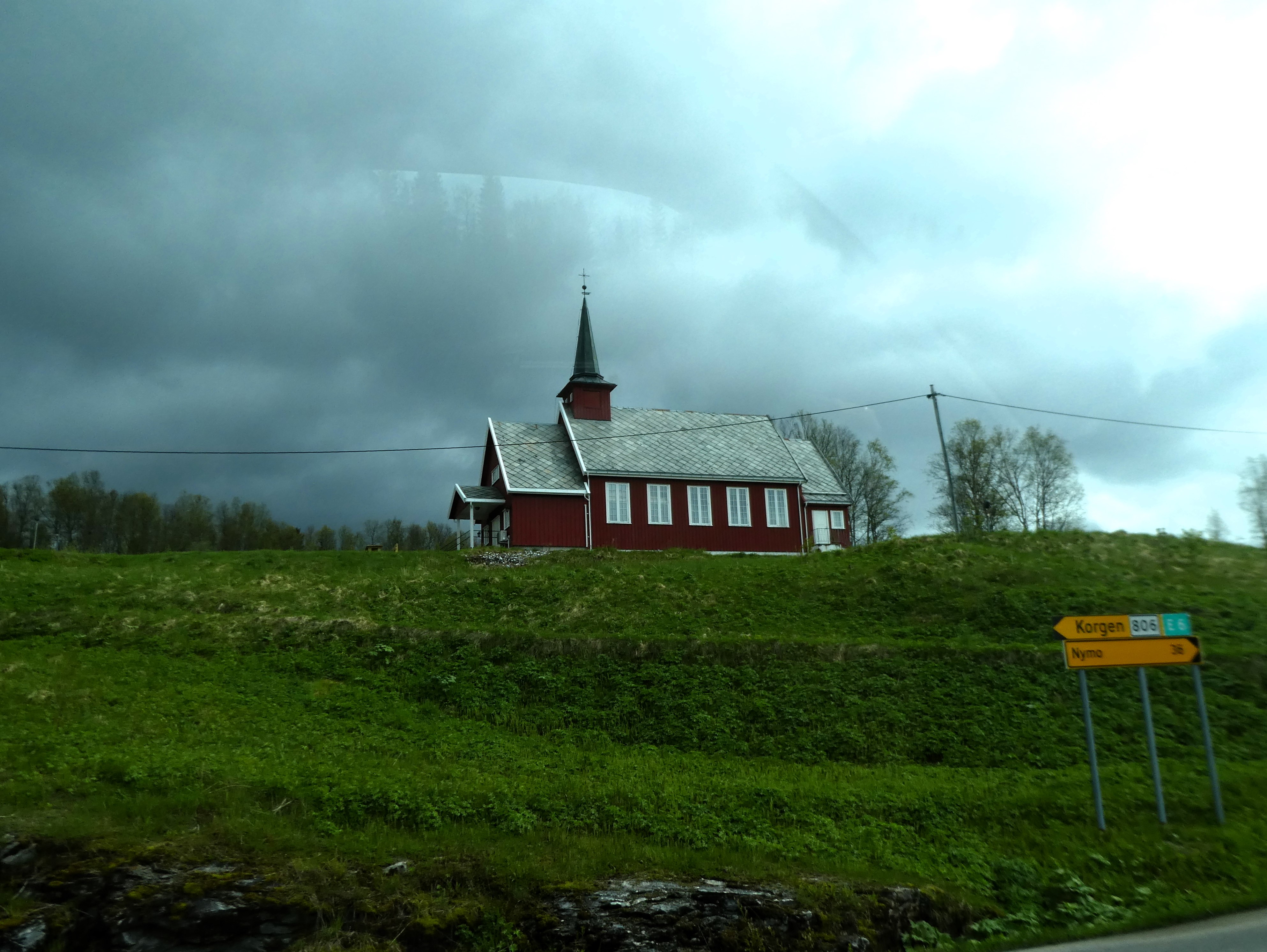
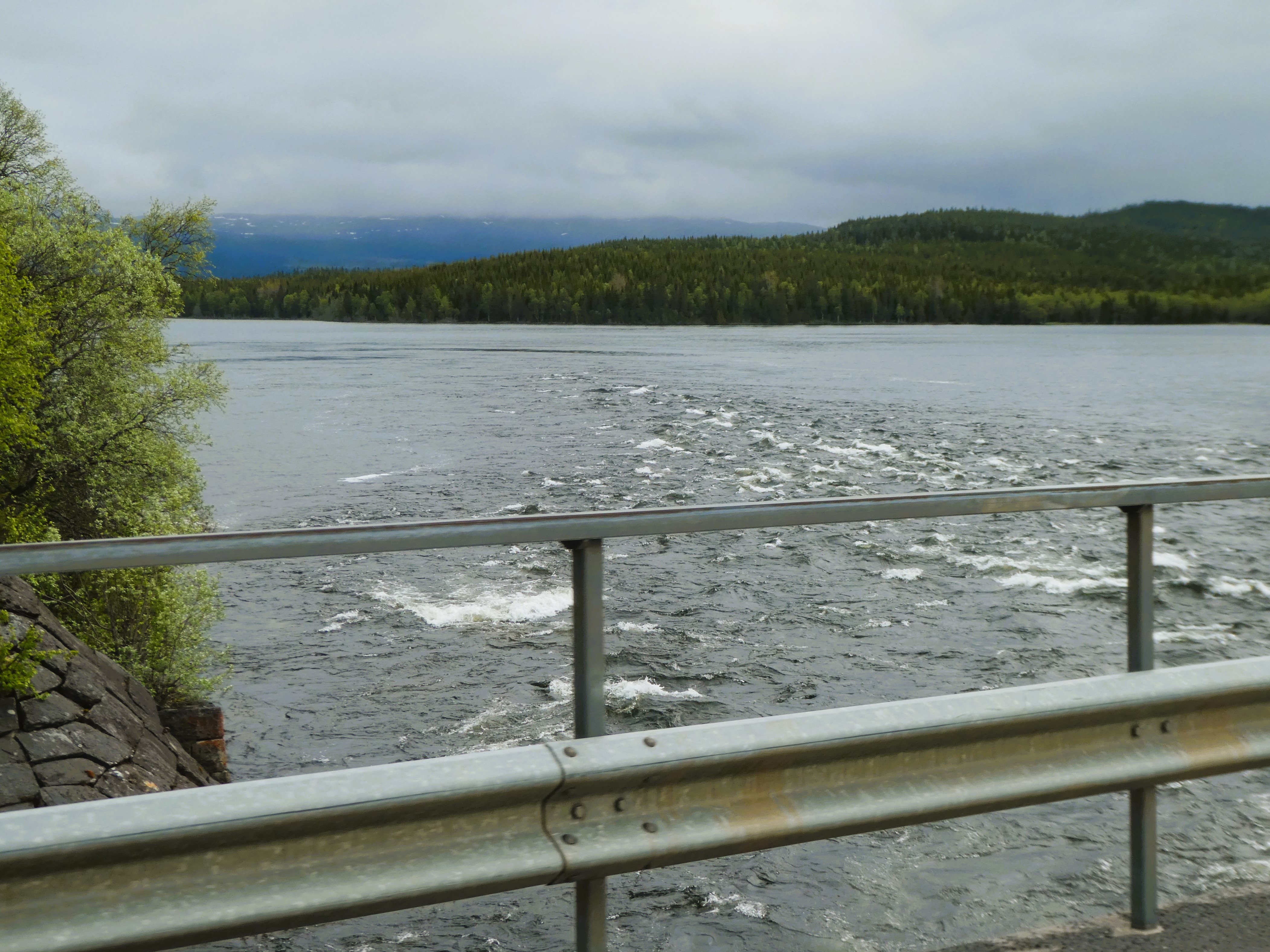
The landscape continued to be big, open and wild. We stopped at a lake to view some black divers and later saw elk and reindeer grazing by the roadside. Just before we reached Jokkmokk we stopped to acknowledge crossing the Arctic Circle.

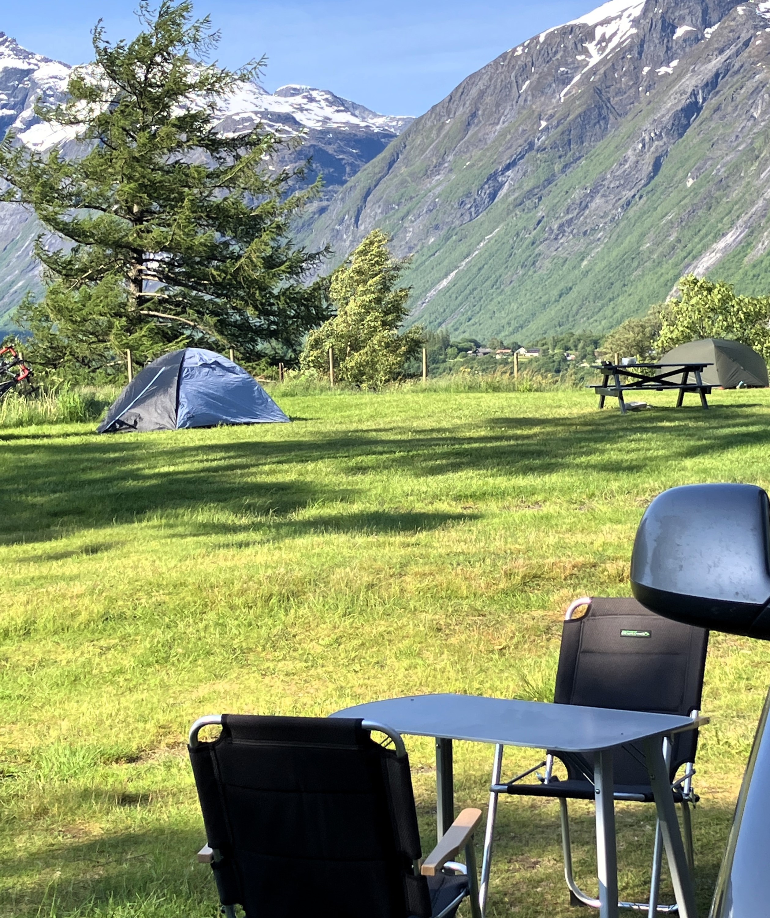
We arrived at what felt like a frontier town. It had a simple linear street system and two or three large stores. We found Arctic Camp just outside the town within cycling distance of the town centre.
We were allocated a plot on the large flat site with a view of the lake. Nearby facilities, which no doubt include singing and dancing in season, were now quietly waiting for summer to open up.
We put the awning up as it started to rain persistently and we had our first darker evening.
Day 15 Jokkmokk

Saturday 31st May
It rained hard all night but lessened as the morning progressed. We did a wash in very efficient washing machines. However, we needed assistance to make the tumble dryer work.

After coffee we cycled up to the centre of Jokkmokk and the Ájtte, Swedish Mountain and Sami Museum.

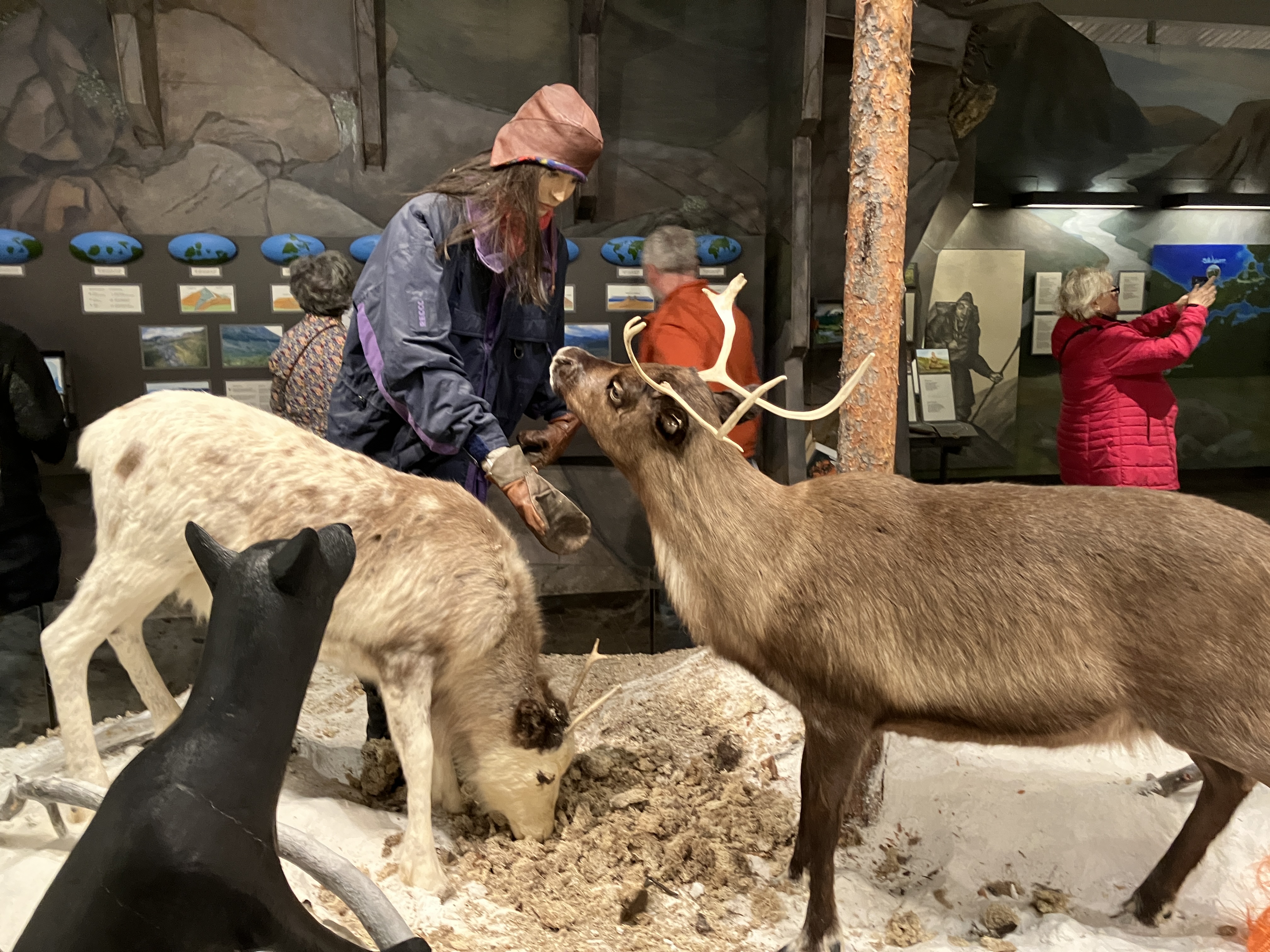
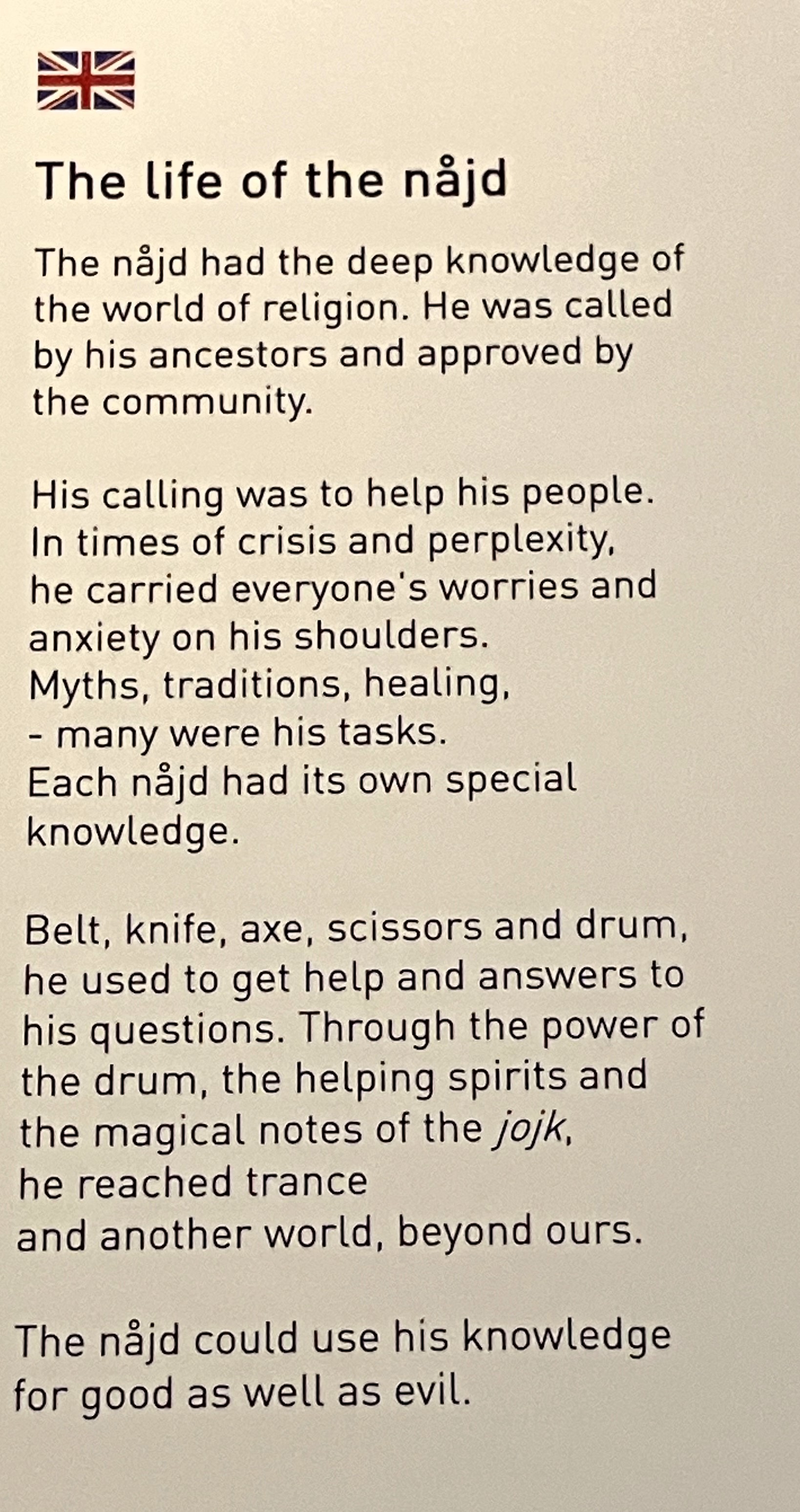
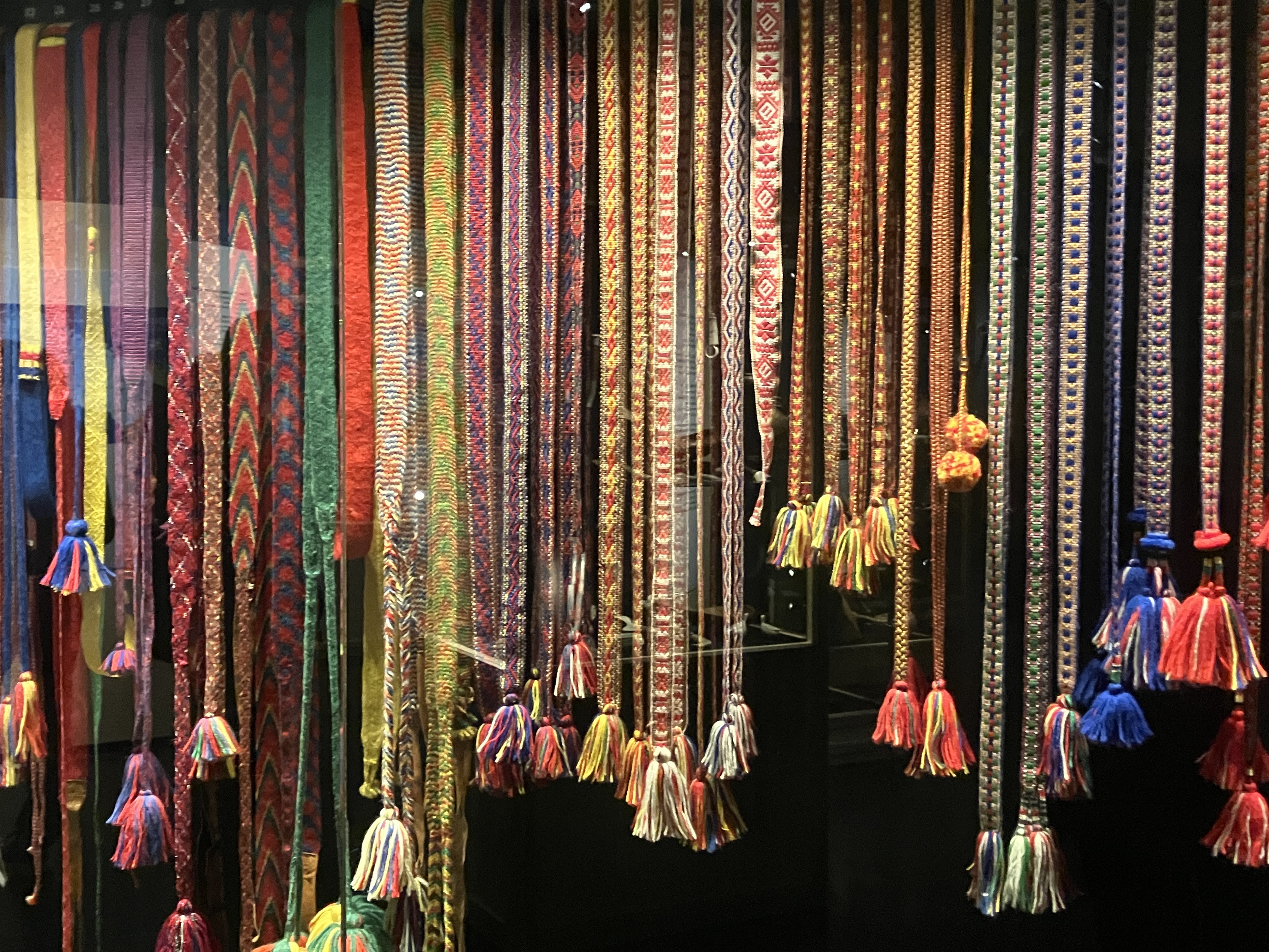
It was a modern, inter-active museum. It showcased the vastness of Lappland and the Sami lands. The museum also highlighted the history and culture of the people and their reindeers.
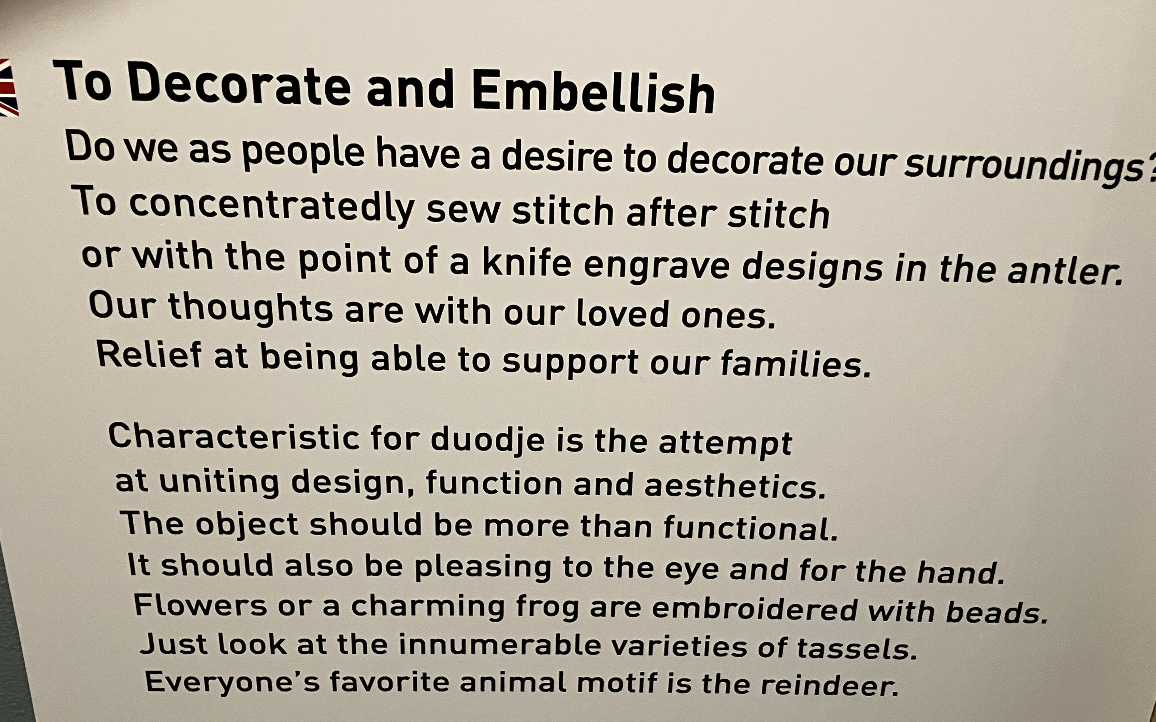
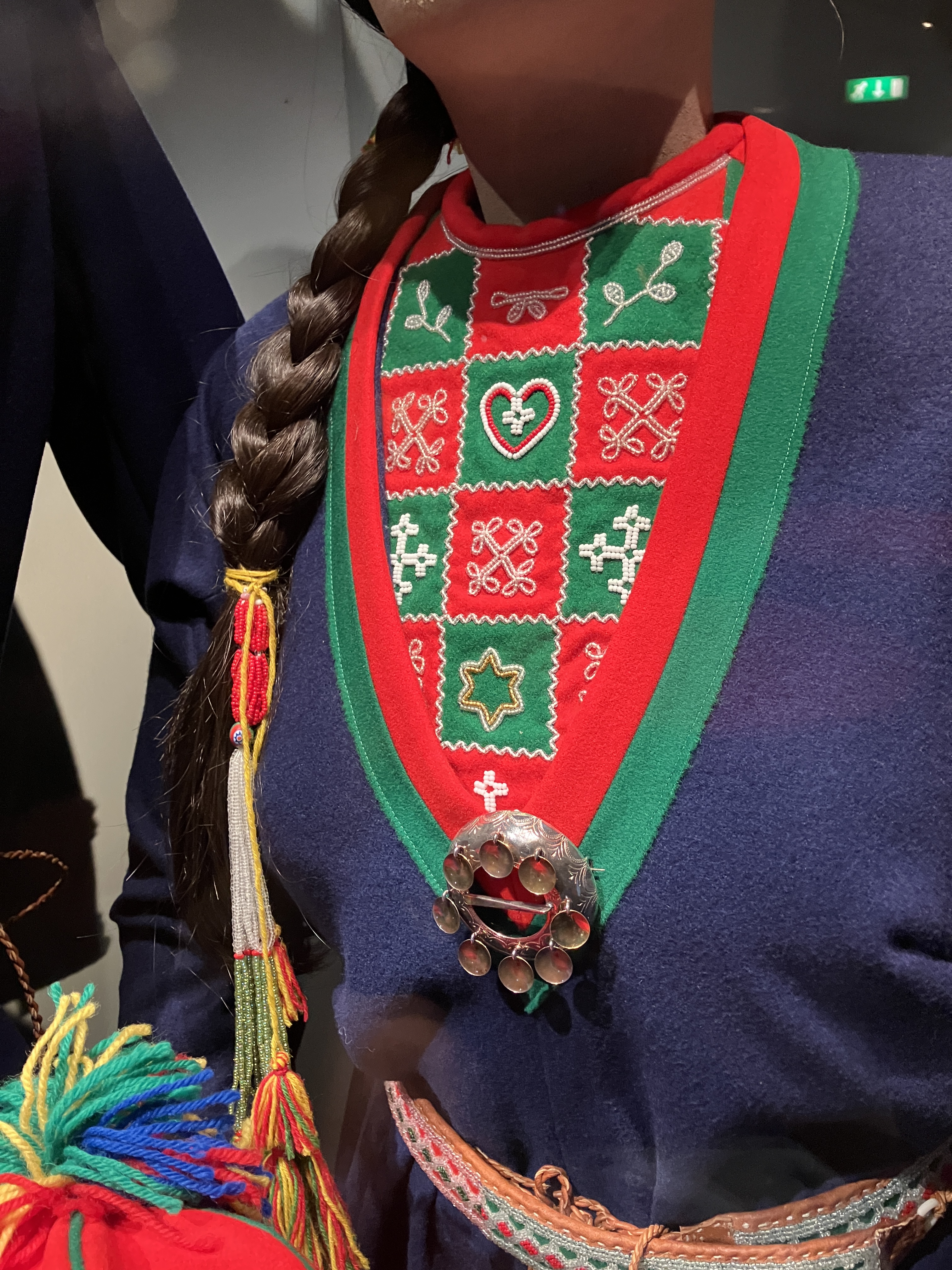


The exhibits presented and interpreted costume and silver. They covered the drums of religion and mythology. They explored the lives of settlers in the 1900s. The exhibits showcased the nomadic life and how people have adapted. They highlighted the changing climate with its effects on migration, as well as the flora and fauna.


The museum was only open from 12-4 and, as there was no Café open, we went out for a quick lunch at a local take away/grill bar for burger and chips. This made a very pleasant interlude. It was situated in a housing estate and used by young and old, families and mates from the local housing area.


We went back into the museum and picked up where we had left off. One of the highlights was a 3D Fly Through installation of Lappland, that whizzed you through the countryside. It followed a feather up and down valleys and over mountains trailing a feather. It was brilliant. Our knowledge of Lappland and its peoples and traditions were increasing by every stop and site visit we made.
Before cycling back we walked through the ‘nothing’ town. A few stores and groups of bored youth. We got rather wet getting back to the van.
Day 16 Jokkmokk to Sollia
Sunday 1st June
We sorted out the water for the van. This involved a hunt for a hosepipe and going to a different part of the site. We are up and off site by 9.30am.
We are aiming to get into Norway today. It involves going further north to Kiruna and west across the border to Narvik in Norway
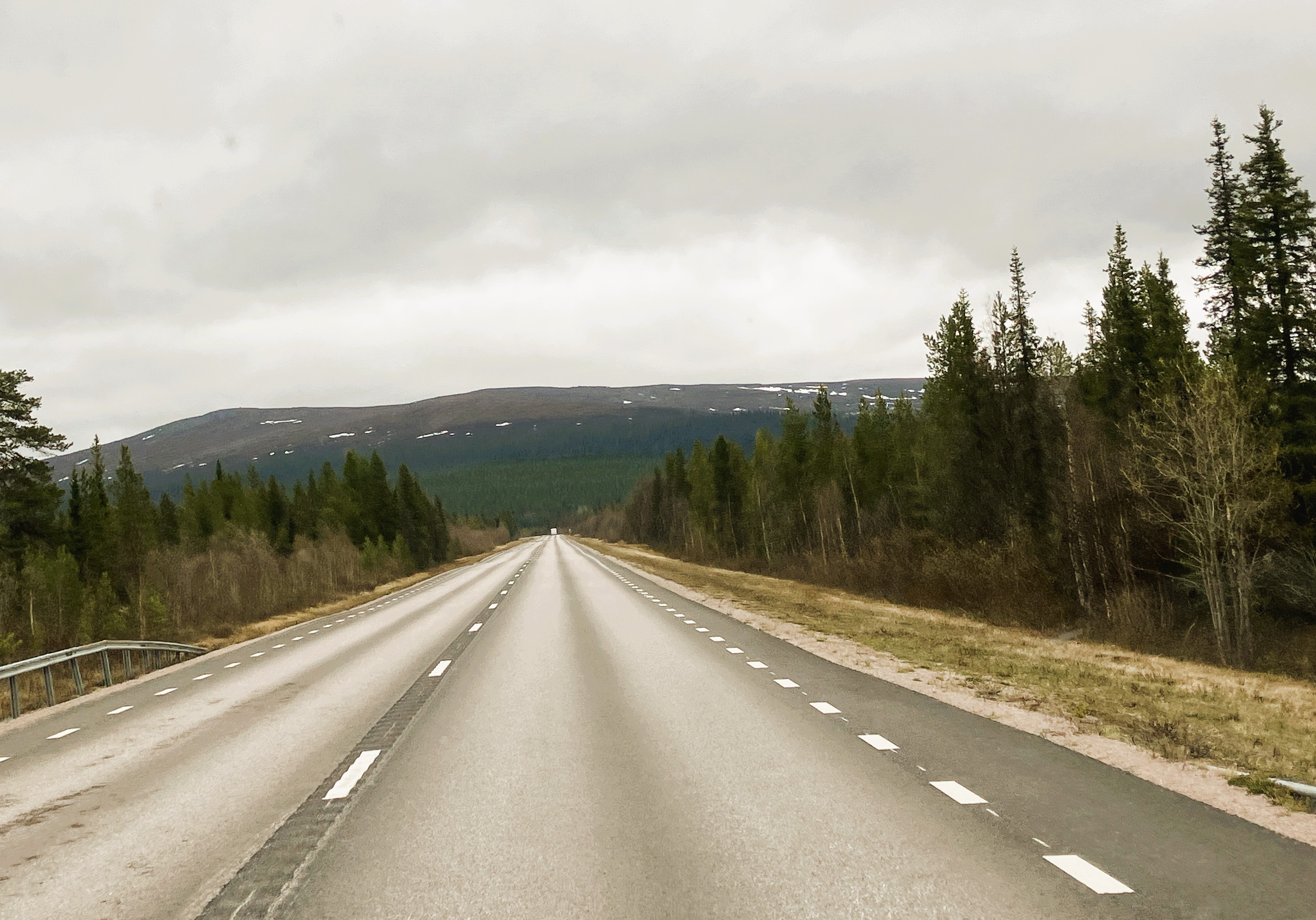
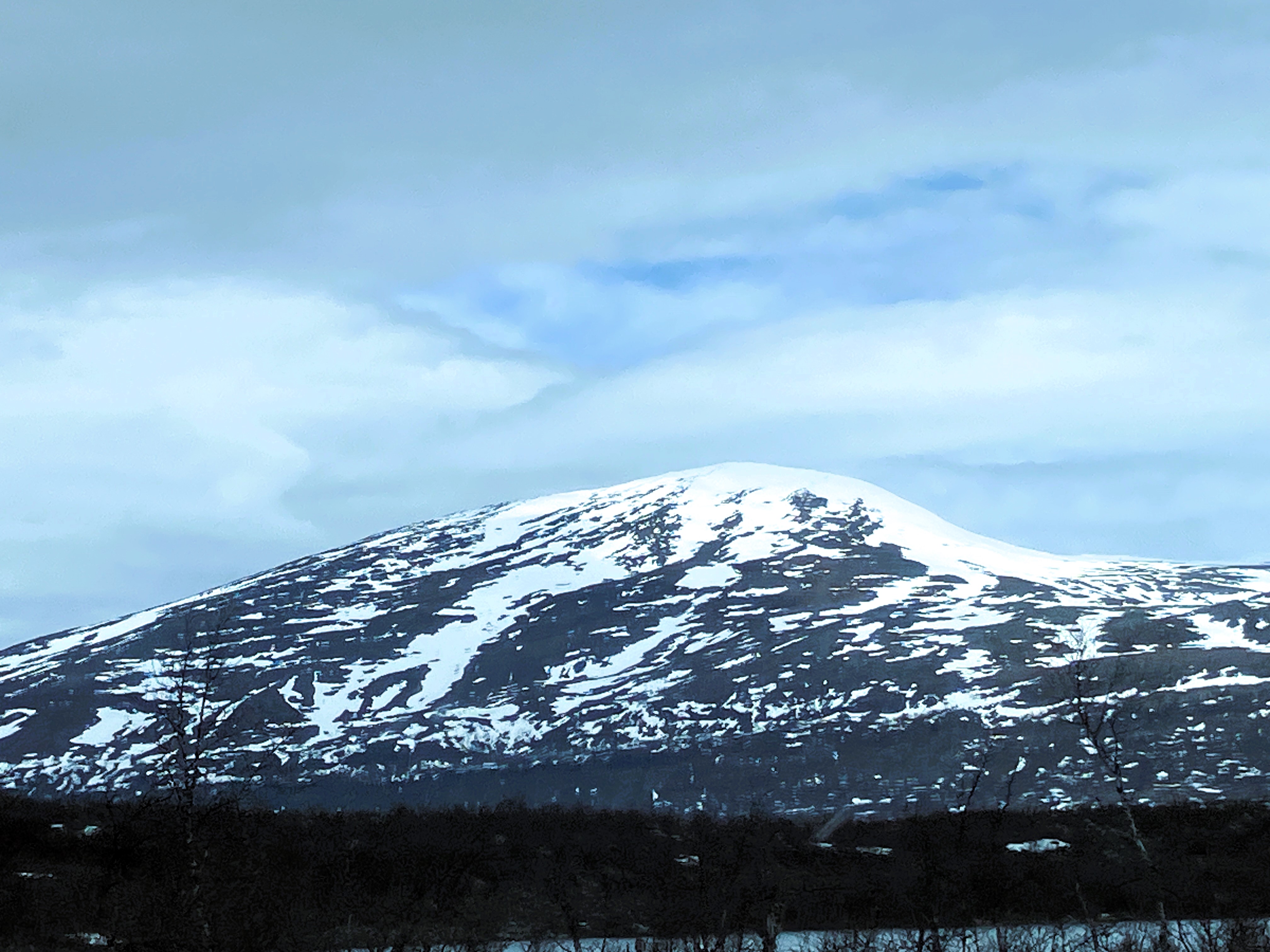
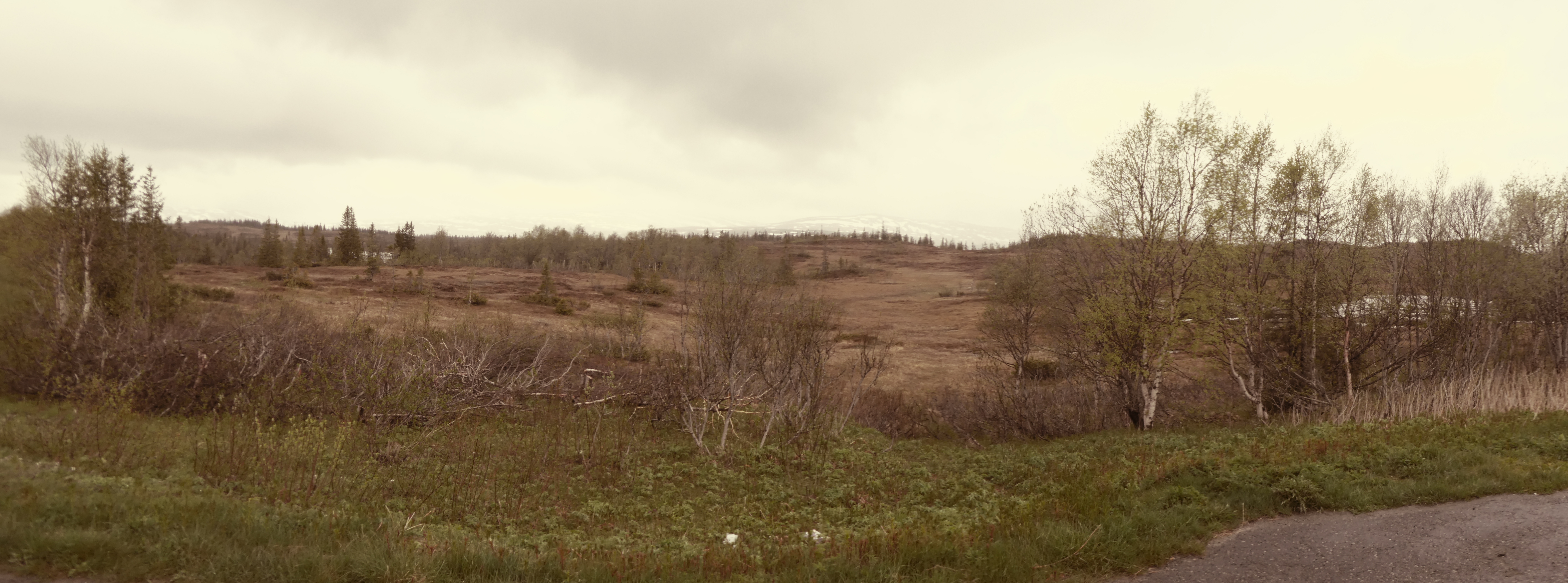
As we travel through Lappland to Kiruna, the scenery stays bleak. We start to see many of the buildings that we have only seen in museums so far. We see more Reindeer and Elk by the side of the road.
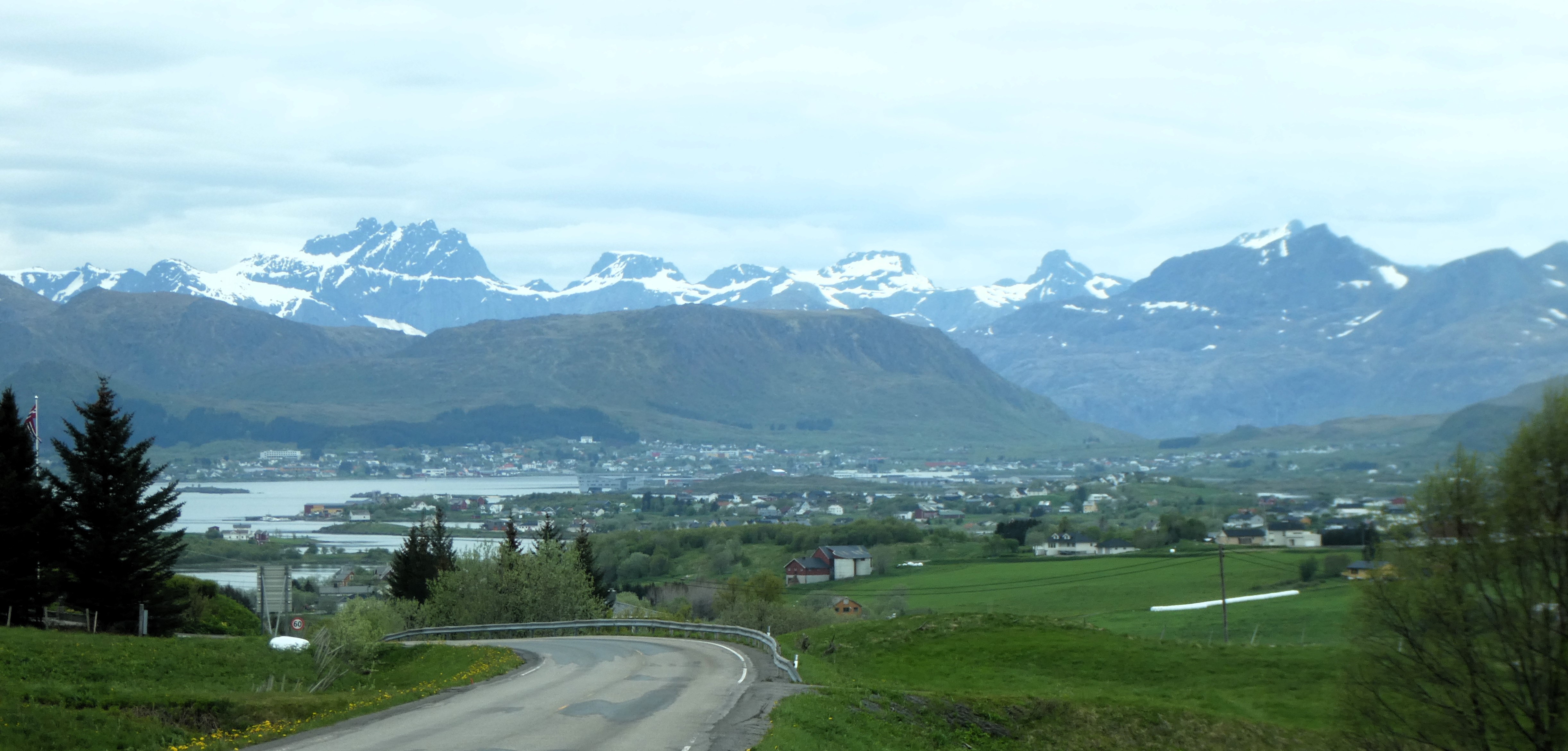
Kiruna is a well-established iron ore mining town. Due to extensive mining most of the old town has fallen into former pits and tunnels. A brand-new shopping centre dominates the town now.
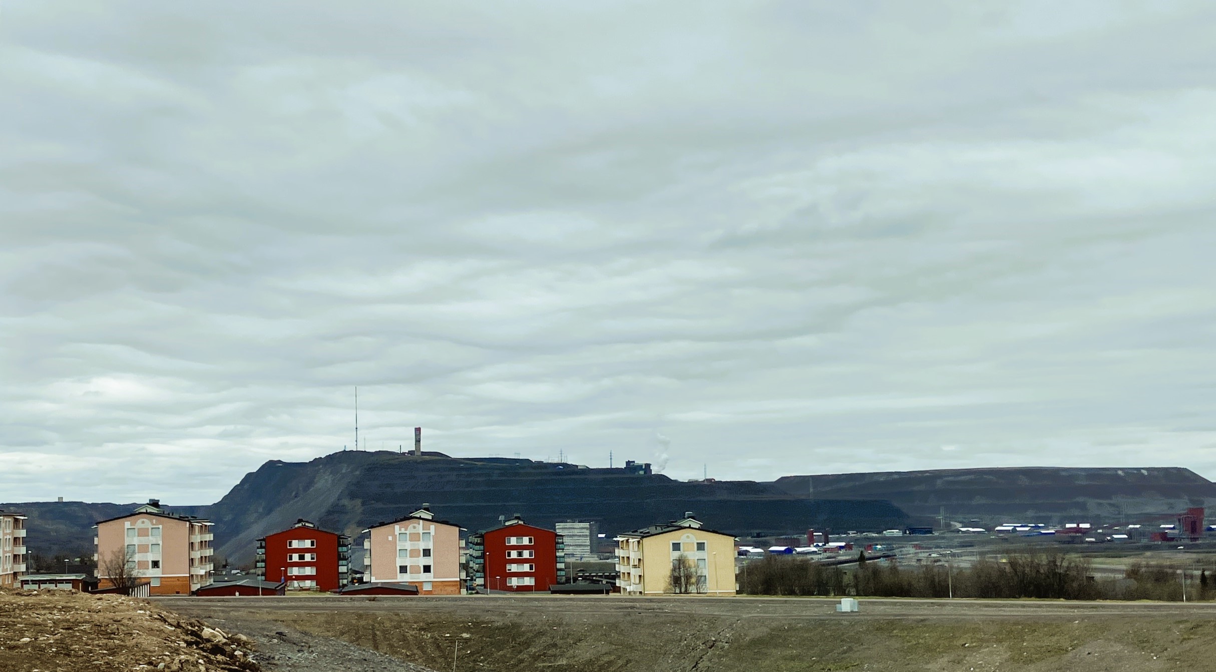

The former tenement residential blocks are still on the outskirts near the depressing skyline of old grey machinery, pumps and gantries.
In recent years the demand for iron ore for steel making in Europe has increased with changes in world politics.
The mine is thoroughly modernised and mining takes part remotely with robots. The mine produces a significant part of the world supply of iron ore as well as rare earth minerals.
The mine is thoroughly modernised and mining takes place remotely with robots. It was very cold and grey when we arrived. We did a bit of shopping and had fika before travelling on to Abisko National Park. Martin had told us about a nice circular walk here at the beginning of Kungsleden, the King’s Long Distance Trail.
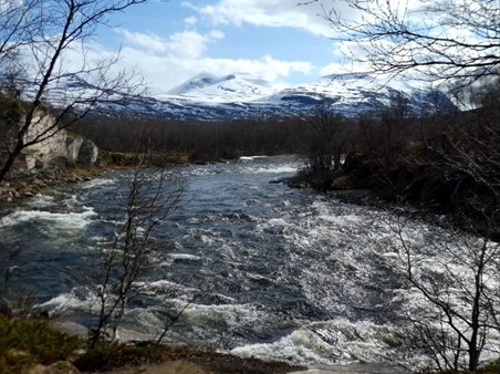
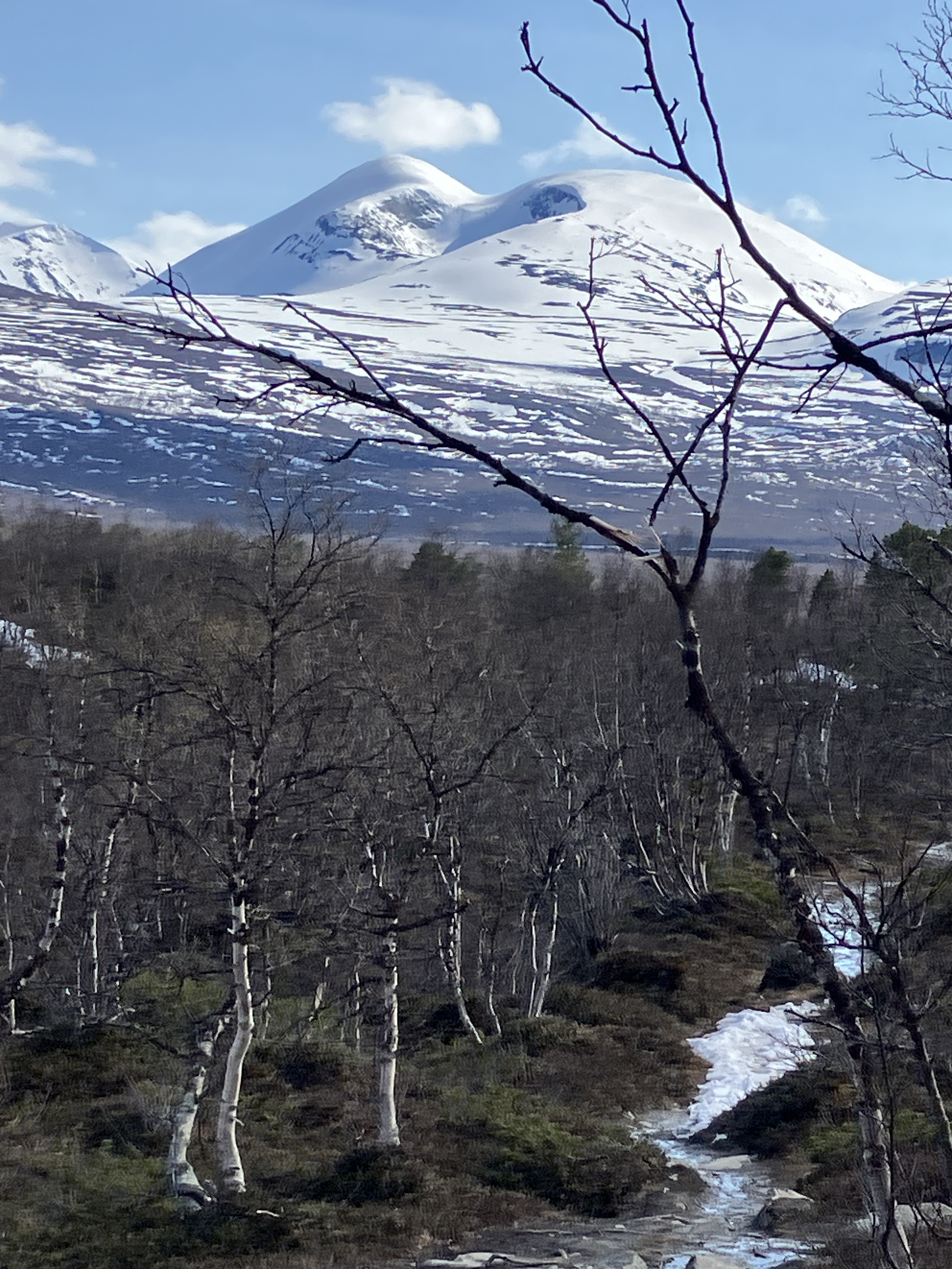
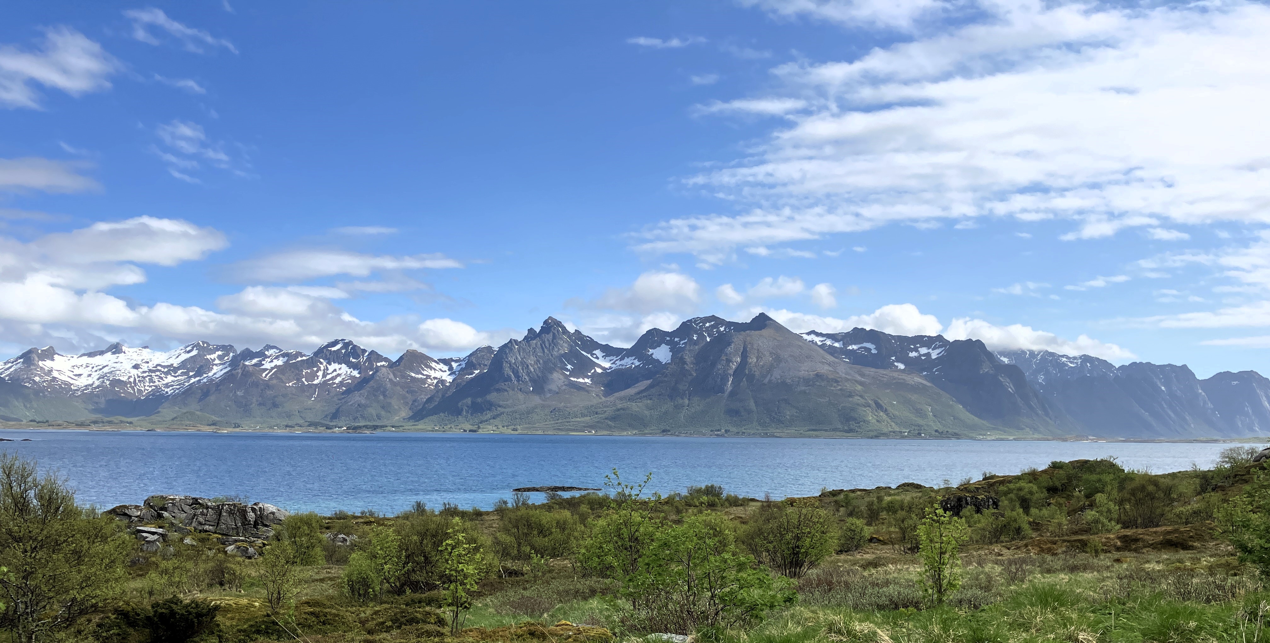
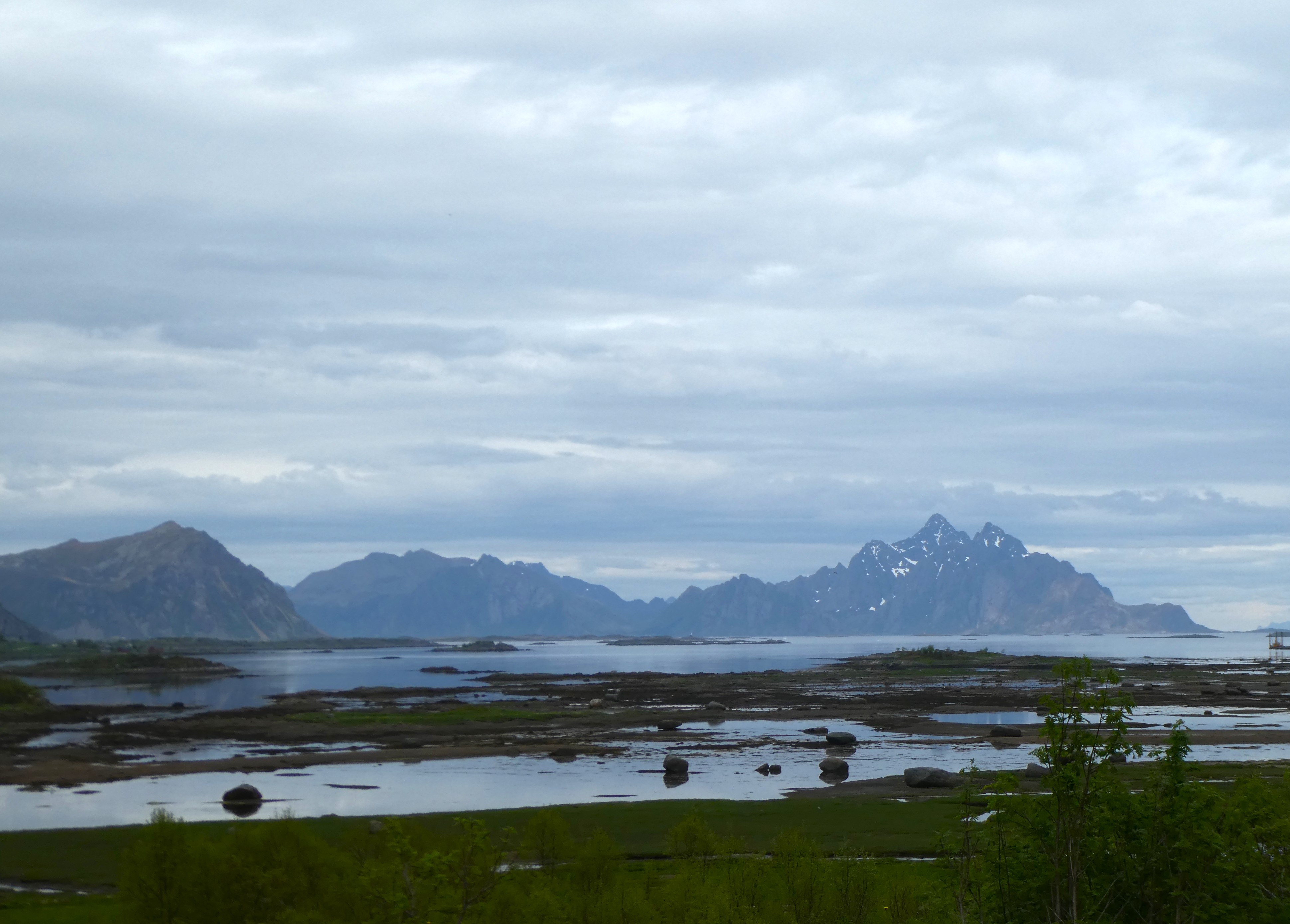
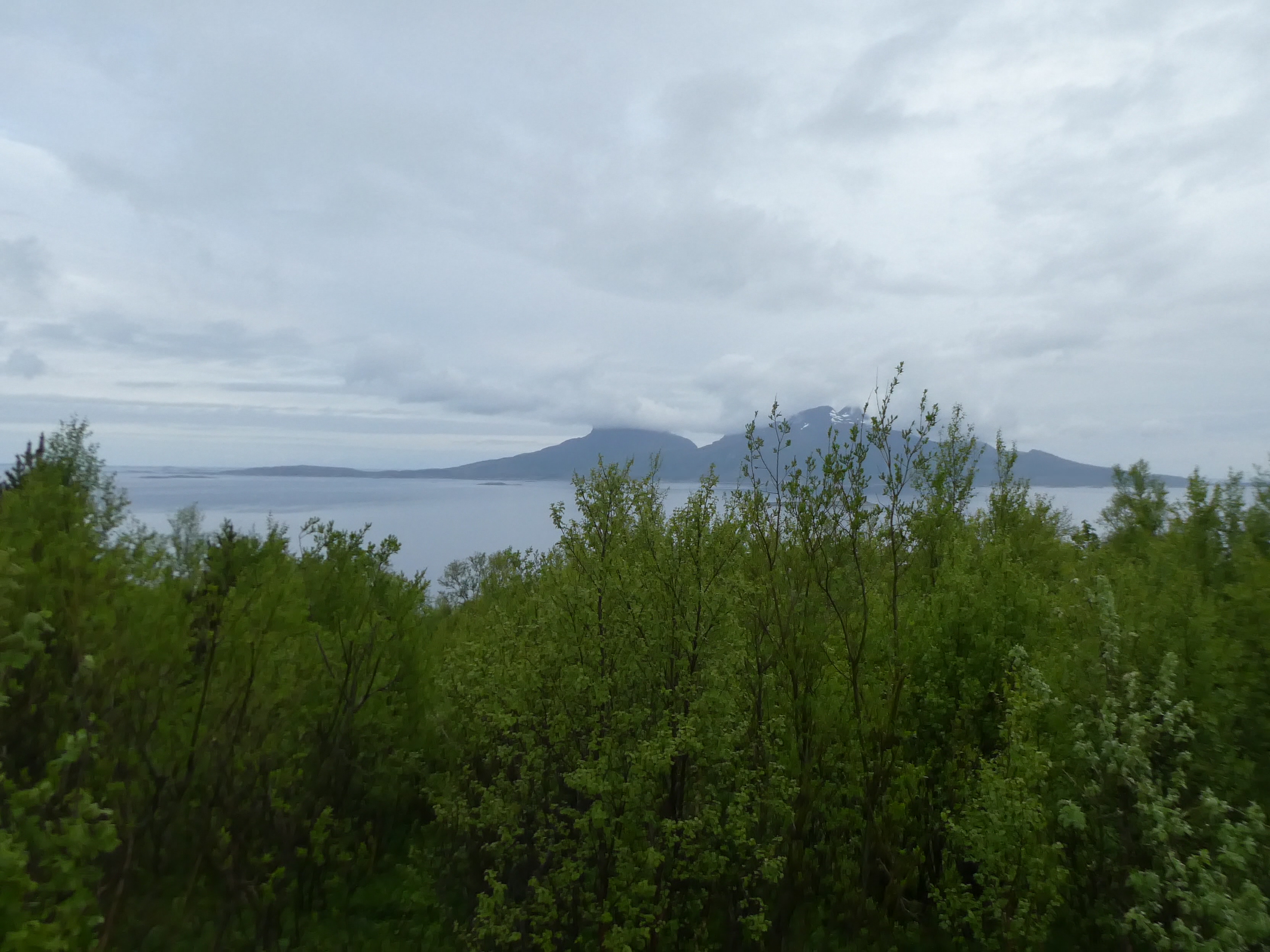
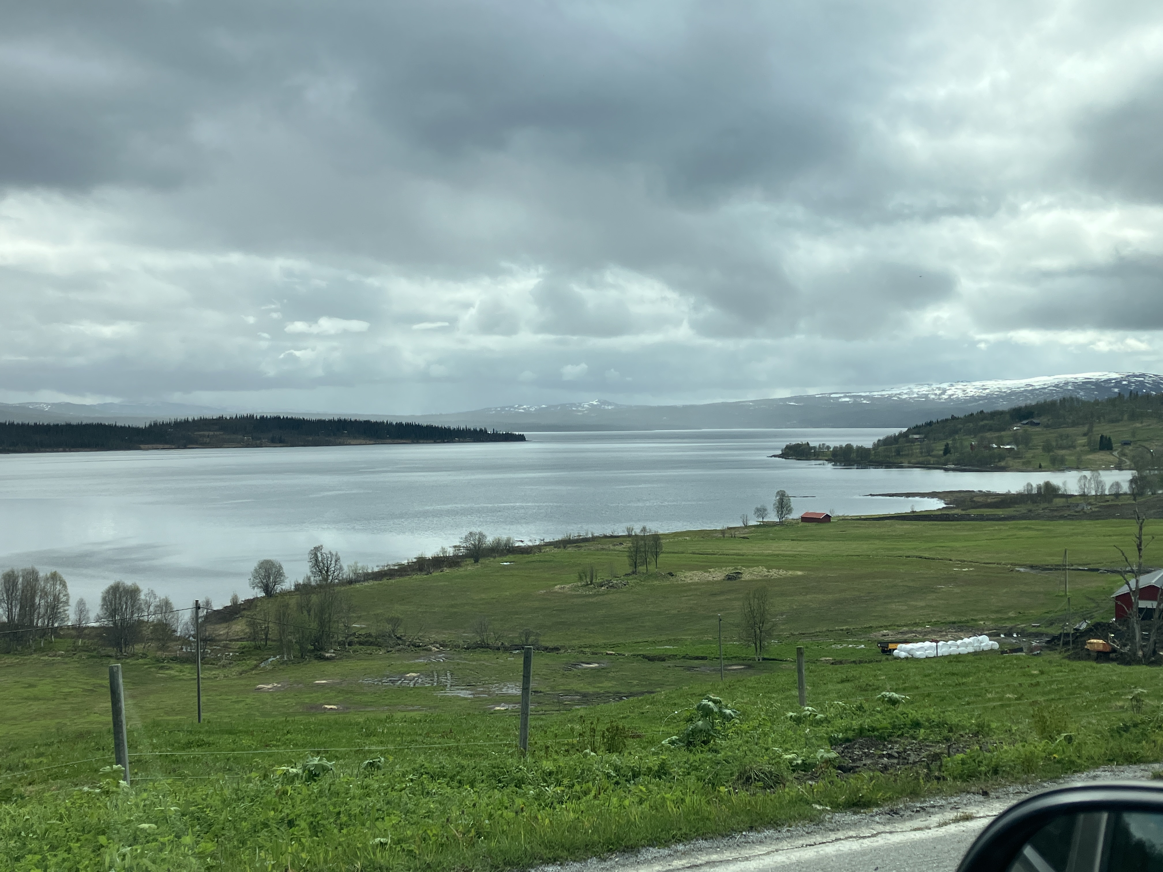
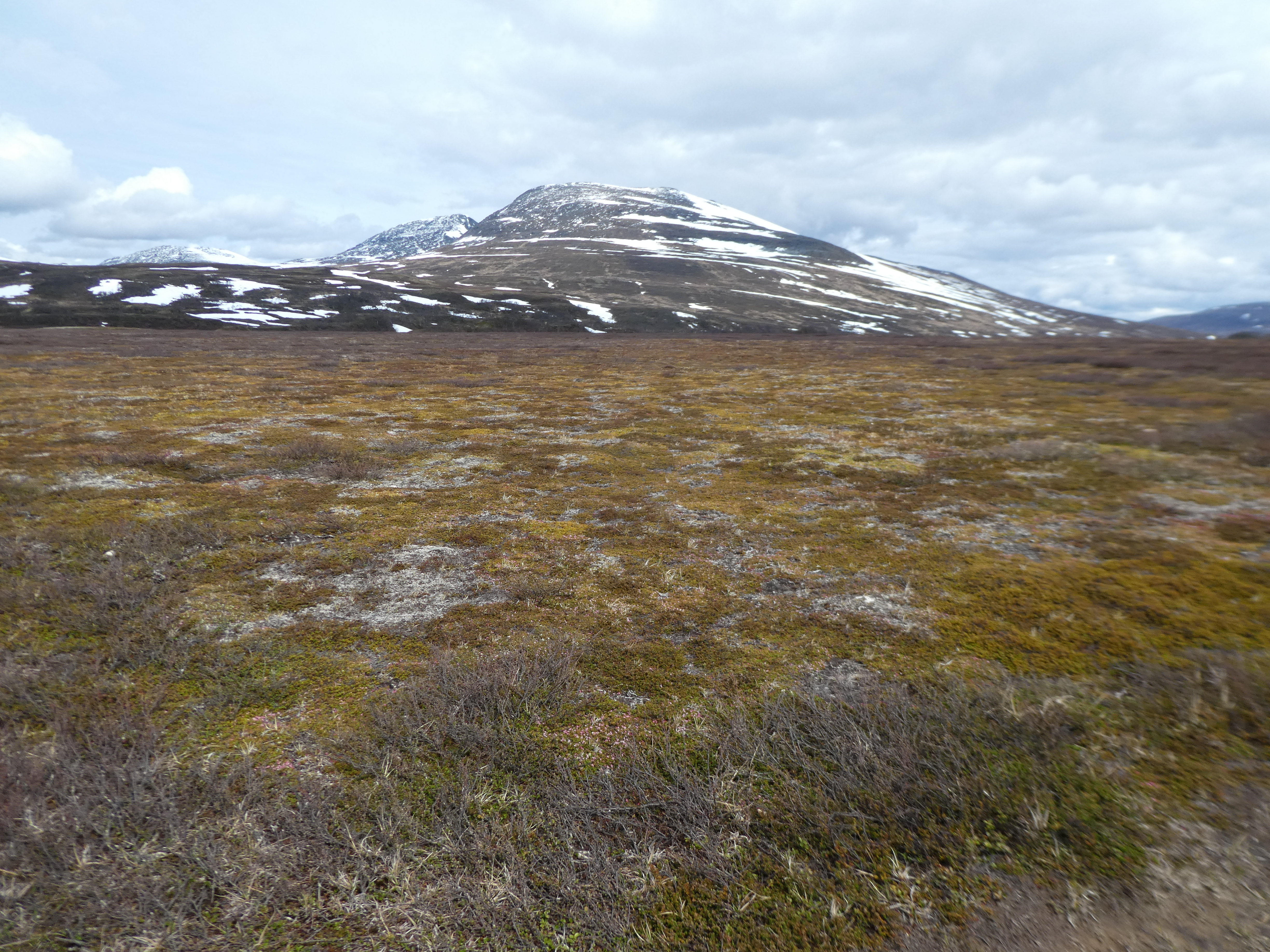
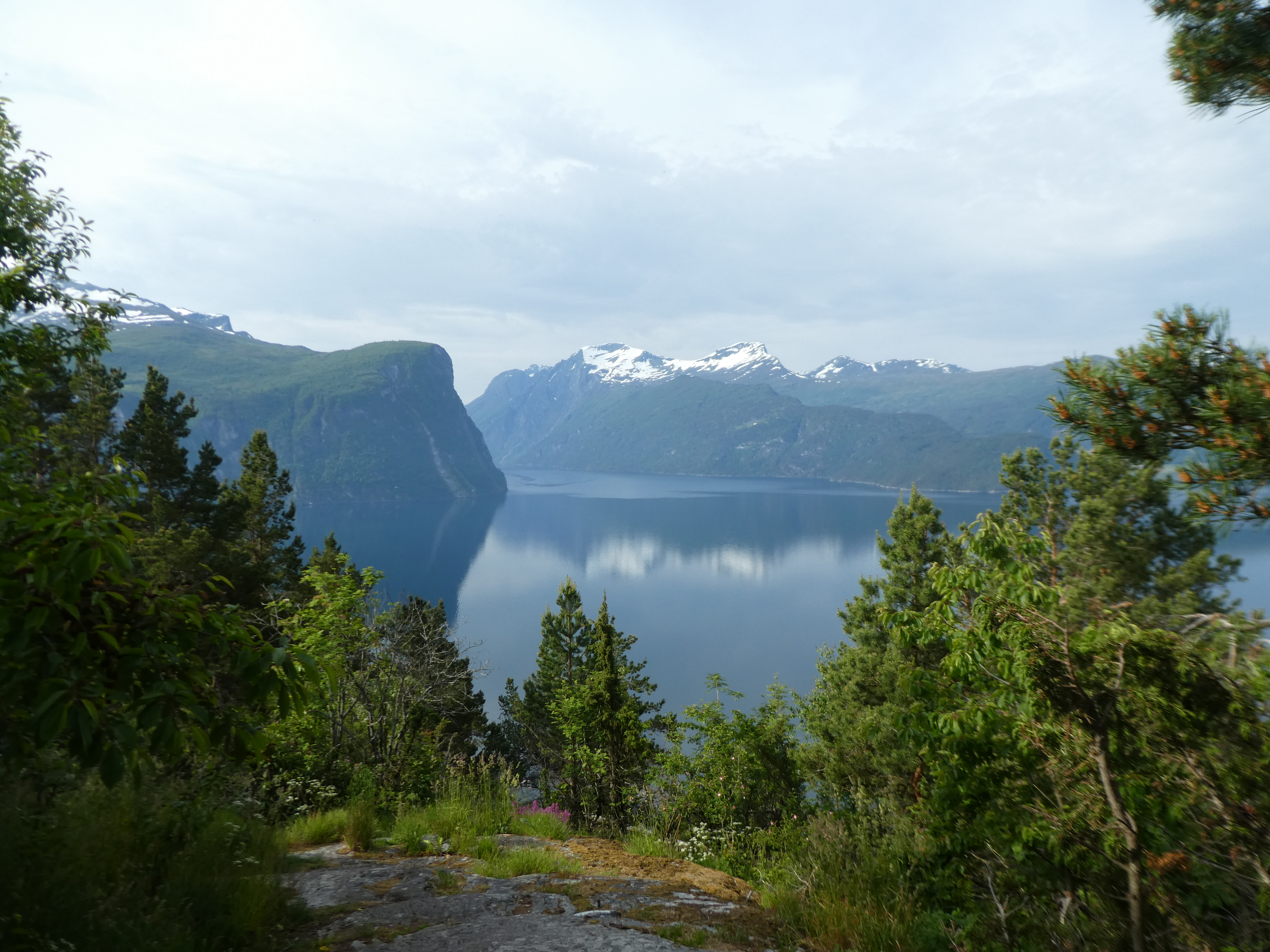
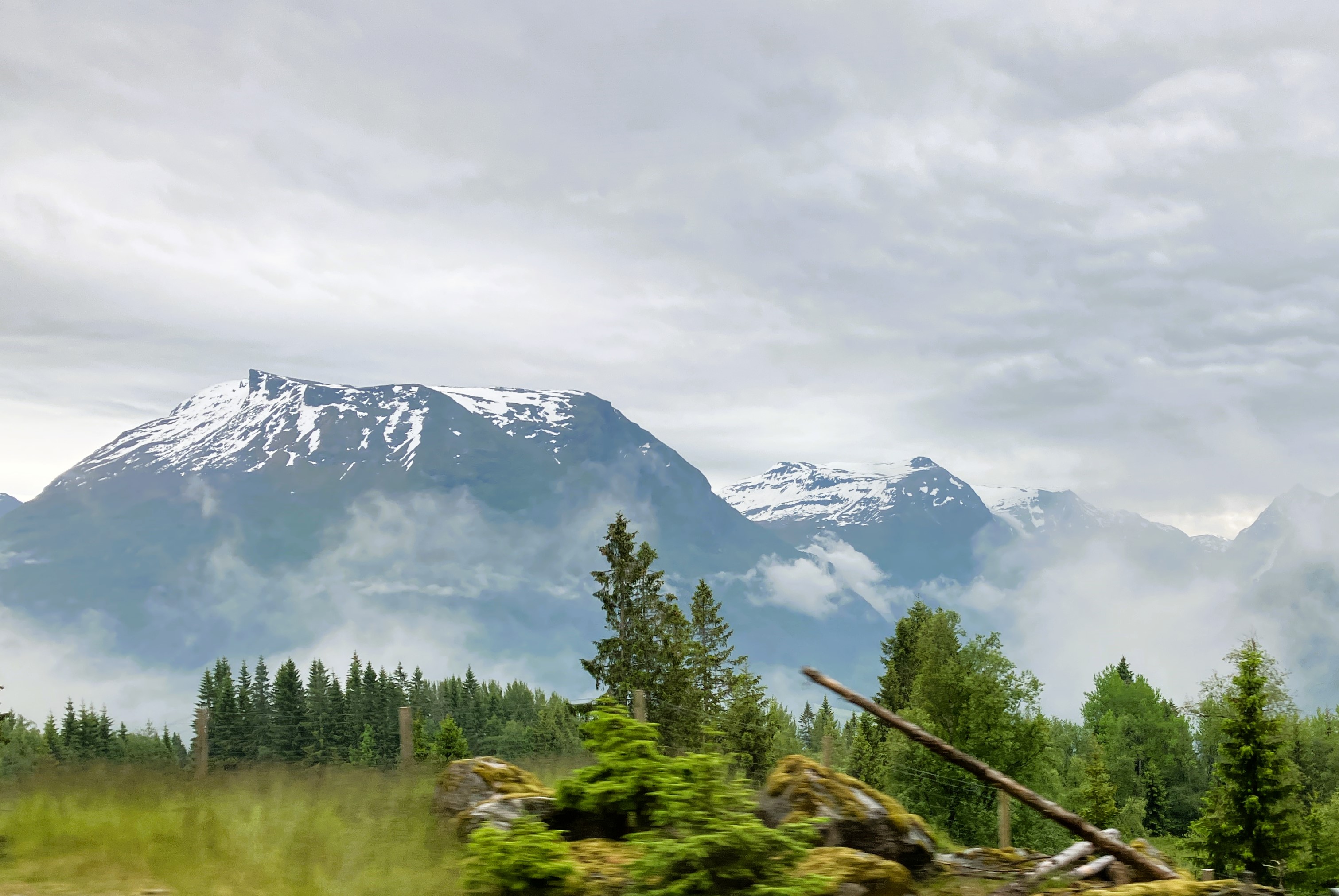
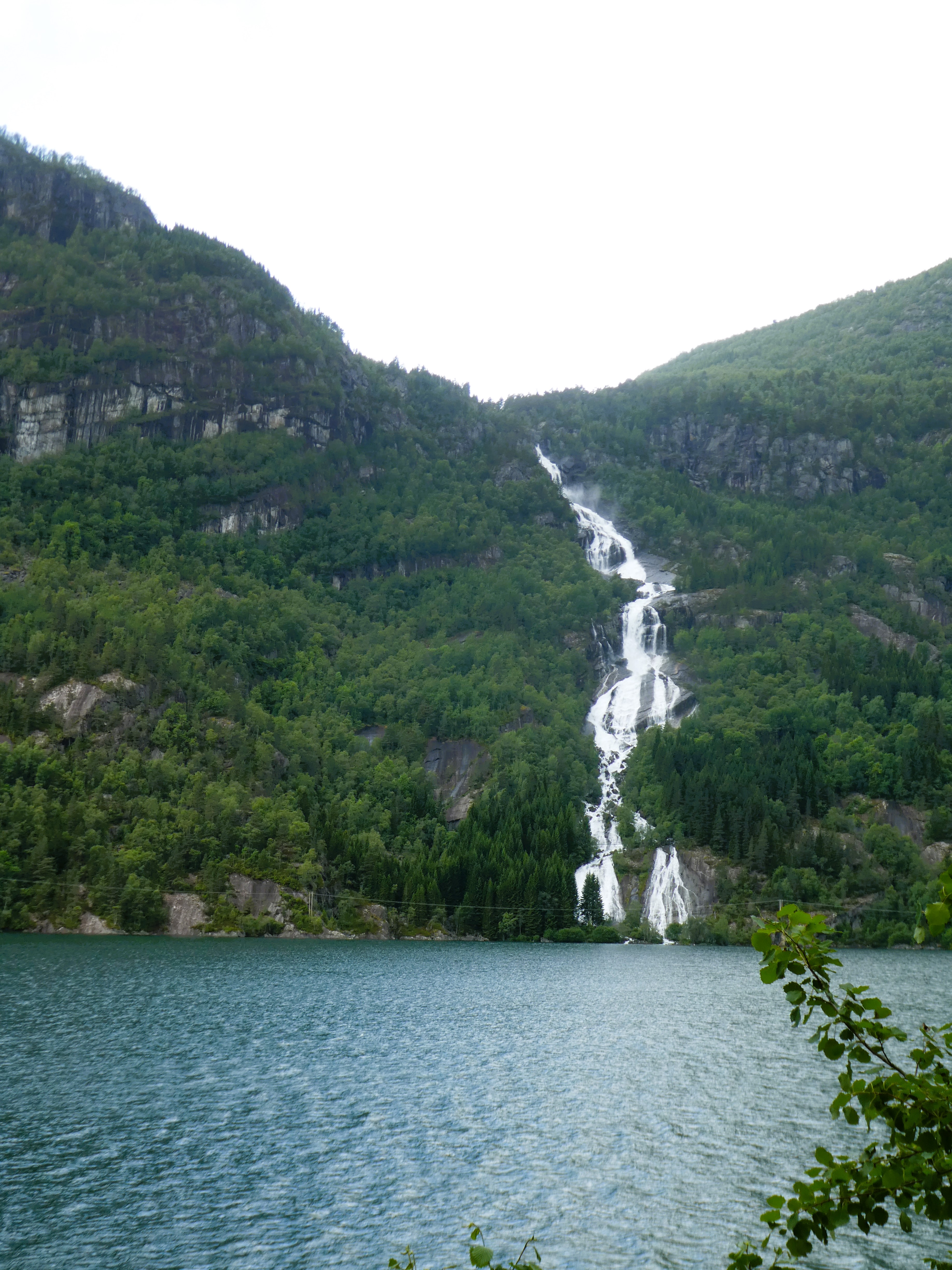
As we travel towards Kebnekaise Sweden’s highest mountain, the rounded snow covered mountains increased in height. The river runs east through a series of lakes strewn with ice and one enormous lake that was part frozen. It is absolutely mind-blowing.
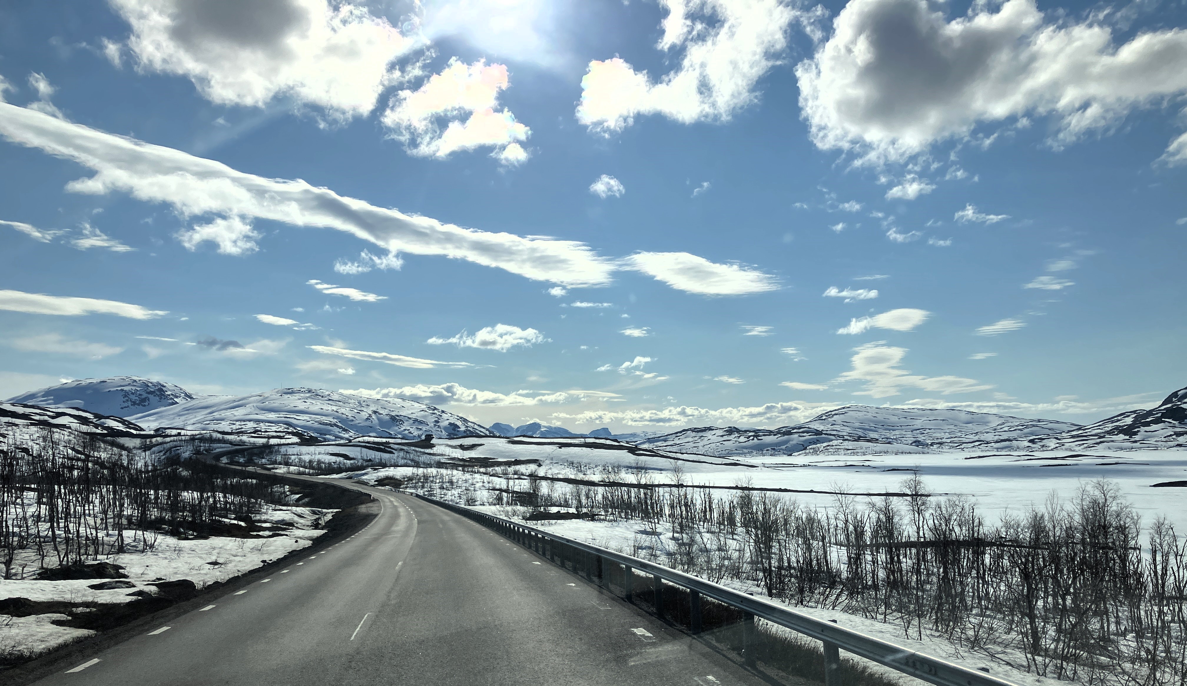
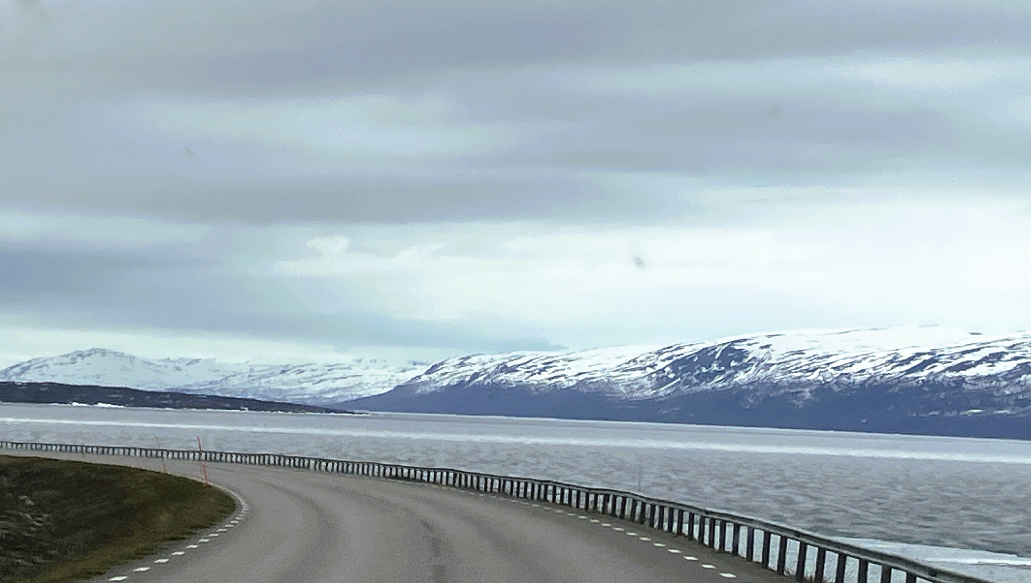
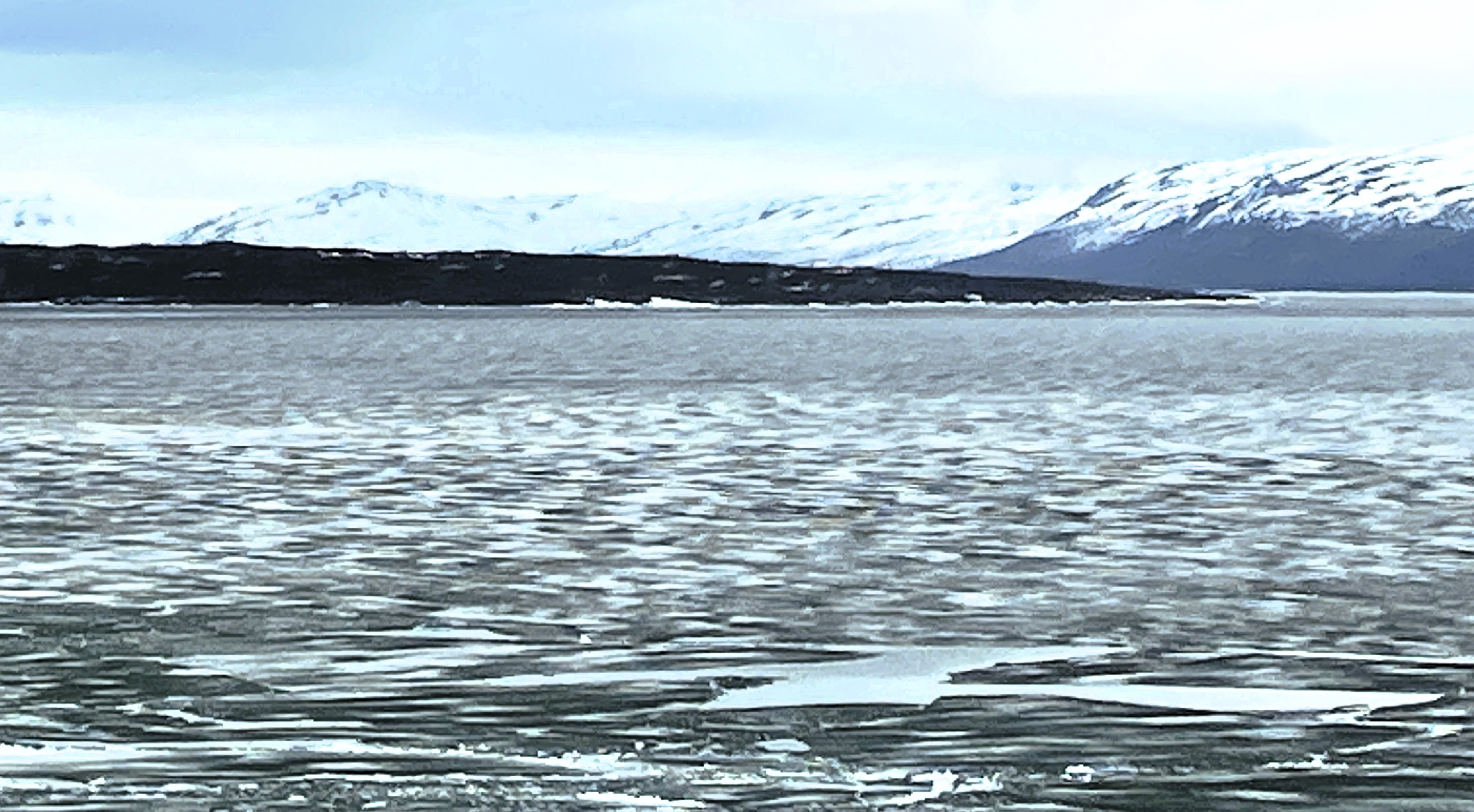
The landscape is vast. As we move away from Kiruna heading west towards the border, the landscape becomes increasingly wild. Apart from the road there is a railway line running parallel between Kiruna and Narvik.

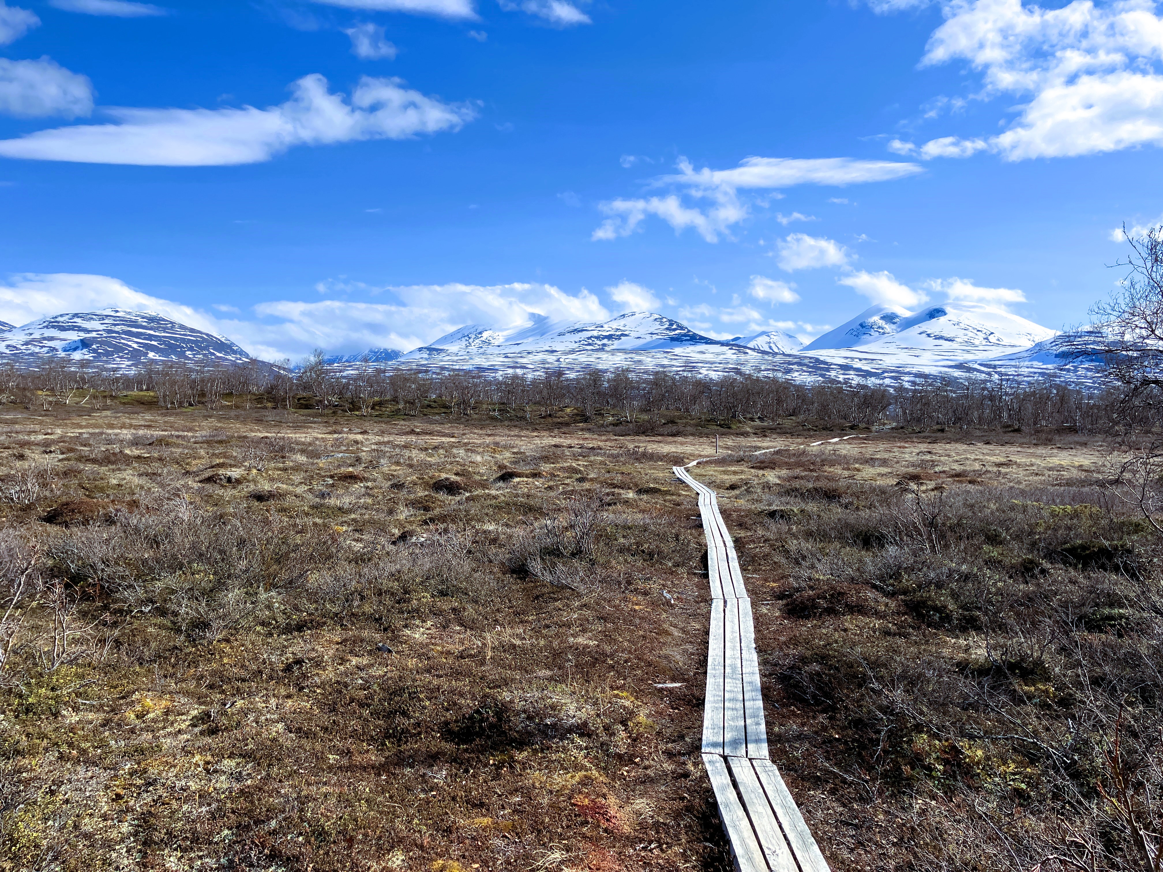
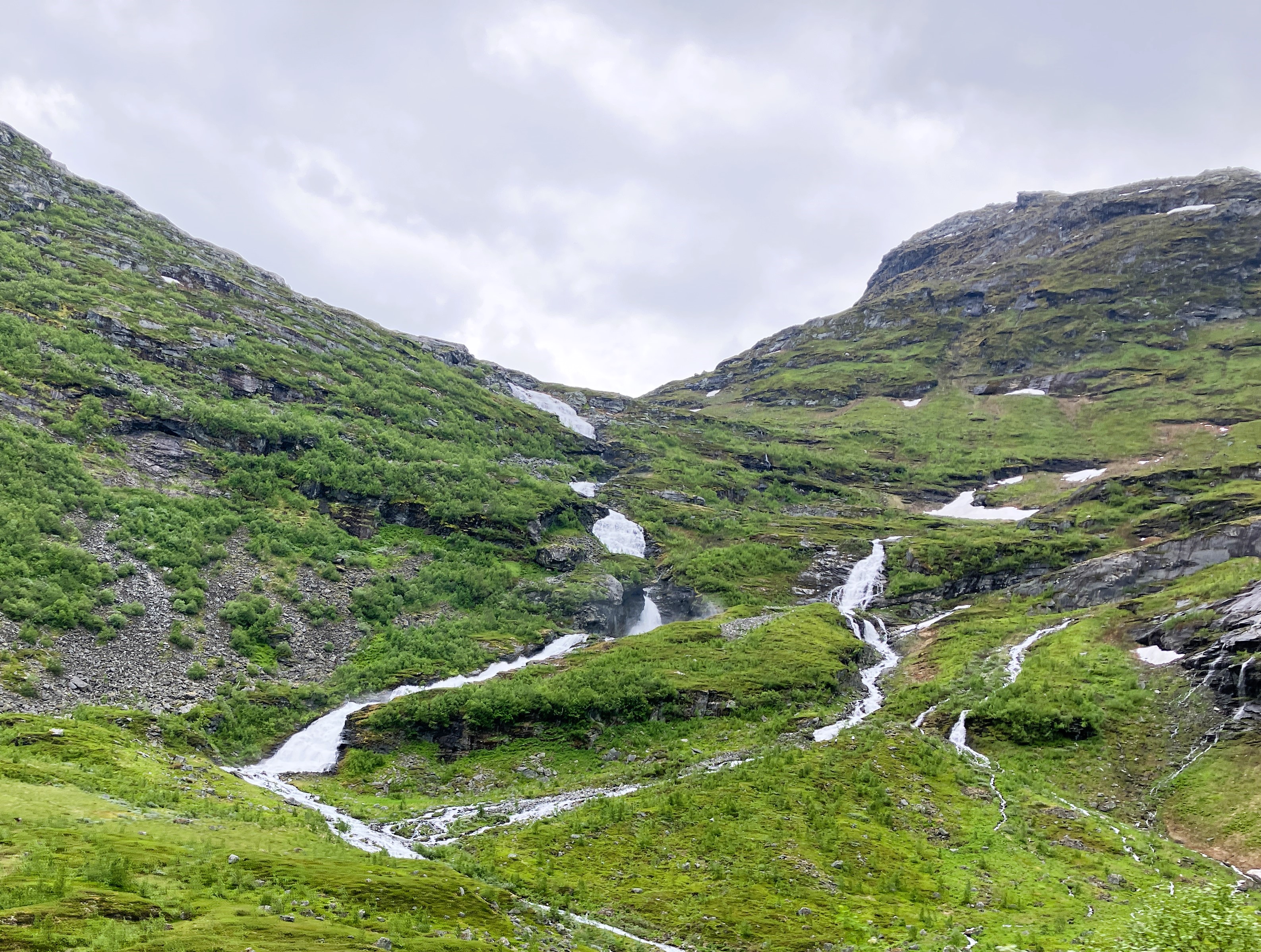
We park at the railway station at Abisko Turiststation and follow the Kungsleden signs south towards the mountains. As we started walking the well-marked trail the sun came out, making it even better.
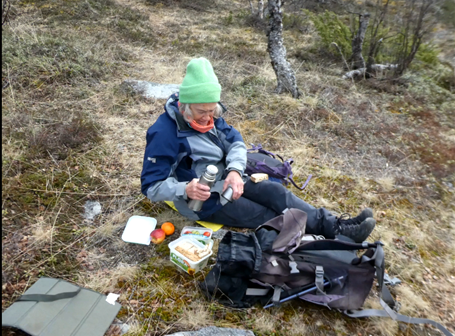
We had a picnic beside the wide, fast-flowing river. Then we took a circular walk, ooing and ahhing at the panoramic views of the snow-clad mountains all around us.
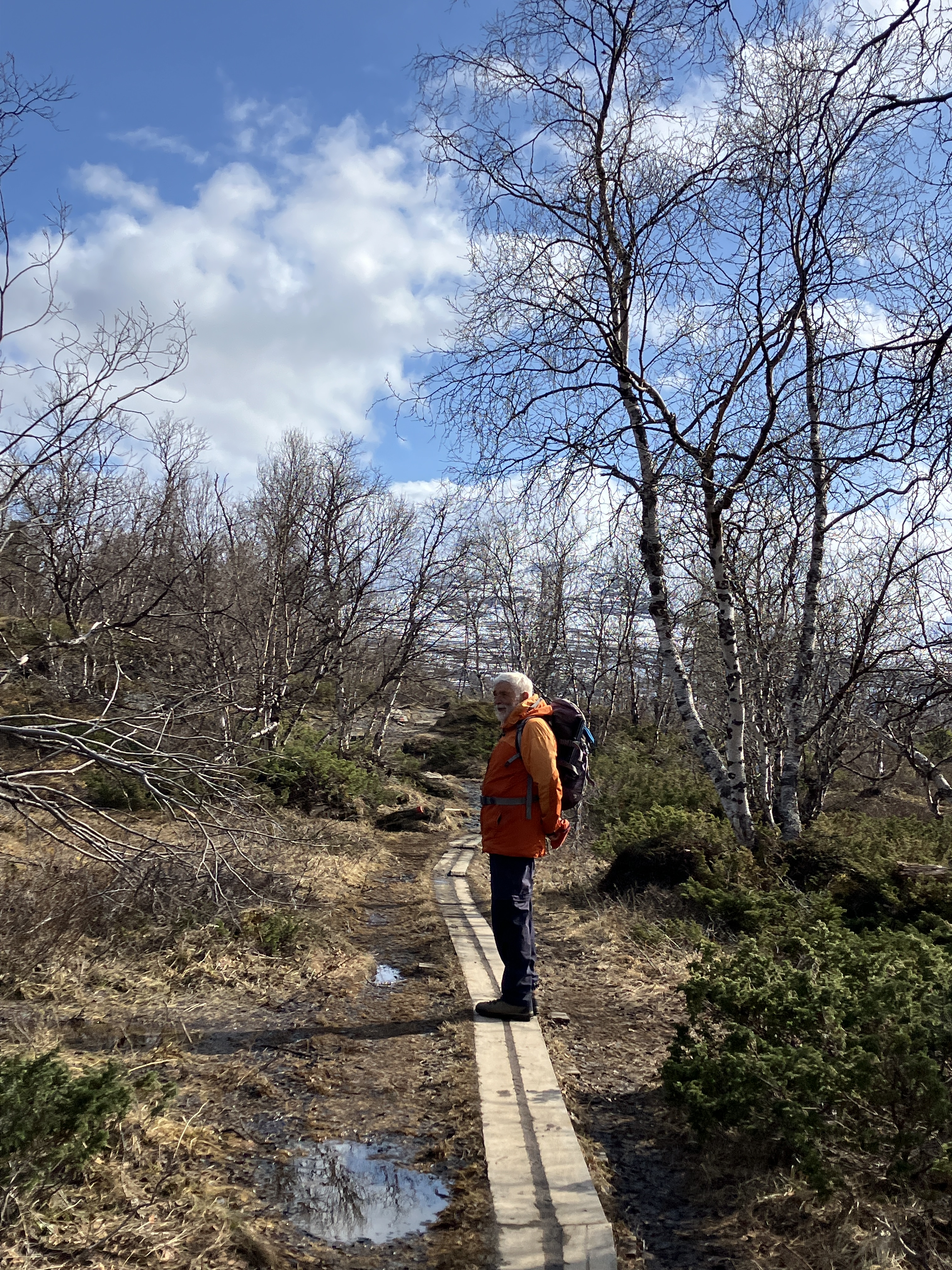
The trail takes us along boarded walkways that led you through areas where the snow makes navigation difficult.

We feel very pleased with our stimulating walk. As we get back to the car park, we see a train discharging its rather dazed passengers. This cold wasteland has only a single hotel offering shelter. We are happy to have a van to return to.
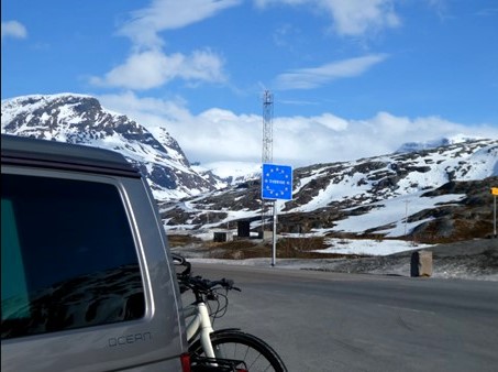


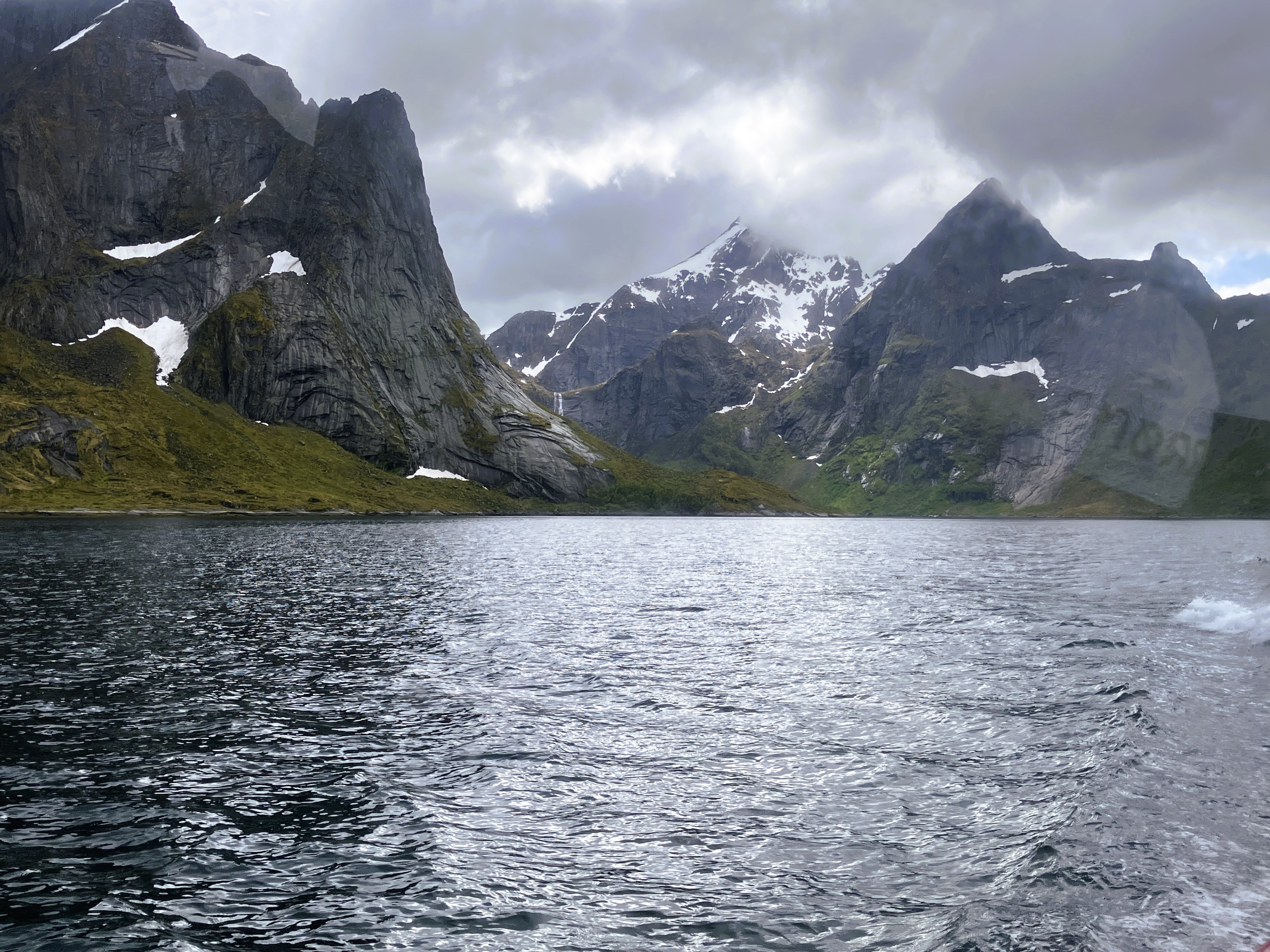
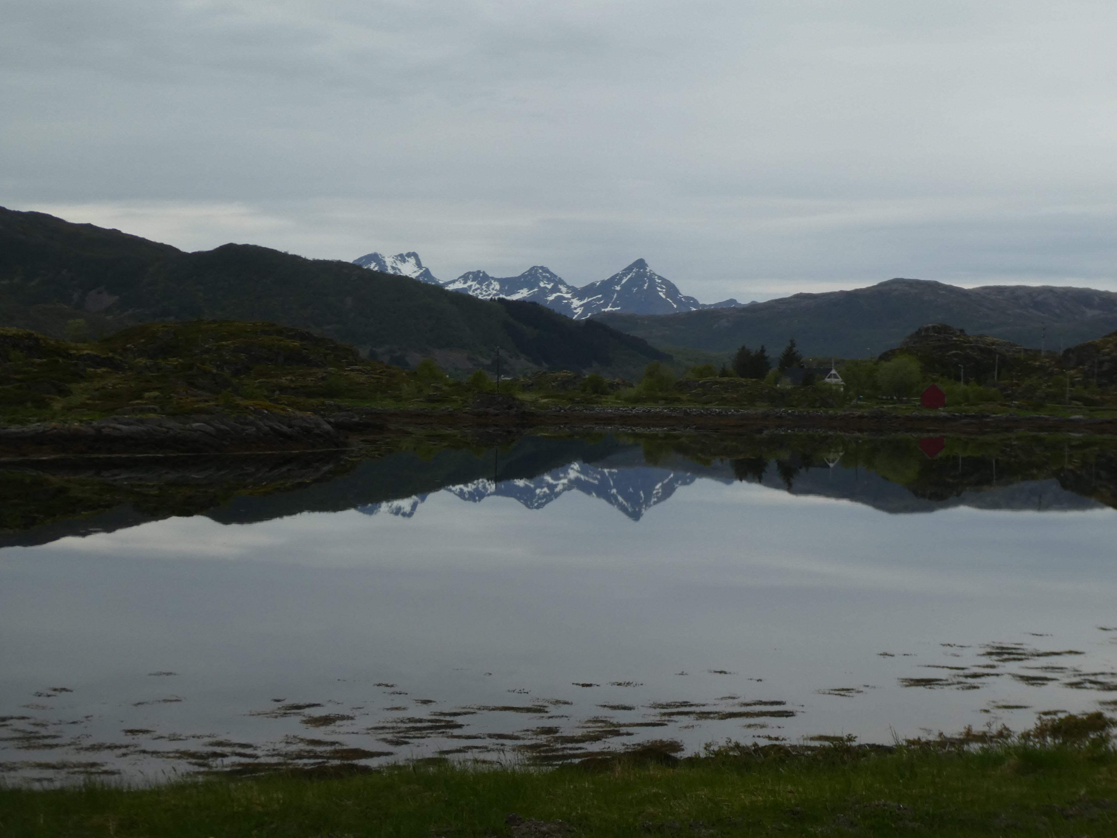
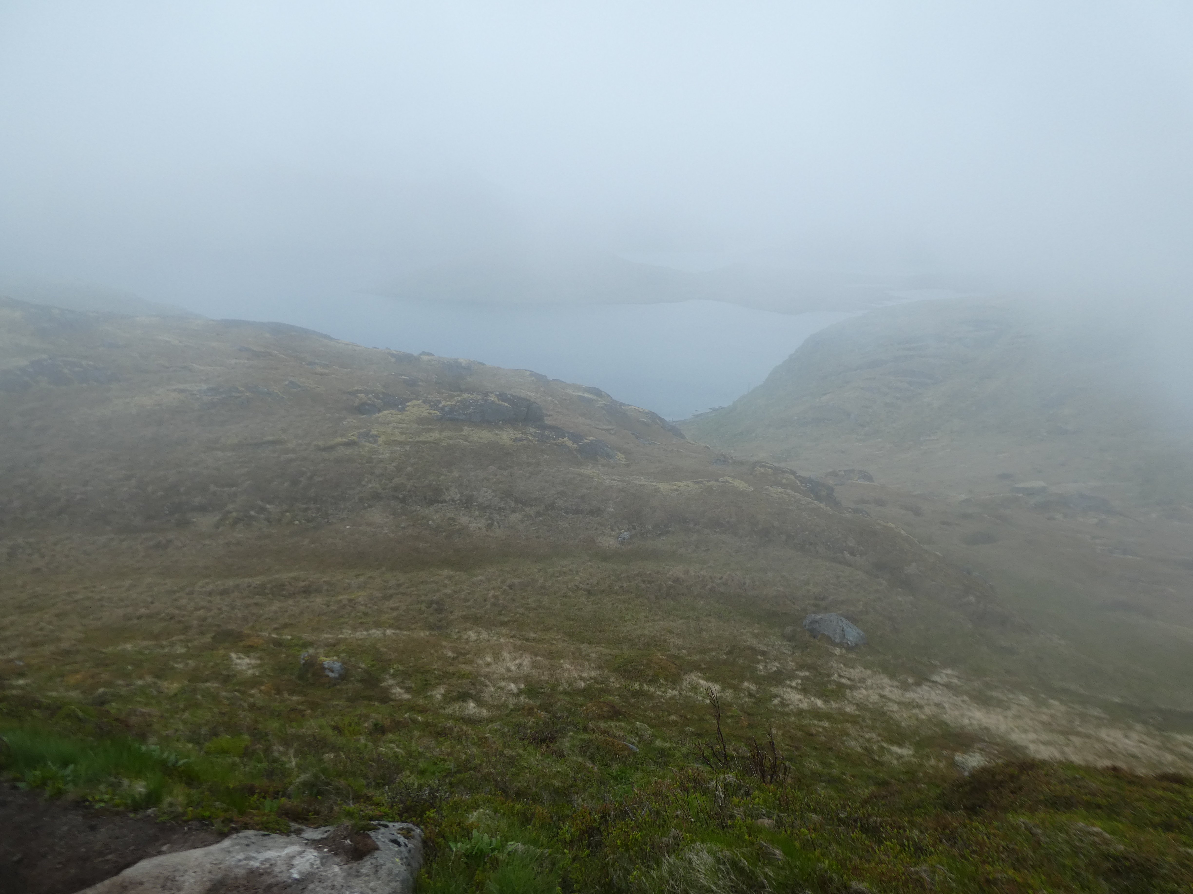
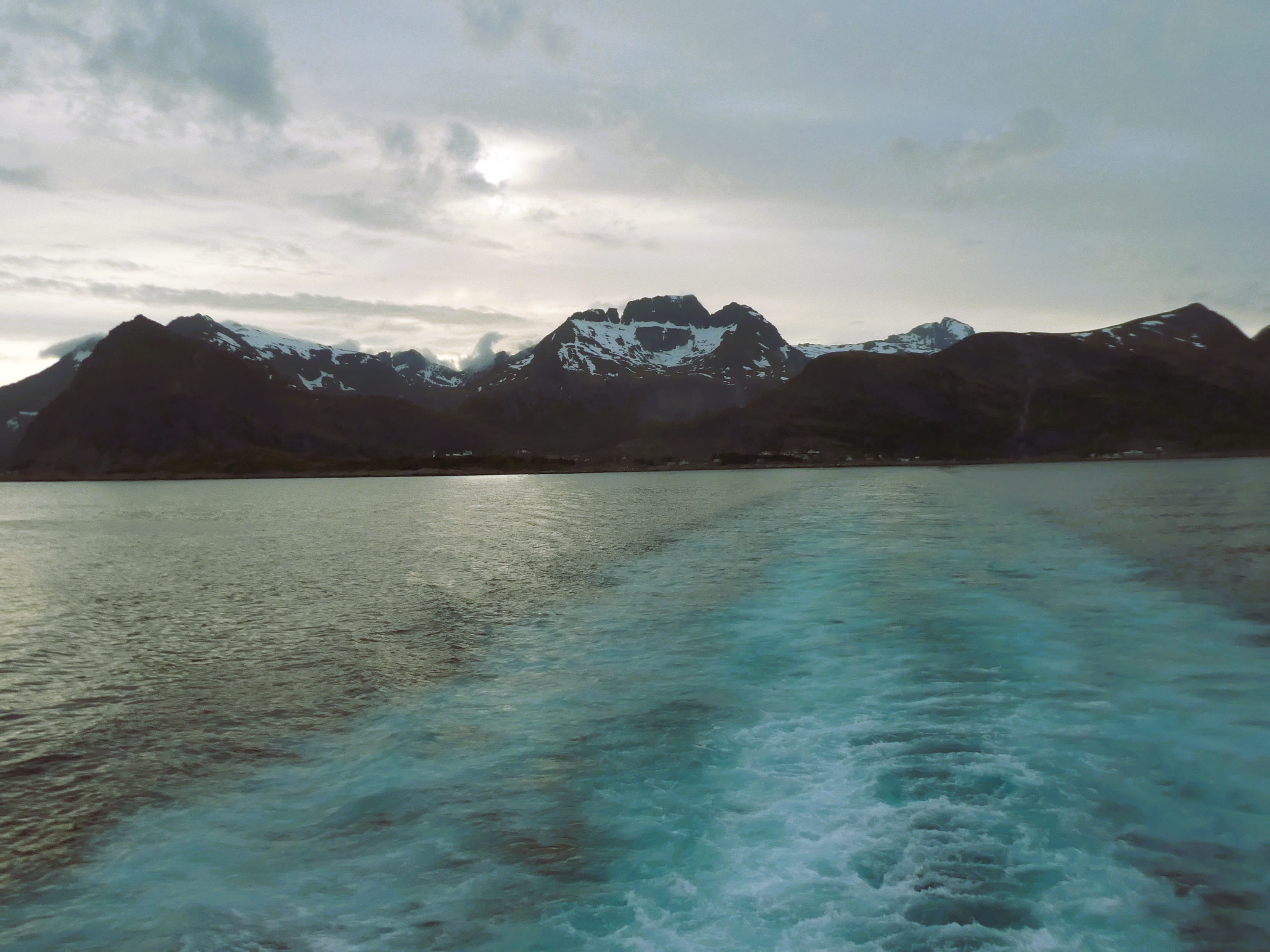
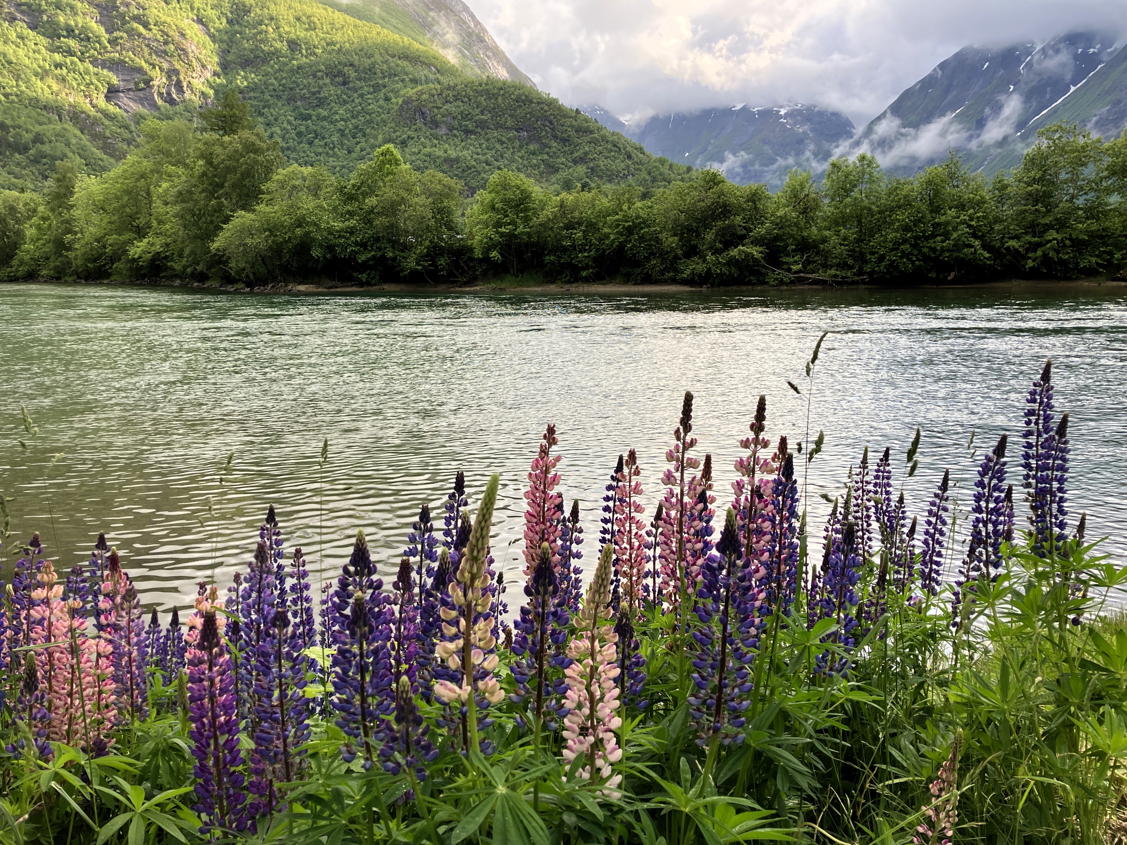
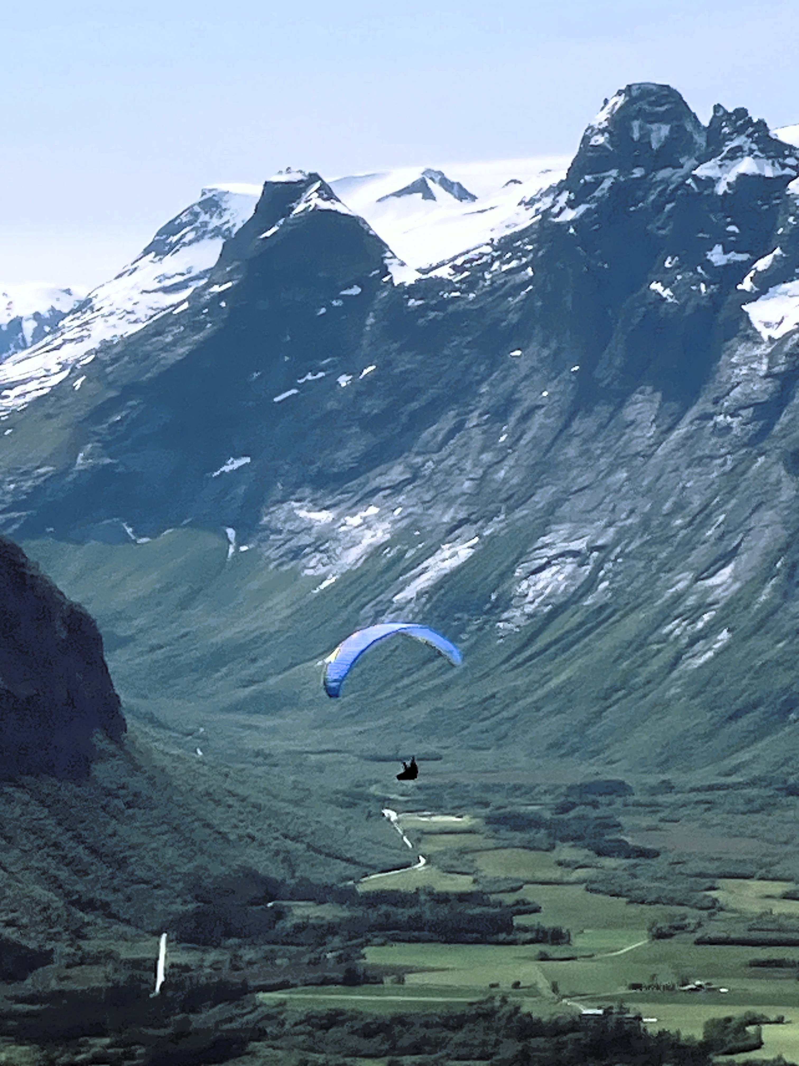
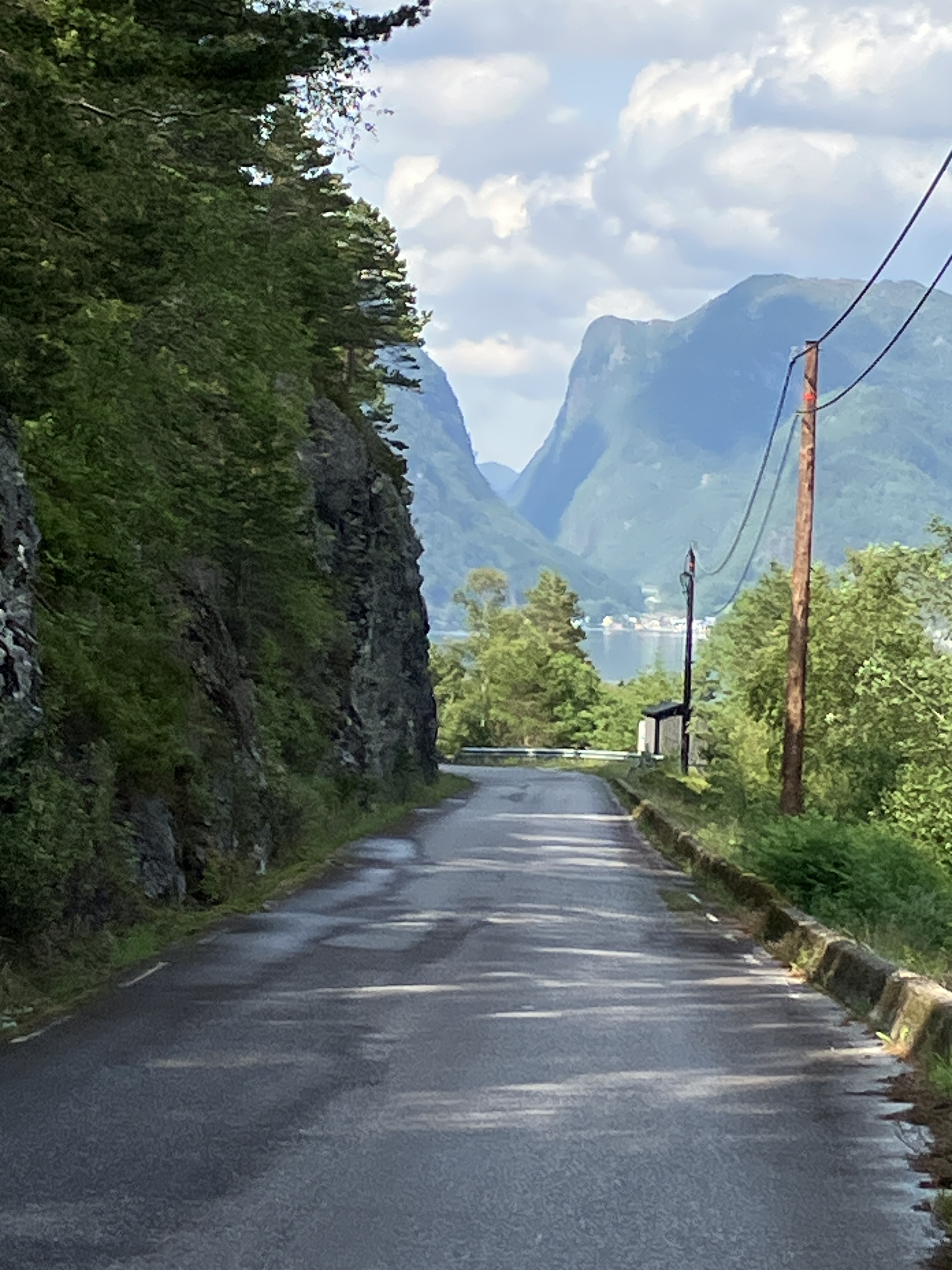
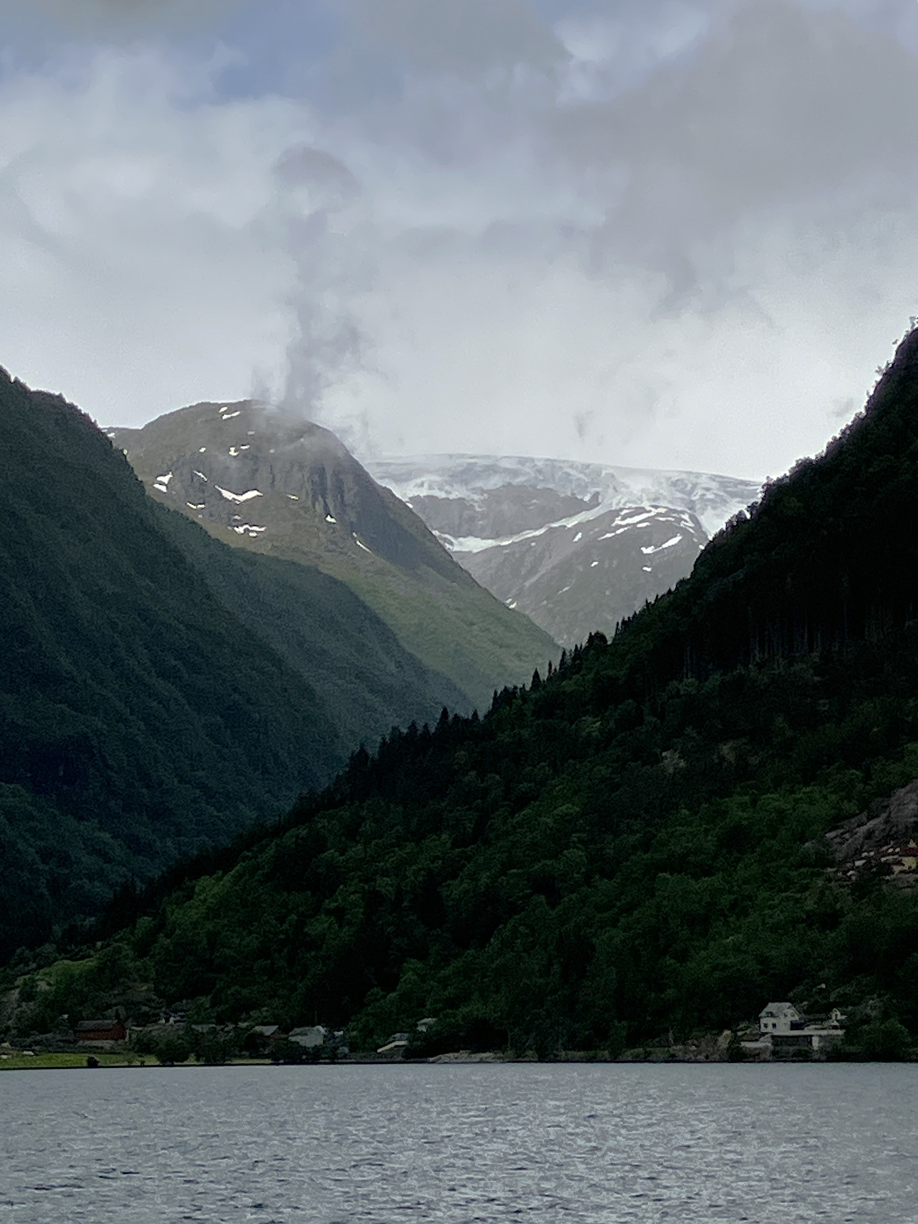
Travelling over the border into Norway the scenery continued to amaze us. Soon narrower valleys lead us steeply down into Norway to join the traffic on the highway E10. just north of Narvik.
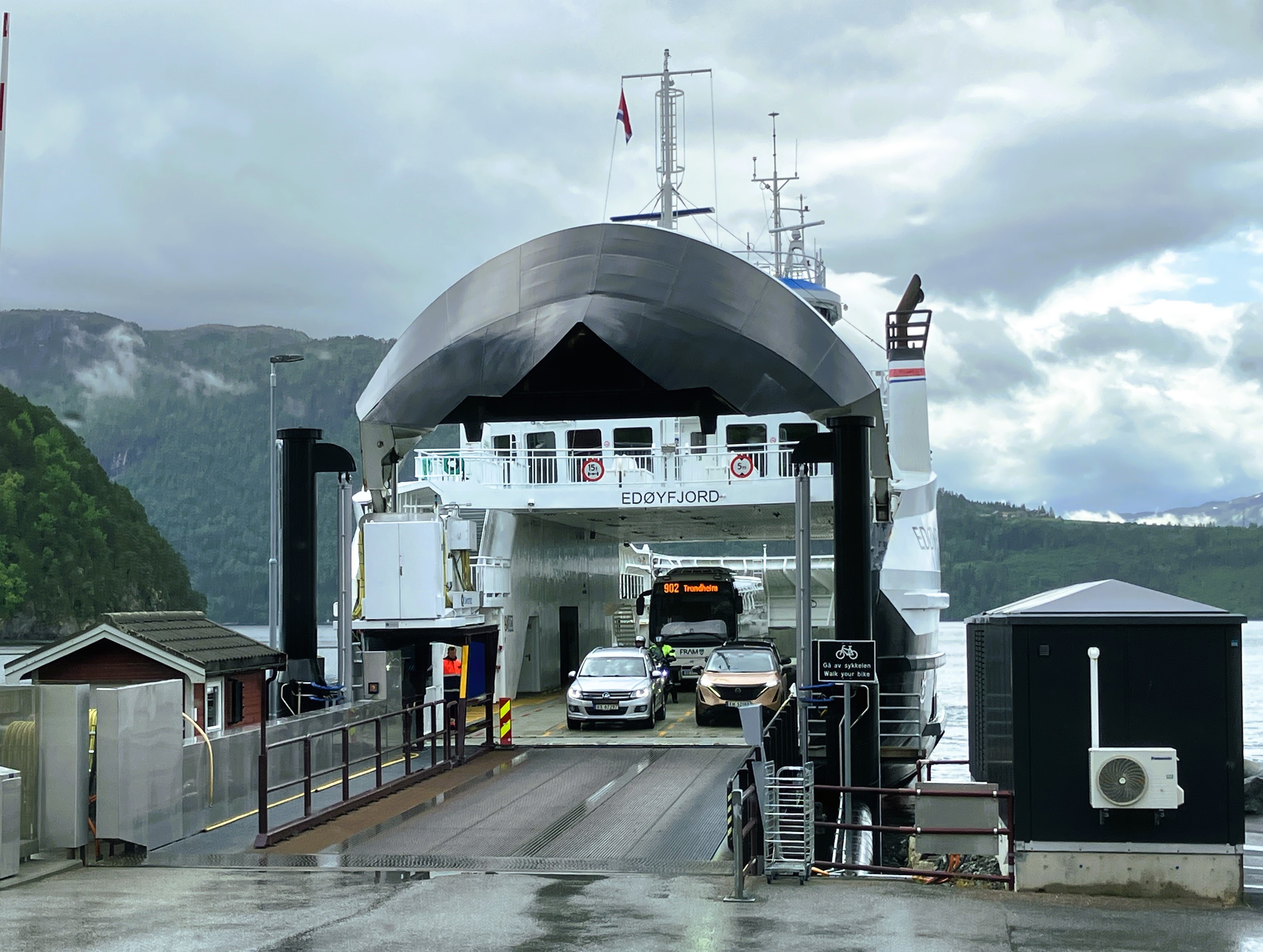
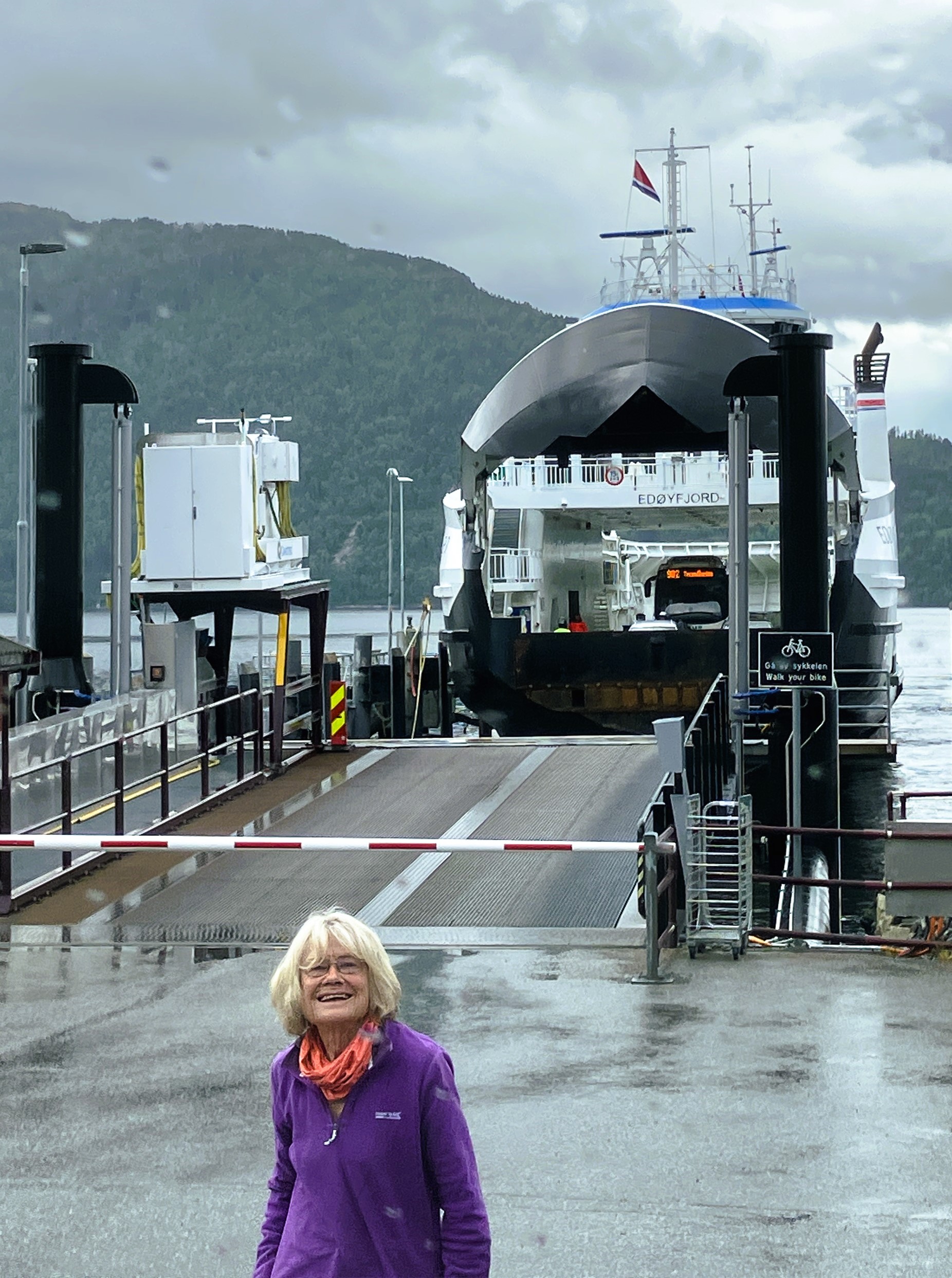
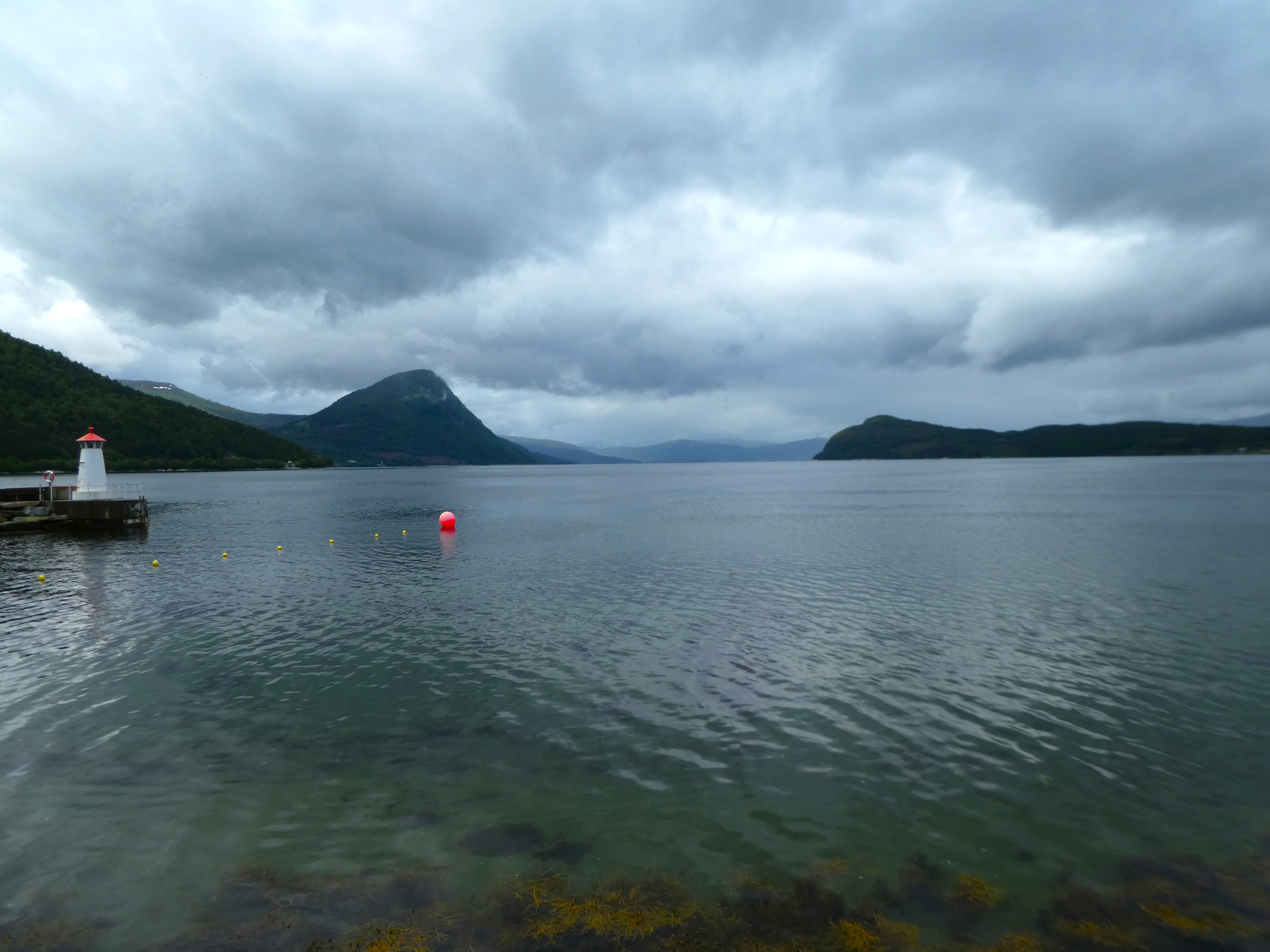
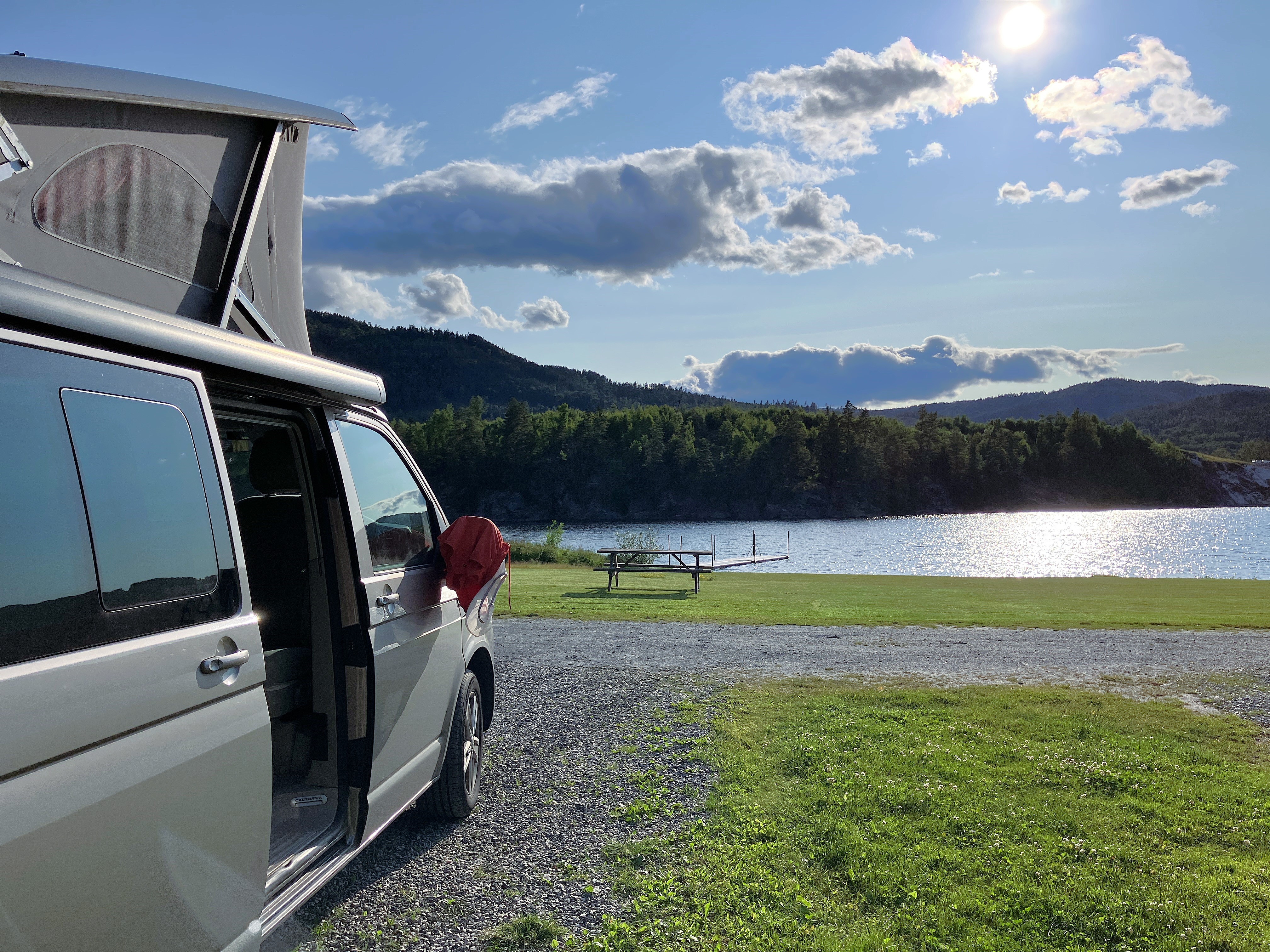
We follow the highway north until it turns to take us west towards the Lofoten Islands. We follow it for a bit before turning off to head north along the route 829 towards Grov. We are, looking for a P4N site at Sollia Grillhytte.
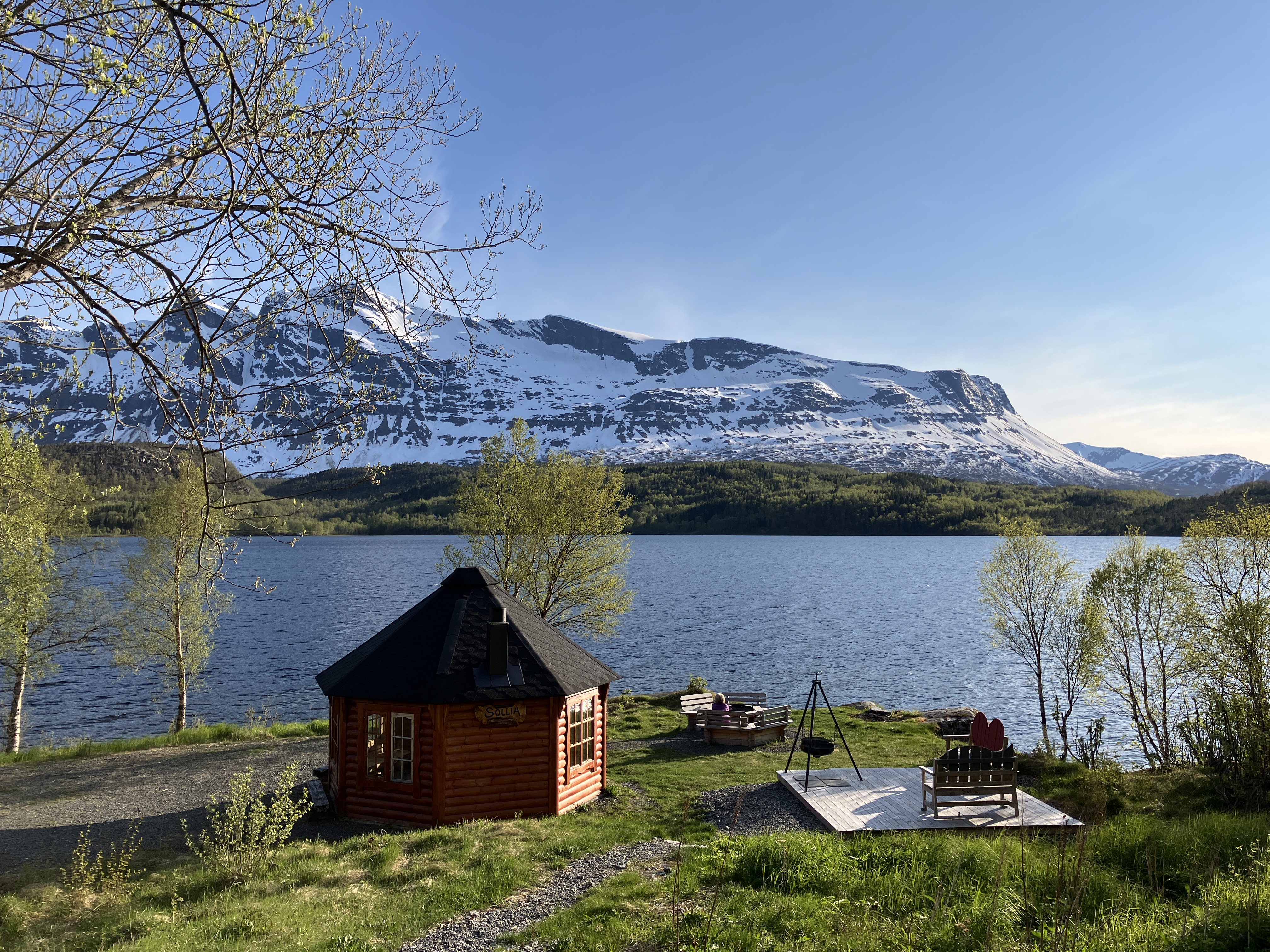
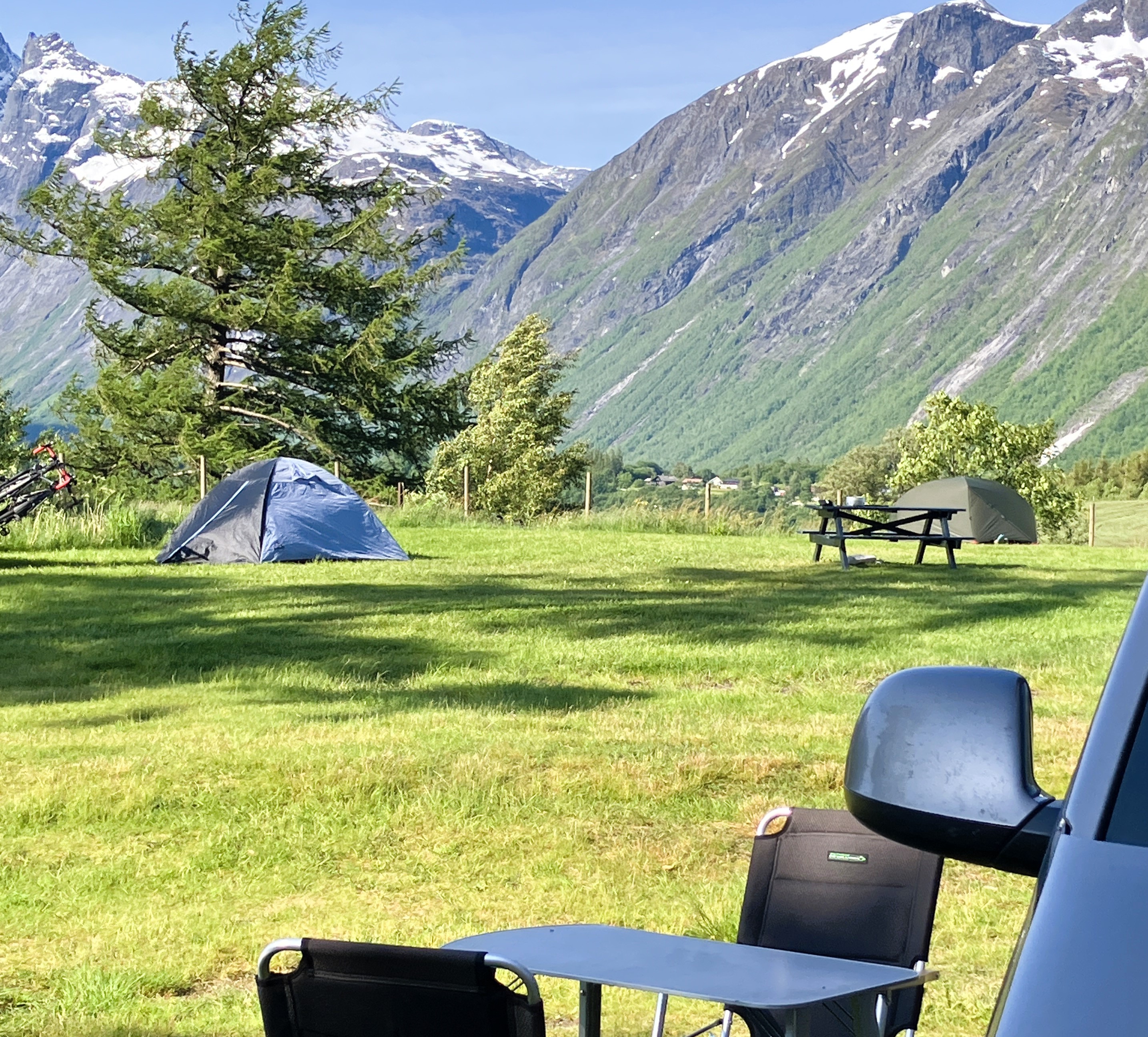
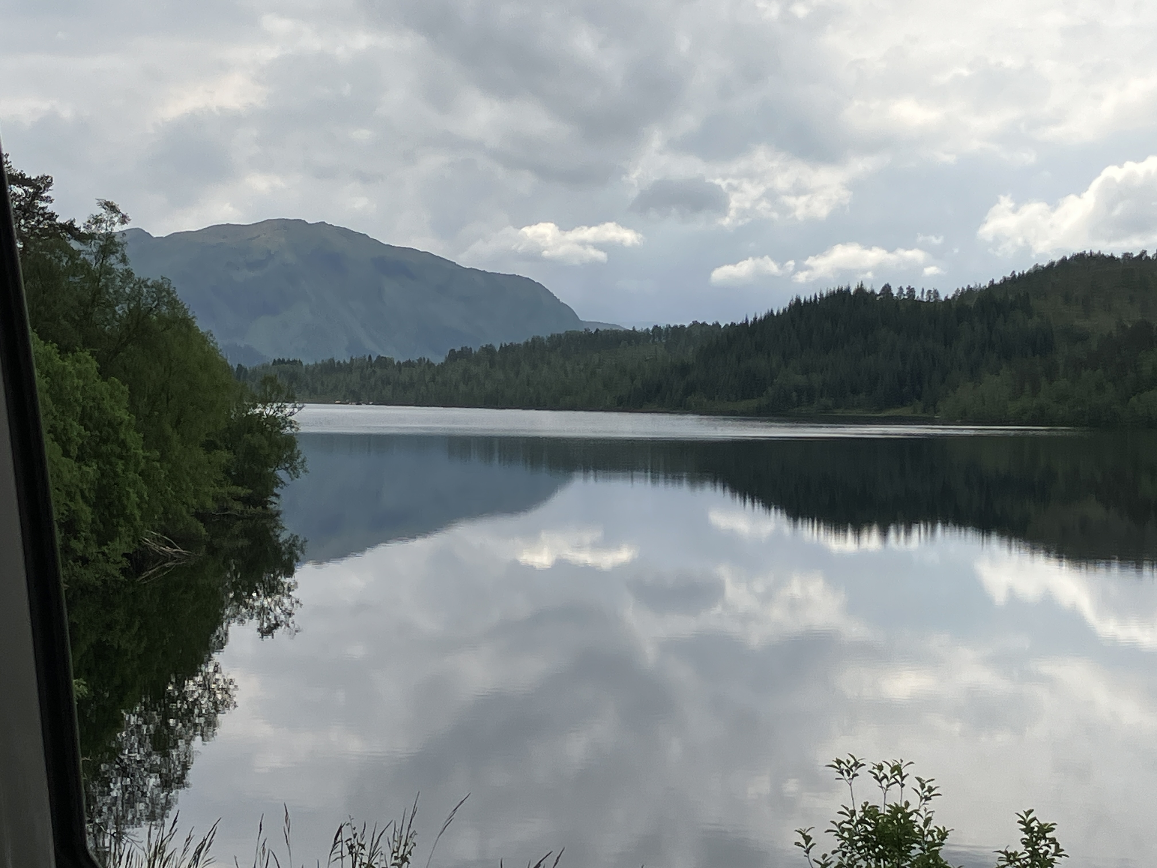
It was paradise. Firstly, nobody else was there. It was beside a lake. It was beside a lake surrounded by snow clad mountains.
It consisted of a compost toilet, octagonal hut with stove, outdoor seating and BBQ area. A grill house for fishermen.
To add to the perfection, the sun was still shining
While Graham cooked Janet lit the stove in the hut. We ate and spent the rest of the evening in there. We watched the sun go down behind the hill at 10.20. We then saw its reflection on the opposite mountain. It continued to light the sky to the north.
We stayed up until midnight. We saw the faint bruising in the sky. This was our first encounter with the midnight sun.!
Day 17 Sollia to Lofoten Islands
Monday 2nd June
A really good nights sleep and a boiled egg in the grill house started the day well.
Such a nice spot. We were disappointed to have to leave. It was good travelling north out of the valley to Grov. We then followed the coast around to Steinsland, where we rejoined the main road into the Islands. There were a lot of road works along the way and progress was slow. The rain started to fall heavily, just as forecast. We made our way onto the Lofoten Islands by bridge and tunnel.


The rain started to fall heavily, just as forecast. We made our way onto the Lofoten Islands by bridge and tunnel.
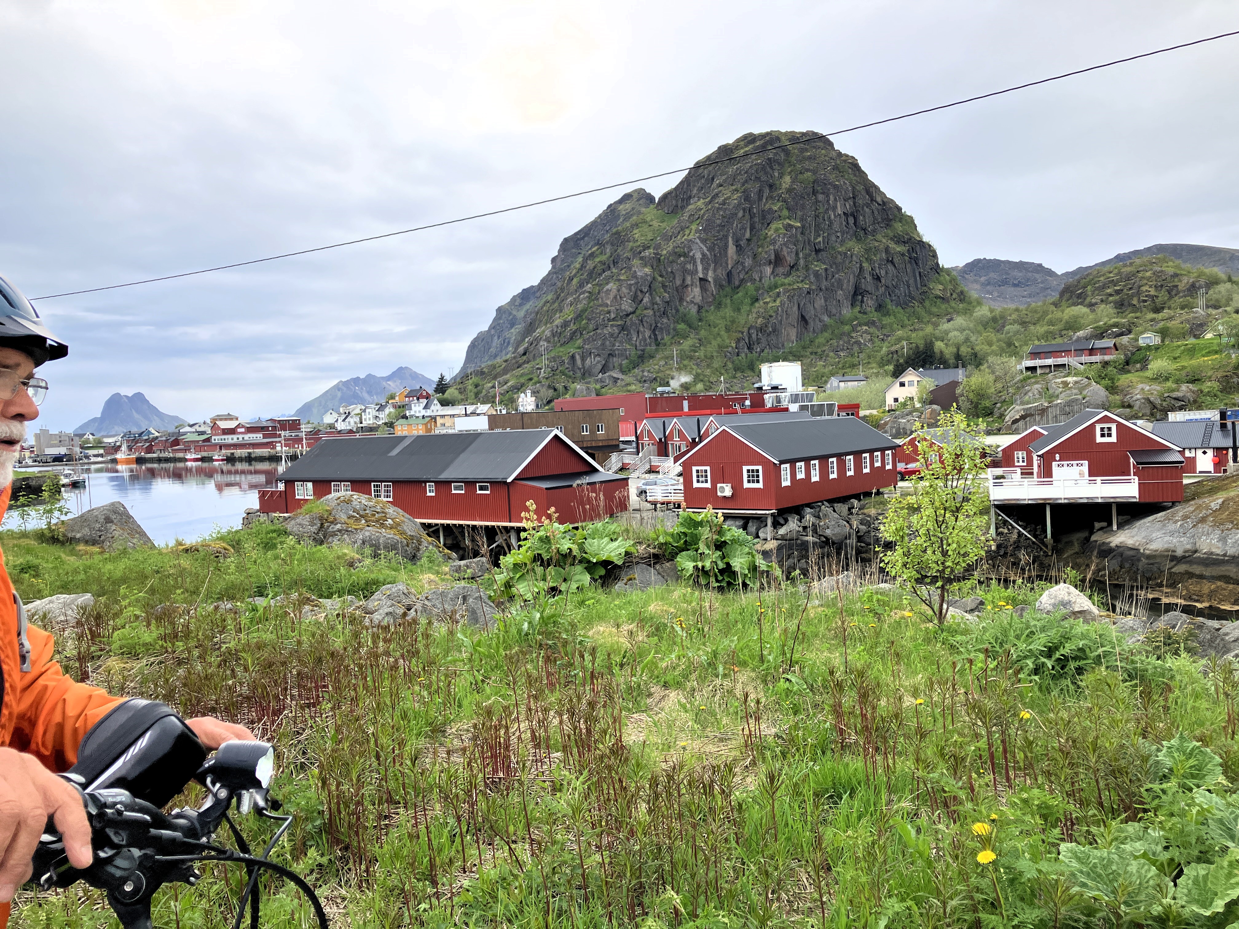
We stopped in Svolvaer for lunch opting for an open sandwich and coffee in a bakery. We then visited the tourist office. There we got a detailed map of the Lofoten Islands. We also received advice about cycling in the area.
Making our way back to the van after lunch we came upon the gallery Stig Tobiasson.
A fascinating artist used mainly rollers to create his art works. Some of his pieces featured pointy mountains and tall Viking ships. These were very reflective of the Lofoten Islands we came to see.
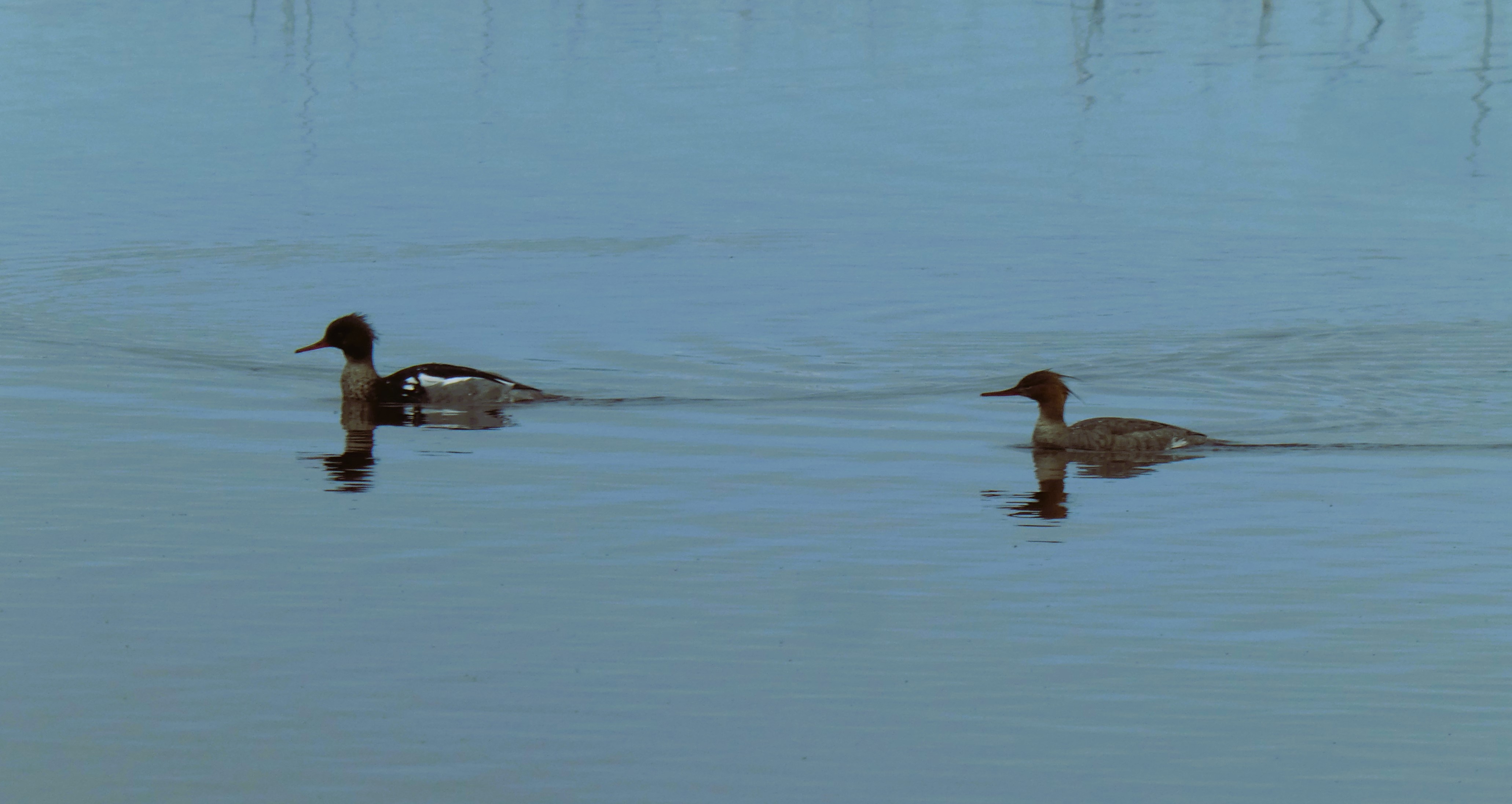
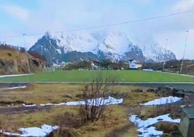
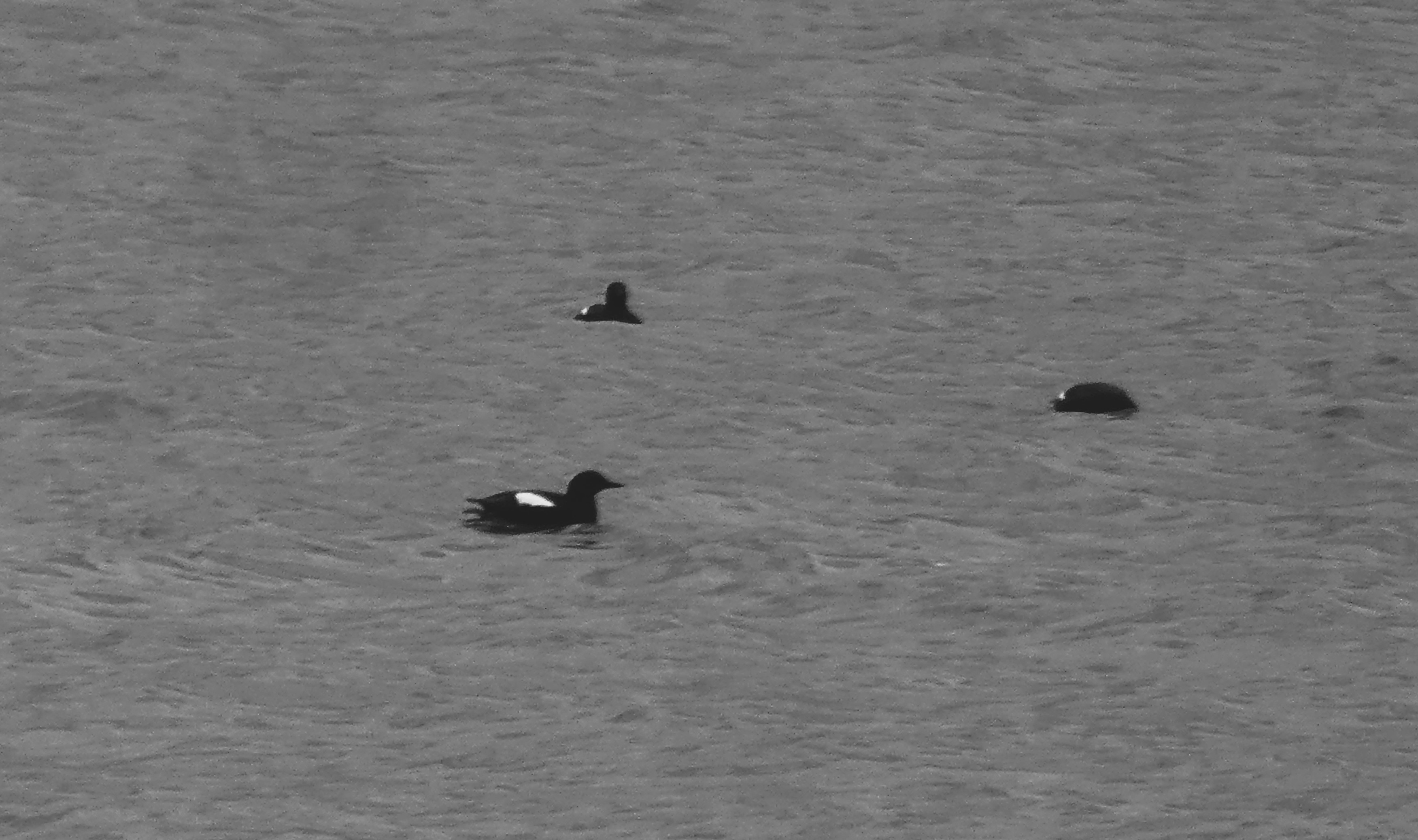
It was very wet so we took our time getting to our next camp site at Rystad Loften. We turned off the main road towards Henningsvaer with its iconic football pitch. We stopped to watch some Red Mergansers (ducks) in the bay. As the rain eased we made out way to the camp site.

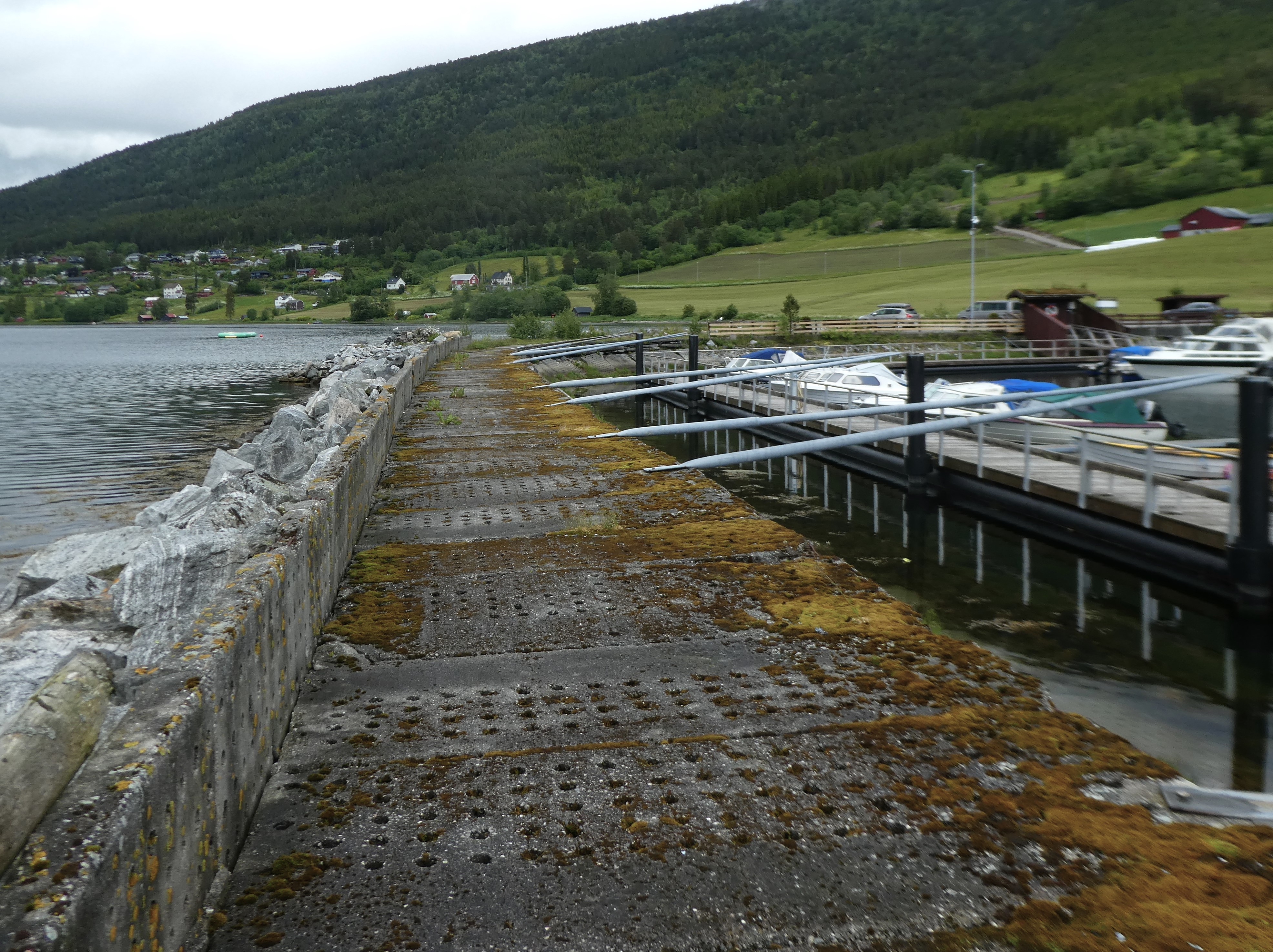
We found a spot on the camp site high up with a good view of the sea. The site was busy. The facilities, although limited, were more than adequate. There was hot water and kitchen areas were available for cooking and eating.


The rain thankfully stopped around 5.30 and we cycled for half an hour to the end of the road at Brenna north-east of the site.
The evening got lighter as it progressed. As we returned, we identified grey lag geese, artic terns, oyster catchers, eider ducks, and great northern divers. Cuckoos were incorrigible among the host of birds around us.


We returned to the camp site and cooked fish in the kitchen before taking it to the van to eat.
As the evening progressed towards midnight, the cloud started to break up and late into the evening at the very end of the day, the sun broke through in spectacular fashion
But it could not hold out against the cloud until midnight by which time the light night sky was grey.
Day 18 Lofoten Islands : Biskopsjord
Tuesday 3rd June
It rained heavily overnight but eased as we got up. We packed up the van. Then, we manoeuvred ourselves to get some water for the tank. We had to navigate around a herd of motor homes trying to discharge their waste tanks. We headed off towards Leknes. Only later did we realise that we had forgotten to pick up our rubber mat from outside the van.
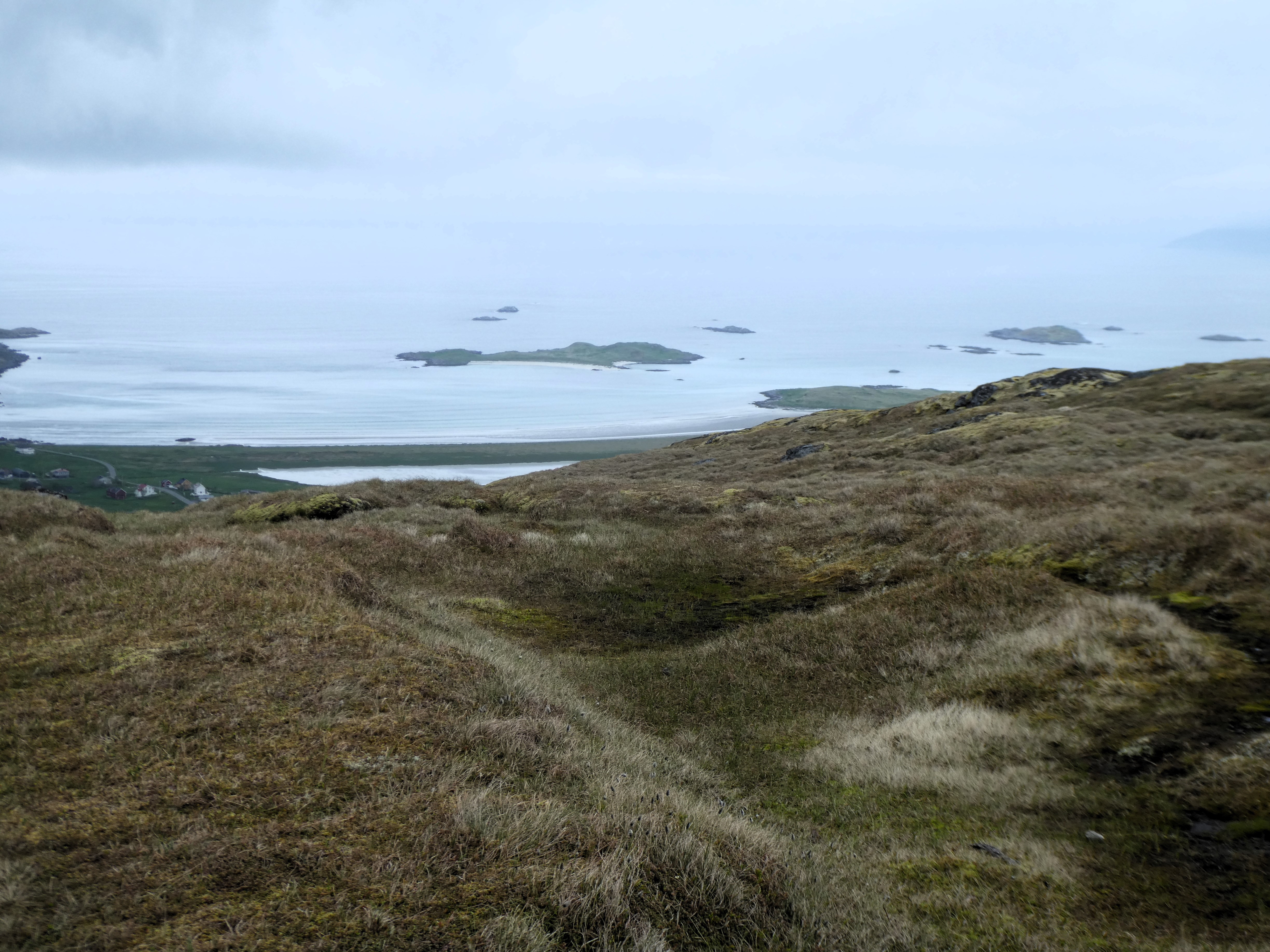
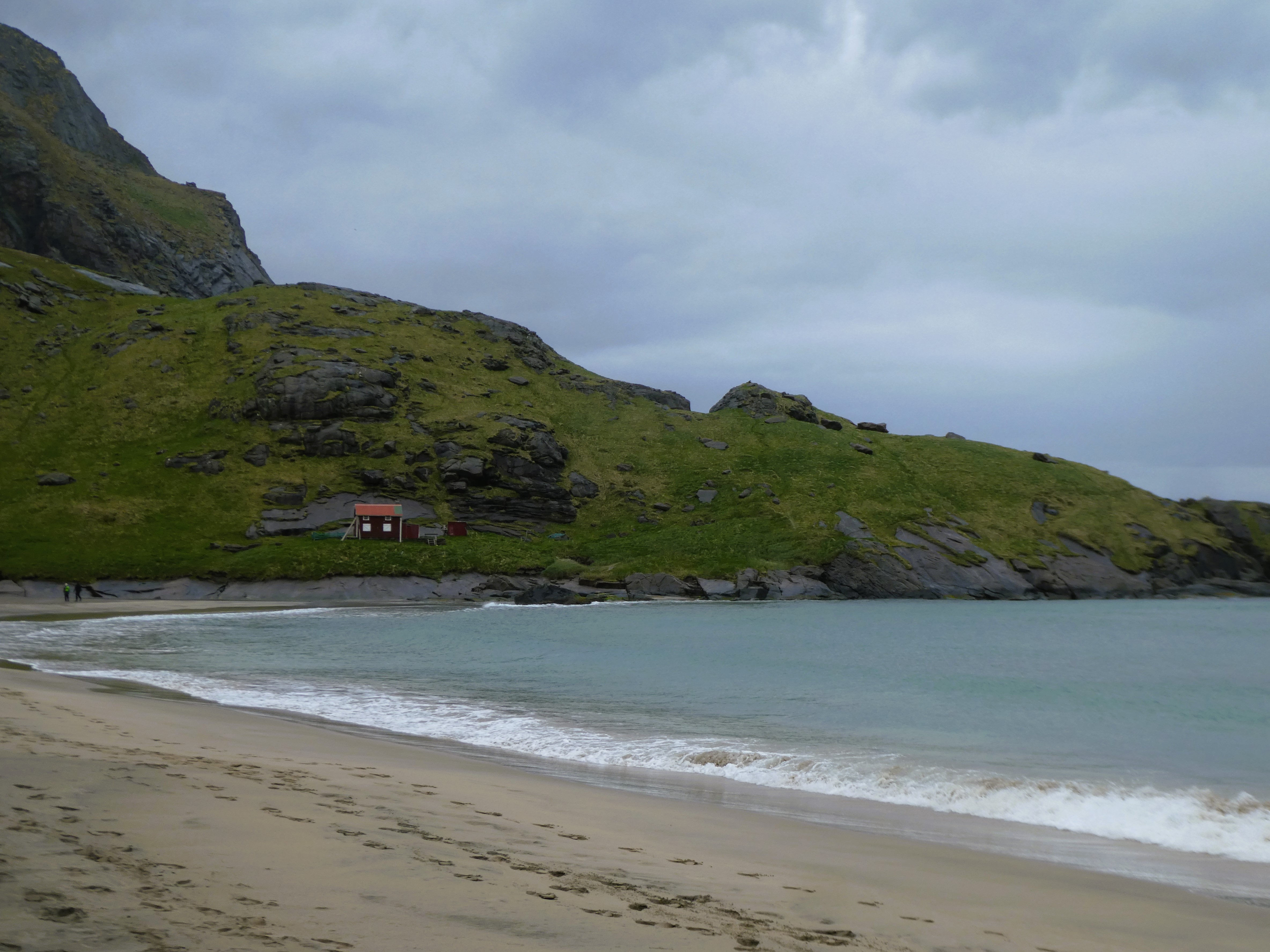
We stopped at Haukland and parked up off the main road to cycle out around the north coast. In a cold wind we made our way to Rekdalen. Here we had a snack on a small sandy beach. We tried to identify the many wild fowl and sea birds around us with the aid of binoculars.

As it started to spot with rain, we cycled back to the van. We took a road to the west towards Sandoya, a very different low-lying spit. As it was getting brighter and drier, we had hoped to eat lunch on the beach. But it was very smelly. Something was discharging from the houses that were built here, that smelt foul
So, we ate lunch on a rock overlooking the end of the isthmus, before cycling back to the van. As we made our way inland, we headed back to take a minor road to the south coast. The sun came out. Although it was only 10 degrees, the sunshine made it feel much warmer.
We travelled along the coast road. We stopped to take pictures of the stunning views of the south coast of the Islands. One of these stops was in a secluded peaceful graveyard surrounded by trees, another, was at the church at Valberg.


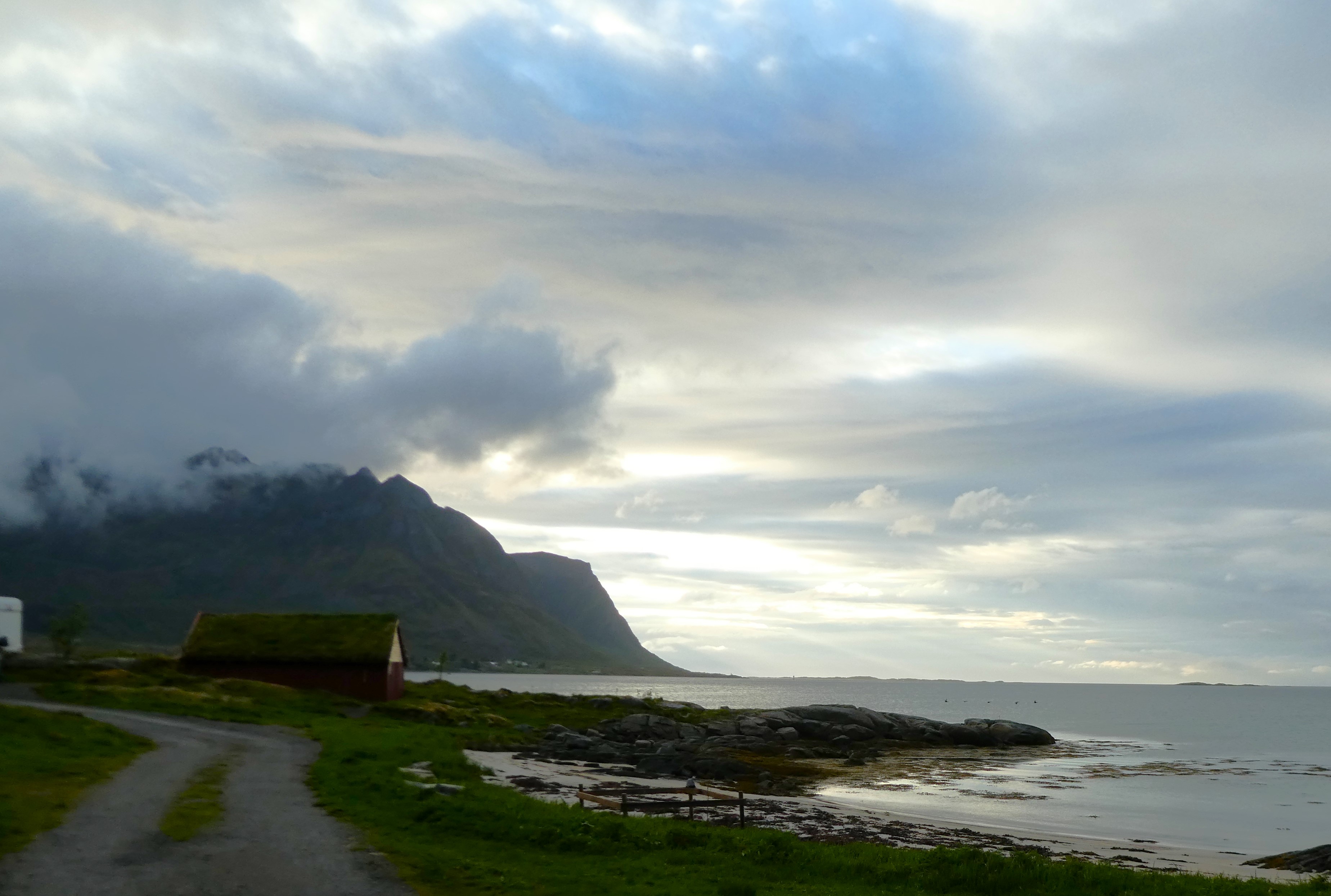
The campsite at Biskopsjord was around a small harbour in a village at the head of a small fjord. It had a mixture of huts and emplacements surrounded by rolling hills, reminding us of the Lake District.
There was a small shop and café at the reception building and a kitchen and eating area on the site as well as plenty of hot token operated showers.


The village comprised of a large service garage, the camp site and some other houses. A mixture of holiday homes and residential, with a couple of farms. A real contrast to the scattered development north coast.
We settled ourselves in and had a short walk up into the hills. We returned to have a meal at the café on the camp site. We enjoyed our first glass of wine in a long while. Not cheap and not to be repeated.
We then put the bikes on charge through the van hook up and they recharged a treat.
Day 19 Lofoten Islands : Biskopsjord
Wednesday 4th June
We had breakfast outside the van. We listened to the cuckoos in the hills around us. We watched the wildfowl and seagulls on the water.
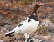
We were entertained by a Willow Ptarmigan that was squawking in the scrub behind our plot. It is a large game bird, that was making alarming calls whenever disturbed. Baaa Baaa BaaBaa babababa.
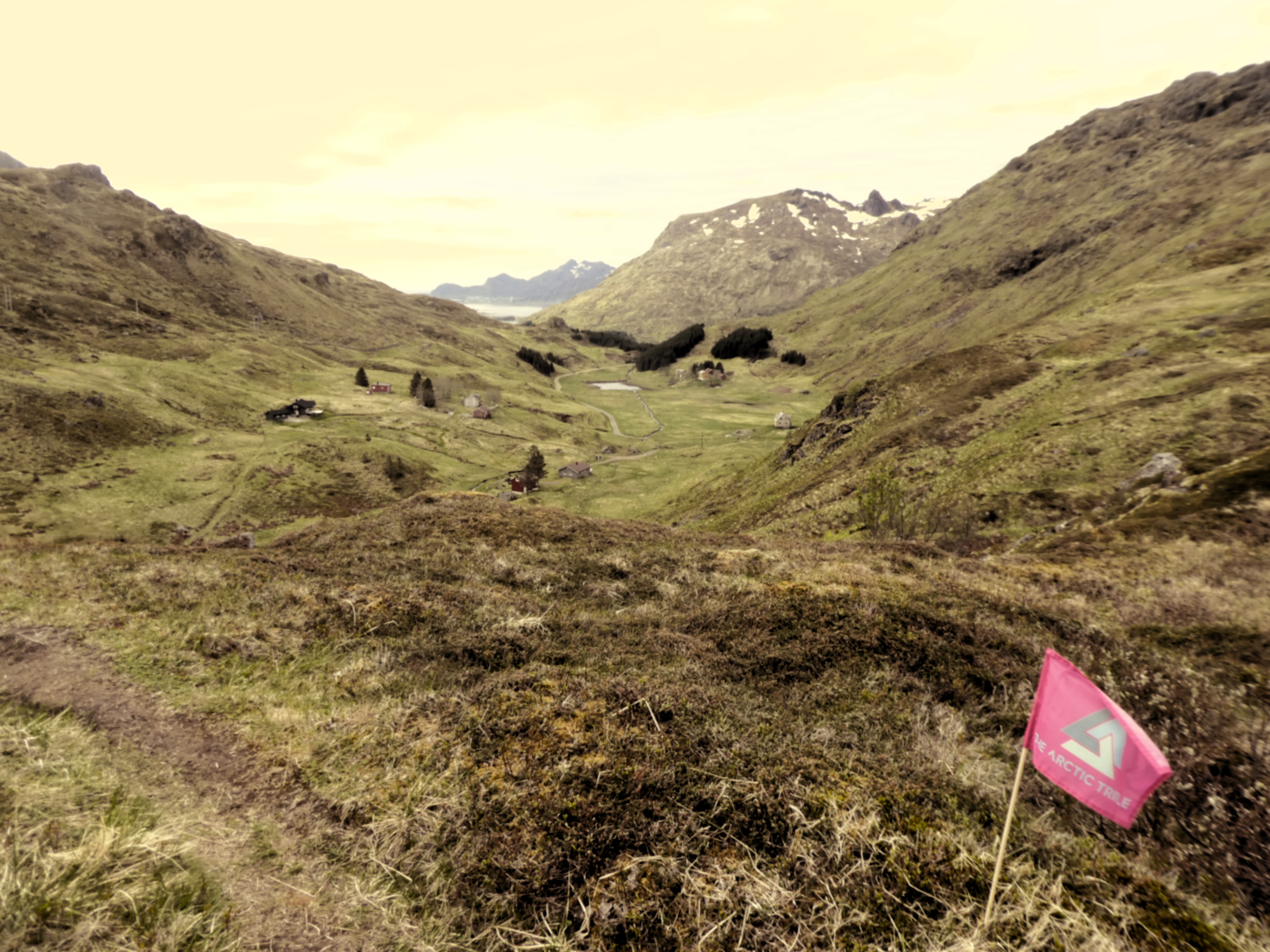
Feeling relaxed we climbed up the track we had started up last night and continued to a ridge where the path divided. Pink flags appeared on both paths ahead.
We followed the path south which had flags along the way with Arctic Triplet written on them. This was a long-distance hill race that had taken place a few weeks before.
As the flags seemed to be marking the path we were going we followed them in a circuit west. We climbed high past a snowy Brattflogan at 460m. where we stopped for a snack at the high point.
An Italian guy briefly joined us. He was walking south through the Lofoten Island. He relied totally upon his watch GIS and did not use a map!
He was travelling much faster than us. He soon disappeared into the distance. We tried to work out how useful or distracting these flags were going to be.


We didn’t realise how helpful they turned out to be. The three hour walk, over rough moorland with smatterings of snow along the path, before walking down the valley back to the site, was satisfying
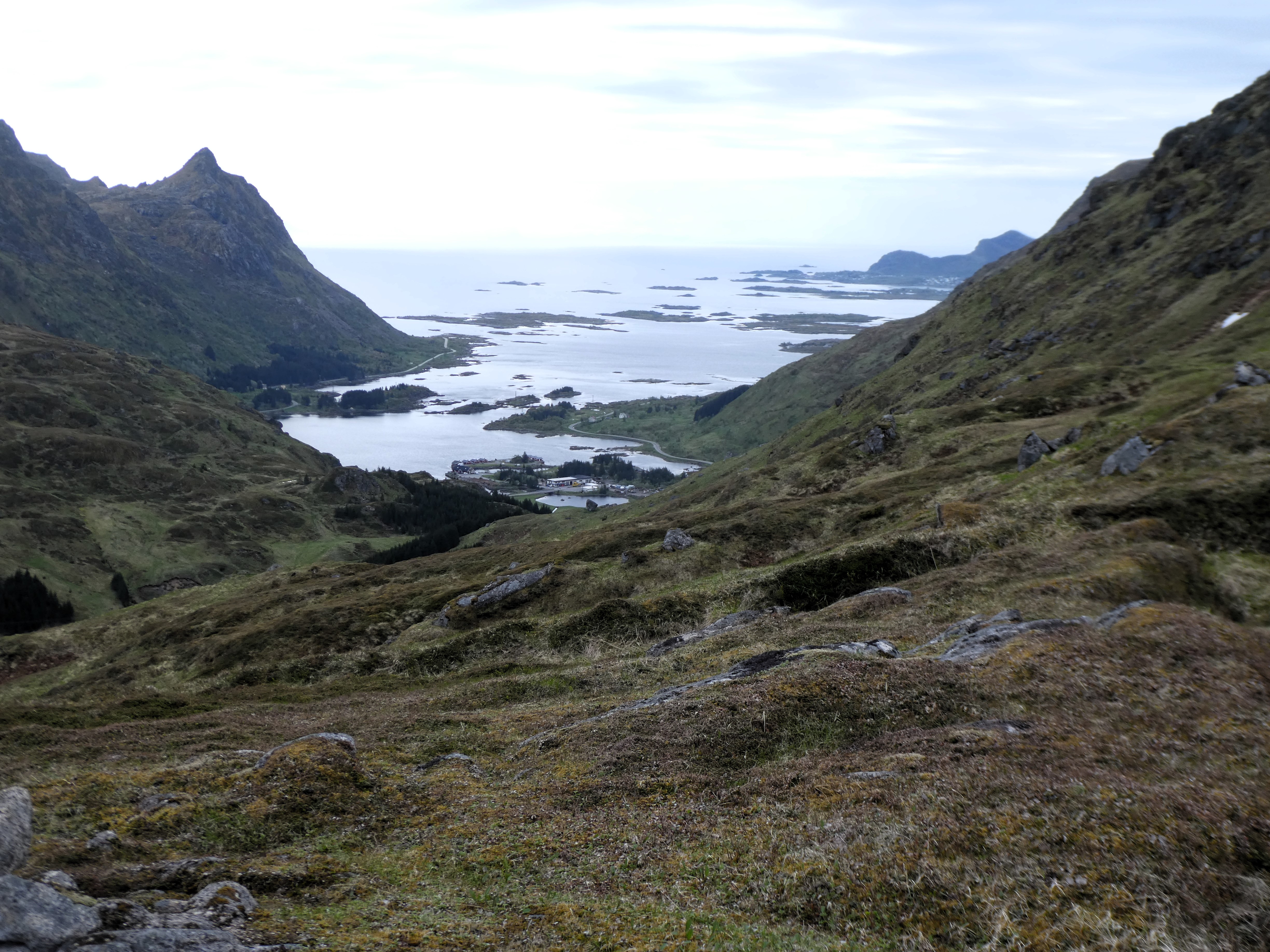
After finishing our lunch, we left the campsite on our bikes. We followed the coast road further southwest to Storfjorden.
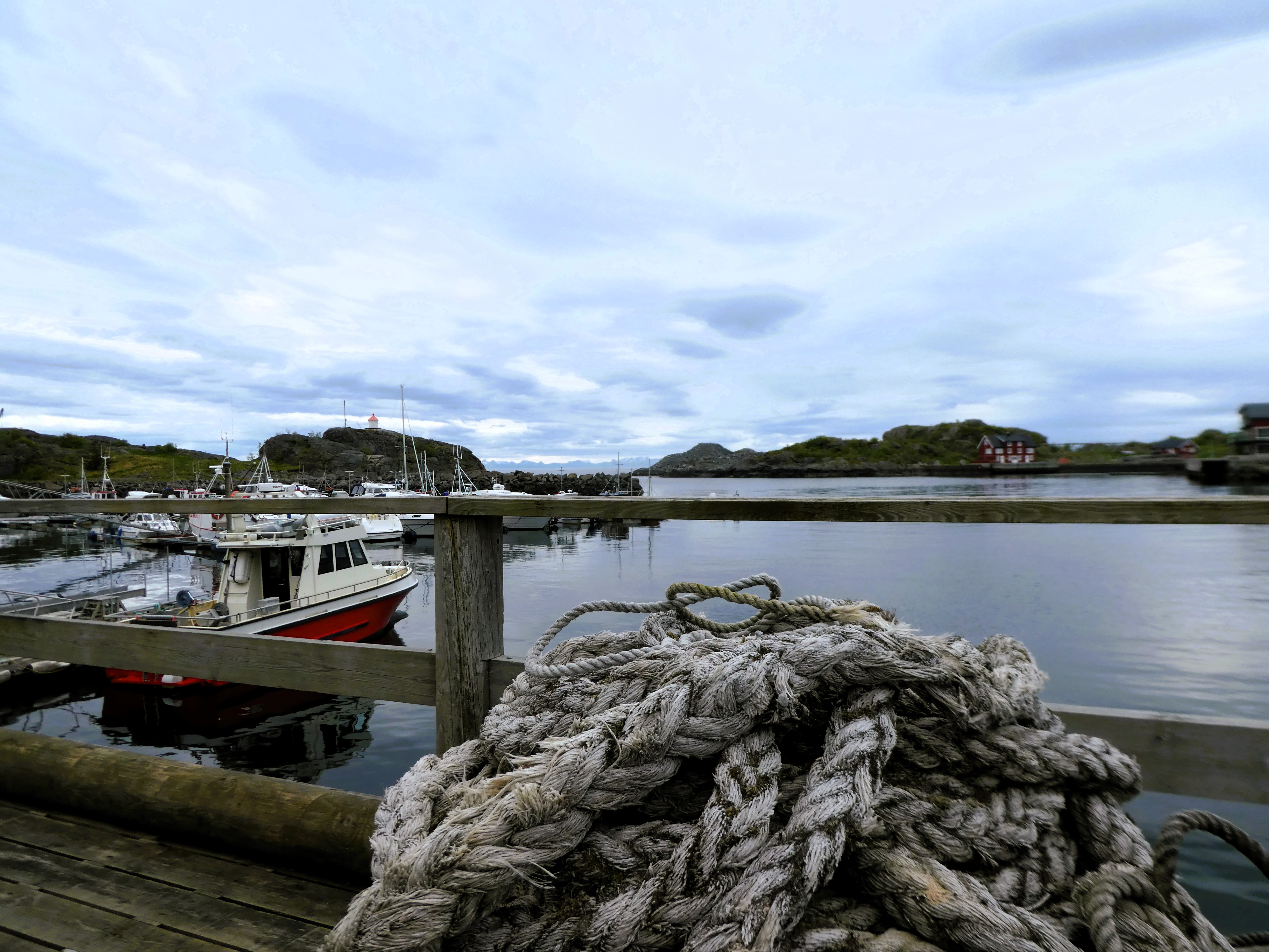
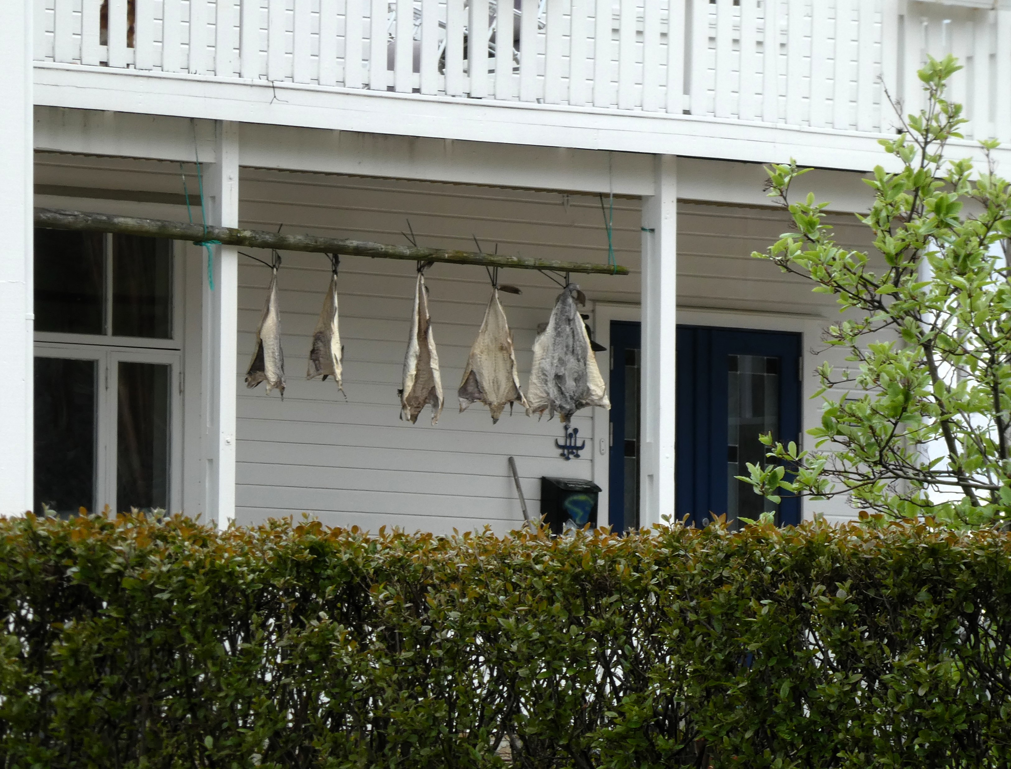
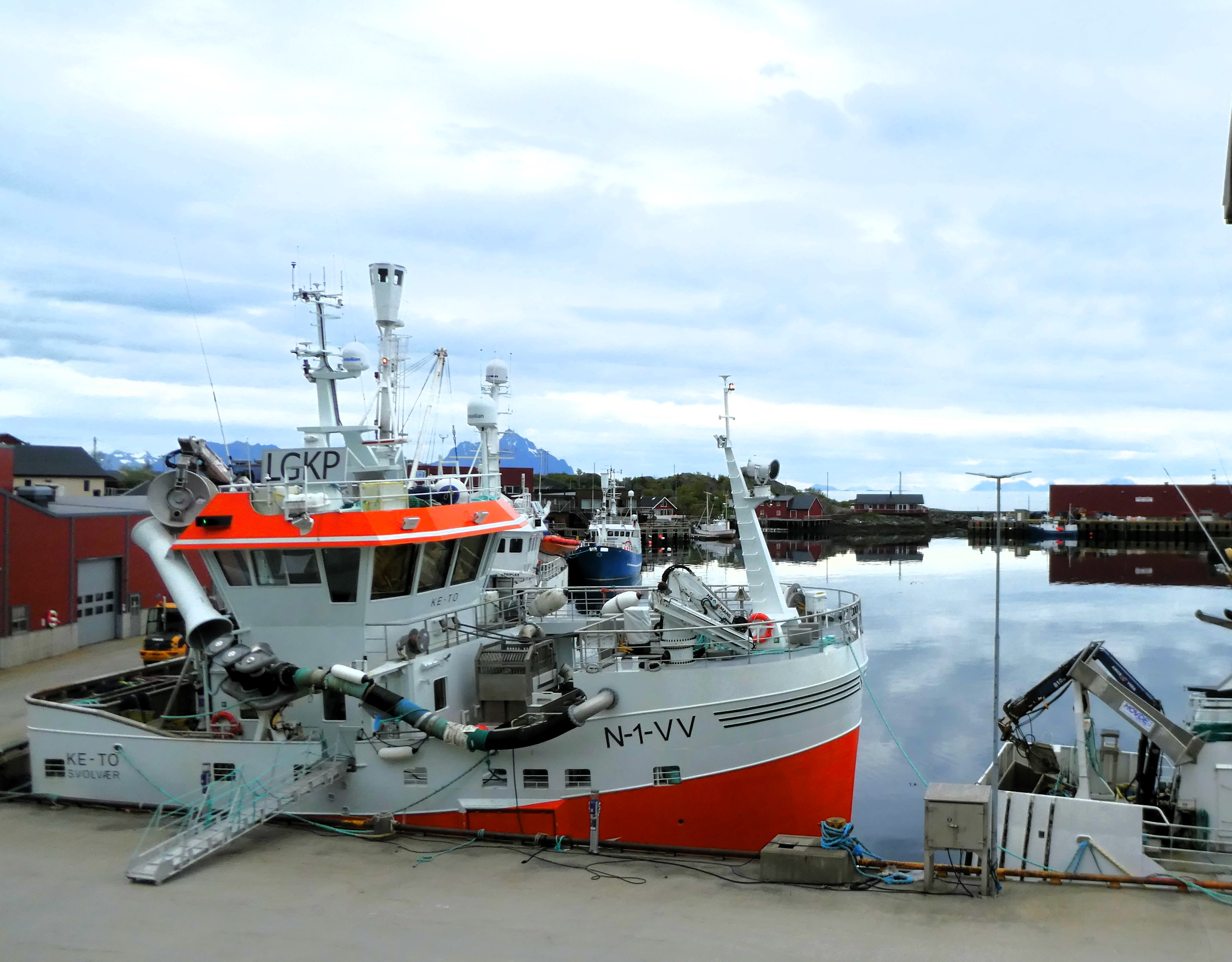
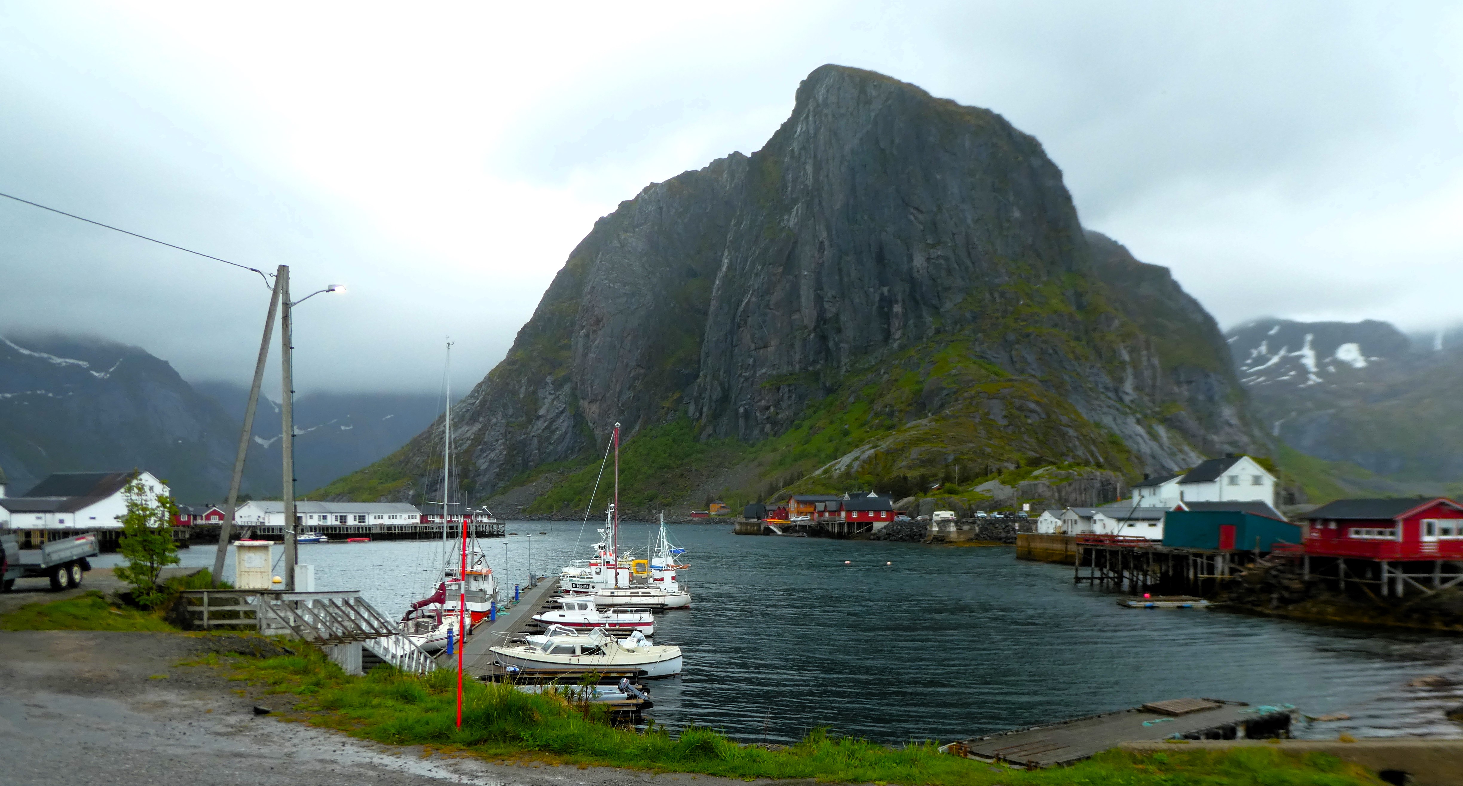
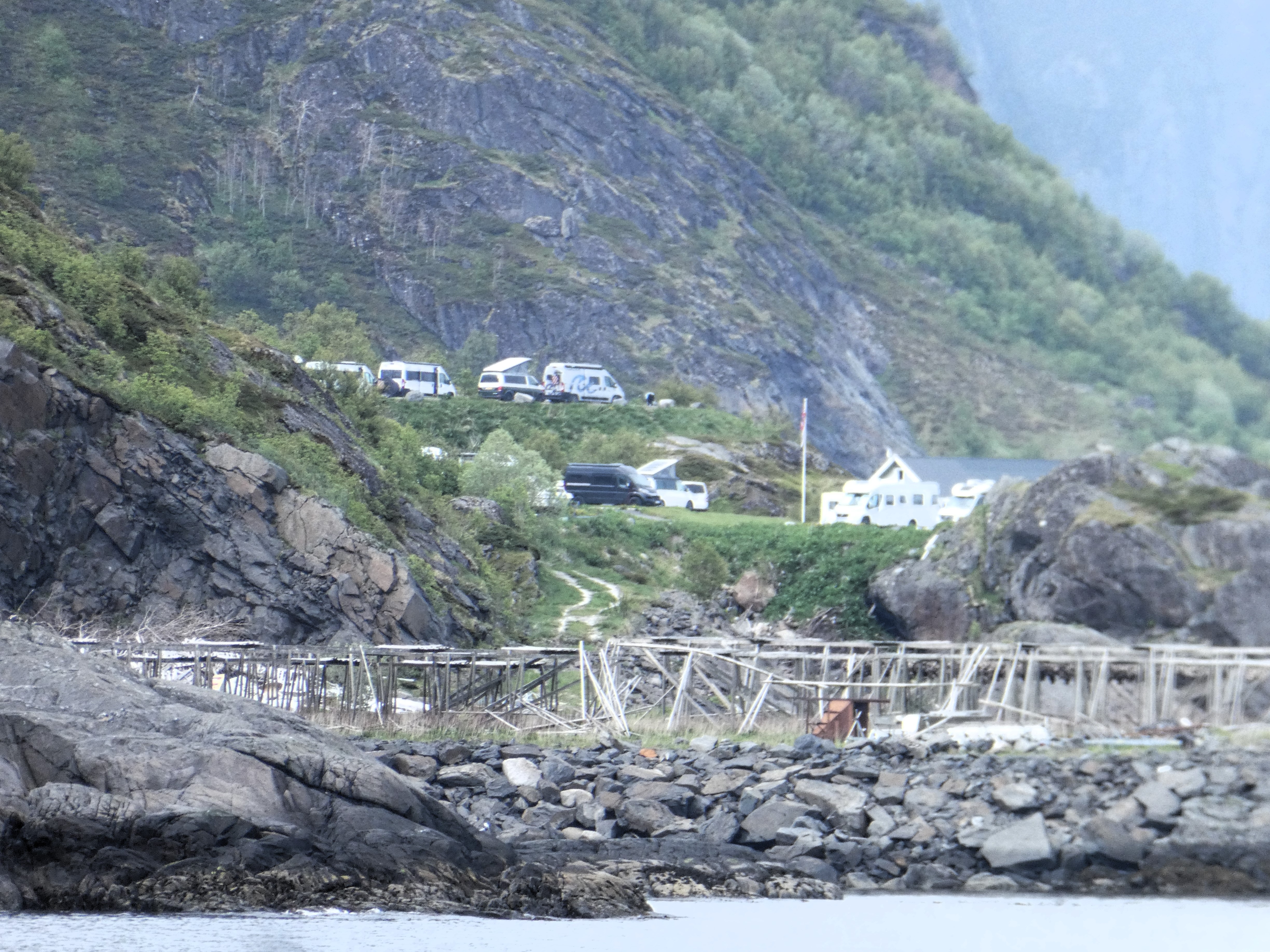
Here we turned off the main road. We followed a minor road east around to Stamsund, a commercial fishing port. There, some big fishing boats were moored up. Stock fish were drying in the eaves of a house.
As we followed the road around the coast, in a circle back to Storfjorden, the reflections on the water were amazing.

We returned to the site. We tried to buy some beer from the camp shop to drink at the van. However, we were told they were not allowed to sell beer to be drunk away from the café. So instead, we relaxed with some crisps, olives, and sparkling water. We felt we deserved this as we were well exercised.
Day 20 Lofoten Islands – Moskenes
Thursday 5th June
We pack up and leave the site at around 9.30 am. The drive along the coast into Leknes we had travelled along in part on the bikes the day before. A sprawling town that provided us with an adequate but unsatisfactory food shop, although we did find a bakery that served wonderful warm stodgy cinnamon and pistachio buns which we stocked up on
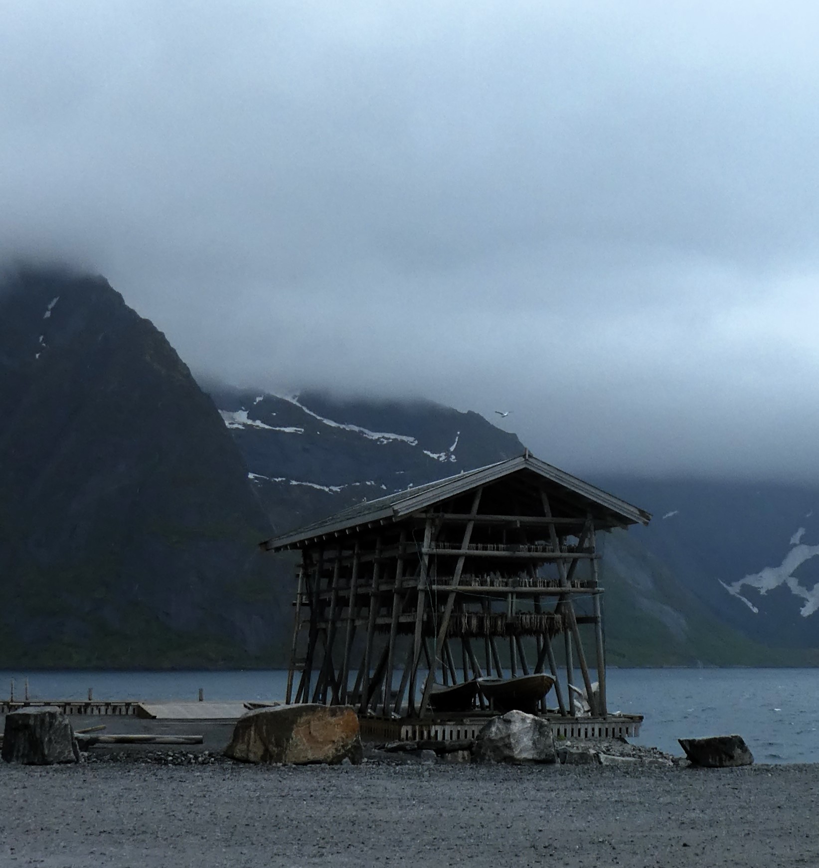
It started to rain as we headed for the Innersand car park where the trail to the infamous Kvalvika Beach started. The journey there took us through an archipelago of small mountain islands. We traveled on a tortuous path along shorelines below high pointy mountains. Tunnels took us under the sea. Bridges spanned gaps not used by the large cruise ships. Along the roadside where there was room there are drying racks for air drying fish.

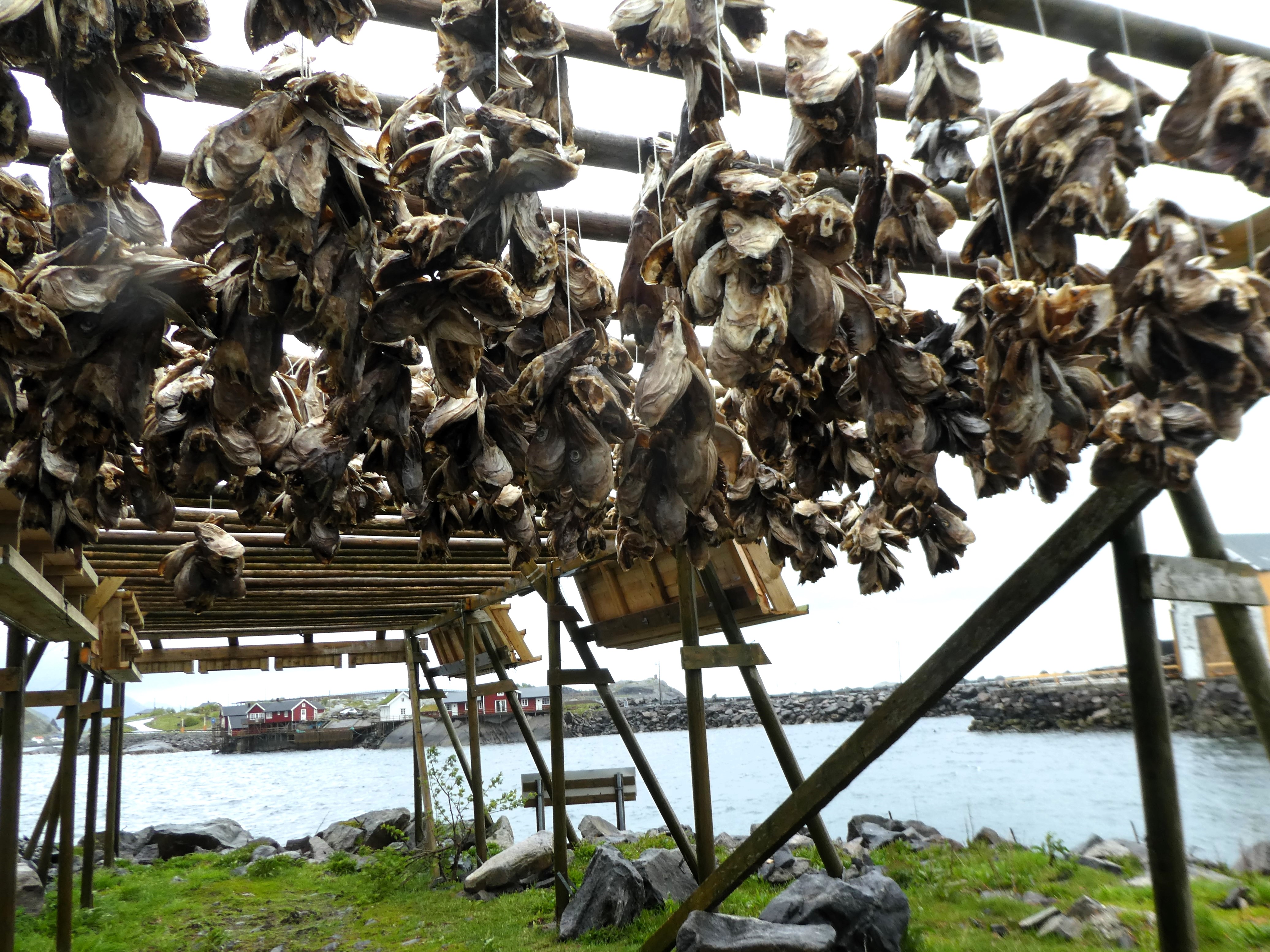

We reached Bergen about a week later. Only then did we finally understand everything about the Lofoten islands’ trade. This trade is in dried fish known as stock fish.
When we arrive at the car park at Innersand, it is raining. We change into wet weather gear such as leggings, cagoules, etc.. There were a lot of people doing the walk along a well-used difficult path with lots of steep muddy clambering.

As we reached the ridge the mist came down. We decided to return to the lower lakes. There we ate lunch overlooking Torsfjorden and the small settlement of Bergland. After lunch, we descended back to the car park and changed out of our wet clothes.
The drive down to Moskenes followed the theme of the morning’s drive. We travelled through tunnels and over bridges along the coast.
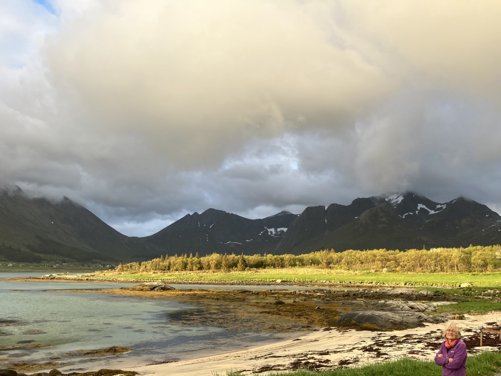
We stopped at the small port of Myran to take in the awesome grandeur of the mountains rising vertically from the sea. It was so different from the landscape of the previous two days.
The rain has stopped it is still low cloud on the peaks and a fierce wind blowing up the coast, as we drive down the coast to Moskenes.
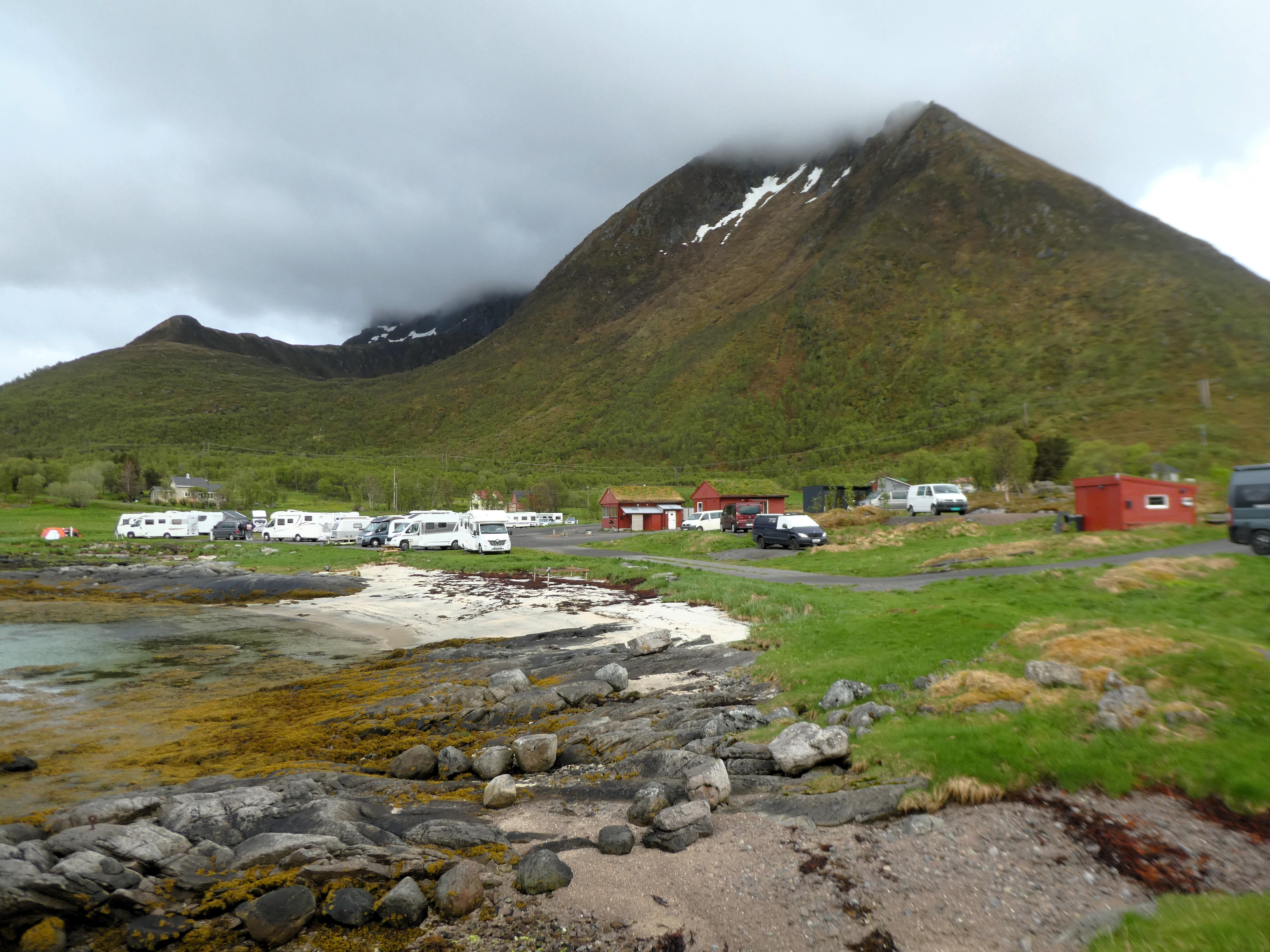
The campsite at Moskenes serves the Ferry back to the Norwegian mainland at Bodo. We intend to go there in two days’ time. It is almost full. In fact, we are the last van in. It is a huge site spread over many levels up the mountainside overlooking the sea
We are a small van and do not need electricity. We are offered a sheltered but grotty non-electric site by the facilities at the lowest level. Alternatively, there is a site with electricity high on the mountainside cliff. It is very windy, but that is the one space left. The lady at reception is concerned about our pop-up roof.

We chose that option, even though the wind was a bit strong. It had an amazing view and was well worth the extra cost.
Later the wind eased and the sun shone for the rest of the evening. We looked down over the activity of the camp site which was very entertaining. Although run to strict guidelines it felt calm and everywhere was clean and tidy.

Day 21 Lofoten Islands – Moskenes- Bunes Beach
Friday 6th June
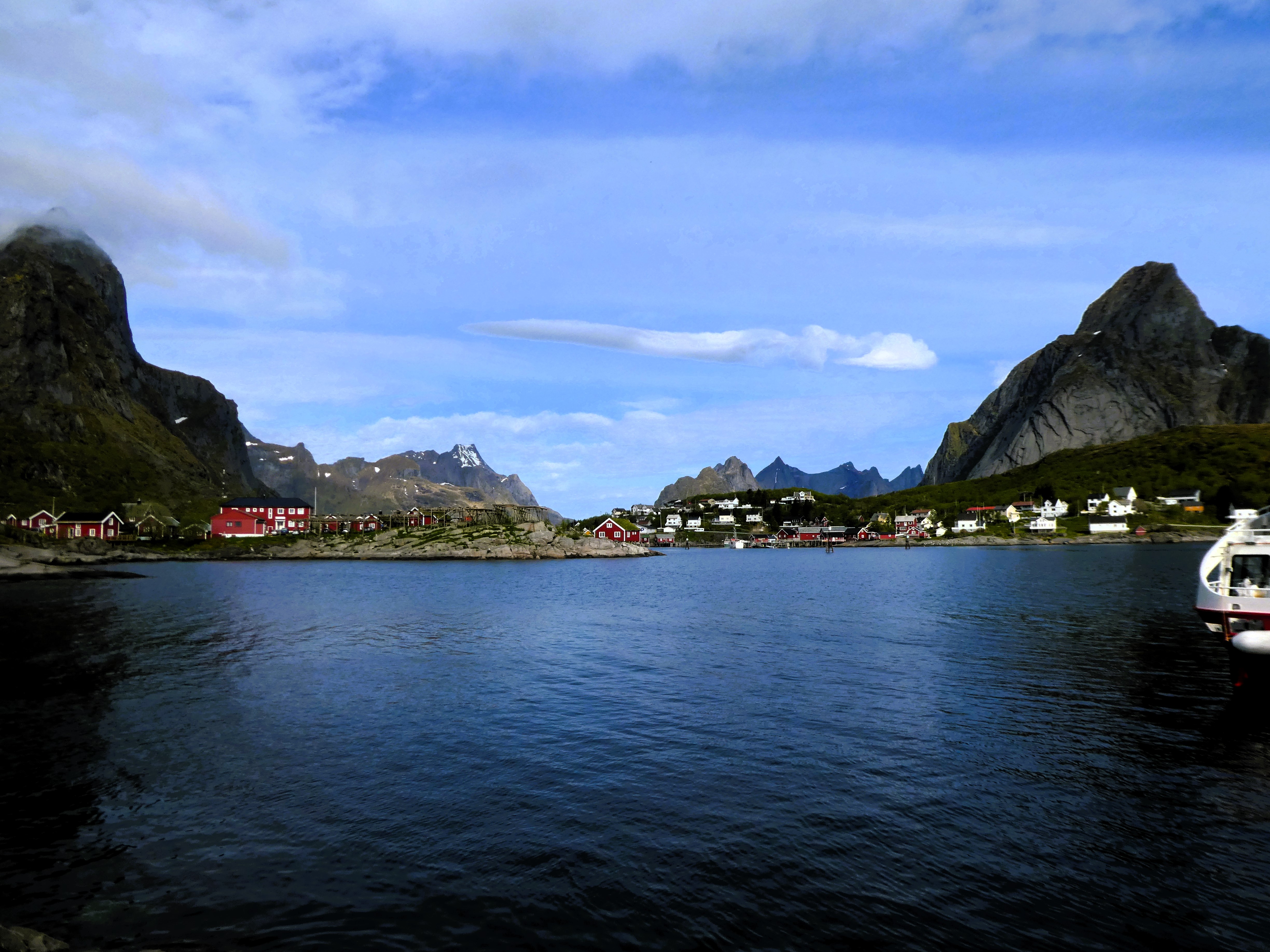
It was a fine sunny morning. We made a packed lunch and cycled three miles north to Reine. There are a lot of tunnels in Norway. We had been advised in the tourist office in Svolvaer not to cycle through them. Instead, we followed the old road, now a cycle track, closer to the coast. We wanted to catch the ferry up the Kjerk Fjorden to Vindstad.
On arriving at Reine we had an hour to wait for the ferry so we walked around the town. We found a larger car parking area and quay near some dried fish racks. Then, we realised we had gone to the wrong quay. The ferry we wanted was from here!
We were relieved as we waited. However, the queue of people grew. We realised that many, if not all, had booked tickets in advance. The website for booking tickets had closed for this sailing.
There was a good chance we would not be able to go on the next boat. We were at the front of the queue and waited.
The ferry arrived and we were able to get on but not all did.
The ferry’s route included three stops. We were the first stop where most people got off, all intending to walk to the beach at Bunes.
The weather was not great with squally showers and a cold easterly wind. The ferry did not return for five and a half hours. We had lots of time to explore before we sailed back to Reine.

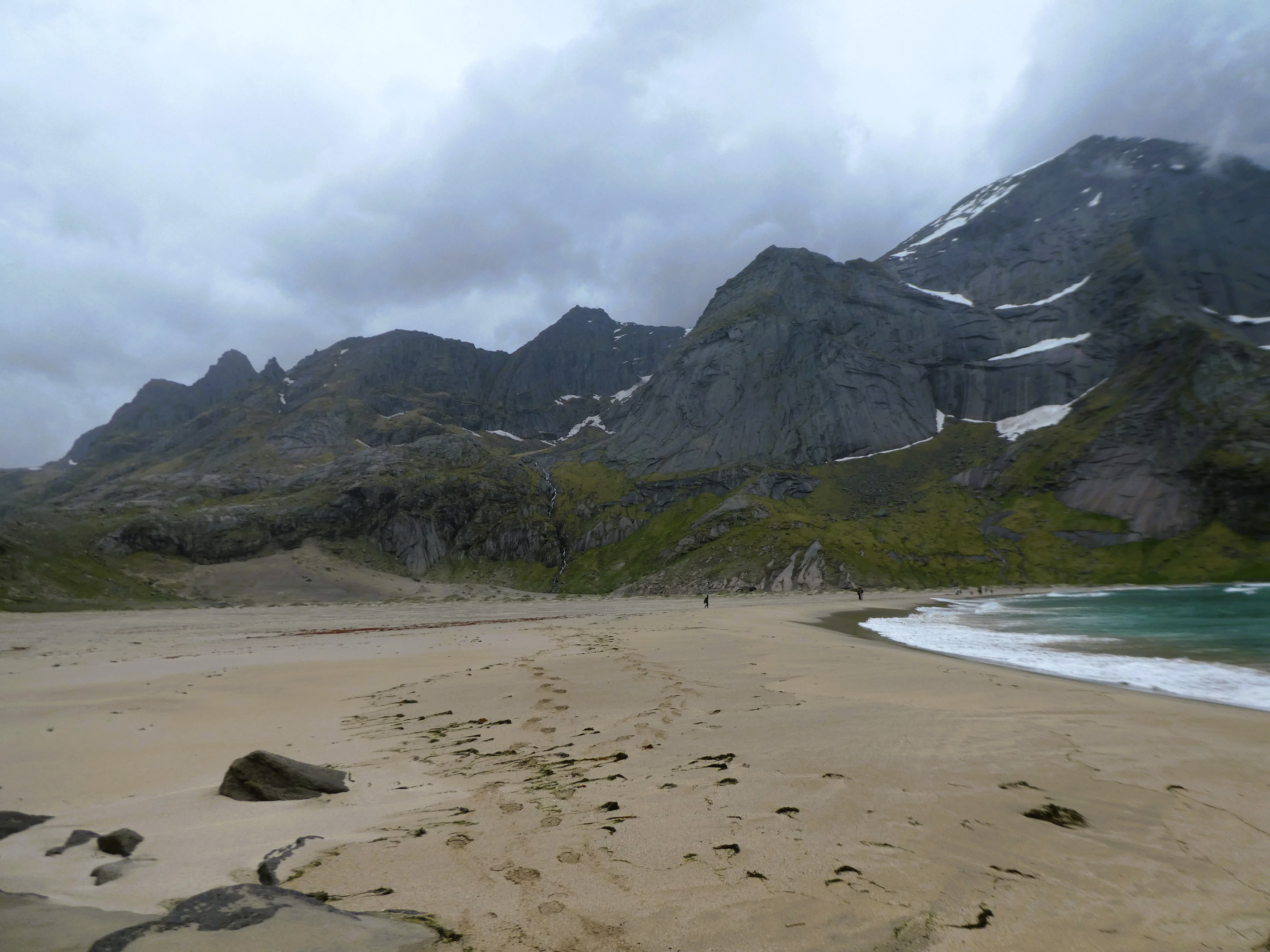
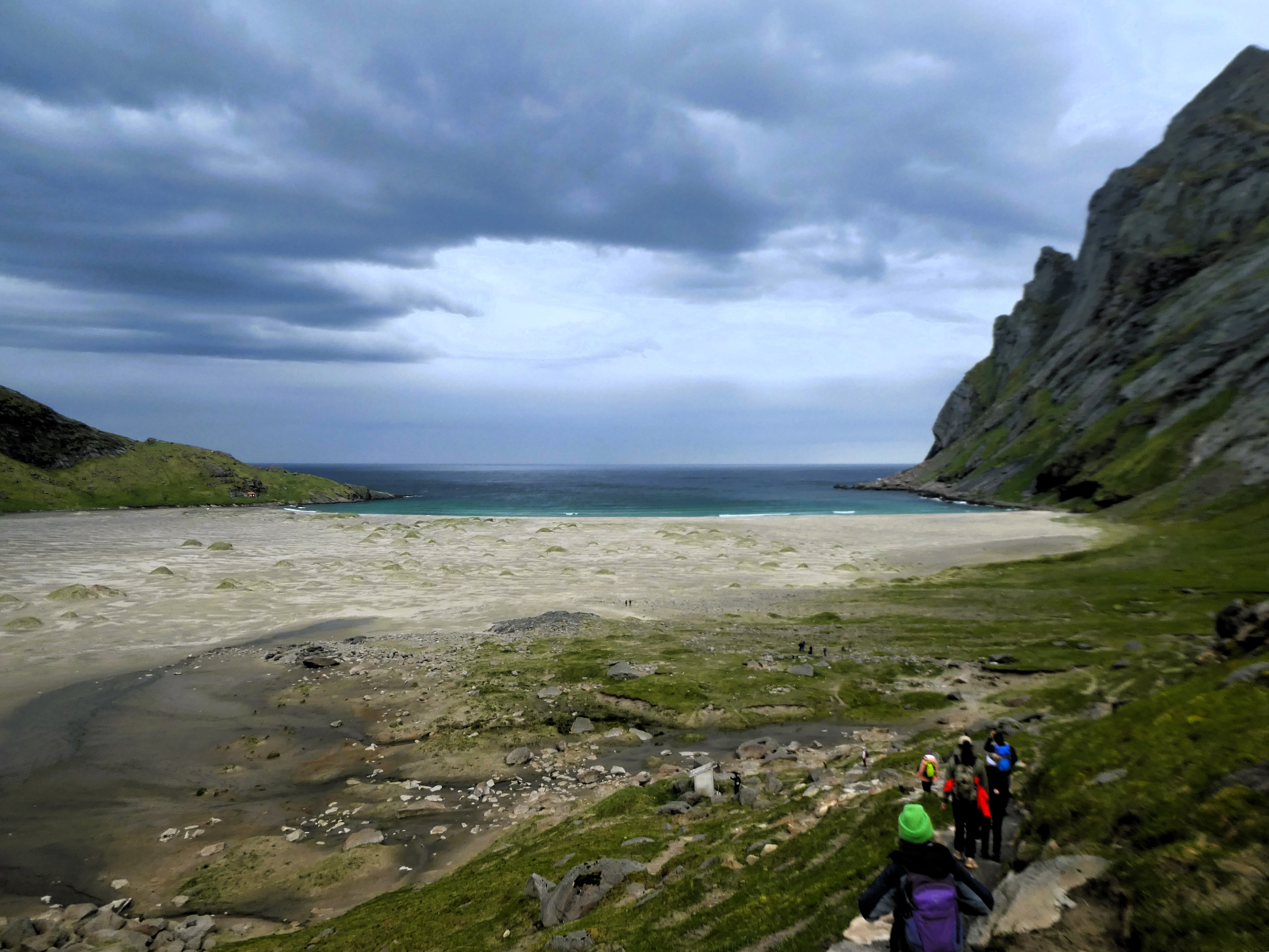

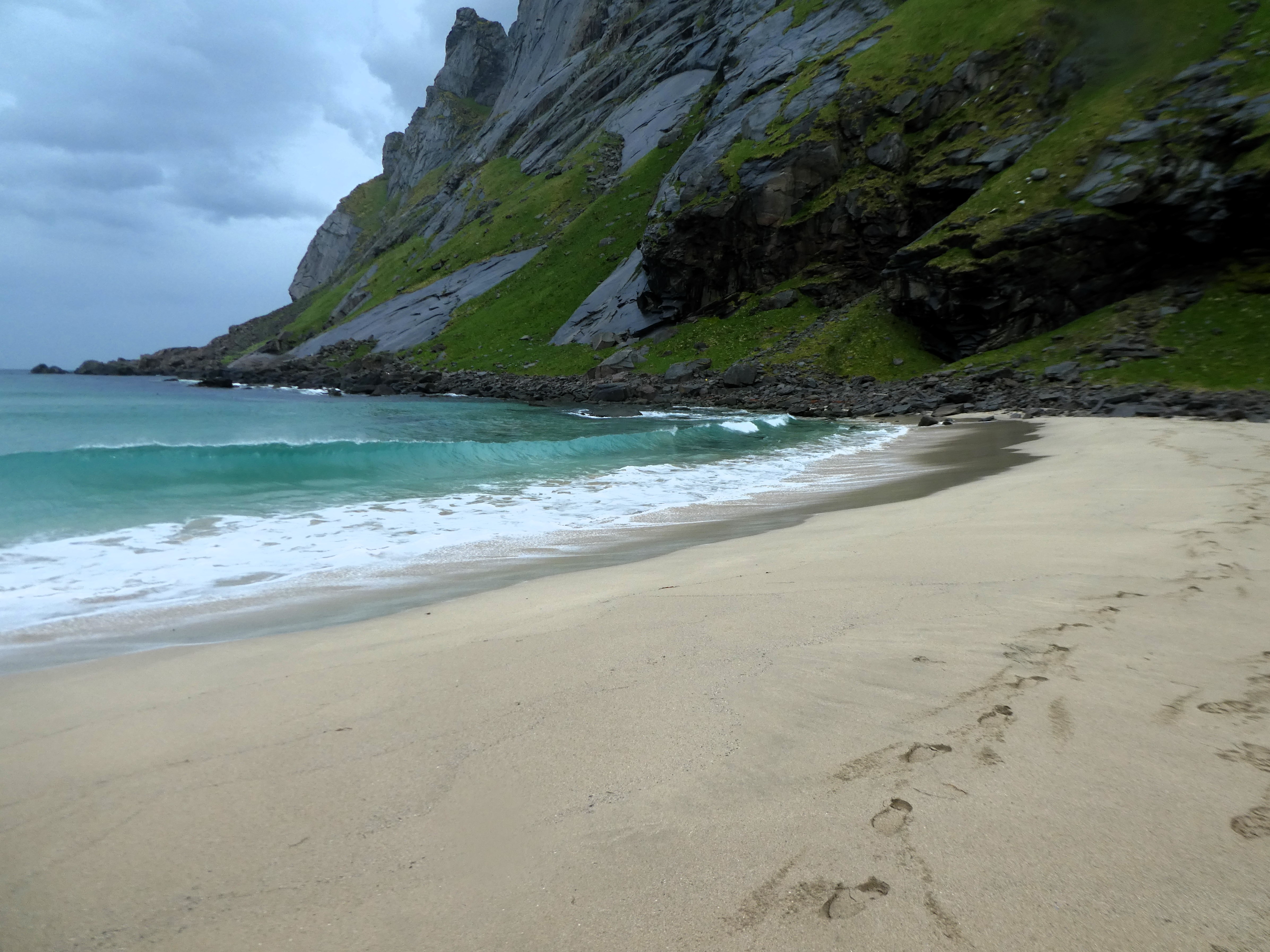

We followed behind groups of people making their way along the track beside the Bunesfjorden. We followed them and crossed a low pass to the beach beyond. It was an amazing a wide beach closed at each end by sheer mountain walls.
One large group went off to swim in the sea. We watched eider ducks, cormorants, oyster catchers, and Arctic terns. We nestled in among the shelter of some rocks. We walked across the wide beach. A hut stood on the mountainside. It was frustratingly inaccessible because of a wide river flowing down to the sea.
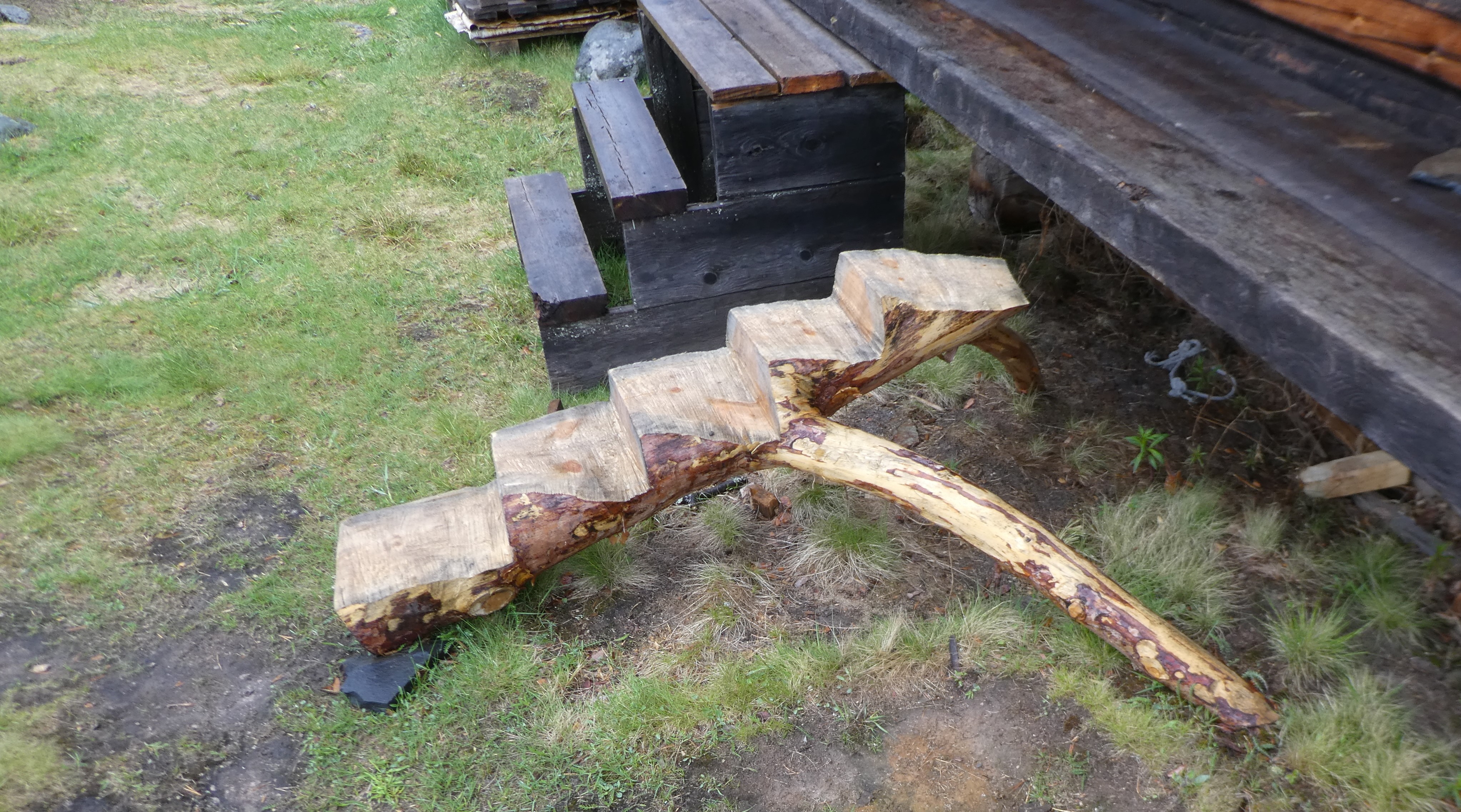
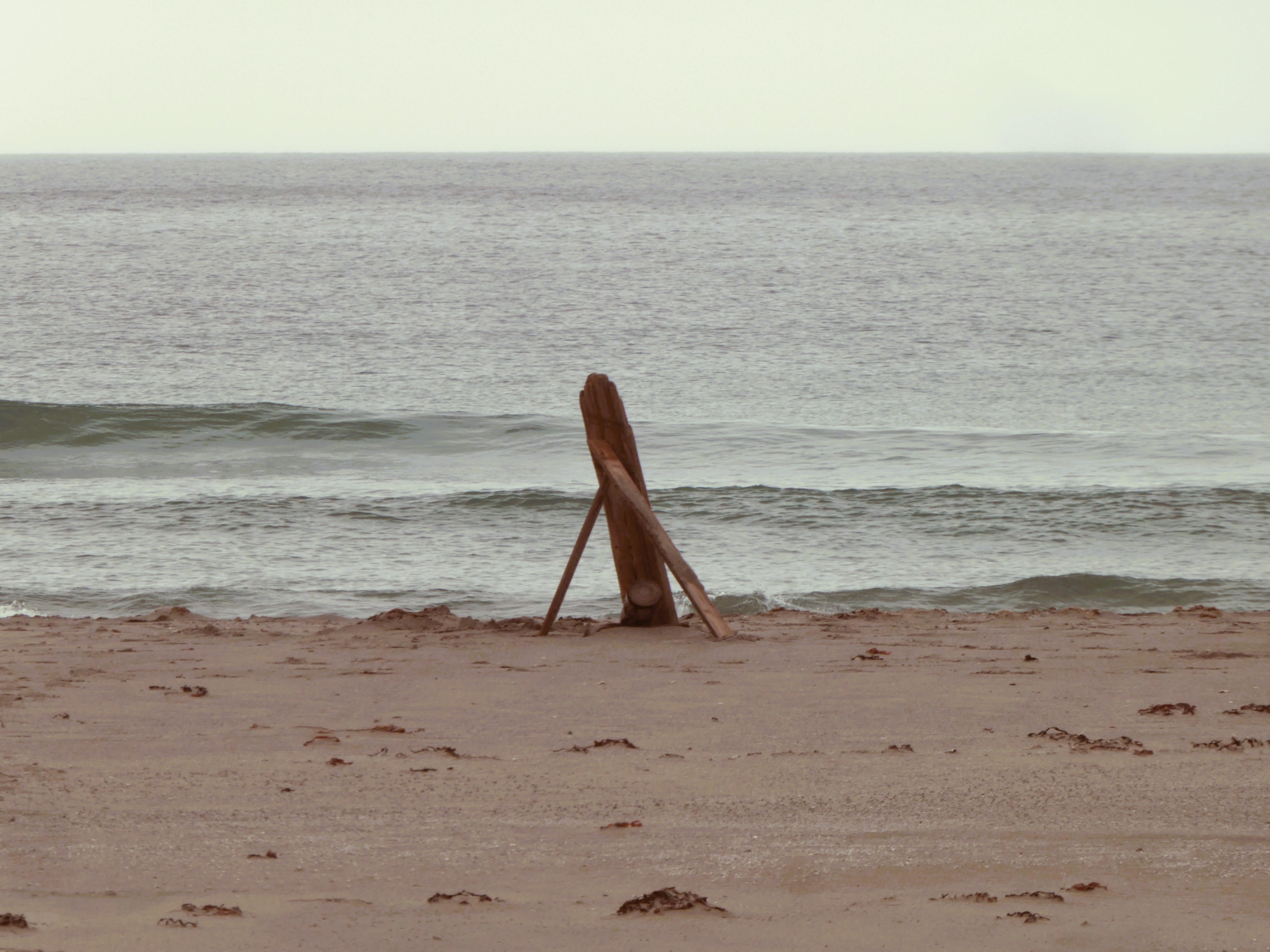
We settled into the dunes on the beach for lunch. Then, to pass the time, we made large wooden sculptures out of the driftwood.


As we made our way off the beach and back towards the ferry. We found orchids growing in the grass at the foot of the mountains. We also discovered other interesting flowers and a fossilised whale bone.
By the time the ferry returned and we got back to Reine, we were cold. We were pleased to get a coffee in a warm café before cycling back to the site.

During the evening, a crowd of people gathered in front of our van looking out to sea. A pod of Orcas, or killer whales, was passing along the coast just below us. They rose out of the water, clearly displaying themselves. It was very exciting!
Day 22 Moskenes to Bodo
Saturday 7th June
We chatted to German couple in their fifties/sixties who had parked their VW camper van on the plot beside us.
On this trip, they drove up to Bodo to cross to the Lofoten Islands. They had originally tried to travel on the Hurtigruten ferry from Trondheim, but it had been too full.

We had to be off the campsite by midday but we weren’t catching the ferry until 8pm. We enjoyed the time pottering around and packing up before we had to go.
We drove to the furthest village on the islands called ‘A’ . There was a free car park there and we walked out on the headland.
There was some sort of fun run taking place and the coffee shops were quite buzzy. After a coffee took a path around the southern shore of the lake behind the town.
The path wasn’t easy to follow and tried to hug the rocky shore. A quarter of the way around we decided to turn back and try the northern side. This path wasn’t easy to follow either. We were tired so, we stopped by some summer houses, only accessible by boat, before turning back.

We changed out of our muddy wet gear in the car park. We went for a late lunch at the Brygg restaurant where we had a delicious bowl of fish soup.
There was still plenty of time before we needed to catch the ferry. We went out on the quay and bought some fresh marinated herring.
The shop also sold cheesecake. We sat and ate a piece by the water among the red stilted wooden houses.

We stopped at Storgatan on the way back to Moskenes where we walked around the former fishing village which was now a marina.
It seemed strange to park up by the camp site for our ferry. Again, the site had the FULL sign up.
The sun came through as we departed making for some nice views of the islands as we sailed away.


We arrived in Bodo around midnight. We made our way to a large car park high above the town. There, with other camper vans and motorhomes, we spent a quiet night.
We had passed the 3000th mile of our trip since leaving home three weeks ago.
Day 23 From Bodo South
Sunday 8th June
We get up in a grey light looking north from the car park towards the mountains before turning south. We get away early stopping for breakfast after an hour or so by a fjord.
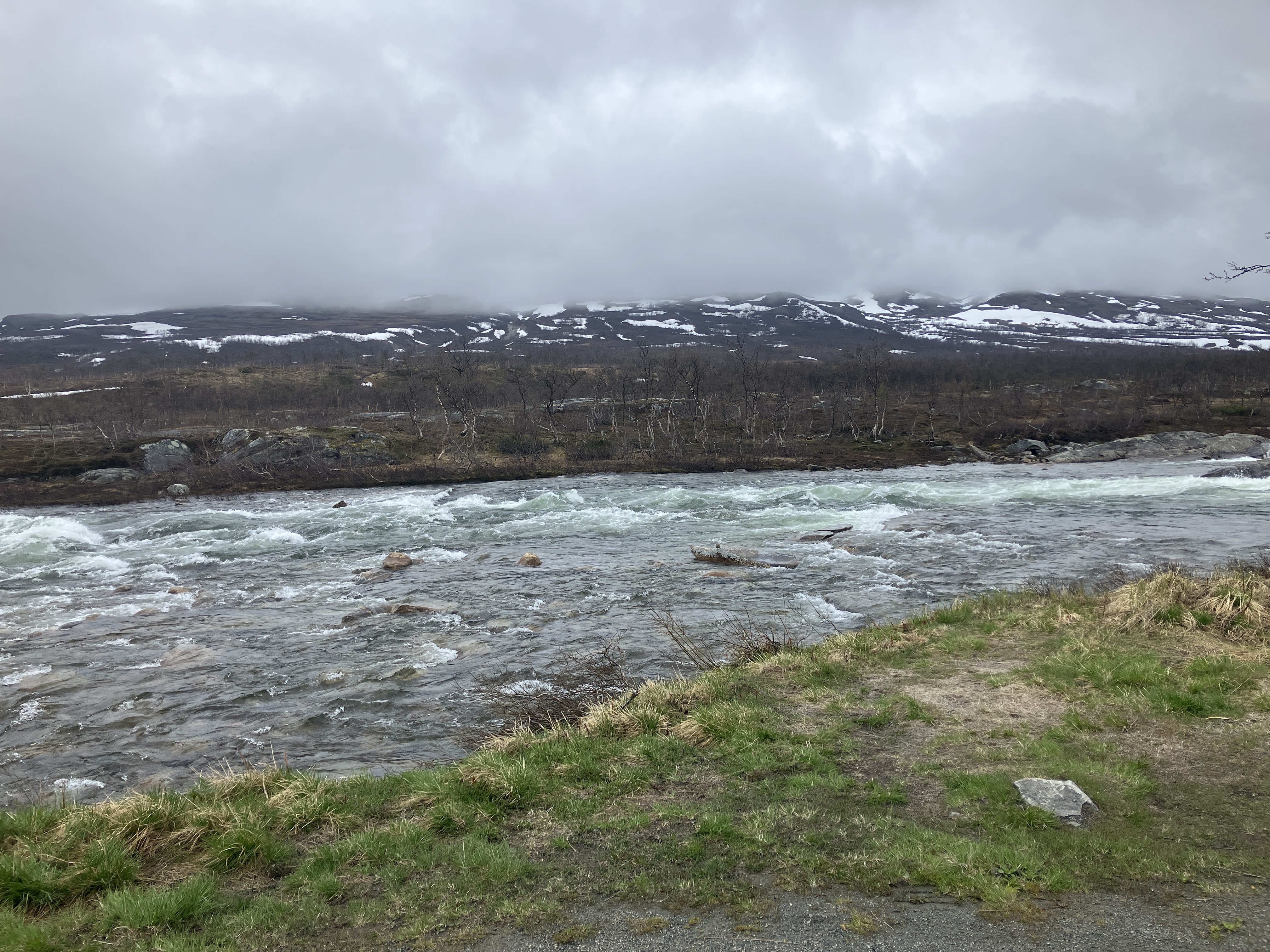
The drive on to Mo I Rana is across a high snowy plateau. It was cut across with fast flowing rivers flowing from icy snow fields
The route taking us out of the Arctic Circle and on to a cold and windy Mo I Rana.
We stop at the Arctic Circle Centre as we crossed the Arctic circle. An overly commercialised place but with toilets! The route taking us out of the Arctic Circle and on to a cold and windy Mo I Rana.

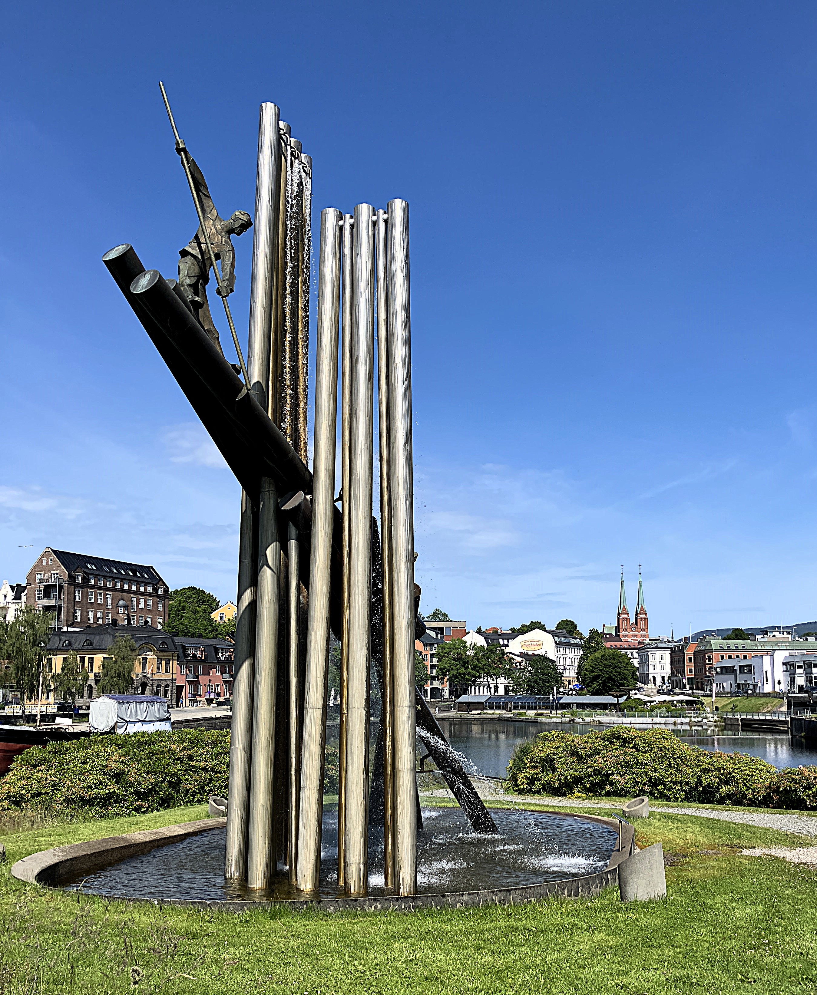
We are here to see a sculpture by Antony Gormley. The sculpture which is on the edge of the Ranfjorden is the focal point of a new housing estate through which a green pathway extends back into the city.

This was formerly an industrial area of the city. Some of the older warehouse buildings have been conserved here
The sculpture called Havmannen, man of the seas, is a large and stern looking figure. He gazes determinedly south down the Ranfjorden towards the sea.
.

Our route then took us off the main E6. We went through an area of small lakes and towering snow-covered rounded mountains to reach Trofors.

By one of the lakes, an ideal camping spot with toilet and litter bin, we sampled our herring for lunch. It was very nice.
We drive on to rejoin the E6 and follow it to Brekkvasselv. By this time we are looking for somewhere to park up and for once P4N is letting us down.


At Haugen, we decide on impulse to turn right over the river just before Brekkvasselv. to follow a forest track until we find a suitable spot.
Here in the quiet of the forest not far from the river the sun shone and it was nearly hot! We found elk poo where we were camping which was fun. Not so far south as we thought. There for the first time we were visited by a few mossies and had to put the fly screen up.!
Day 24 Brekkvasselv to Storsvallvagen
Monday 9th June
After an undisturbed night’s sleep, we left our spot around eight o clock. We made good progress to Steinkjer where we filled up with petrol and had a coffee in a service station. We noticed something peculiar. If you are Norwegian and pay by card at a particular pump, it is much cheaper. However, we couldn’t get the pump to work either obviously did not pass the test..
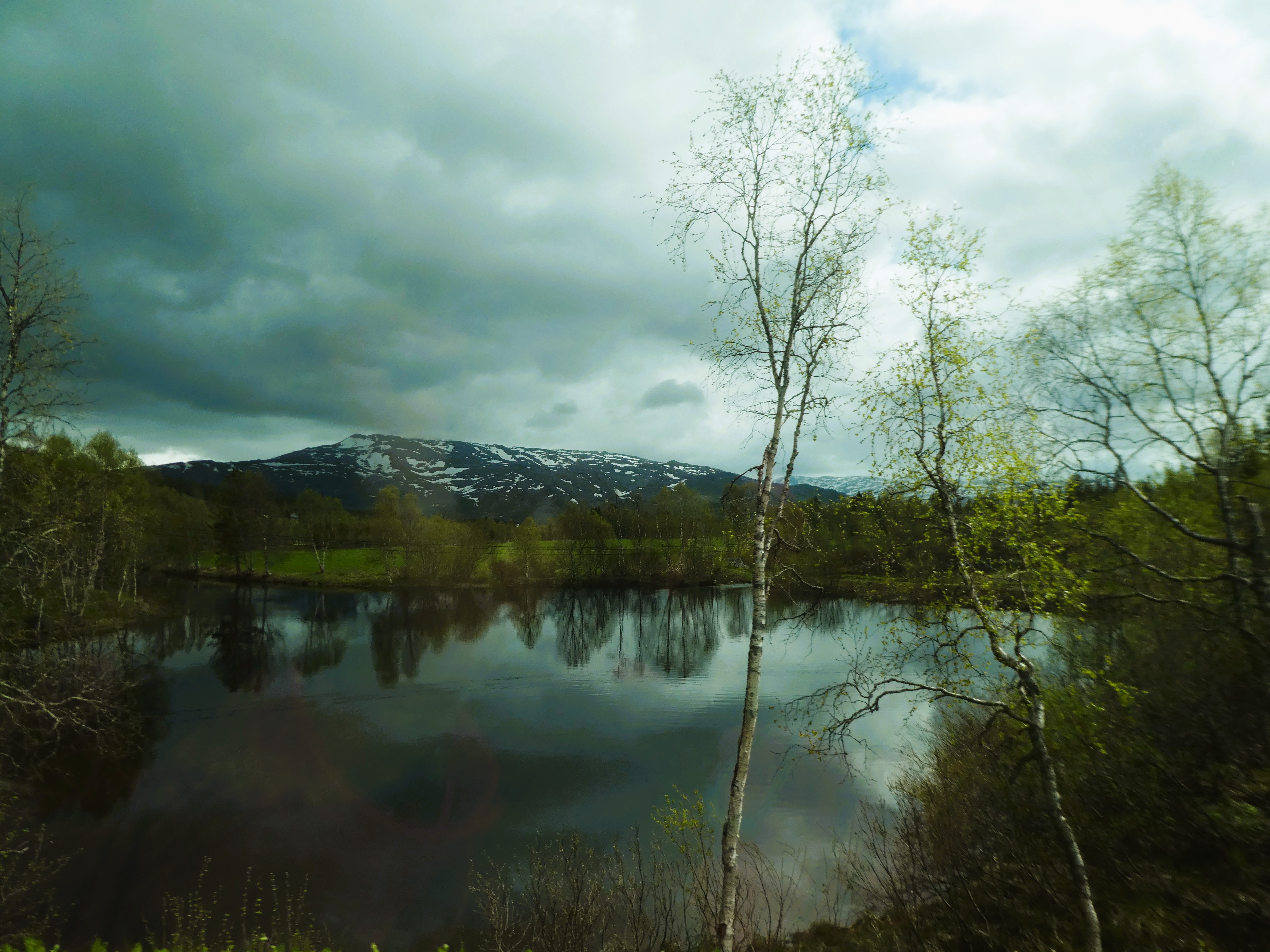
We then continued south to Verdolsora where we turned off the main road towards the border town of Sandvik. We headed towards Saxvallen and Are. The journey took us across a high plateau with lakes and rough vegetation seemed to go on forever.

As we were nearing the E14 there was a board advertising Sweden’s biggest waterfall, Tannforsen. After some moment’s hesitation we drove to it and were pleased we had.

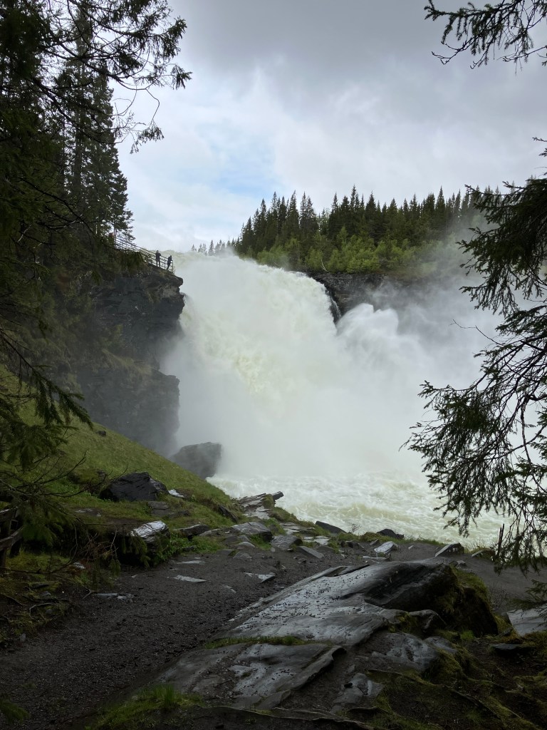

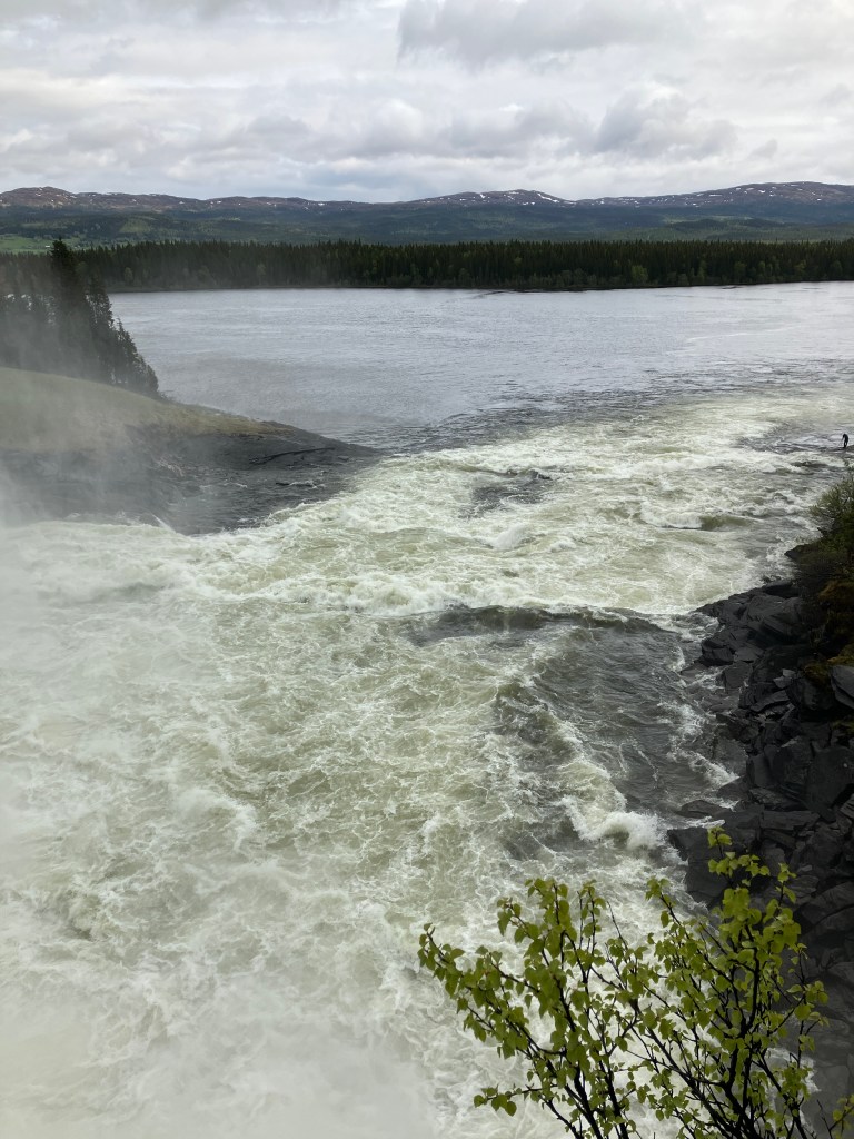
Whilst not the highest waterfall in Sweden it carried over it the largest volume of water. The force of water amazing, not a big drop but wide and spectacular accompanied by appropriate amounts of roaring water noise and spray
We read from a series of information boards. They explained that it had been a popular place to visit in the last century. Boats would come up the river and horse-drawn wagons would bring visitors to a point on the other side of the river below the falls. Now there is a car park and a path with well laid out viewing areas.
We made our way through Are and west to Storlien. We found Anna’s apartment block at Storsvallvagen and let ourselves into what seemed a very empty apartment block. We didn’t know what to expect and were delighted by the open airiness and light of the apartment.
We ate a late lunch. Then, having no more food, we immediately drove to the big store in Storlien.
There were several budget supermarkets filled with sweets and booze and very little fresh stuff! We went to two stores until we found the essentials we needed and escaped!
Having obtained the directions from Anna we prepare to do a clothes wash. The laundry was hard to find. We had to open closed doors in the basement. There were different washing and drying machines as well as storage rooms!
We put a wash on, then we walked up to the church. Anna and Martin had fought their way there in a blizzard last Christmas. They had sent us a video of being there. We tried to make a video in a similar vein to send to them. It was great fun. It was a lovely chapel with big windows looking out to the mountains.
Further on from the church, we started to follow a board walk out across open ground. We stopped once the boards were submerged and turned back!
There were huts and houses and a lot of snow mobiles stored at the back of the houses. This was a reminder of how the winters were very different from this cold damp day.
Back to the apartment for a drink before tea and a serious planning session on our forthcoming journey through Norway.
Day 25 Storsvallvagen – Storulsvans Fjallstation
Tuesday 10th June
We had a good night’s sleep successfully negotiating the steep stairs up to the bedroom on several occasions.
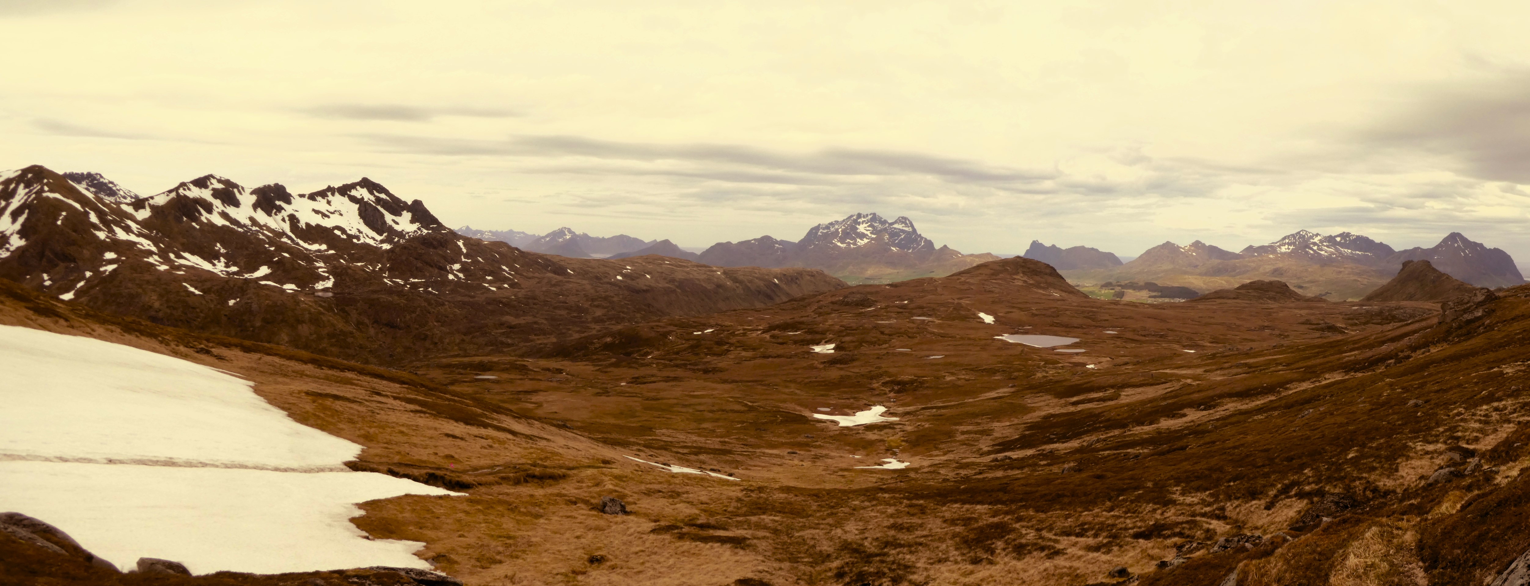
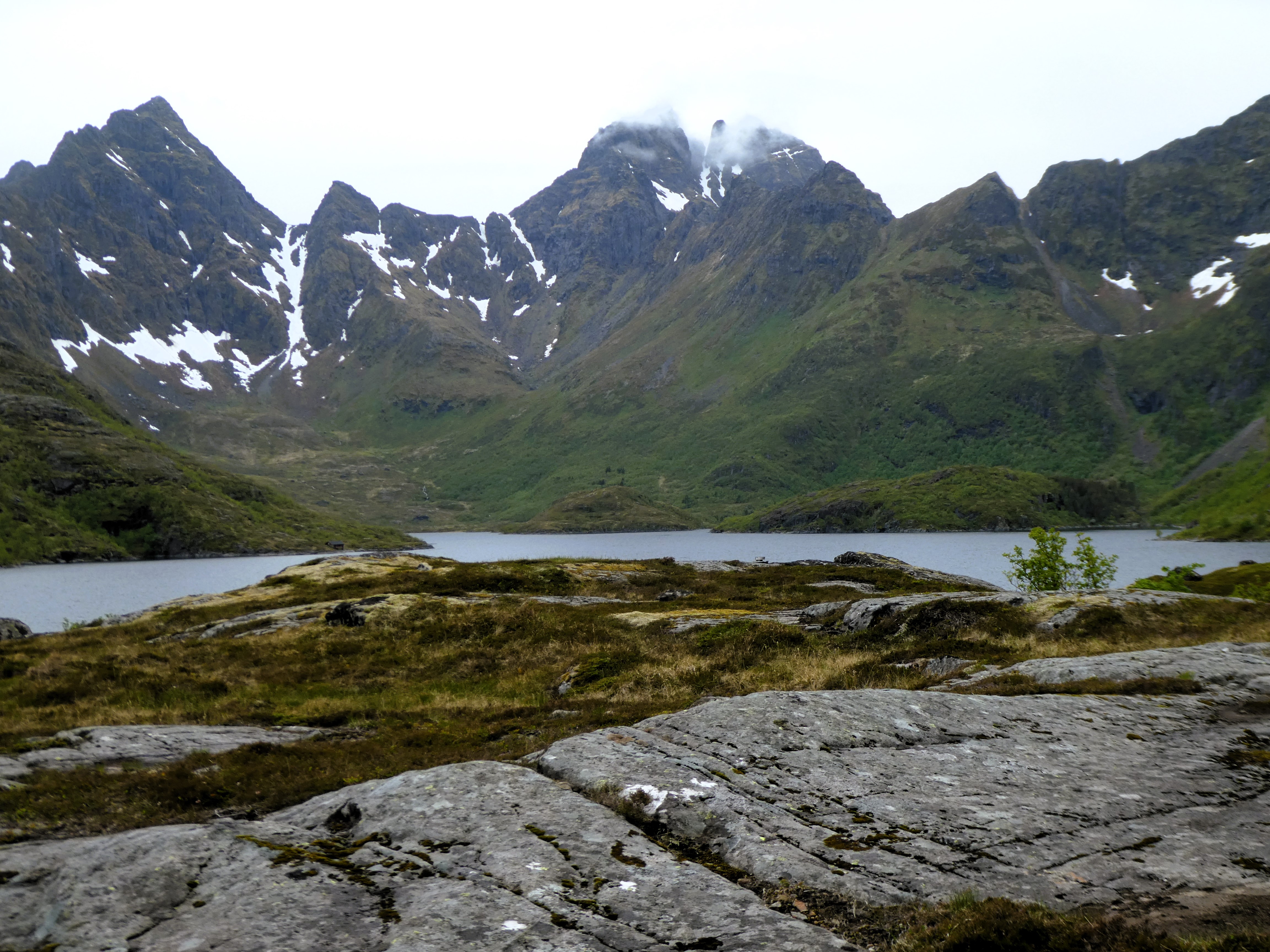
We felt fully recovered. We put on another wash and drove back towards Are and the Storulvans Fjallstation some ten km. away. Martin had recommended a walk. This walk would take us up a long ridge along one side of a valley. We would head towards a hut near the Norwegian border. Then, we would return along the other side of the valley on an unmarked but ‘clear’ path.
We had found a walking map in the apartment. The pathway to the hut looked clear. The hut was shown on the map. The way back was not.

We left the van at the Fjallstation and started out on the track towards the hut at Ulvajarnens Rastsydd.It was an easy path to follow. Apart from crossing various pockets of snow.it was easy going. The landscape was so big and awesome, lovely.
We had found a walking map in the apartment. The pathway to the hut looked clear and the hut was shown on the map.
We left the van at the Fjallstation and started out on the track towards the hut at Ulvatjarn. It was easy going apart from crossing various pockets of snow, the landscape was so big and awesome, lovely.


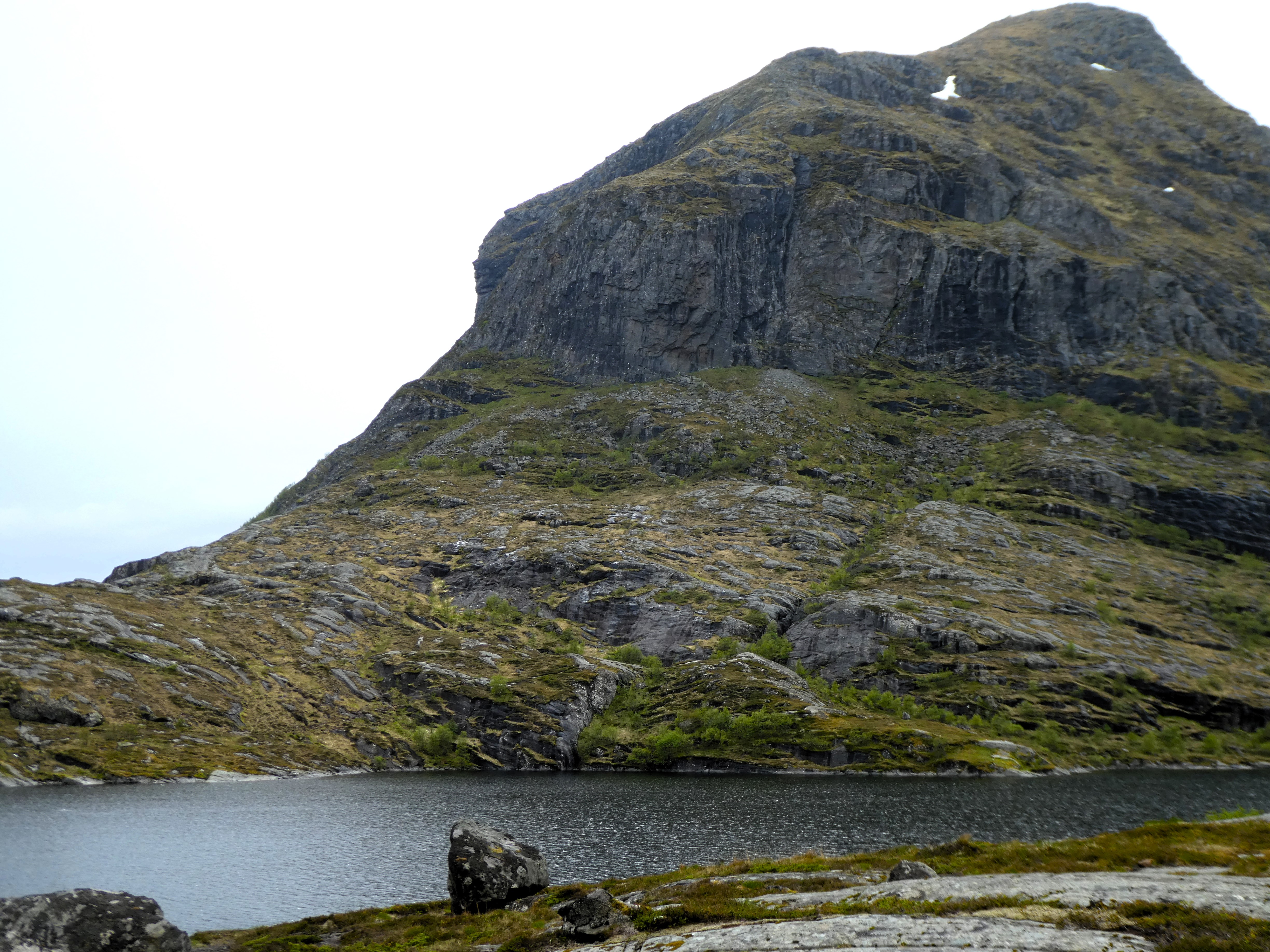
We got within sight of the hut and were faced a swollen river. To reach the hut, we needed to cross a set of submerged stepping boards.
We had already decided there was too much lying snow. It was too risky to walk back down the other side of the valley on an unmarked route. Wading through an icy stream to reach the hut seemed rather pointless, so we decided to return the same way.
We ate lunch overlooking the winding river bed, and then headed back. After half an hour we were walking in a heavy shower of hail. Luckily the wind was behind us so we were protected from the icy wet blast we would otherwise had experienced. The cold wet weather meant that we walked back at a very good pace. Thankfully, we returned to the van warmed up and put on some dry clothing.
Back at the apartment where we chilled out and sorted ourselves out for the next stage of our adventure.
Day 26 Storsvallvagen to Andalsnes

Wednesday 11th June
Packed and cleaned and by 9.30 we’re heading in rain and mist over the border into Norway.
We are heading for the northern Fjords and the town of Andalsnes at the recommendation of our son-in-law Mox.
After we have been past Trondheim the choice of routes to Andalsnes are numerous. We wanted to get off the main roads, so we found an inland route.
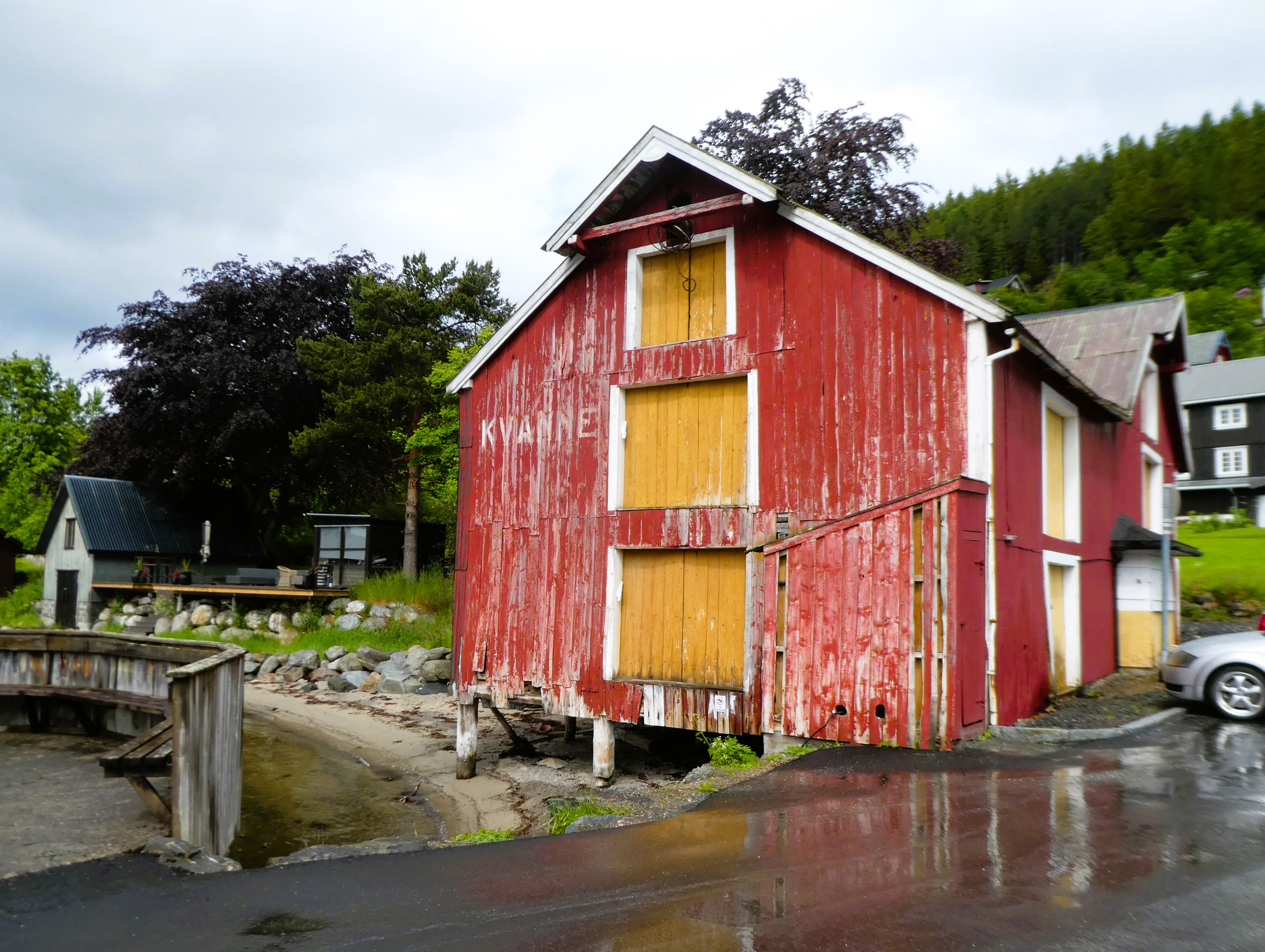
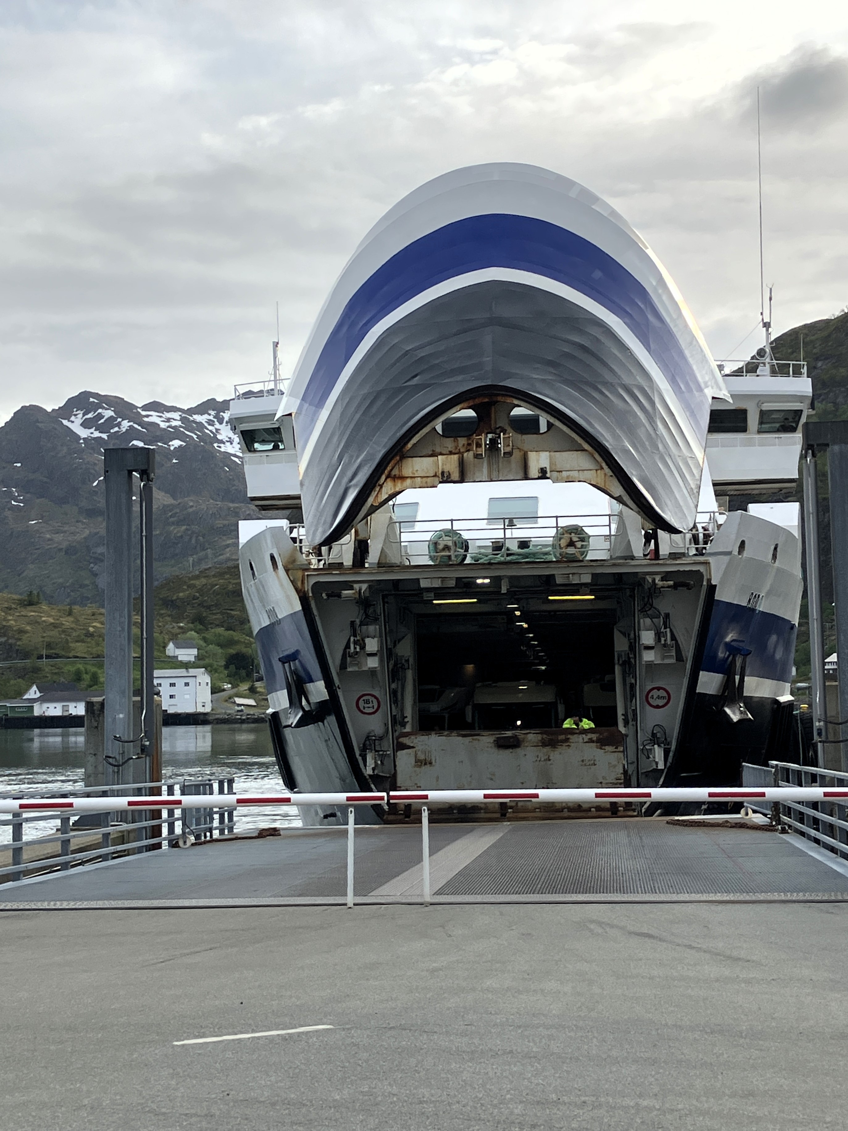
We found a way that took us to Orkanger, and then we south on route 65 through Skei to Kvanne. There, we got a ferry to Rykkjem.
We stopped for lunch on the jetty at Handlarstuhamran. A school group were having a field trip there. Their trip was based on water studies and the activity appeared to require students to get wet. There were fish sheds and a small harbour, now used for leisure craft. The weather was cold and windy with rain in the air so we carried on our way.
We went along the shores of several fjords and through several long tunnels several longer than 10 kilometres. They took us under the tall sharp sided mountains that separated one fjord valley from another.
Each time we came out of the tunnels, it seemed like we had entered a different region. The vegetation and climate were different each time.

From Eidsvag, we climbed over a high mountain pass over to Myklebostad and around the fjord to Rodven.

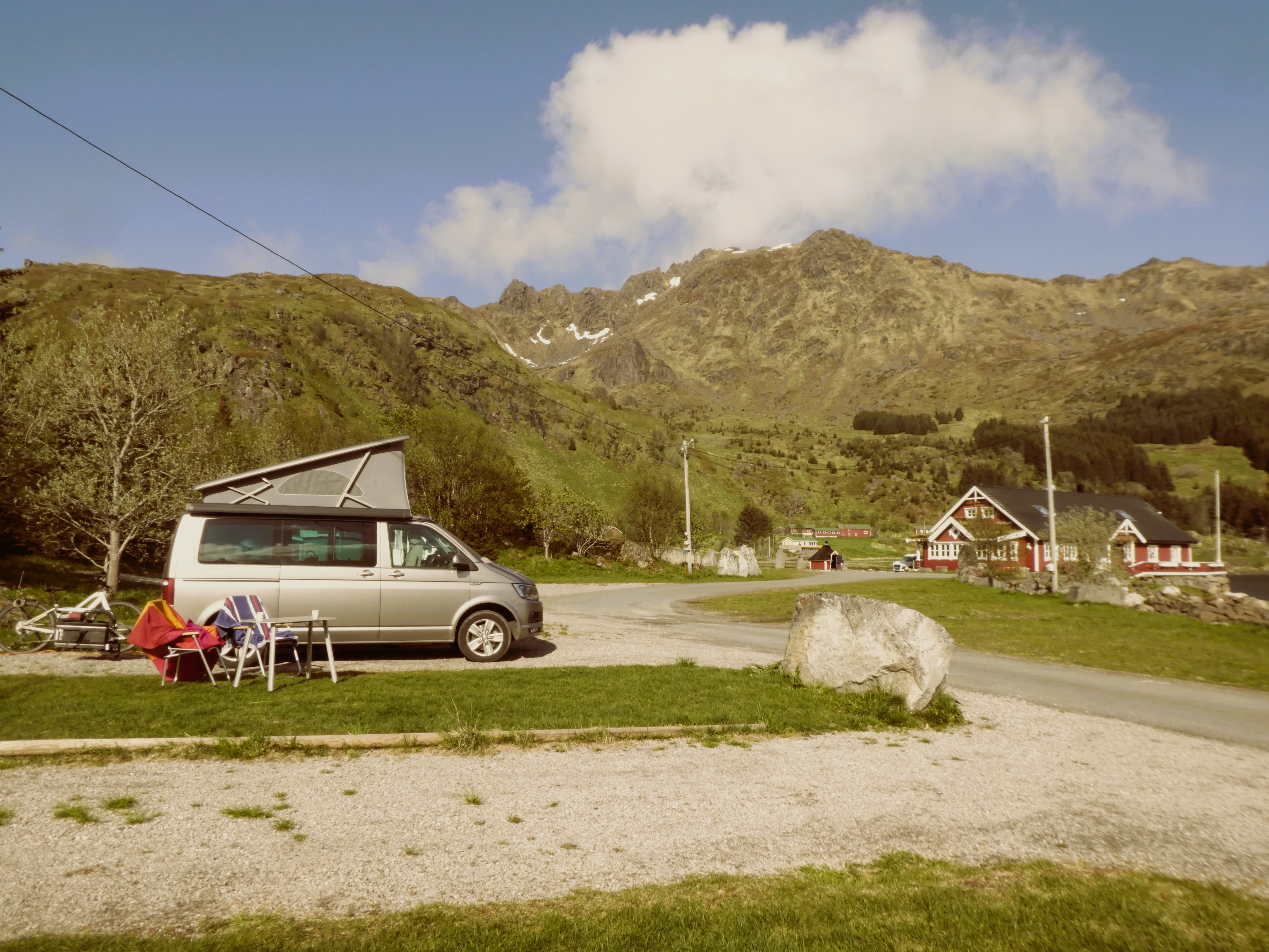
We approached Andalsnes over an impressive five-kilometre-long causeway from Isfjorden. We drove south of the town to Romsdalsvegen and Camping Mjelva.
We had emailed ahead and were expected. Dag, the owner, gave us a lovely welcome. He showed us the plot he had reserved for us. The plot had an amazing view west over the mountains.
As we got settled the rain returned briefly before clearing and the sun coming out for a sunny evening. We walked down to the river before returning for dinner and bed.
Day 27 – Andalsnes
Thursday 12th June
We woke up to sunshine and heat, so much so that we both wore shorts! In the toilet/shower block they were playing golden oldies on local radio, Channel P9. In the van we tuned into this programme which stayed with us a road trip music right through to Denmark.
As we ate breakfast looking out over the mountains and reflecting how nice the site was.

All these things made us feel very positive and we arranged to stay an extra night. Dag showed us a local cycle ride up the valley and a view point climb in Andalsnes.
We cycled down into Andalsnes.
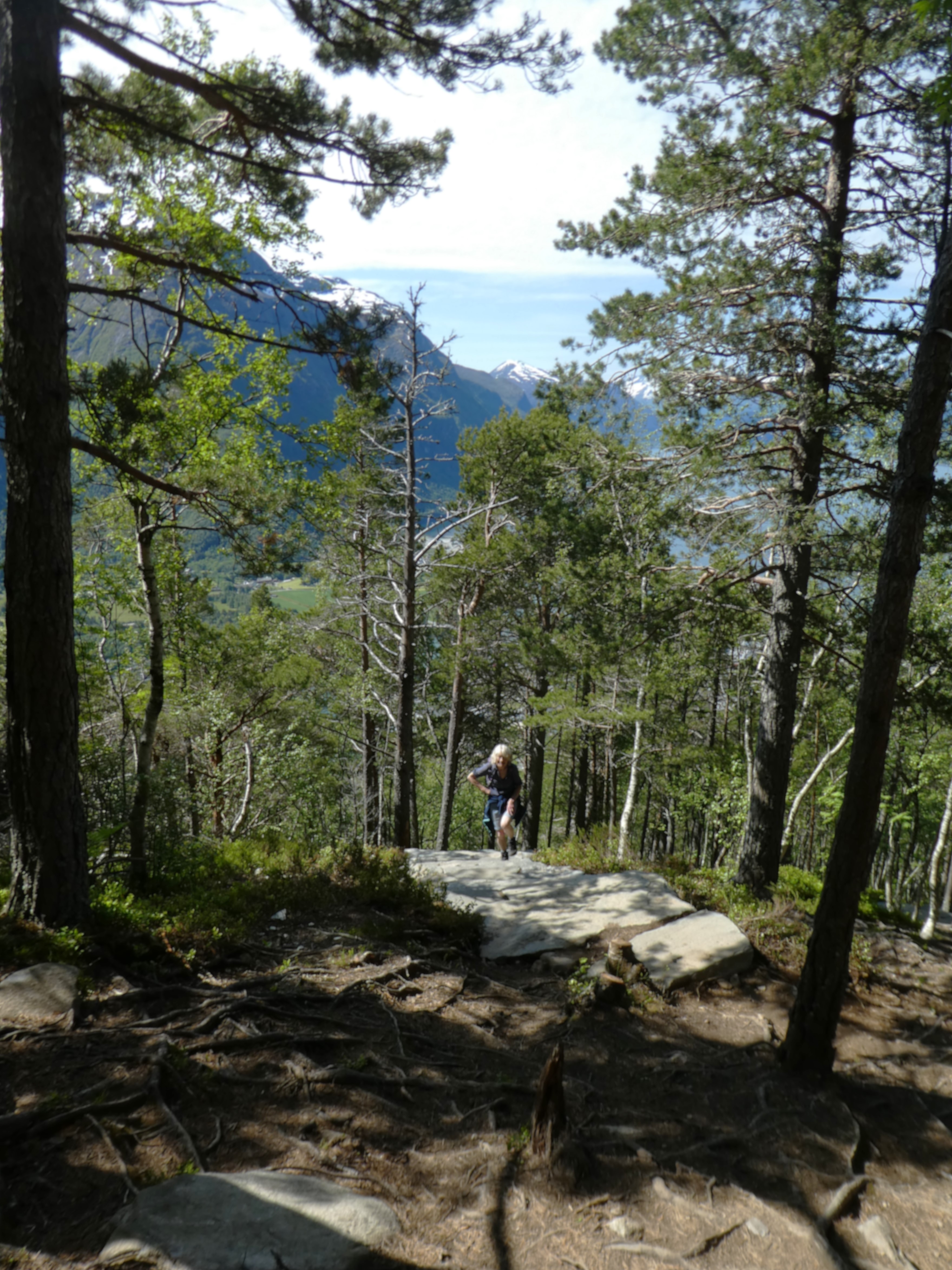
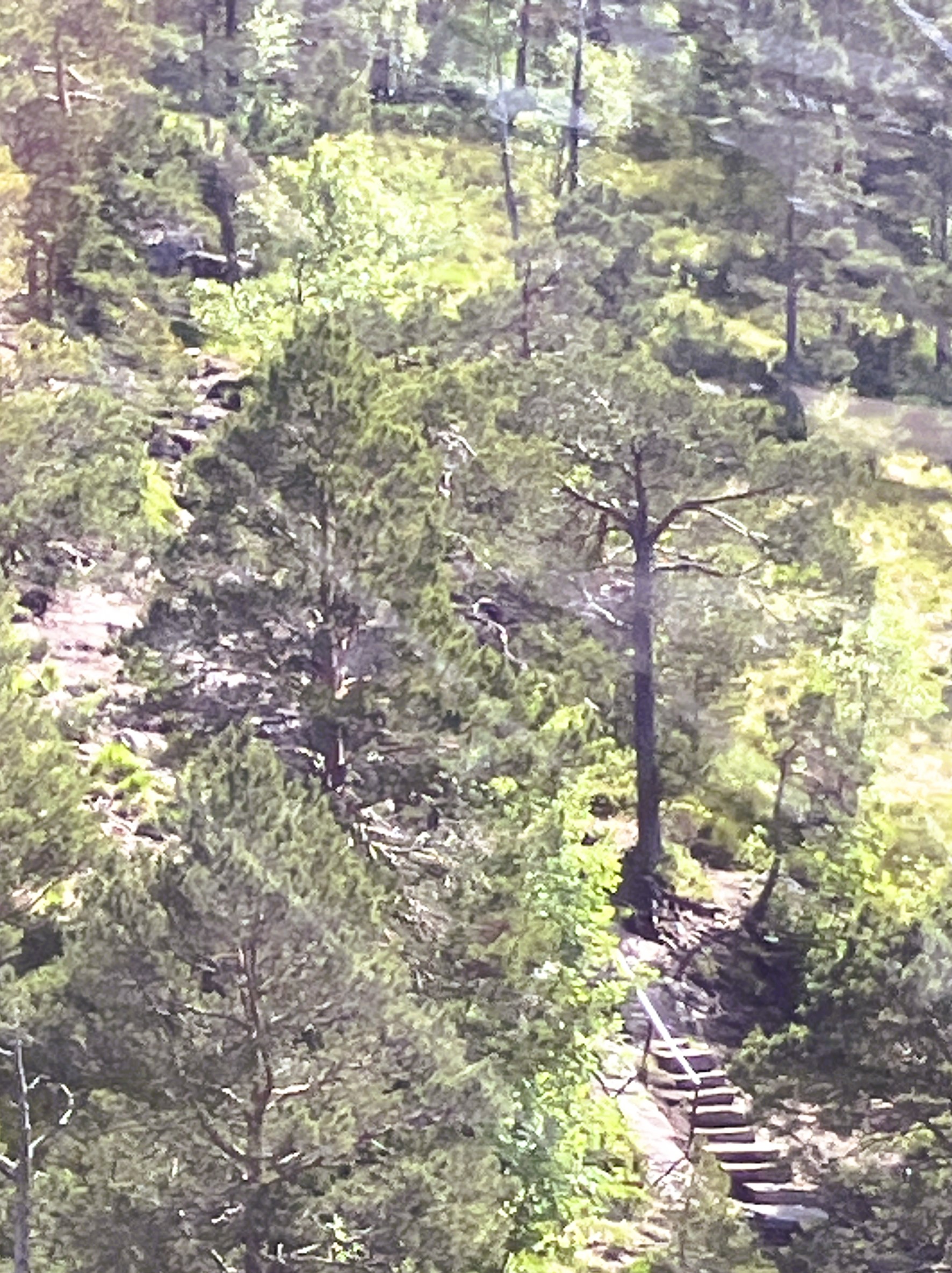
We left the bikes at the beginning of a climb. The climb led up to a viewpoint and rest station at Rampestreken, 775 metres above.
There were lots of people setting out. They were of all different ages. There were people of our years as well as young people with dogs. One mother was carrying her baby.
The route climbed very steeply initially through woodlands. It followed a tree-rooted steep path and then continued over more rocky terrain. We climbed on steep stone steps until we reached a viewpoint just below the rest station. We did not look forward to going down all those stone steps.


From here, we scrambled up to the rest station. There was a café open, and much to our delight, the cable car station was operating. We sat at a table just outside the cafe and ate our sandwiches and drank coffee and water. We fully recovered with the help of a cinnamon bun from the café.

The view from the top was amazing and we enjoyed wandering around before it was time for our descent. We descended in style down in the cable car before exploring Andalsnes.
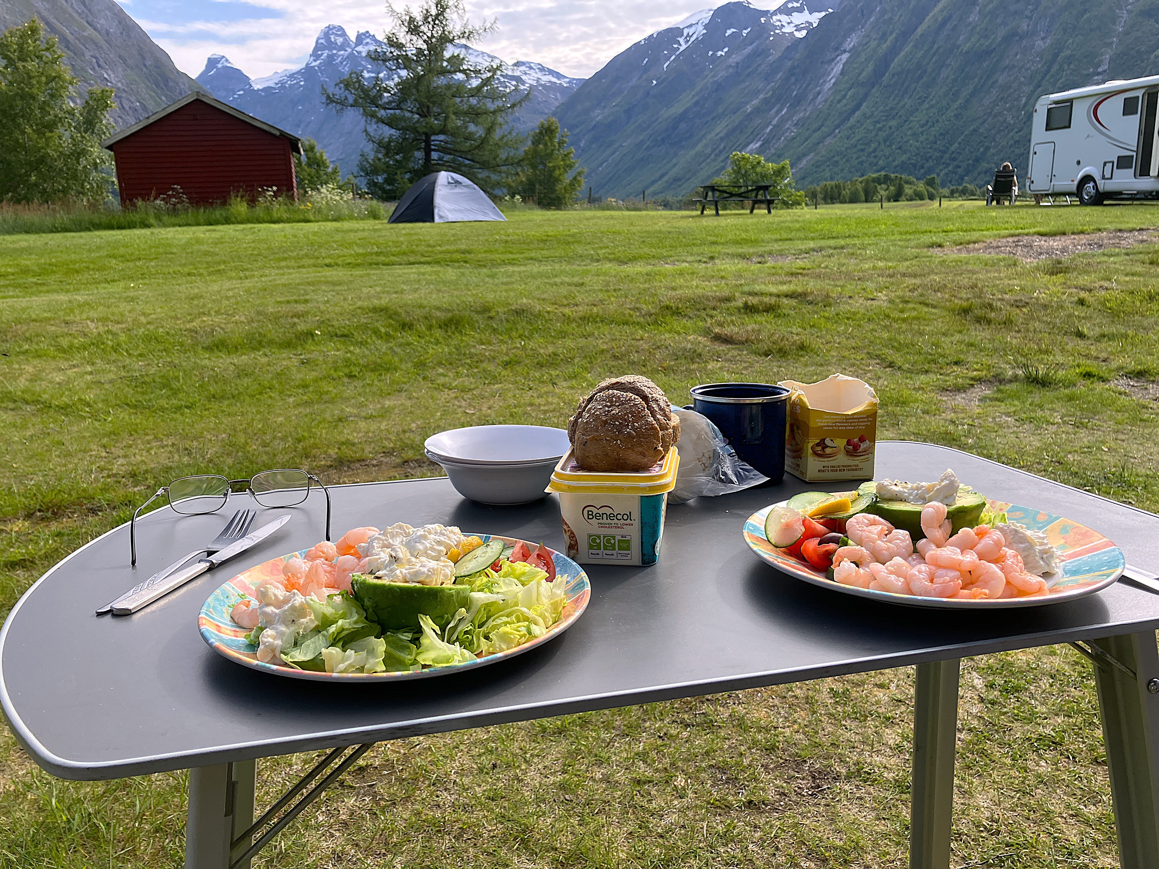
We found a supermarket where we bought ourselves the ingredients for a prawn salad meal for tea.

After tea we cycled along the valley between the narrowing mountains. We rode to Trollveggen where there was an internationally famous climbing face up the vertical mountain sides.

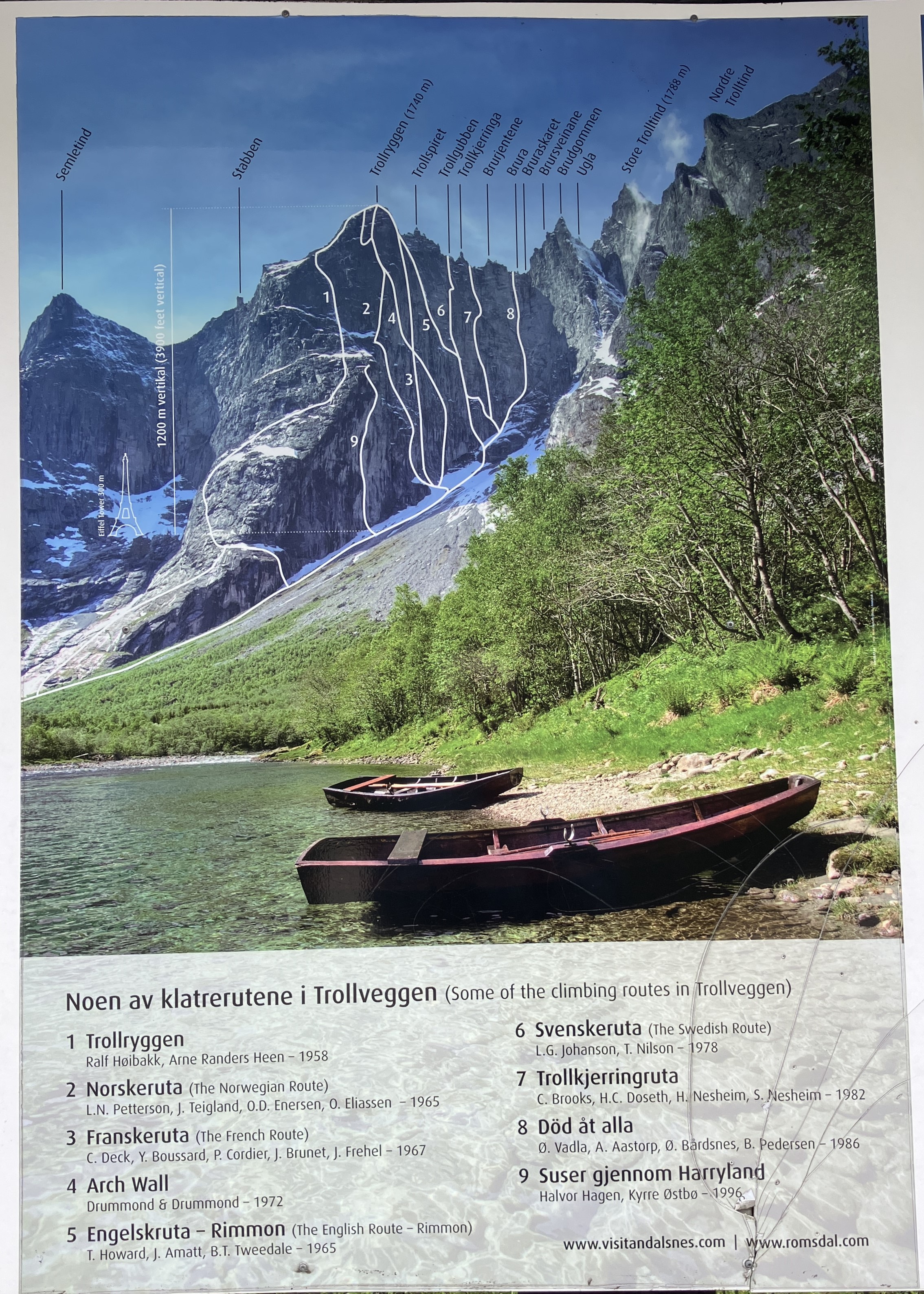

It was quite sobering to realize how many climbers had been killed over the years. They died attempting to climb the tougher stages.
As it started to spot with rain we cycled back to the camp site where the sun was shining still. It was great to sit out before going to bed.
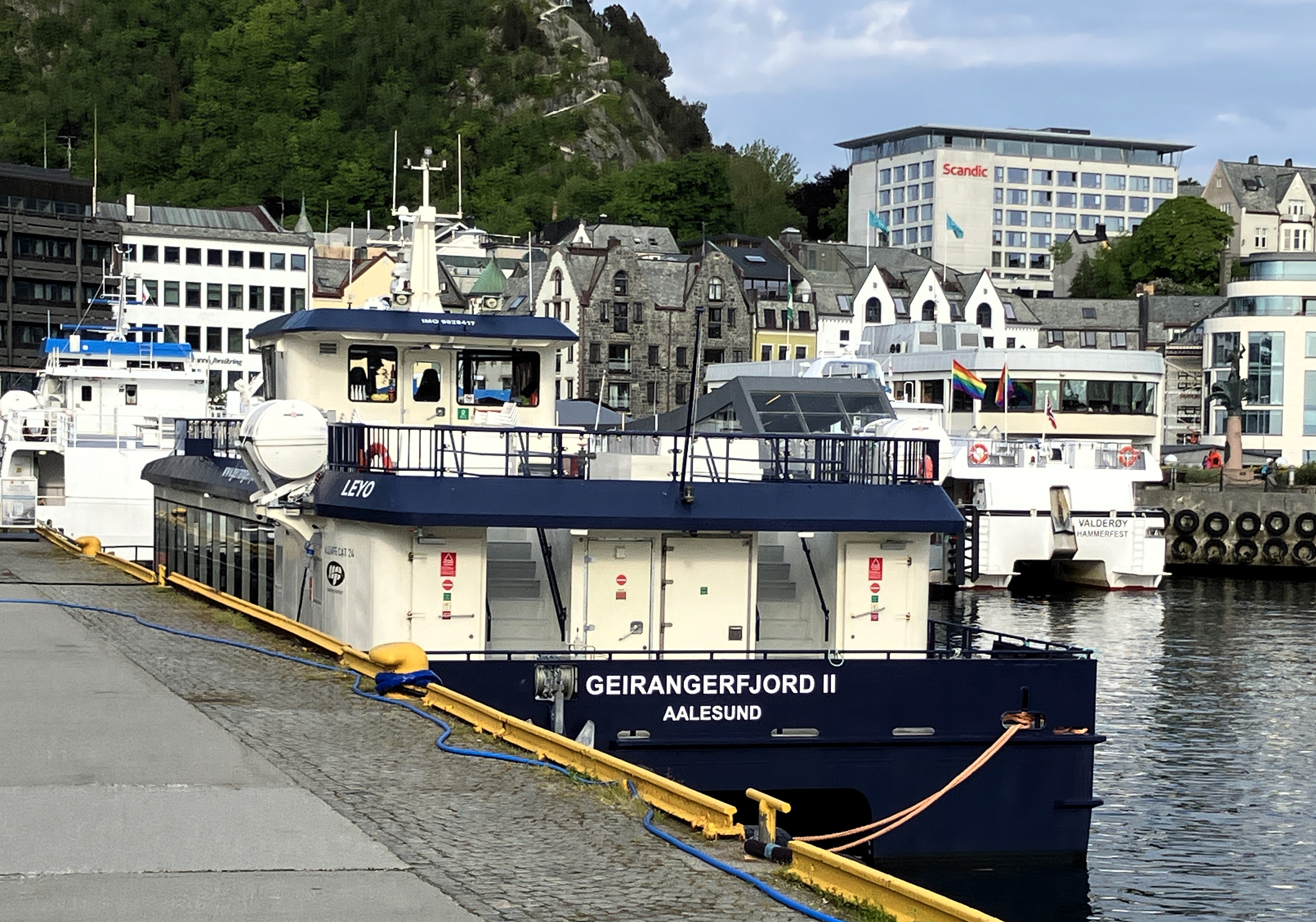
Day 28 – Andalsnes to Alesund
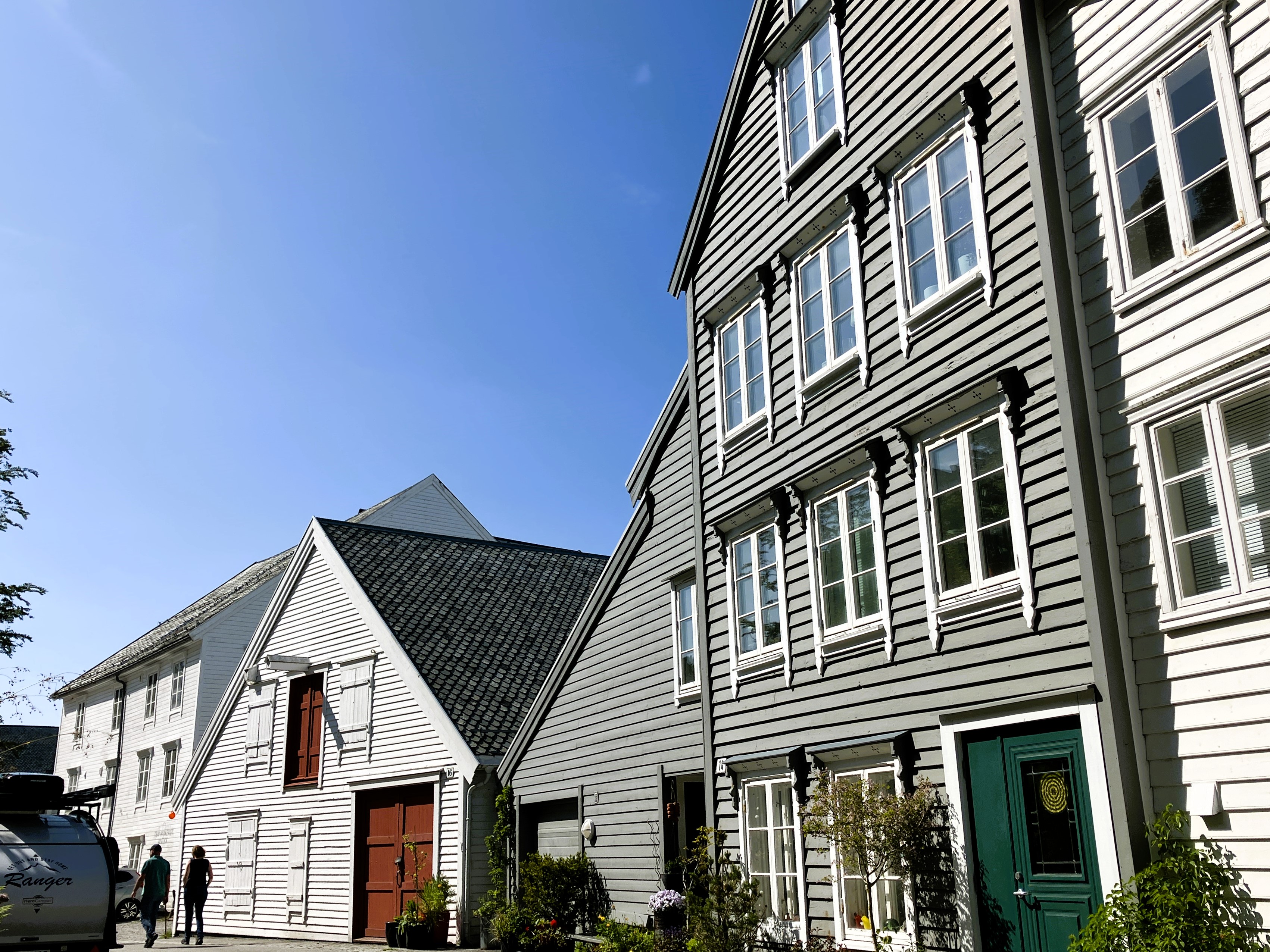
Friday 13th June
We are up and have left the site soon after 9am. There is only one campsite in Alesund and according to reviews it fills up quickly. We have tried to book in advance but it operates on a first come first served basis.
We travel west to Helland. There we join the main E39 from Trondheim where it has crossed over via a ferry, from Molde .
The bakery and coffee shop in Helland recommended on Google is not open. We eventually find another café in the shopping precinct, which has great buns..
We sit out near a children’s play area. It is next to a mini lighthouse constructed from recycled debris from the sea. Here on the waterfront at the end of the fjord we drink our cortado coffee and eat our buns

Our journey continued on along a busy E39 to Volsdalen campsite just outside Alesund. We arrived at midday.
We found a plot easily in a really good location. It had a grassy sitting out area and a view south over the water.
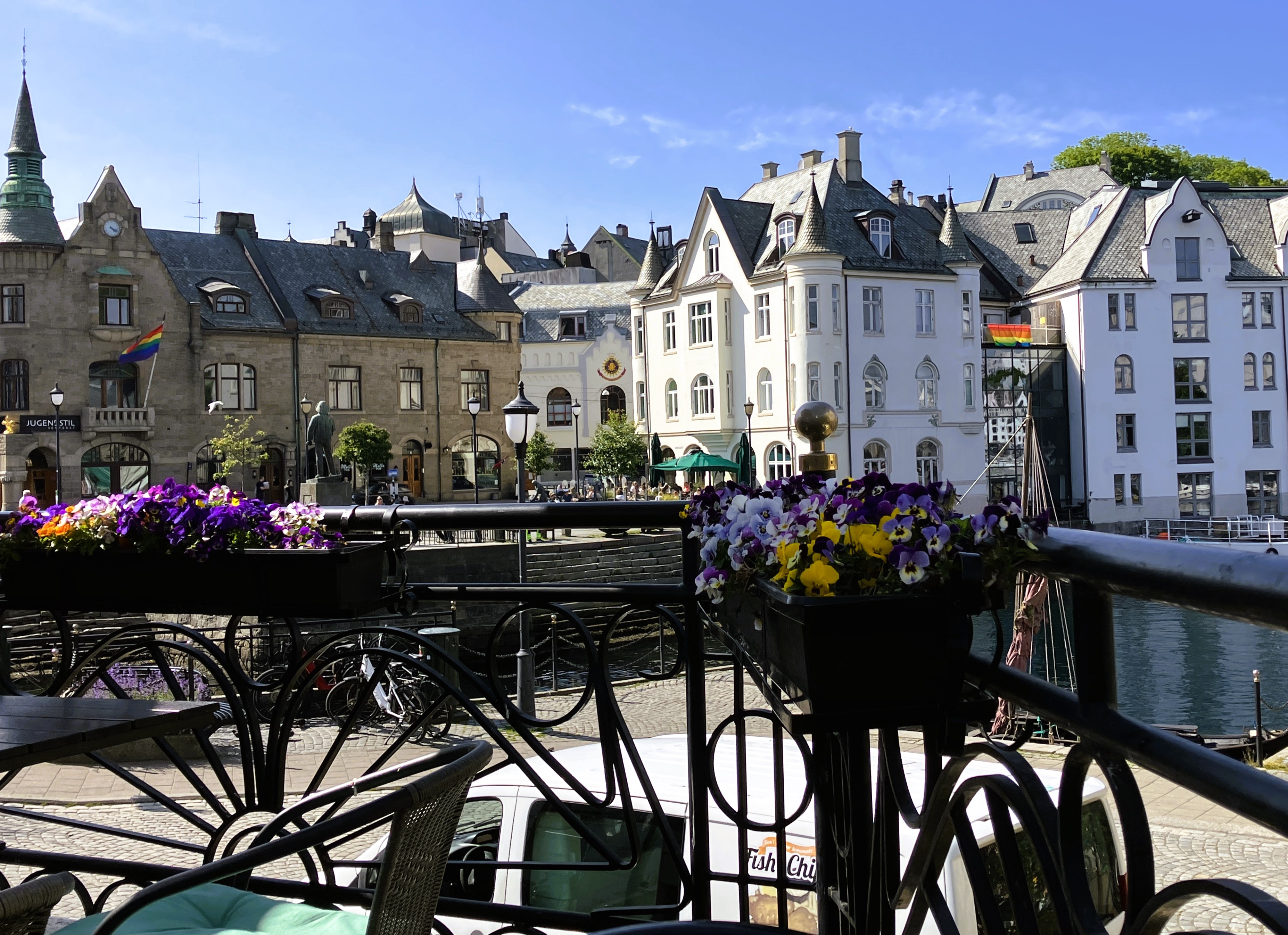
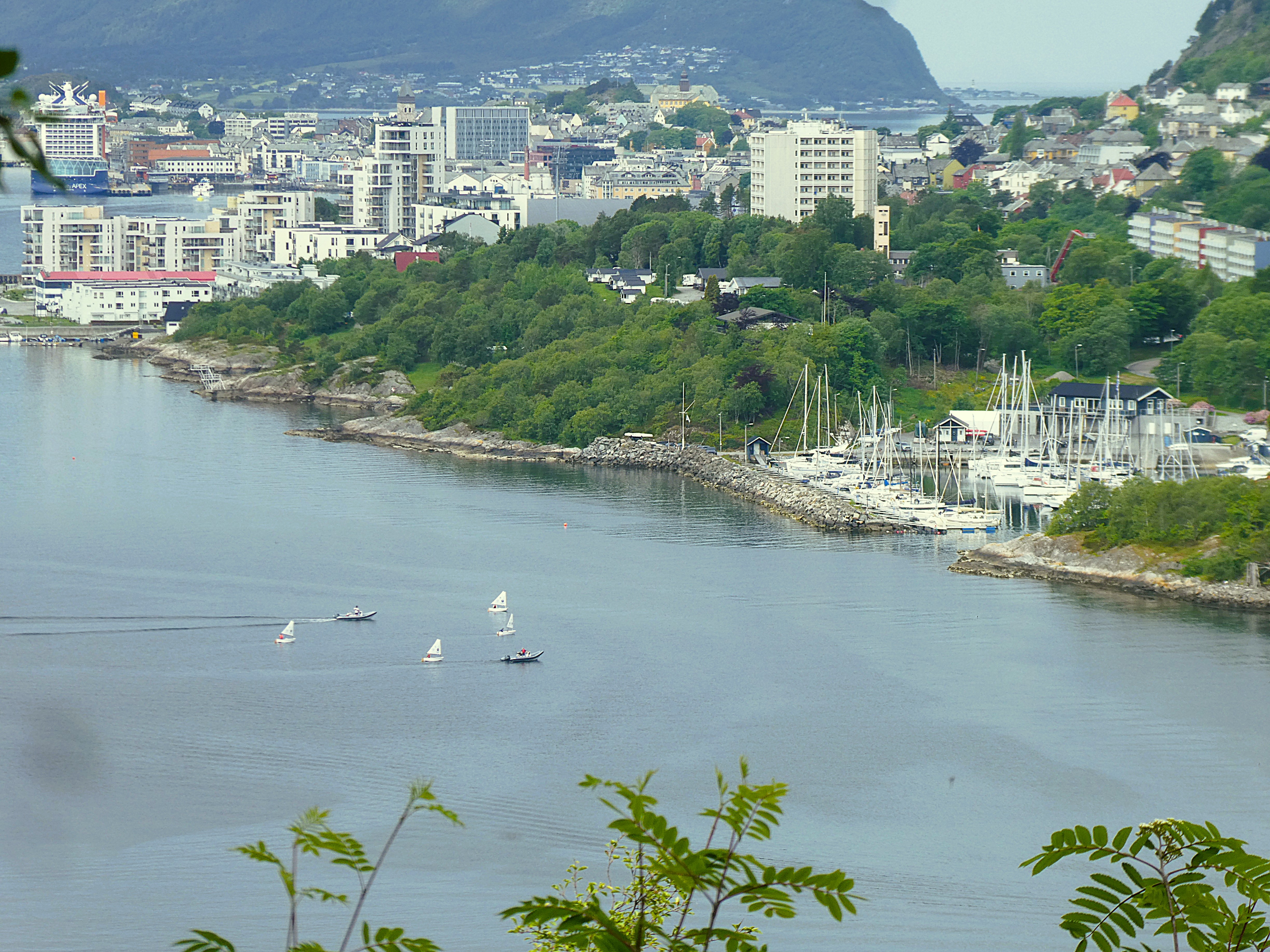
After lunch we cycled into the centre of Alesund. We went to the Tourist office and followed an art nouveau/ arts and craft trail through the city.


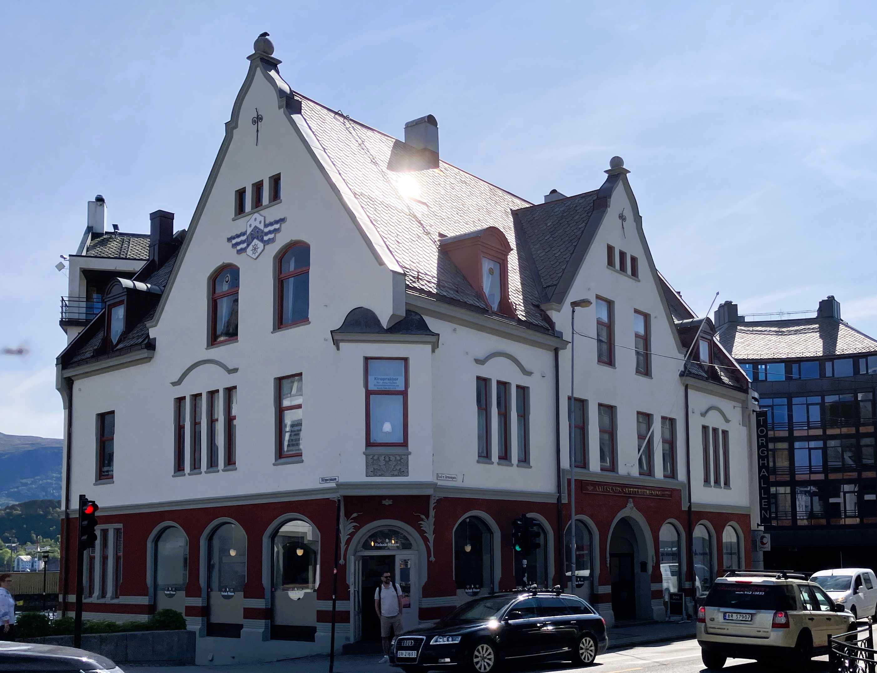


There were lots of examples a bit here and there. Apart from the obvious conserved art nouveau buildings, the architectural style hadn’t influenced more recent development in the city. This lack of influence was disappointing.
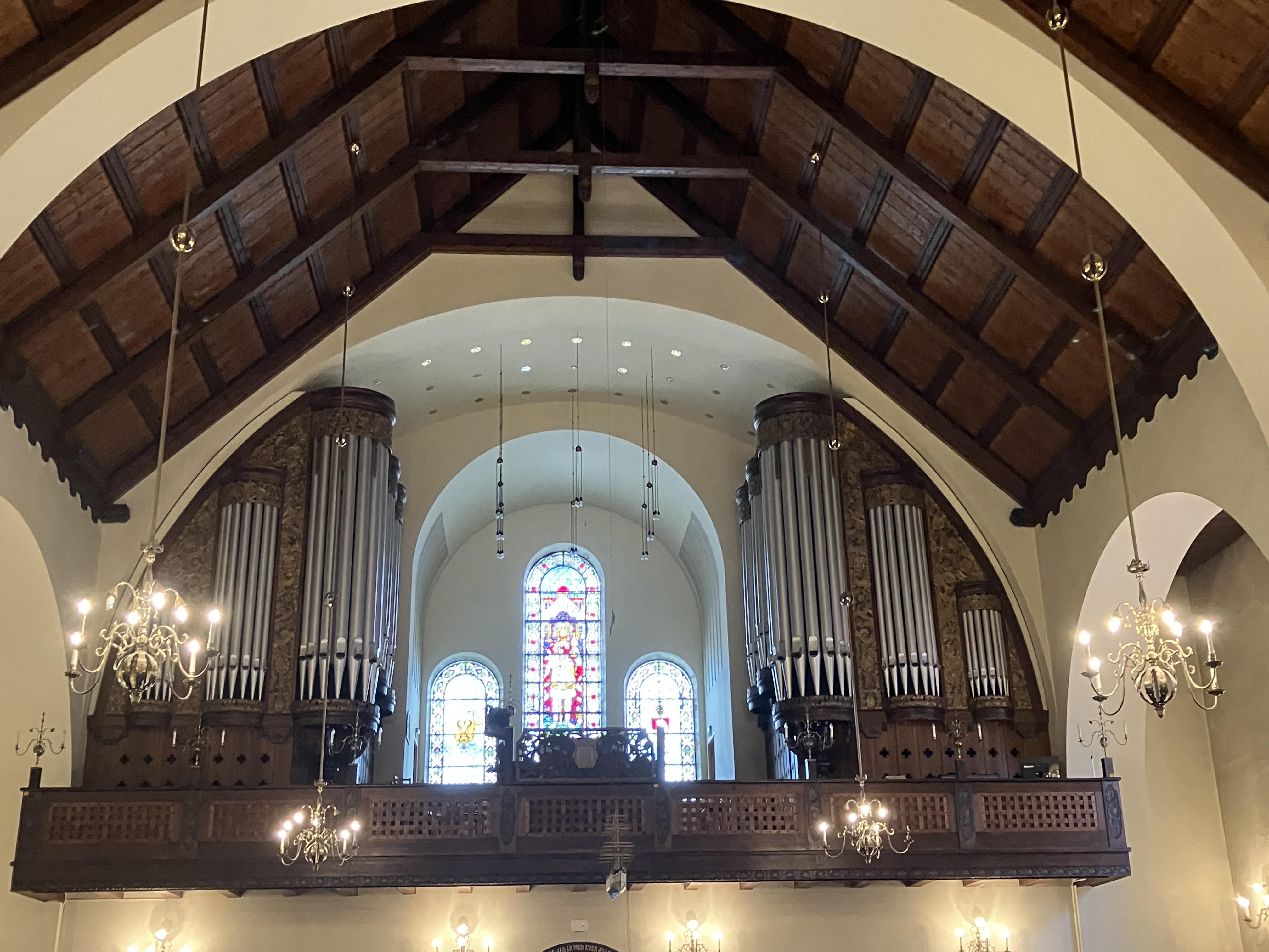
We just managed to see the Church before it closed. It had amazing frescoes around the altar.


We left the trail after the church and wandered into a residential area. We found our way up to a view point high above the town. The view point emphasised just how dependant the town is on the sea. Boats and ferries were going off in every direction.
We found ourselves on the wrong side of the hill as we came back down. We had to make our way back around the older dockside.

We wandered back into the city centre. We had a Mr Whippy type of ice cream at a Fish and Chip shop! Bizarre. We looked at places to eat but nothing really appealed.
We decided to buy some fresh pasta and eat it back at the camp site.
A good decision. The evening was warm and sunny. We sat out on the grass in front of our plot, ate our pasta and read.
Just below the campsite along the waterfront was a rough parkland. It was alive with groups of youngsters hanging out. Some were sitting around barbeques.
Whilst their chatter drifts up to the camp site it does not disturb us as we go off to bed.
Day 29 Alesund
Saturday 14th June
We wake up to a lovely sunny day and sit out to have breakfast. We are in no rush to go anywhere. We sit around and read for a while. Then we cycle to the Sunnmore museum, a couple of miles east of the campsite.
This is an open-air museum of traditional rural buildings from the surrounding areas. These buildings range from schools to houses. They also include farms and barns. They had been moved and reconstructed to show what traditional buildings in the area had been like.


Some of the buildings were open. You could see the layout of the rooms and the decoration painted on the wall. Others were closed and you had to look in through windows.

The museum was set amongst wooded parkland with a high viewpoint westward towards Alesund and the campsite. There were a lot of tourists visiting here and a nice café where we had some coffee.
We cycled back to the van and spent the afternoon reading and sewing. Later, we cycled into the centre for a meal.
We went to a lovely restaurant overlooking the port. The XL restaurant specialised in the traditional dish of bacalao. This dish was made from cod.
The cod had been naturally air dried by hanging it outside in the open air after it was caught. We had seen this earlier in our trip on the Lofoten Islands.
We had tasted the Spanish bacalao many years ago in Leon in northern Spain and had found it incredibly salty. This bacalao was delicious, not at all salty as we had feared it could have been.
It was a lovely meal in a special place. The fish was delicate and beautifully presented with fresh vegetables. It was washed down with a bottle of white wine and followed by coffee and dessert.
The restaurant offered three different styles of bacalao. Italian, made with a lot of tomatoes and Spanish made from salt dried cod.
We wandered around the town for a while. We watched a Hurtigruten boat arrive and its passengers spreading out into the town.. We looked at all the different boats that were moored up.
We were feeling very well fed and rested. We returned to the camp site and sat outside for a while before going to bed.
Day 30 Alesund to Avsnestunnelen
Sunday 15th June
We slept with the front of the tent top open. For the first time, we were aware of car headlights across the water, during the darker and more southerly night.
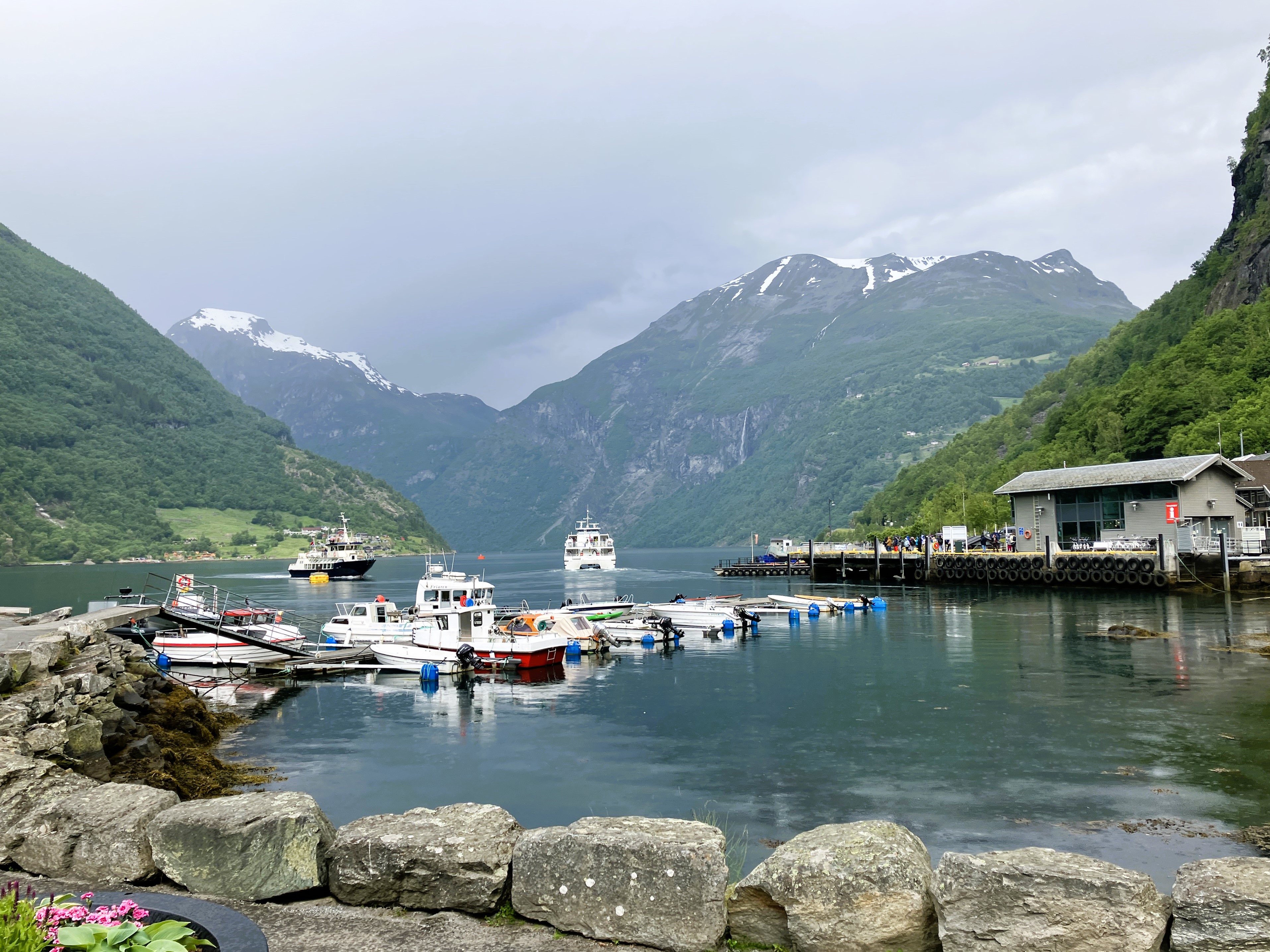
After breakfast outside we packed up and were off the site by 8am. We made our way to Geiranger ‘the’ fjord town.
It is situated at the end of a deep sided fjord and for centuries has had tourist visiting it. Most do at least one way by boat!

Our route first east and then south took us in the rain through an area of fjords and low hills. It ferried us over on the Linge Ferry to Eidsdal. The Eidsdal valley then led us up to a high snowy valley pass. Here we went through a tunnel until we were high above Geiranger.

The Eidsdal valley led us up to a high snowy valley pass. Here we went through a tunnel until we were high above Geiranger.

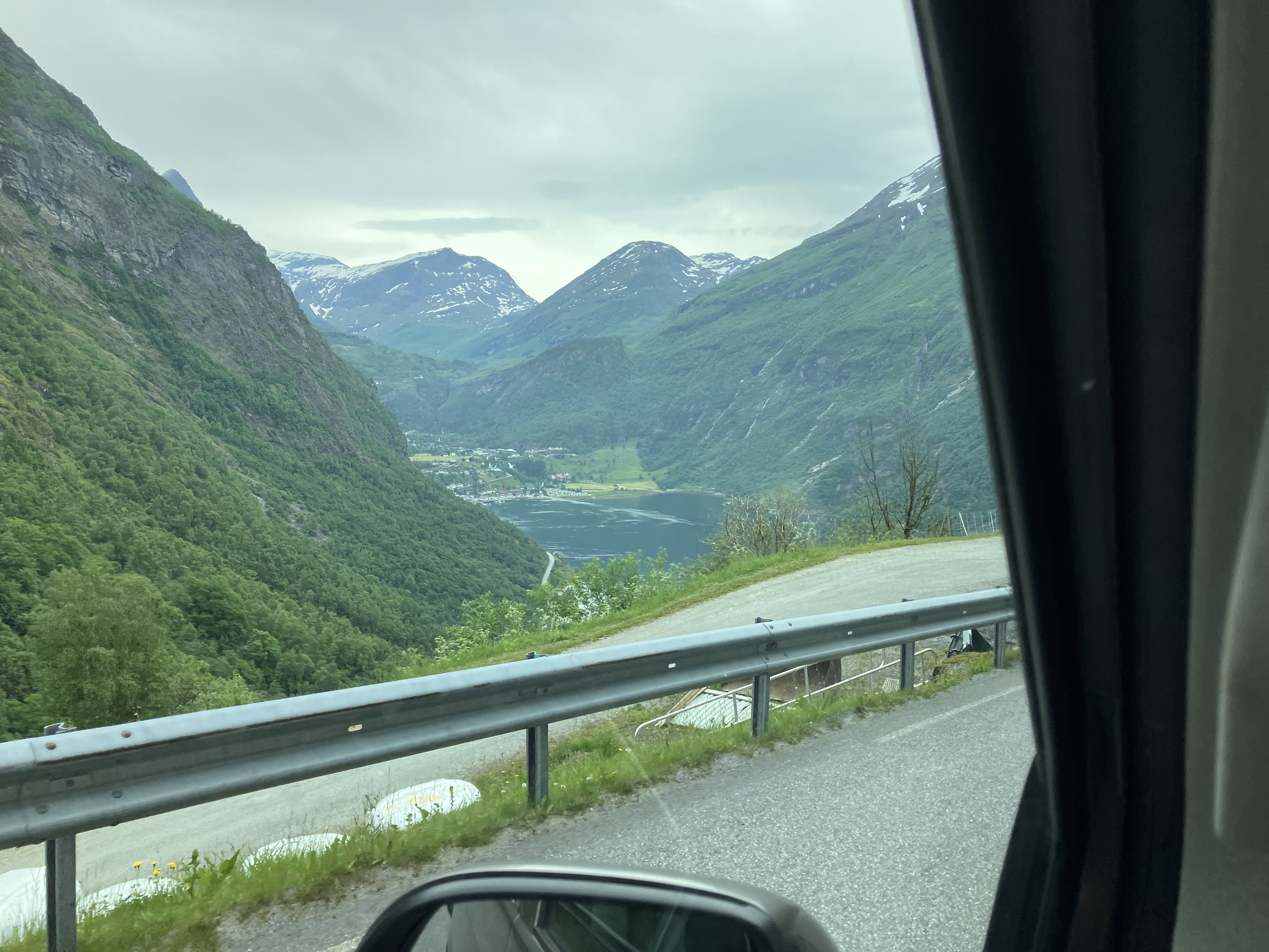


It was still early when we descended the steep zig-zag road that took us down the side of the fjord into Geiranger. The many zig-zags down were not crowded with coaches and cars. Unfortunately it was grey and damp and did not offer much appeal.
We found a quirky coffee shop that sufficed our needs. The stop had given us a snapshot of the World Heritage Site. There were many retail outlets and gift shops, which were underwhelming to say the least.
Recharged, we continued our way up and away from the town. We followed another set of zig-zags, We reached a high glacier plateau in the snowy mountains at the Djupevatn lake.
This spectacular lake in the heart of the former glacier was frozen over and quite took our breath away. Heavy rain broke the spell. We continued down past a series of small lakes and through a tunnel to Erdal.

Our route took us to Innvik and Forde. Soon after we stopped for lunch at the Langeland Resteplass by a lake.
After lunch we followed the E39 to Vadheim on the huge Sognefjord. We had found a rough camping spot on the old road that the Noreviktunnelen had replaced. Just by the old tunnel entrance we found a space by the road which served us well.

It was overlooking the fjord above some fishing enclosures and associated dwellings. We walked along the old road to the next tunnel taking in views over the fjord.
On our return to the van ‘No Camping’ signs had been put out at the head of the driveway down to the buildings.
We returned to our spot, further along the road, a little chastened. Here, in the steadily falling rain, we ate and settled down for the night.
Day 31 To Bergen
Monday 16th June
We awoke to mist hidden mountains and drizzle.
We sorted out the clothes we wanted to wear in Bergen. We were not sure if we would be able to access the van when we parked it. We packed two rucksacks with all we needed for a two-night stay in Hotel Heiman and got underway.
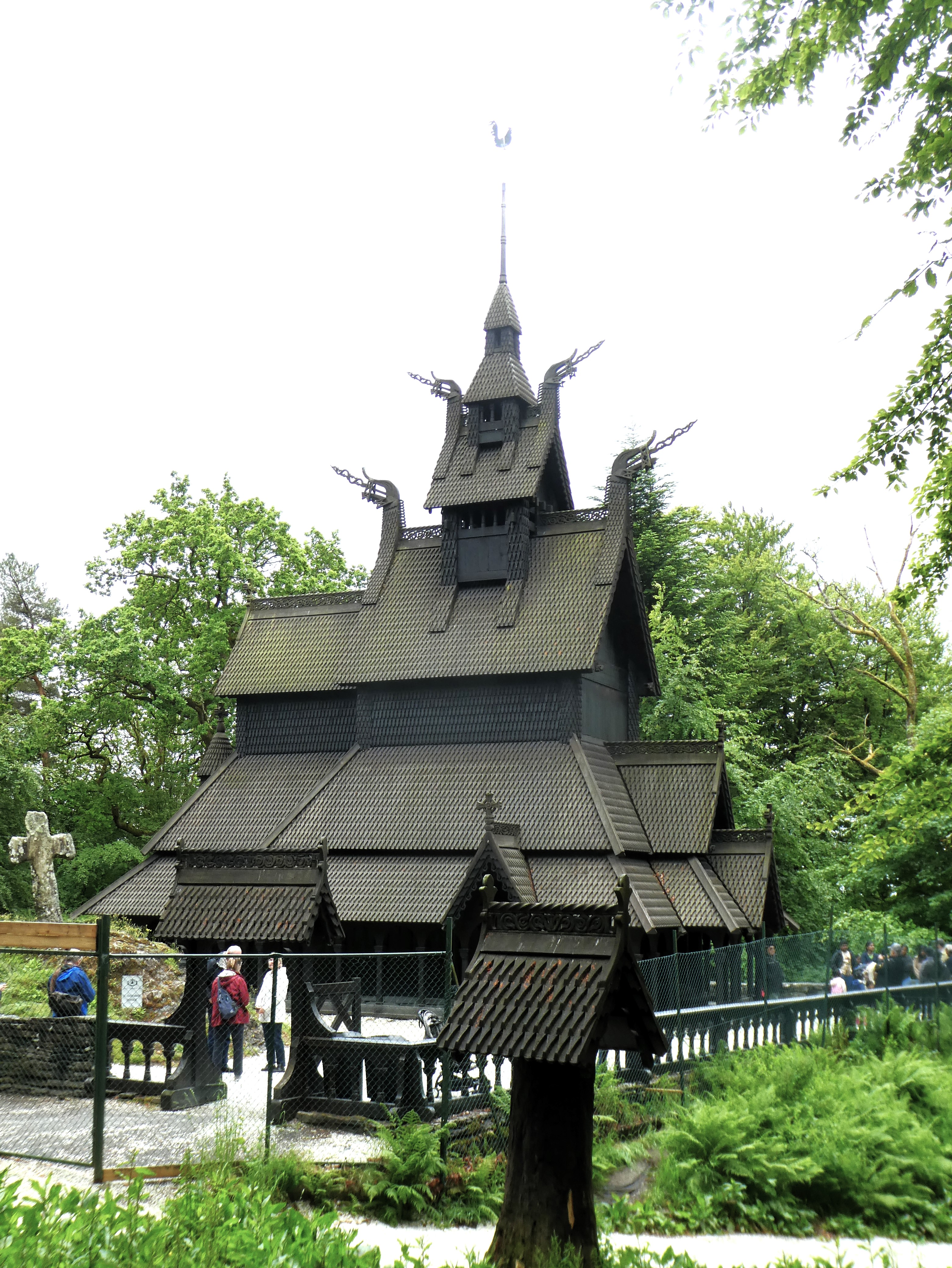
Our journey in to Bergen included yet another crossing and the crossing of a long bridge into the City. Having stopped for Fika outside Knarvik we travelled through Bergen to the Fantoft Stave Church.
The stave church is an iconic Norwegian medieval building not uncommon throughout north western Europe. Many are designated as World Heritage Sites. But, this was not one of them.
This was a reconstruction which had replaced an earlier wooden stave church that had been destroyed by fire. We walked around and took some photos.
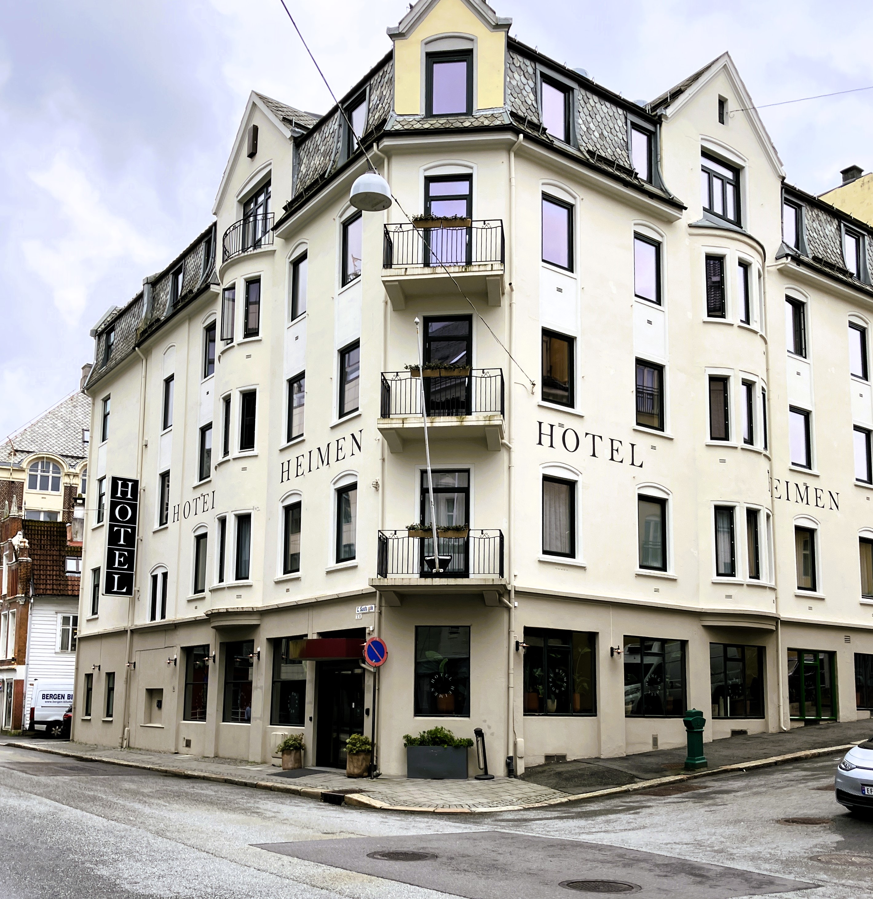
As it was still raining, we had lunch in the van before going to the hotel. We found the hotel and stopped briefly on the double yellow lines outside whilst we got directions for a garage.
We were directed to an underground parking in a quiet urban area nearby. Eventually we found it after a few circuits of the neighbourhood. The spaces were long enough so that we didn’t have to take the bikes off. It was only a couple of minutes’ walk from the hotel. Very convenient
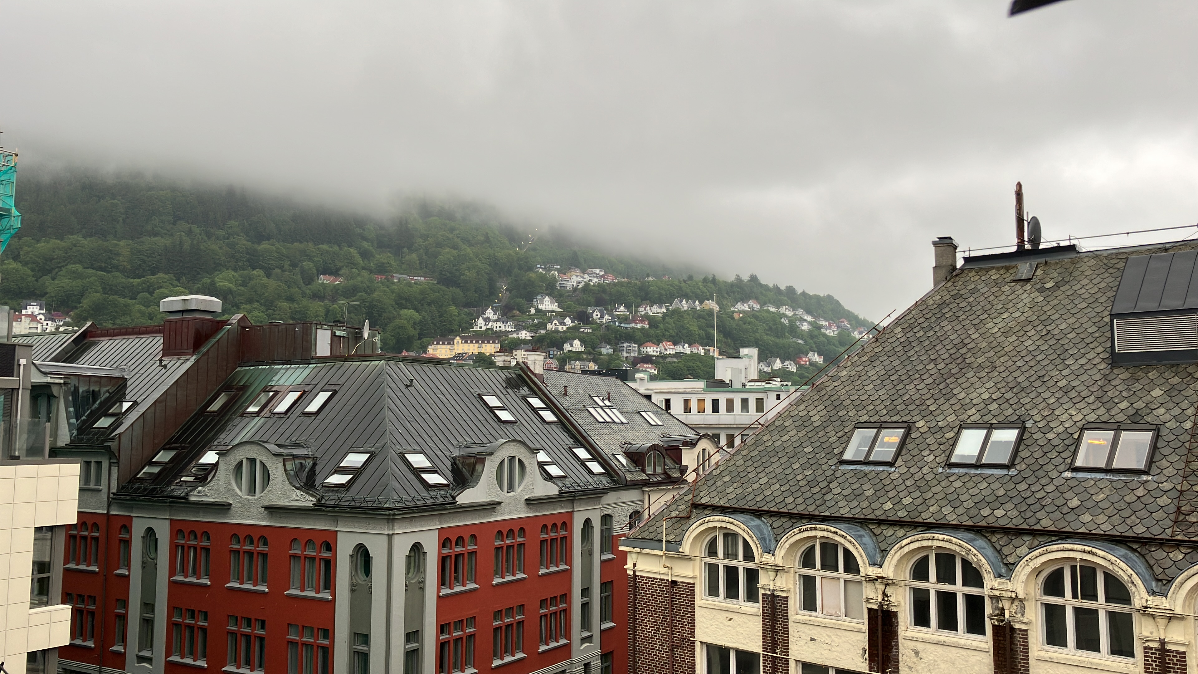
Back at the hotel, our room was on the 6th floor. We had a Velux window so that we could look out over the roof tops and sky. It was all distinctly grey ,with mist and light rain.
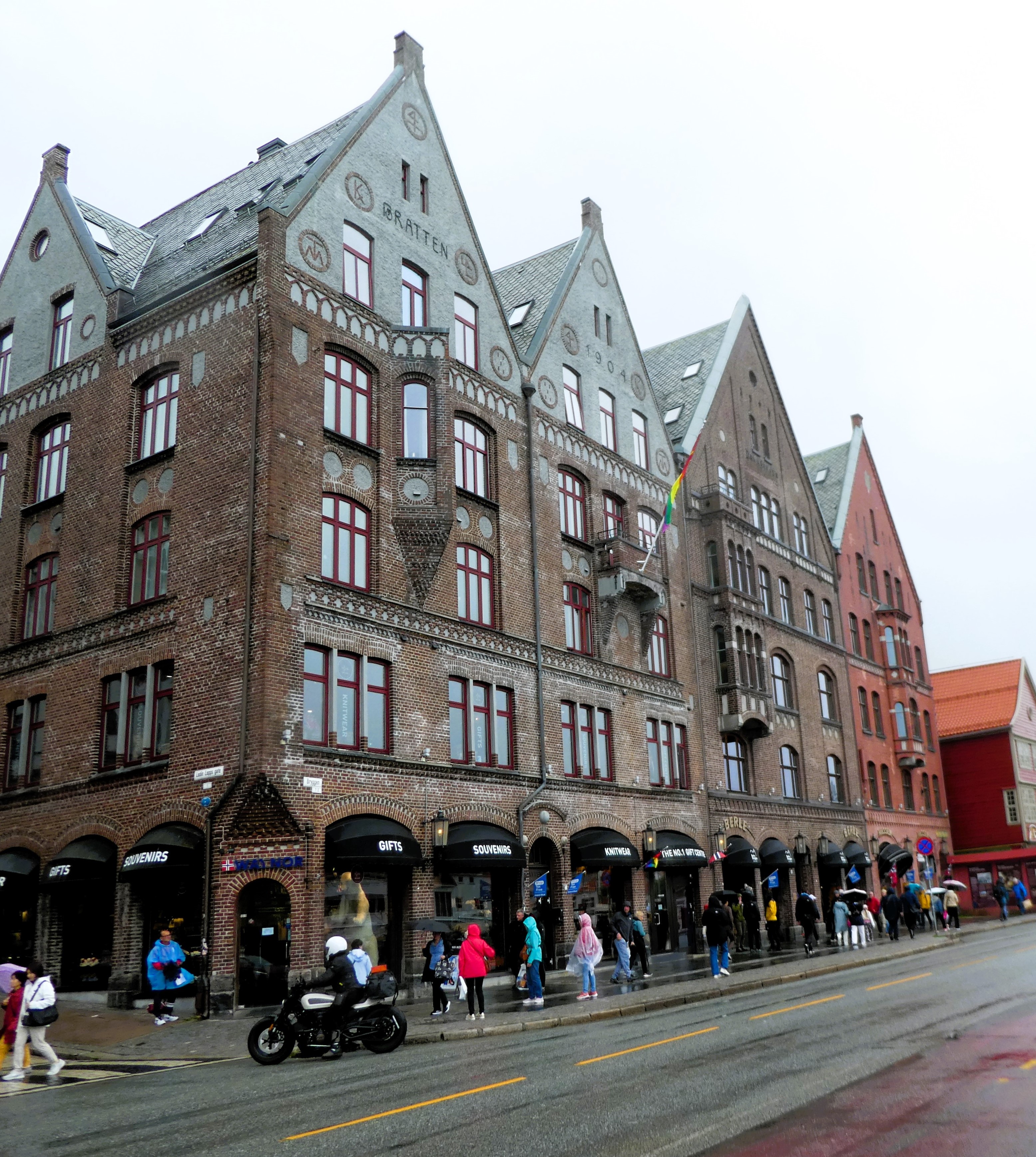
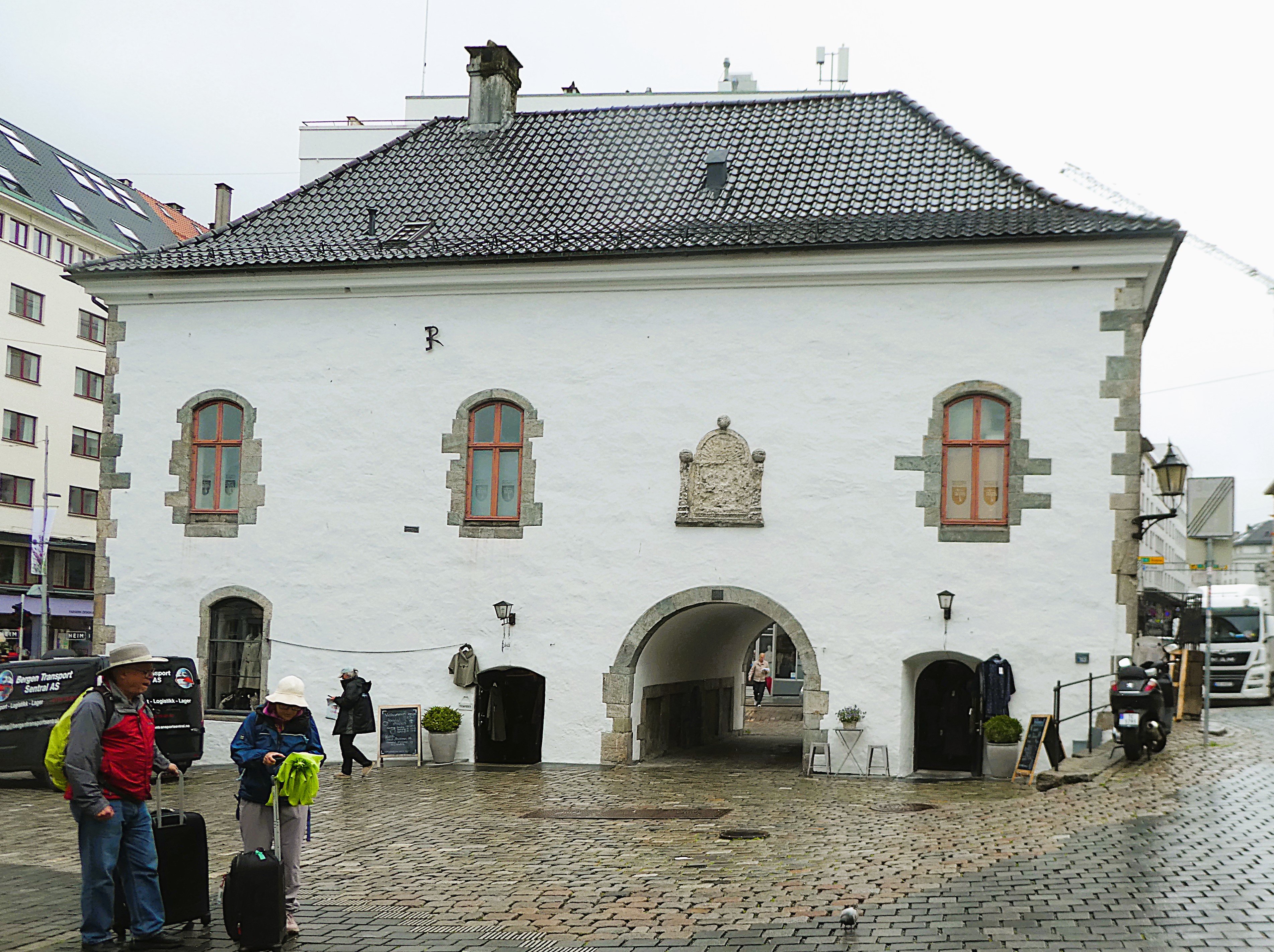
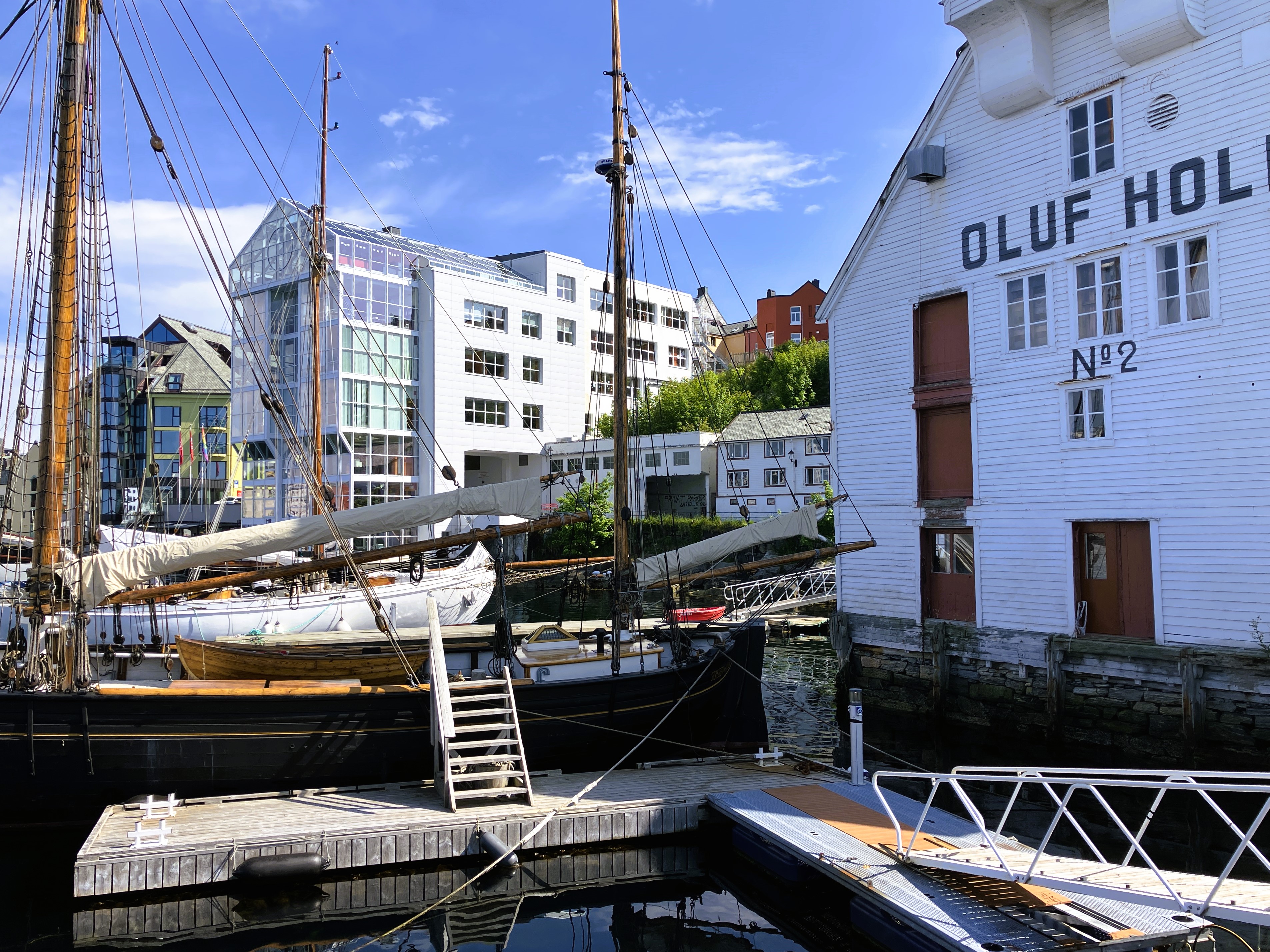
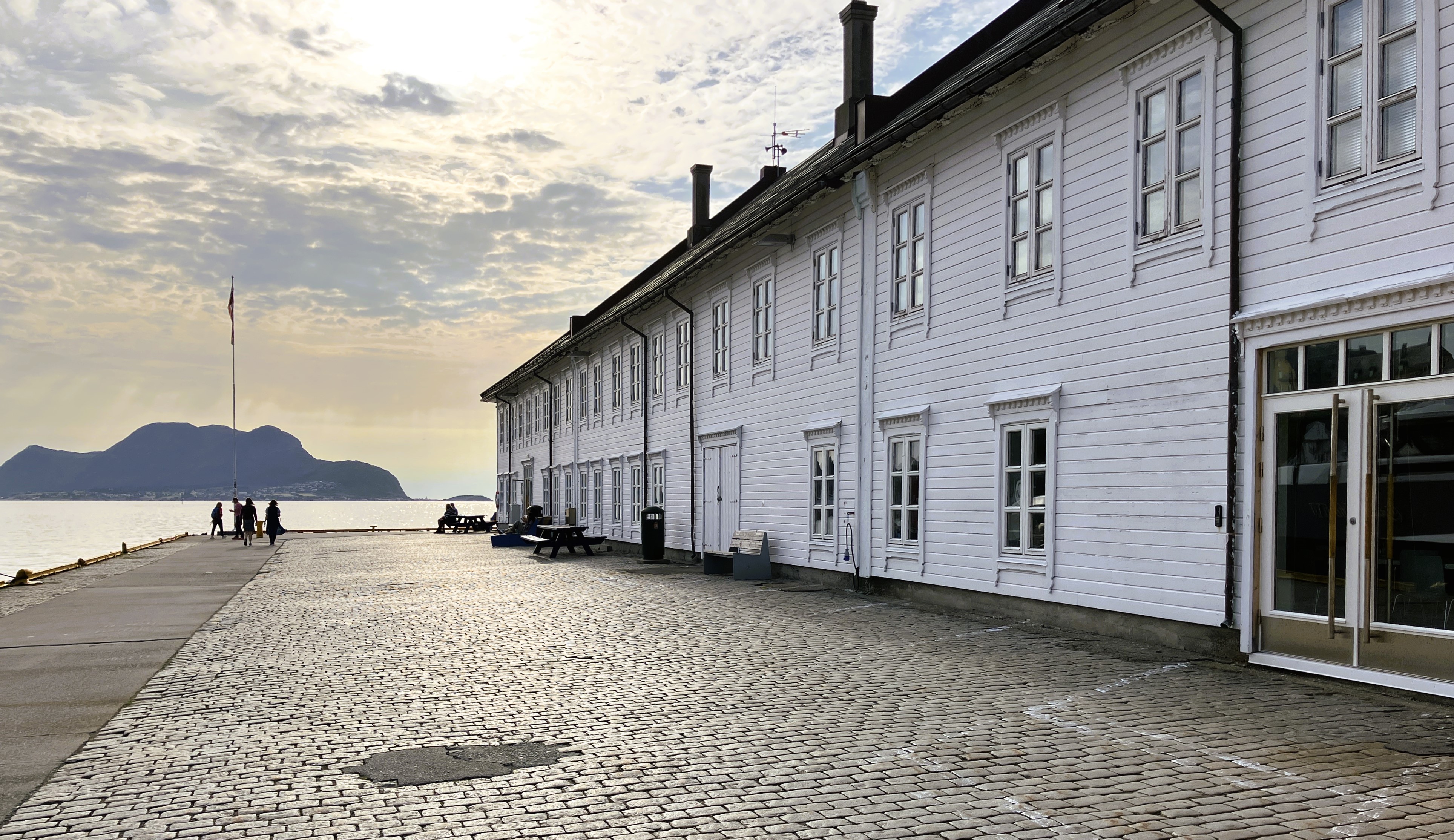
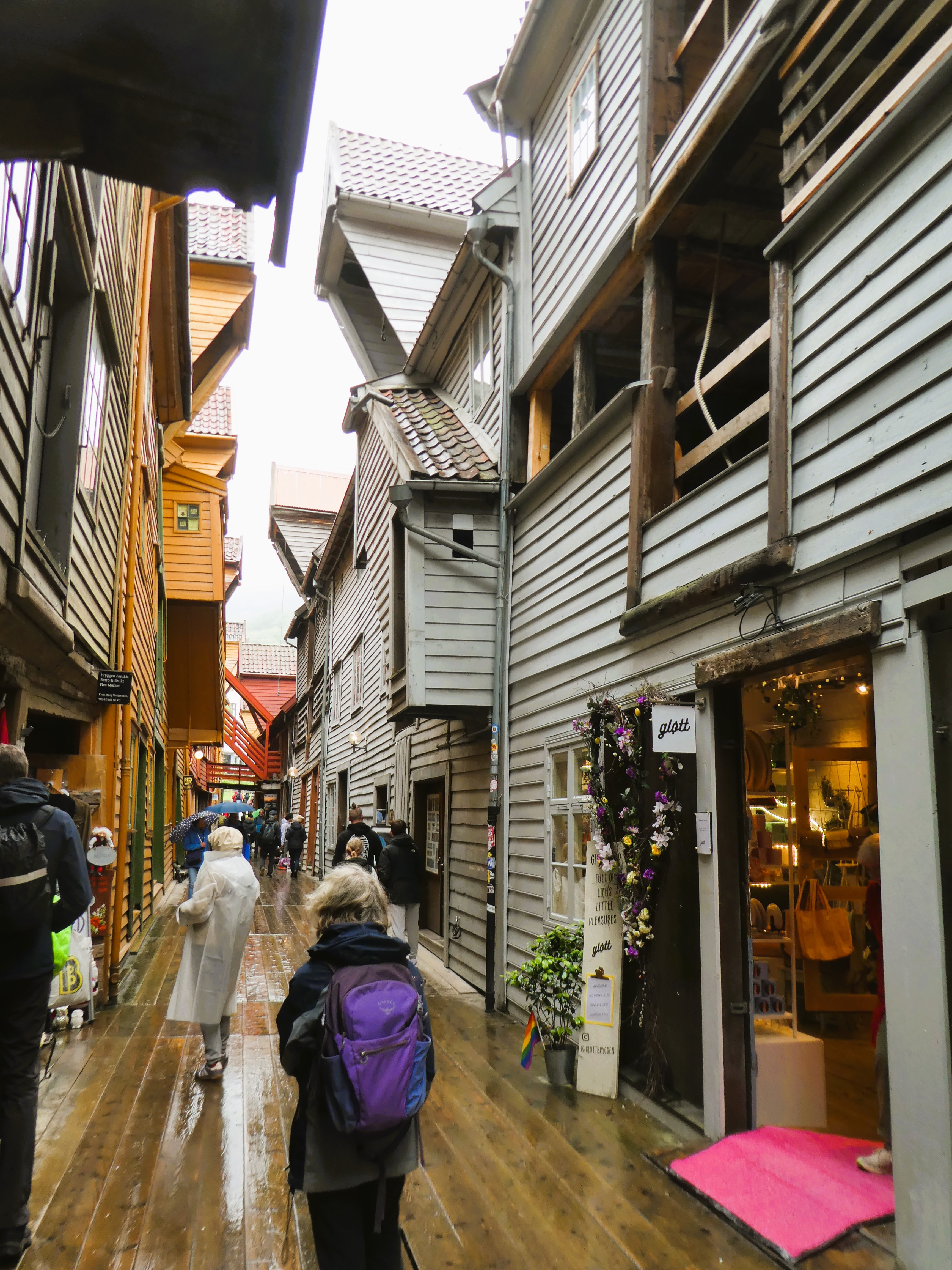
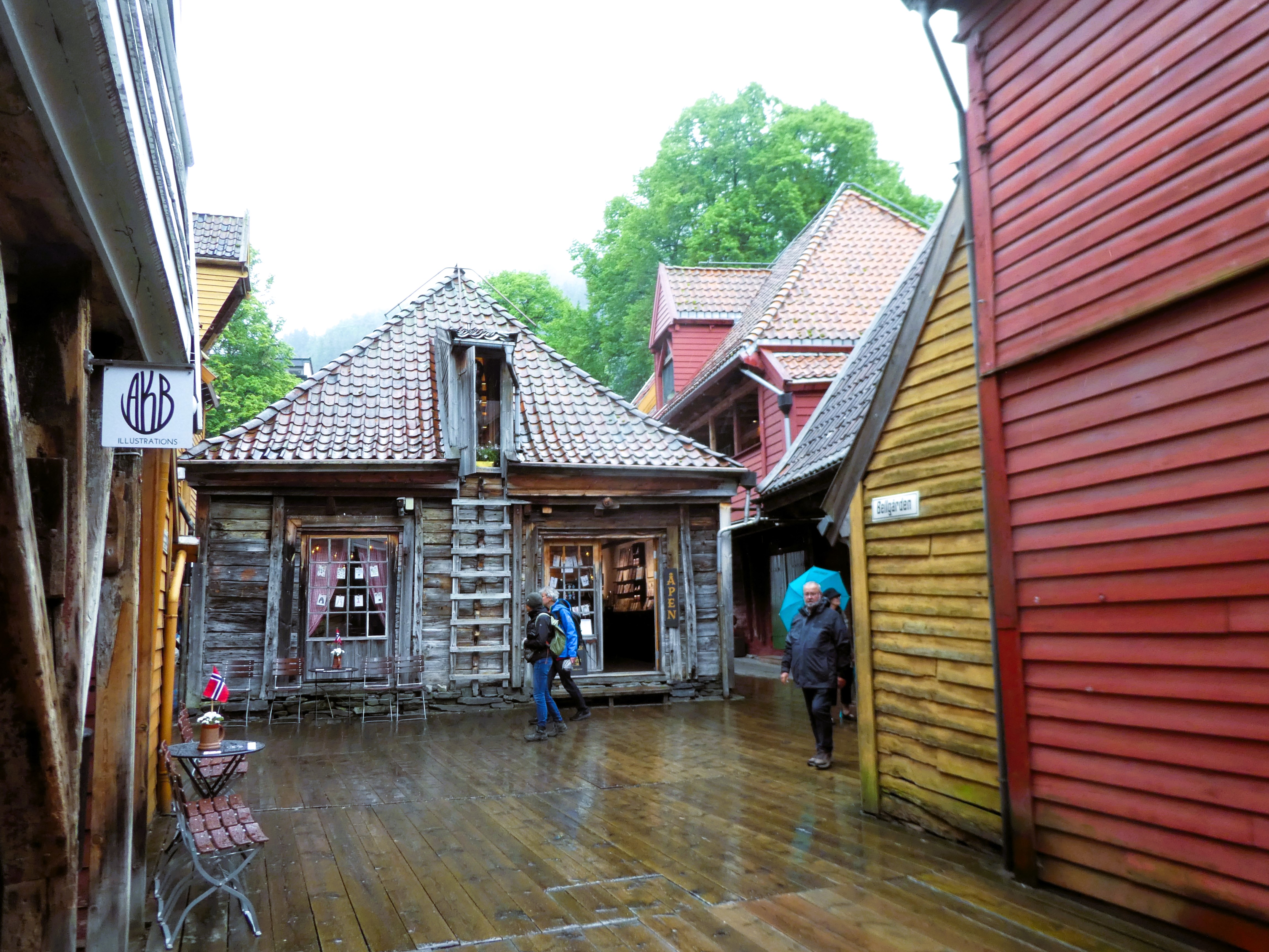
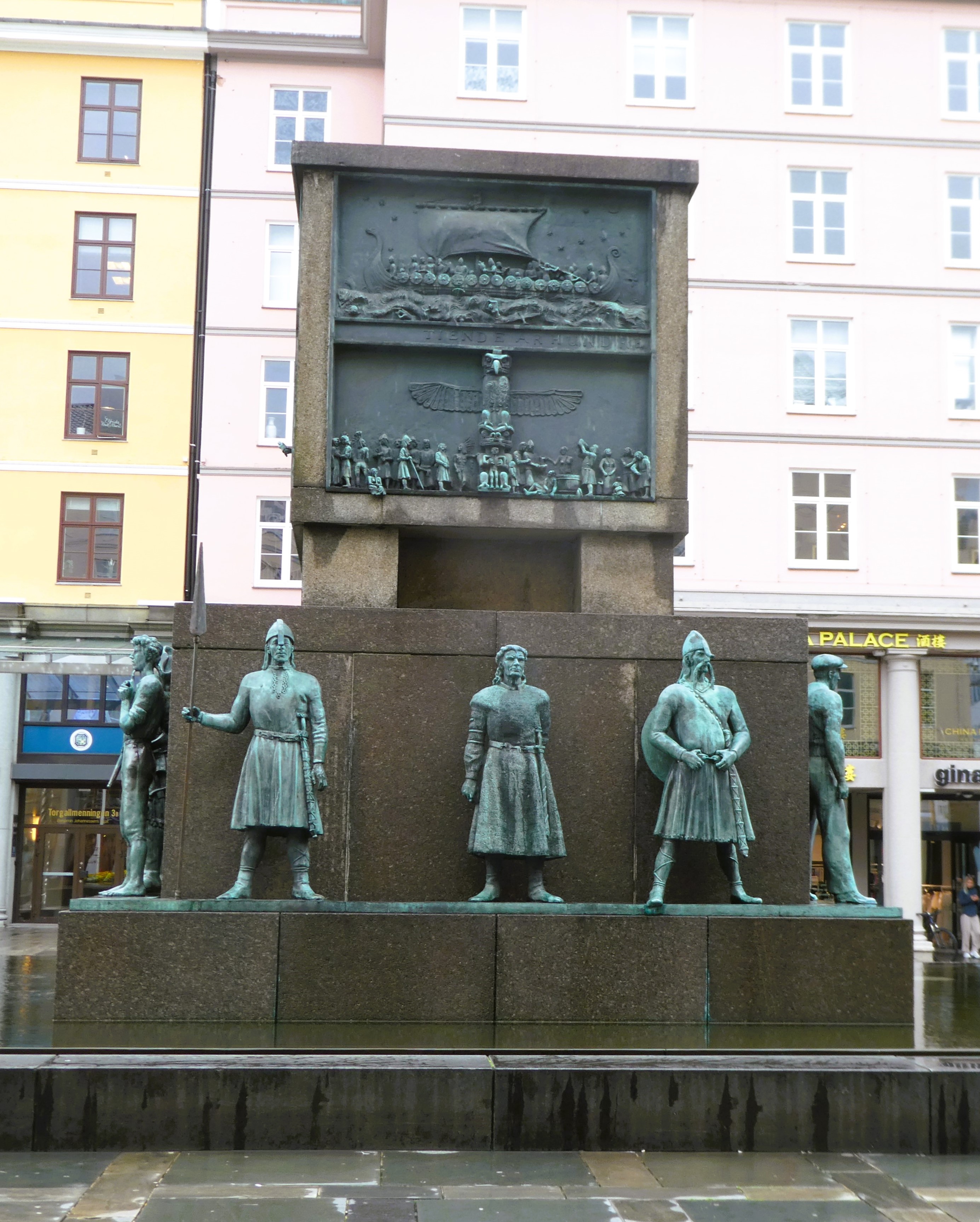
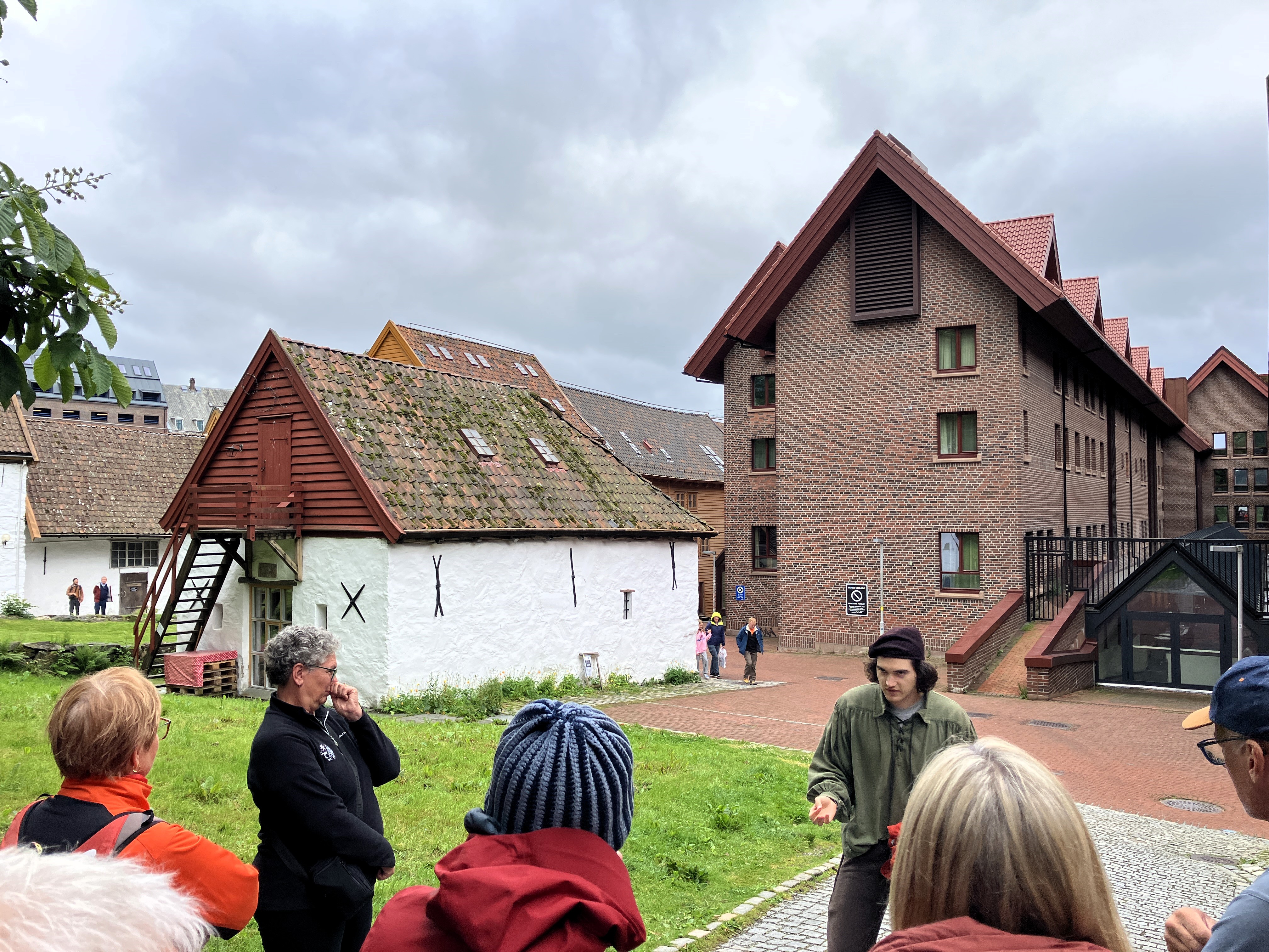
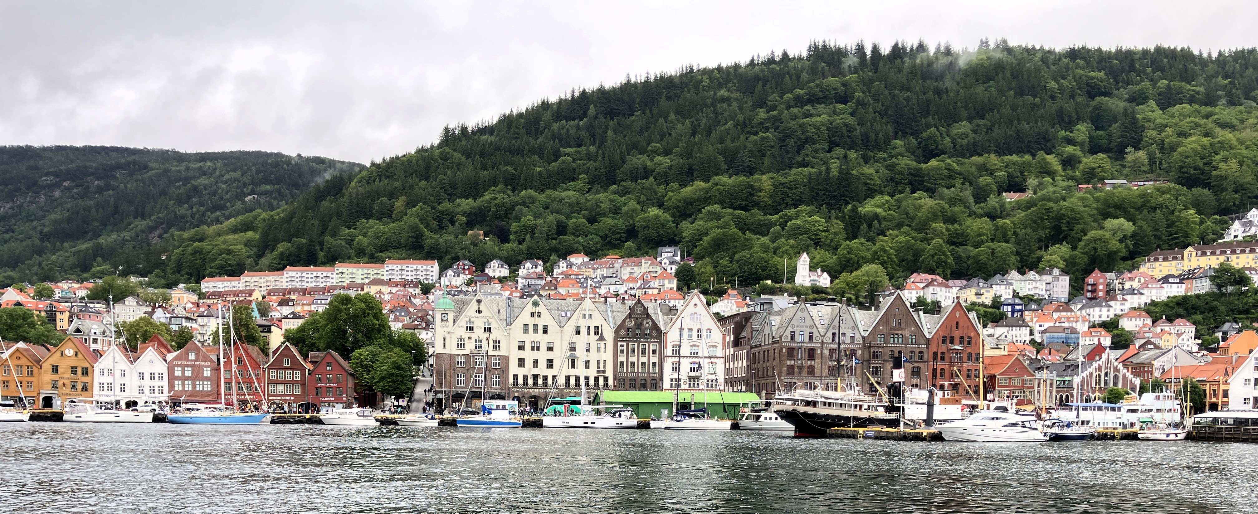
After a cup of tea we made our way to the Tourist office. Equipped with maps and guides we ambled around the fish dock area called the Bryggen. It was a fascinating area of old wooden and stone warehouses packed tightly together. Some were being renovated and others were now filled with little craft and souvenir shops overlooking the harbour. There was a small museum at the back of the Bryggen illustrating how the district had been laid out.


We continued to the Bergenhus Fort at the end of the harbour. It was raining by now. We walked up to the top of the building. Fromand from the lookout surveyed the mix of cruise vessels, ferries, fishing and naval vessels on the Vagen.

It was raining steadily as we made our way back towards the hotel looking for food. The rain eased as we found ourselves in a residential area near to our garage parking. Here there were more restaurants that catered for residents and less of the chain restaurants and tourist traps around the harbour.
The Daily Pot was a popular simple café/restaurant. It was fully booked but we ate at a small bar. It served either a thick soup or a large salad to which you could add various meat or fish options.

It was just what we needed and we opted for a mix of salads, beans, potatoes cheese, chicken etc in a bowl, lovely
We ate and enjoyed sitting at the bar listening to the buzz of people around us. They were enjoying meals with their mates and work colleagues.
We left and walked back over the hill to the hotel randomly following delightful, steep, cobbled residential streets and passing through squares.
We settled into the luxury of a soft double bed and slept well.
Day 32 – Bergen
Tuesday 17th June
It rained all night as we slept snugly in our hotel room. We had a nice buffet breakfast when we got up to set us up for the day.
The rain continued to torrent down. We dressed up in our wet gear and grabbed an umbrella from the hotel foyer. Then we made our way to the start of the free tour we had booked.
Olivia was our guide, she was organised, told us facts but didn’t have charisma. She took a route that kept us dry when there was the opportunity!
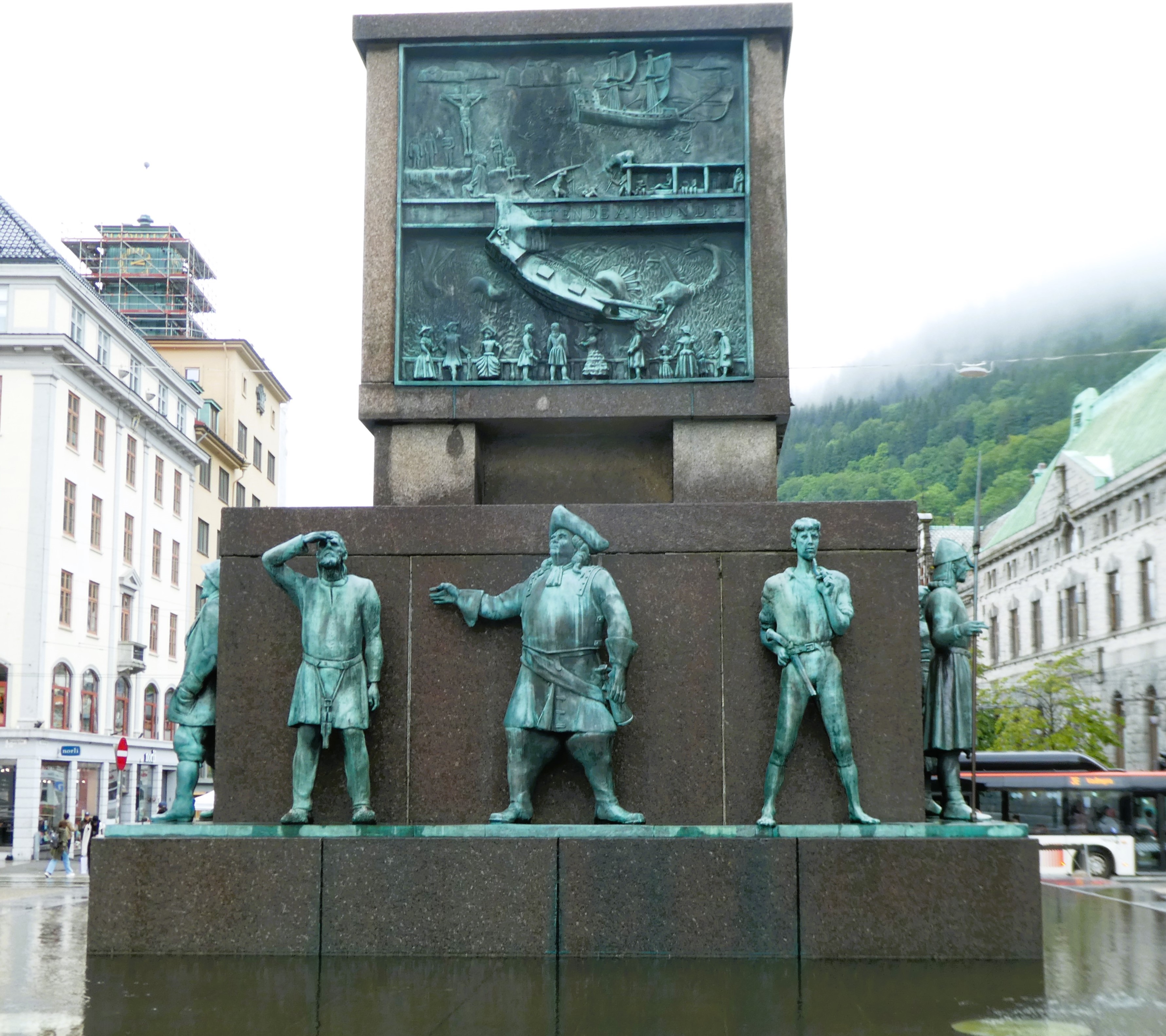
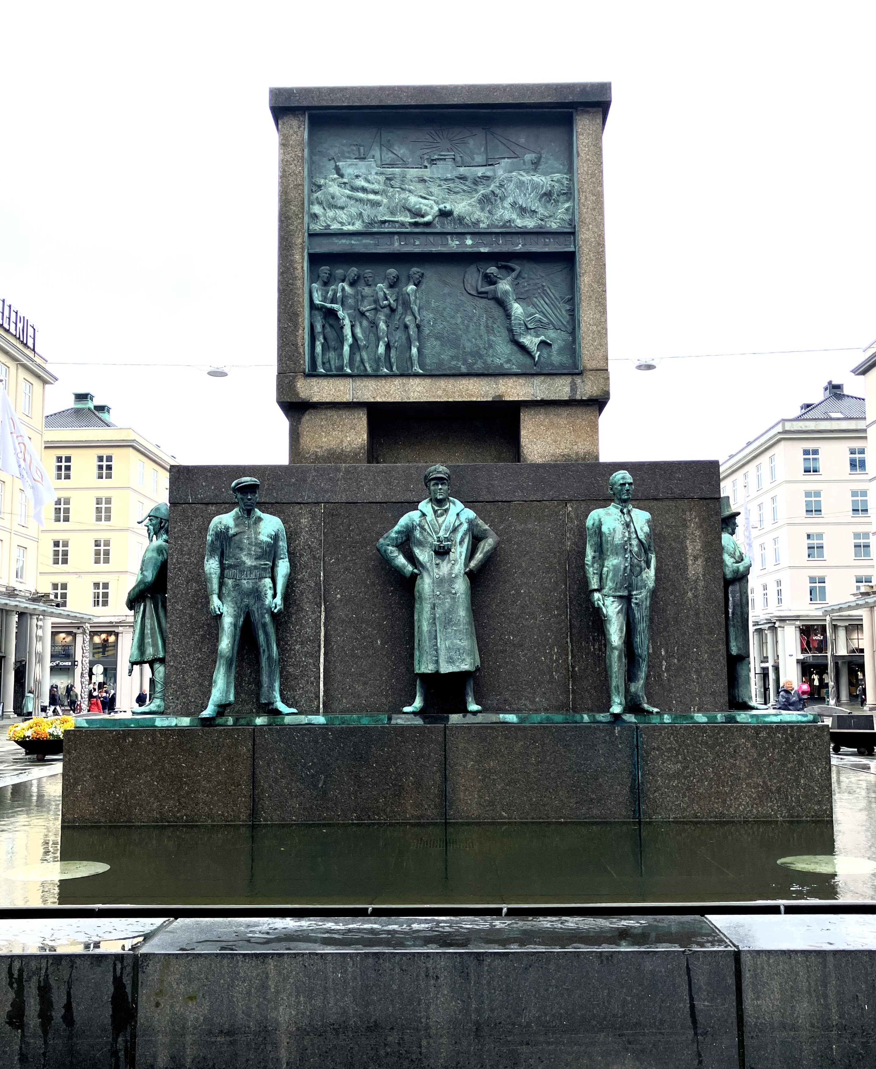
First we examined a four-sided monument, with a range of scenes made in bronze of the social history of Bergen.

then walked up to the theatre where Ibsen and Bjornson plays had been performed. We walked past the statues of Edvard Grieg and Ole Bull, before visiting the meeting place with fallen pillars. It is so wet it is difficult to focus on what we are seeing. But then as we keep being told Bergen is the wettest city in the world.

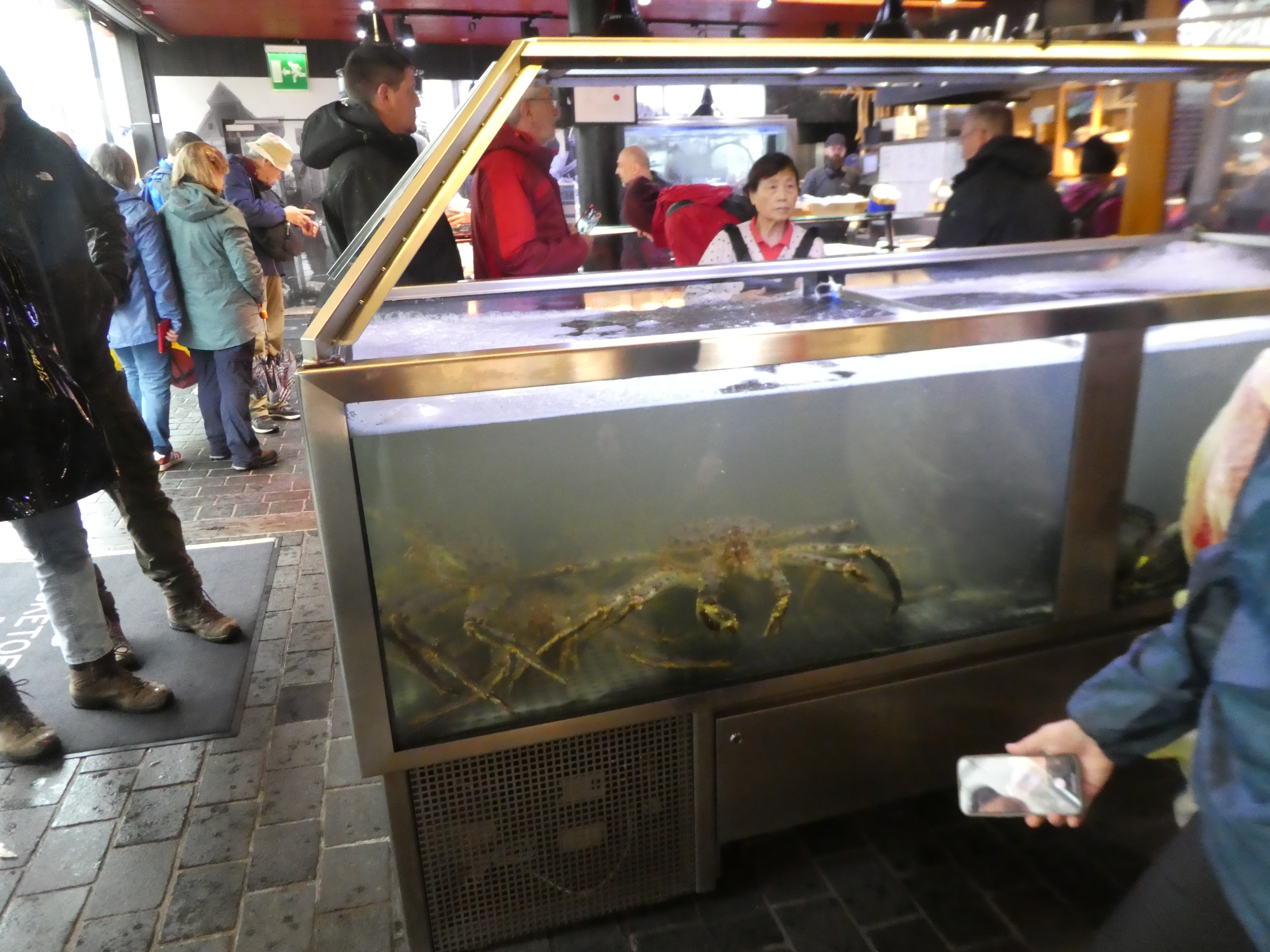
We have a break at the fish market to go into the dry. Part of the wet fish market is now there. The rest is amongst the popular tourist fish market restaurants on the quayside by the Bryggen.
We go on to Bryggen by which time Olivia has lost the will to live. She finishes with a brief and immemorable explanation about the fort. Not the best Free Tour we have had and probably not the wettest but certainly the least interesting.
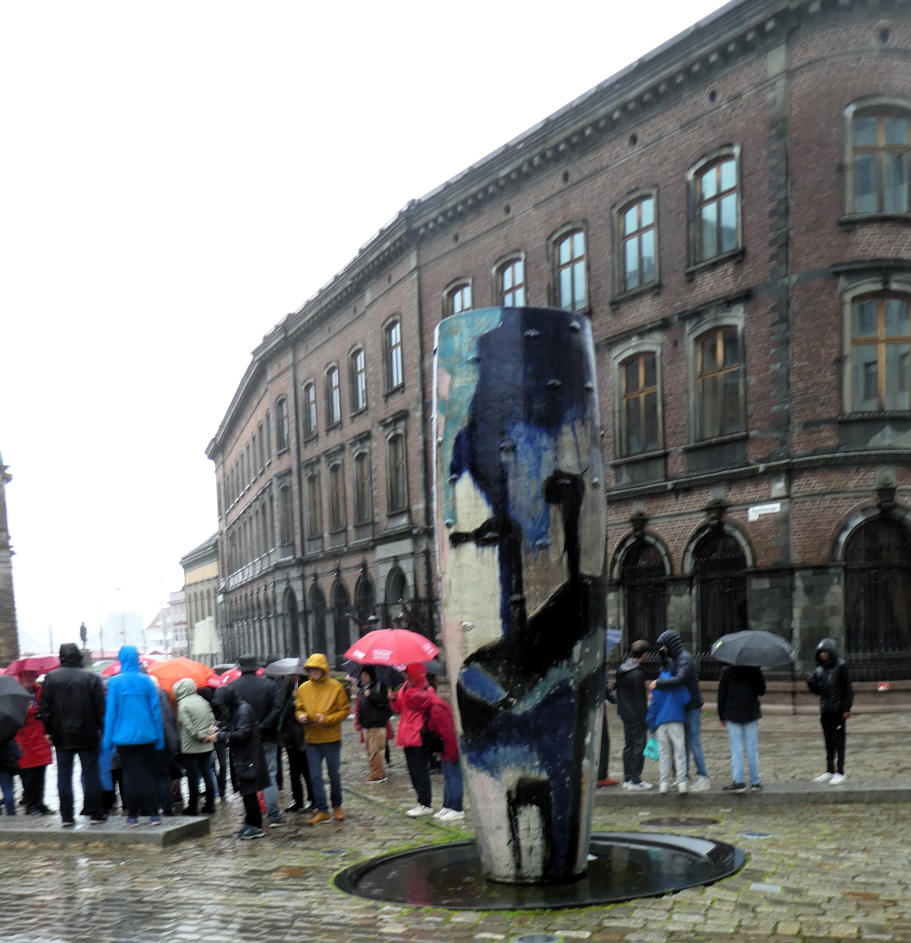

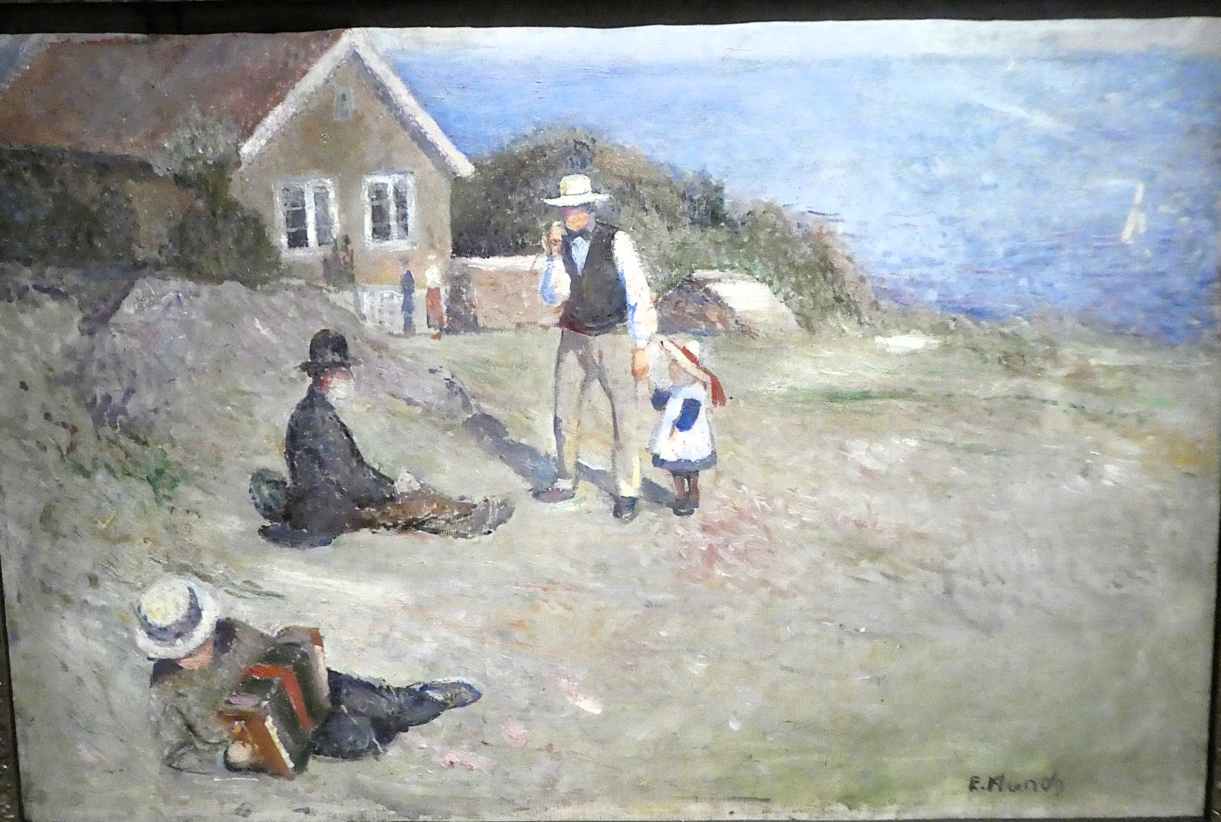
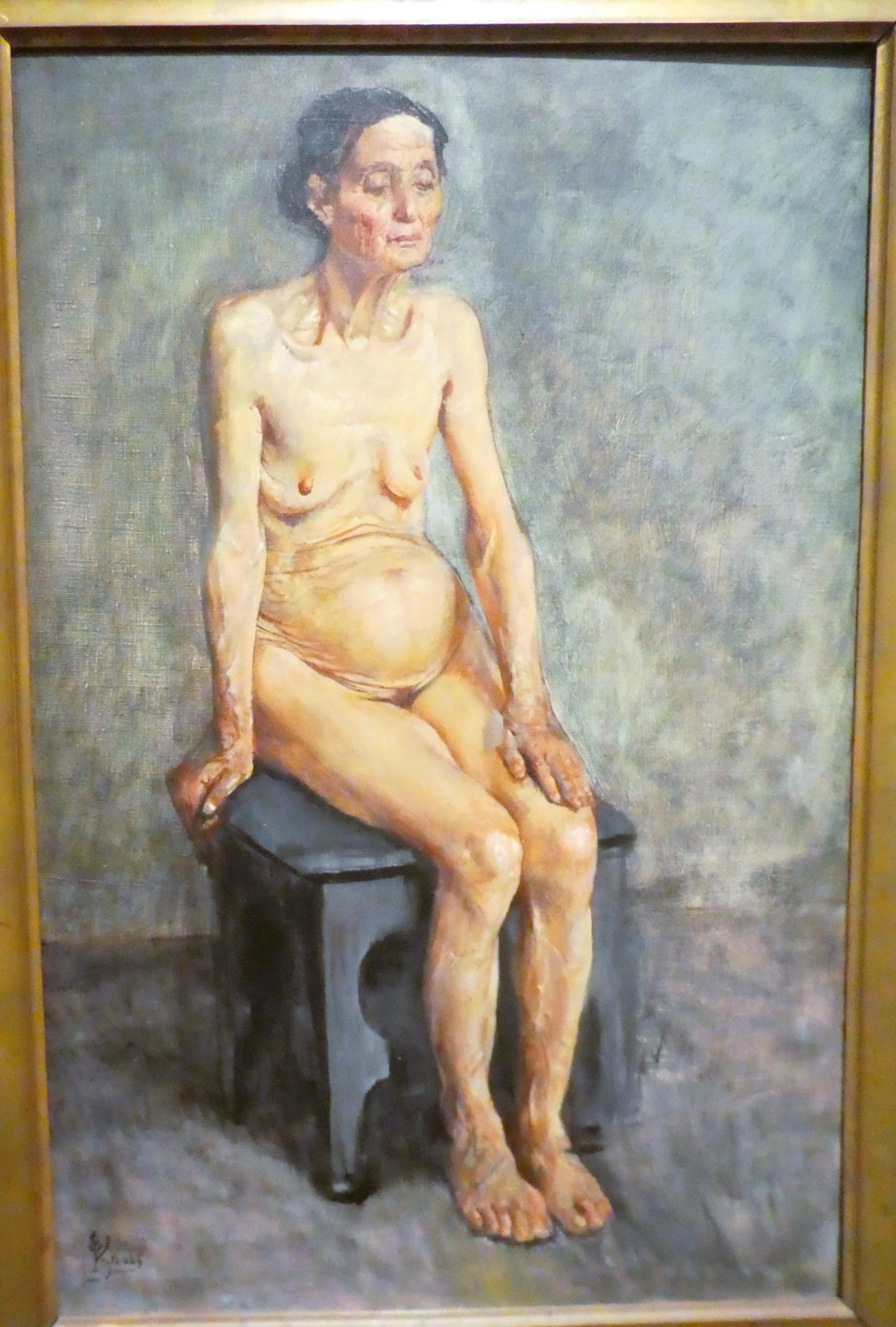
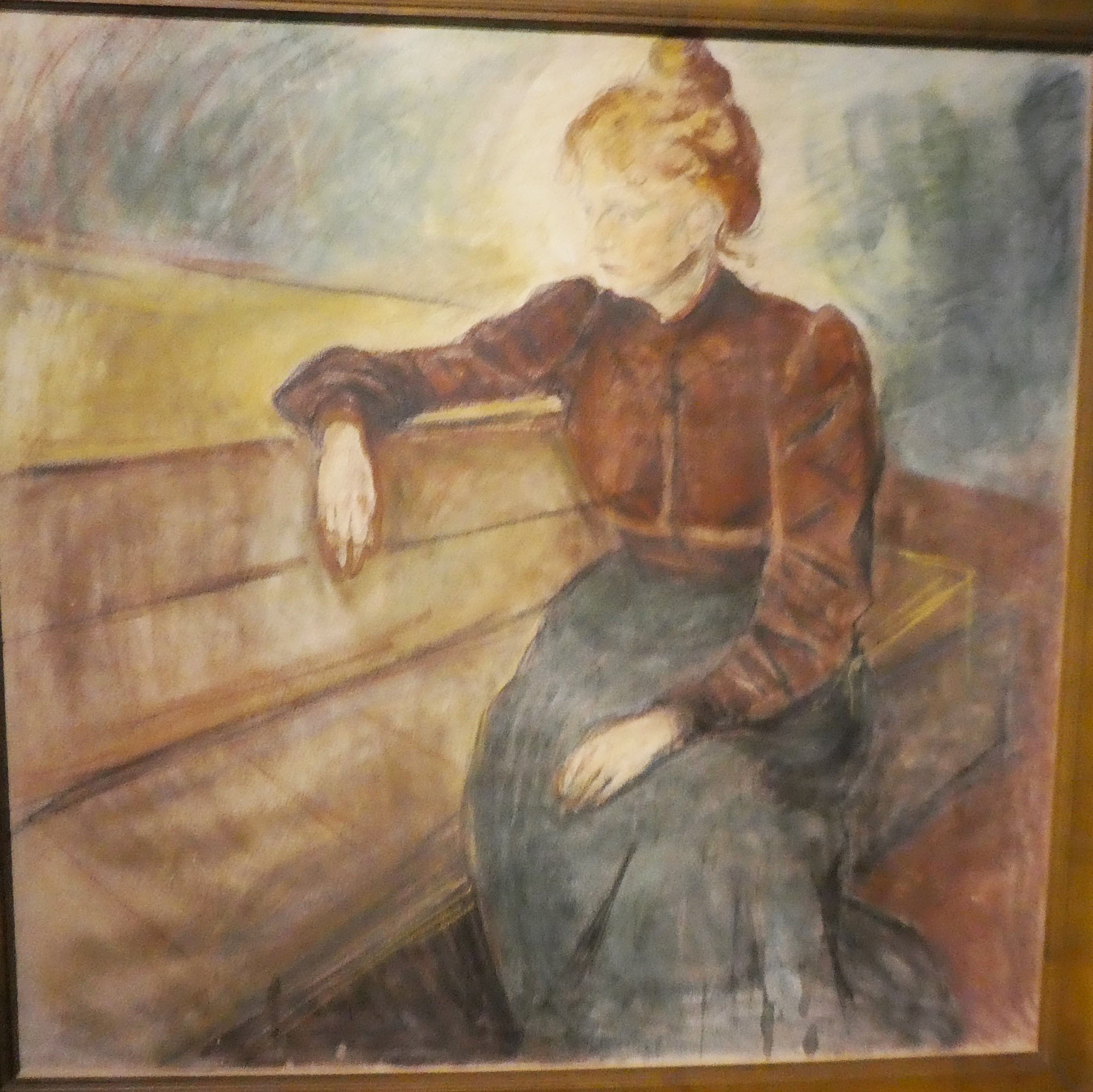
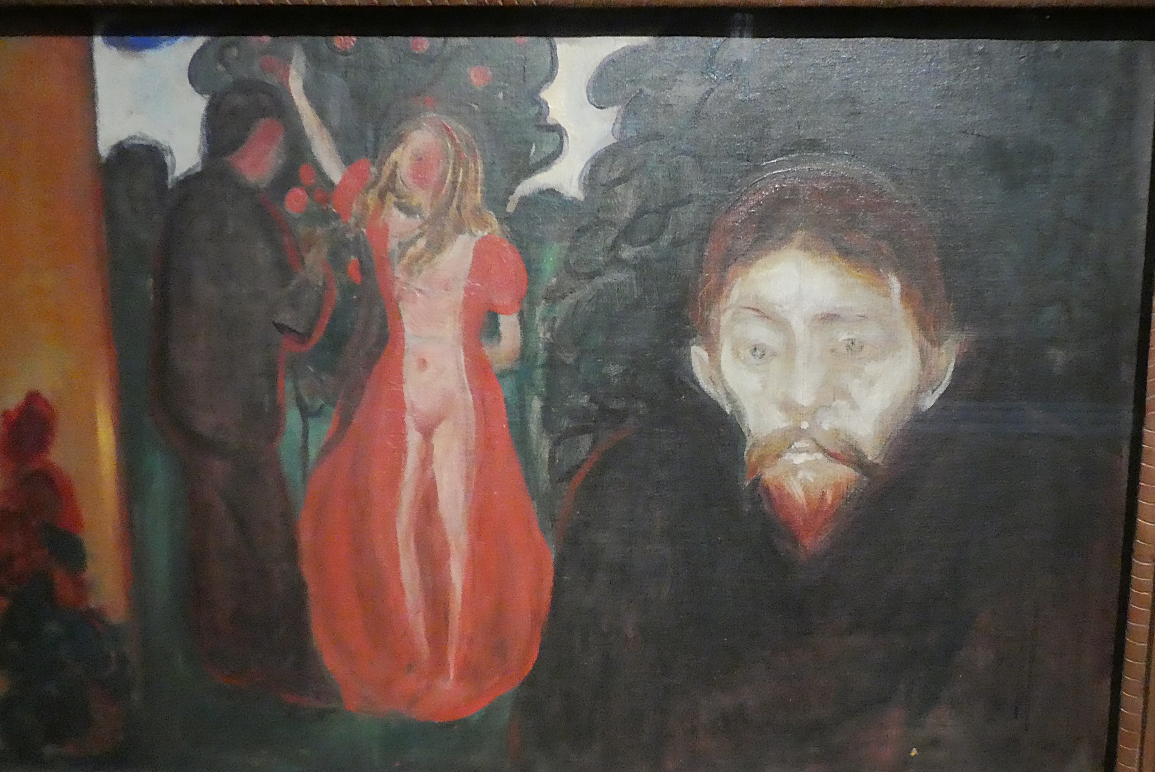
We are very wet and cold as we dive into a coffee shop. We warm ourselves up before making our way to the trilogy of art galleries collectively called to the Koda. Here we followed the development of 19th century Norwegian artists including Edvard Munch which we found interesting. The impact of the French Impressionists and the time he had spent in France was fascinating.

We looked at another building with some contemporary art before walking back to the Hanseatic Museum. We had a booked a tour to learn more about the Hanseatic countries and their impact on Norwegian life.
Tao led the tour. An enigmatic twenty something or other, whose knowledge and ability to communicate was very good. He explained about the Bryggen buildings and the way of life of the Norwegian traders who operated in them.

He reflected on Germany’s overwhelming trading force. Norway had to fight to limit its stock fish trade within the Hanseatic League. He assembled the pieces of the puzzle for us that had begun on the Lofoten Islands.
This was about the significance of the Stock (dried cod) fish. Stock fish was a commodity in high demand. More countries were using shipping to exert influence and trade throughout the world. They needed well preserved food for their crews.
Tao was dynamic and engaging. He filled in gaps about the Hanseatic League that completed our education of the role of dried fish in the history of Norway.
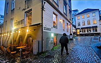

Back at the hotel we removed our still damp clothes and dressed up to go out for a meal. The restaurants were very busy but we found one in the same area as last night.
The Frk. Schmidt restaurant offered a range of delicious Norwegian cuisine. We tried Reindeer steak and a forest mushroom casserole. The food was lovely and we washed it down with a beer.

We made our way back to the hotel as we had done last night. Passing the local church we missed an American gospel choir performance by moments.
Day 33 Bergen to Lystang
Wednesday 18th June
It is still raining when we wake up but we were in no rush to depart. We had a leisurely breakfast before we left the hotel and recovered the van.
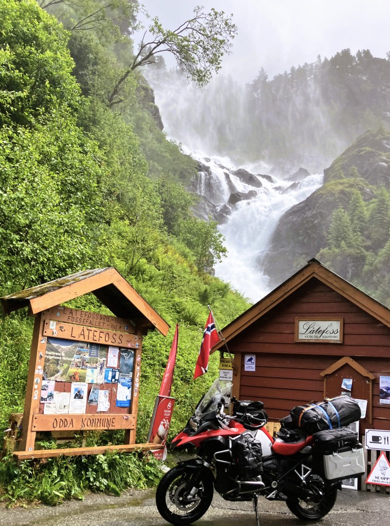
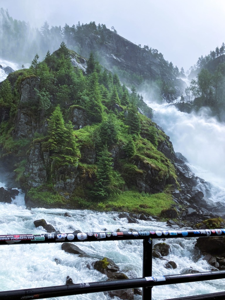
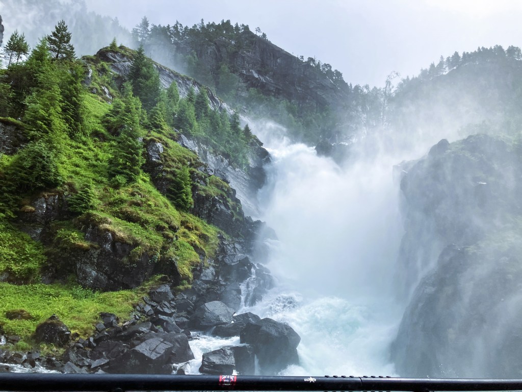
We eventually got on the right road out of Bergen and headed south east taking the Jondal ferry towards Odda.
We navigated twisty turn roads around lakes. There were lots of long tunnels, including one of 11km to Odda.
As we travelled on, we caught a glimpse of the Stavanger glacier high above us.

There were amazing waterfalls, and lots of lakes set amongst barren snowy mountain tops. The clouds were low and rain never far away as we stopped for Fika in Odda. As we had found before the recommended café was shut but we found a very acceptable alternative.
Once past Amot the scenery became less dramatic but still beautiful. We were travelling inland away from the major Fjord area and the weather was improving.
We stopped in Rodal at lunchtime where there was a stave church that was on the World Heritage list. It was small and busy so we decided not to go inside but wait until the Church at Heddal.
Before continuing our travels, we shopped at the Coop, looking at the church and eating lunch in the van.
We saw large lakes all the way as we descended from Rodal to Bo. From here we made our way to Gvarve up to the campsite at Lystang.


We arrived at our booked campsite at Lystang and were greeted by Julia. She and her family had moved from the Netherlands last October. They took over this glamping site and changed it back to an ordinary camping site.
Our plot was with lots of other VW camper vans overlooking the lake, it was a very restful lovely location. The day had warmed up and the sun was shining which was a real bonus.
Graham decided to swim. He quickly discovered that he couldn’t. It was too muddy and shallow even off the jetty!
Day 34 – Lystang

Thursday 19th June
Lovely to wake and have breakfast looking over the peaceful lake. We charged up the electric bikes just on the inverter in the van. Great rejoicing!
We got ourselves ready for a day out and set off across the bridge to the other side of the lake.
We followed a quiet tarmacked road along the lakeside and down a busy settled valley. After the airport we joined a cycle track to Heddal.
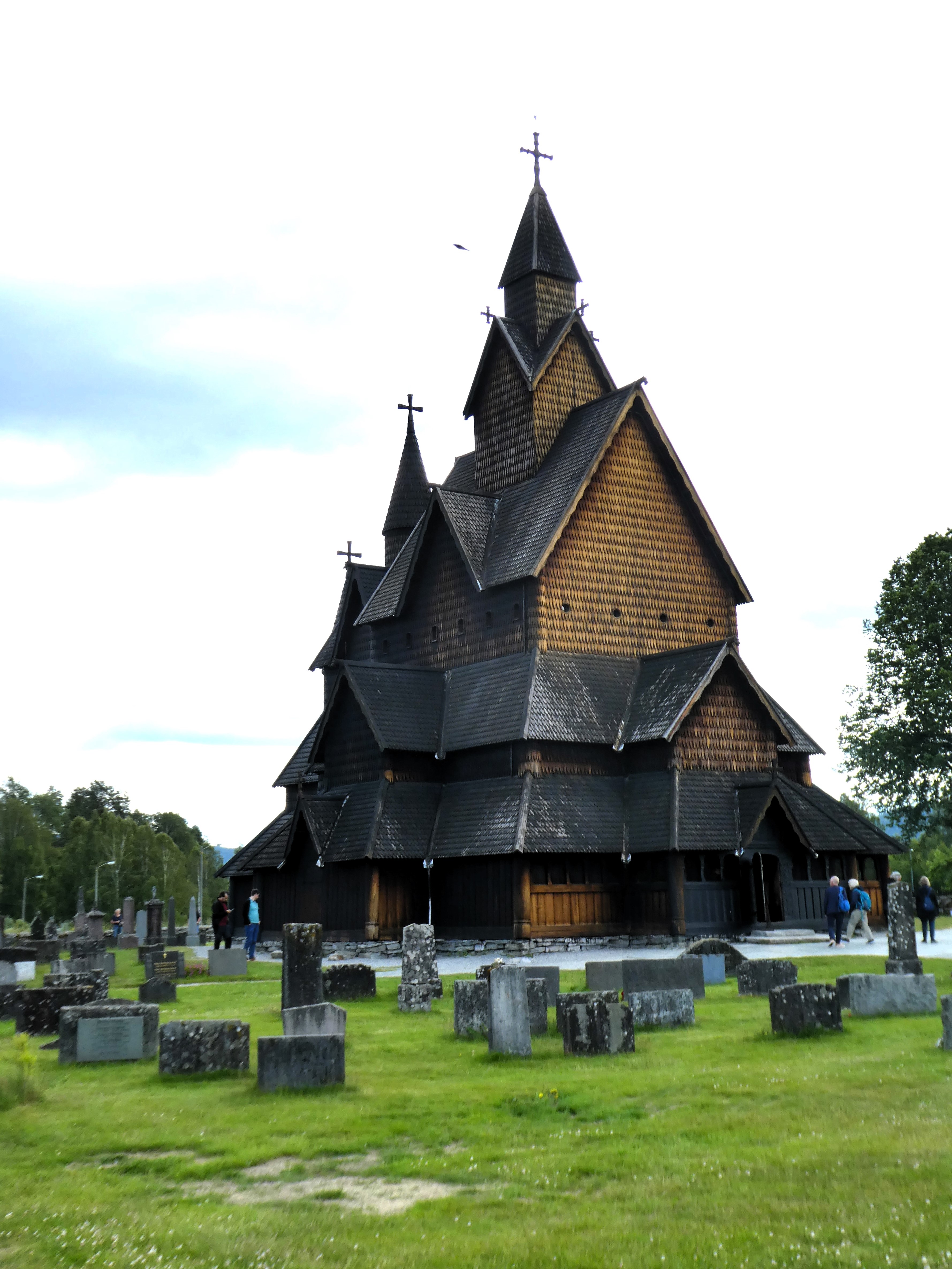
Heddal Stave Church is a World Heritage site. It was renowned as the best stave church in Norway. It was certainly fascinating.
Beautiful with a lot of the original detail and good explanation. There was also a small museum and a coffee shop that only sold coffee and cake. We were hoping for lunch but would have to wait.


We spent time taking it all in before cycling back to the industrial town of Notodden. Here we found the Eydd restaurant in the centre of town.

A popular spot, we had a buffet lunch for 210NOK (£15). The food on offer was of great variety fish, meat, chicken, and vegetables. We had one or two helpings of hearty hot and cold food. We followed it with a couple of helpings of dessert and coffee. This sustained us on our ride home and well into the evening.
Back at the camp site, Graham was encouraged by others swimming in the mud. He ventured out again and went far enough to swim above but not entirely free from the mud. Not a pleasant experience!
We had a light supper before it grew dark on a beautiful sunny evening before going to bed.
Day 35 – Lystang to Sindal (DK)
Friday 20th June
Another lovely morning. We enjoyed breakfast by the lake and watched an otter swim on the lake in front of us. We eventually left the site around 11am.
We took a back road to the town of Skien. We parked and had coffee in a retail centre. The sun was shining brightly and it was getting hot.


Skein was on the eastern end of the Telemark Canal that connected Oslo to the fjords to the west.
The legacy of dockyards and shipping was all around us. We looked at the enormous lock that managed the harbour basin and constituted the start of the canal to Dalin, and the legacy of warehouses being converted to flats and offices
There were also sculptures reflecting its nautical history.

On our way to the ferry at Kristiansand, we stopped at a service area to have lunch by a lake that was hidden away behind the car park.
After lunch we continued to Grimstad, a little seaside resort, to the east of the Kristiansand. It had a small beach and several areas of pontoons with small motor boats.
We walked along the front in the hot sunshine and had an ice cream. We then walked up to a lookout. It overlooks the archipelago of islands that we would pass through on the ferry this evening.
.
We visited the large town church which held well over 1,000 people. It had replaced a smaller church built in the mid-19th century which had held 500 people.

In the church there were three girls were practicing Abba songs for a concert later that weekend. Bizarre !
We walked back through the touristy town centre with its smart shops and eateries. It reminded us of English resorts like Salcombe and St Mawes. Then we drove on to the ferry port at Kristiansand.
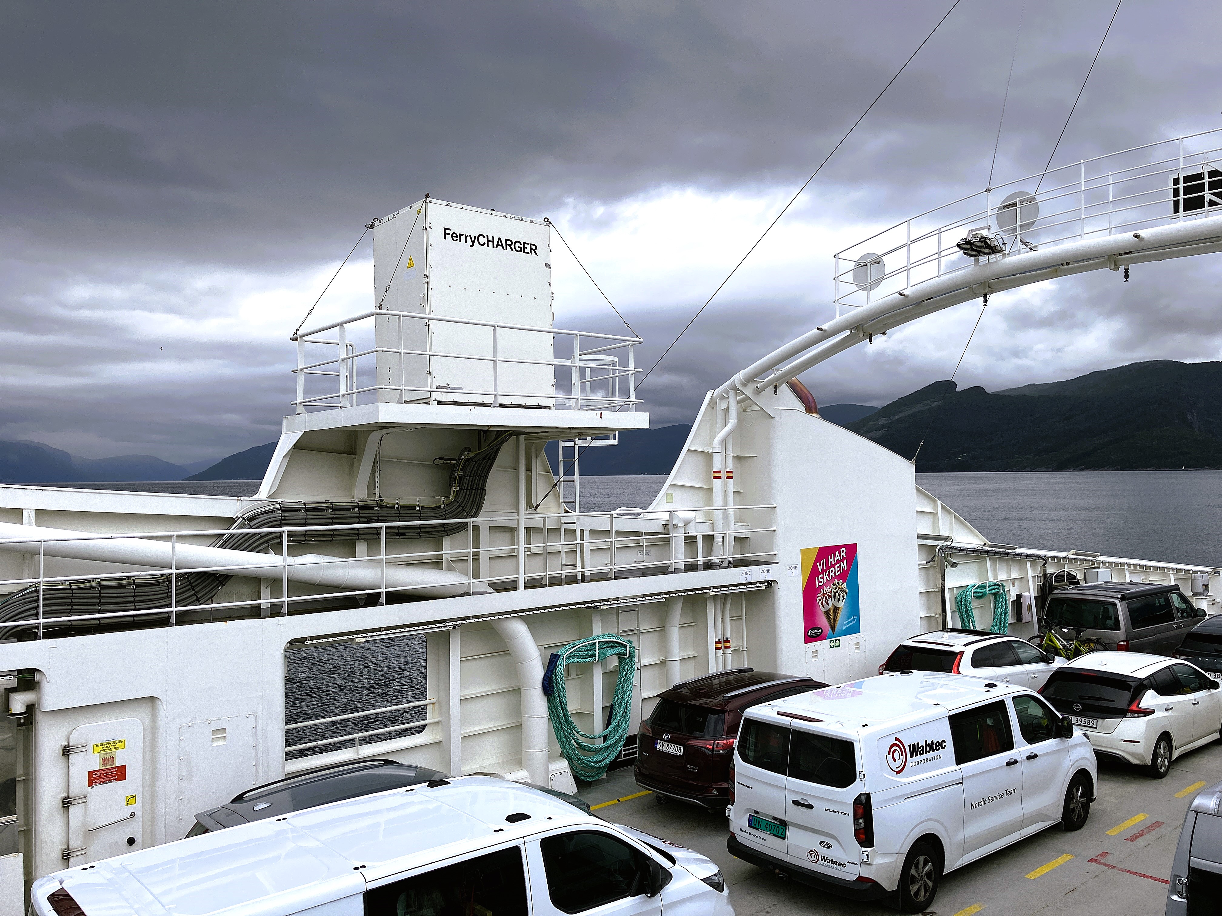
Whilst booking on to the ferry the height of the van was queried and measured. They decided it was too tall for the car decks. We had to pay an extra €27 for it to go below!

The ferry was a huge twin hulled boat painted a deep red which gave it a sinister appearance. However, once we were on board, the fast two-hour journey to Hirtshals began. In Denmark we left Hirtshals and were quickly located the P4N site near Sindal a few miles away.
The site was in a car park in an area of ancient woodland and parkland. The car park was equipped with a heated toilet and wash area.
Although there were several camper vans in this or an adjacent car park but there was plenty of room and we weren’t aware of them. There were however, some loud local teenagers enjoying the warm summers evening but they soon went when it got dark.
We were left in peace to put up the roof. Soon, as it quietened down, we slept.
Day 36 Sindal to Fickmoulen (DE)
Saturday 21st July
We knew today was going to be a long drive. So, we picked up some bread and iced buns from the bakery in Sindal. We returned to the edges of the woods where we had camped. There, we had breakfast. Then, we set off south on the main E39.
It was very busy, and with road works and heavy traffic. We faced several hold ups. It was a relief to leave the main road and head south-west, through Brunsbuttel and to the ferry at Gluckstadt.


The ferries were busy but the thirty-minute wait soon passed watching the ducks and geese on the shoreline and the ferries coming and going across to Wischafen.
The ferry went diagonally across the river. It avoided the enormous tankers heading in and out of Hamburg. Then, it slipped into the shallow muddy terminal on the west bank.
Having disembarked we headed south to Fickmoulen. Here we looked at the car park in the wood we were hoping to camp in later. It was fine. We headed west to the coast and Wremen.
It was a lovely hot evening and we ate at Wremen Fischerstube.
This was the fish restaurant we had eaten at previously on our trip around the Baltic. It was run by two Bosnians, who were delighted that we had eaten there before and had been to Bosnia in the past.
After eating we walked north along by the mud flats as the sun sank in the sky. The light was delightful and hay was being harvested from the fields by the waterside.


Janet followed the fields further up river. Meanwhile, Graham nostalgically paddled in mud which got wetter as the tide came in.
Our wooded car park camping spot was empty when we got there. We went to sleep with the front of the roof open looking through the trees to the moonlight.
Day 37 – Fickmoulden to Houthulst
Sunday 22nd June
Awoke to birdsong and an annoying hum which we never worked out what it was.
Around 8am dog walkers started to arrive in the car park so we took an historical trail through the woods. It identified various ancient tombs in a historic burial site and made us feel more comfortable being there.
We had some breakfast. Then, we headed south and west, avoiding Bremerhaven, to Oldenburg. We faced the prospect of another long drive ahead of us.
En route into the Netherlands at Bunde we turned west towards Groningen. We leave the main road at Bad Nieuweschans. We find a bird watching area on the River Ems estuary in the Dollard area at Nieuwe Statenjiul.
There were very few cars there but lots of cyclists and an enormous lock gate. This was on the border between Germany and the Netherlands. Information about the interesting birds and the sluice gate structures were described in both German and Dutch.
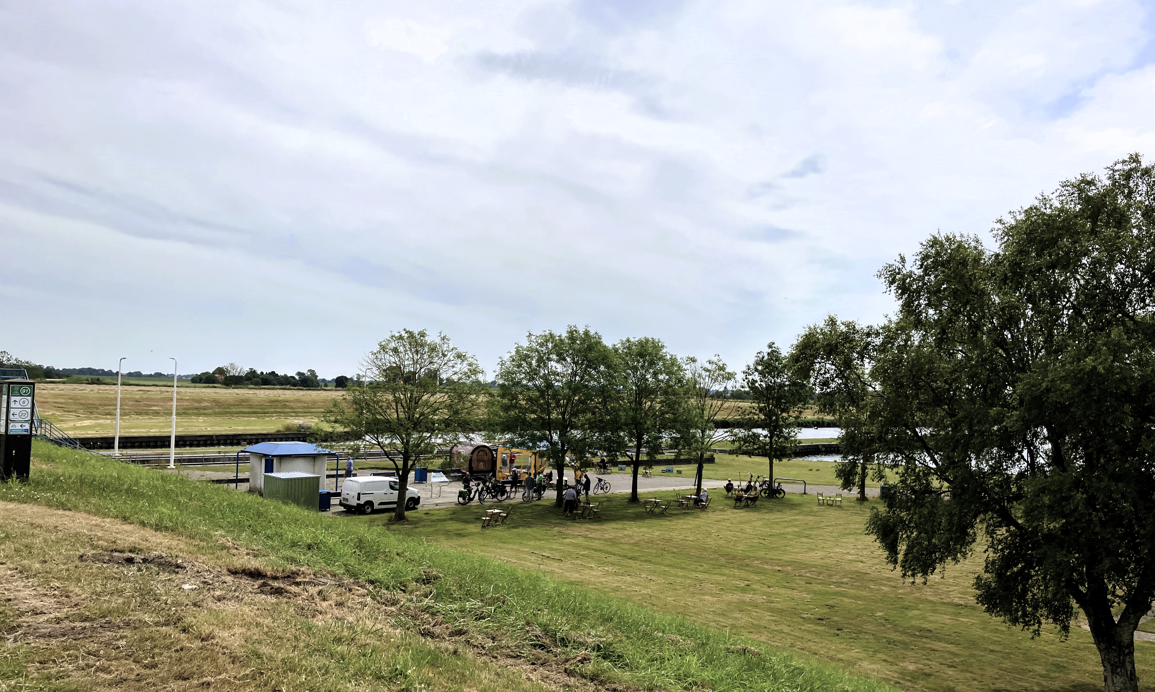
Amongst the tall reed beds was an enormous bird hide. It towered high above the muddy waters. A raised walkway provided access to it. It was lovely walking out there. We spent time identifying shellduck, godwit, black headed and black backed gulls. We also spotted tern, curlew, martins, swallows, red shank, avocet, oyster catcher, dunlin, stint, and plover.
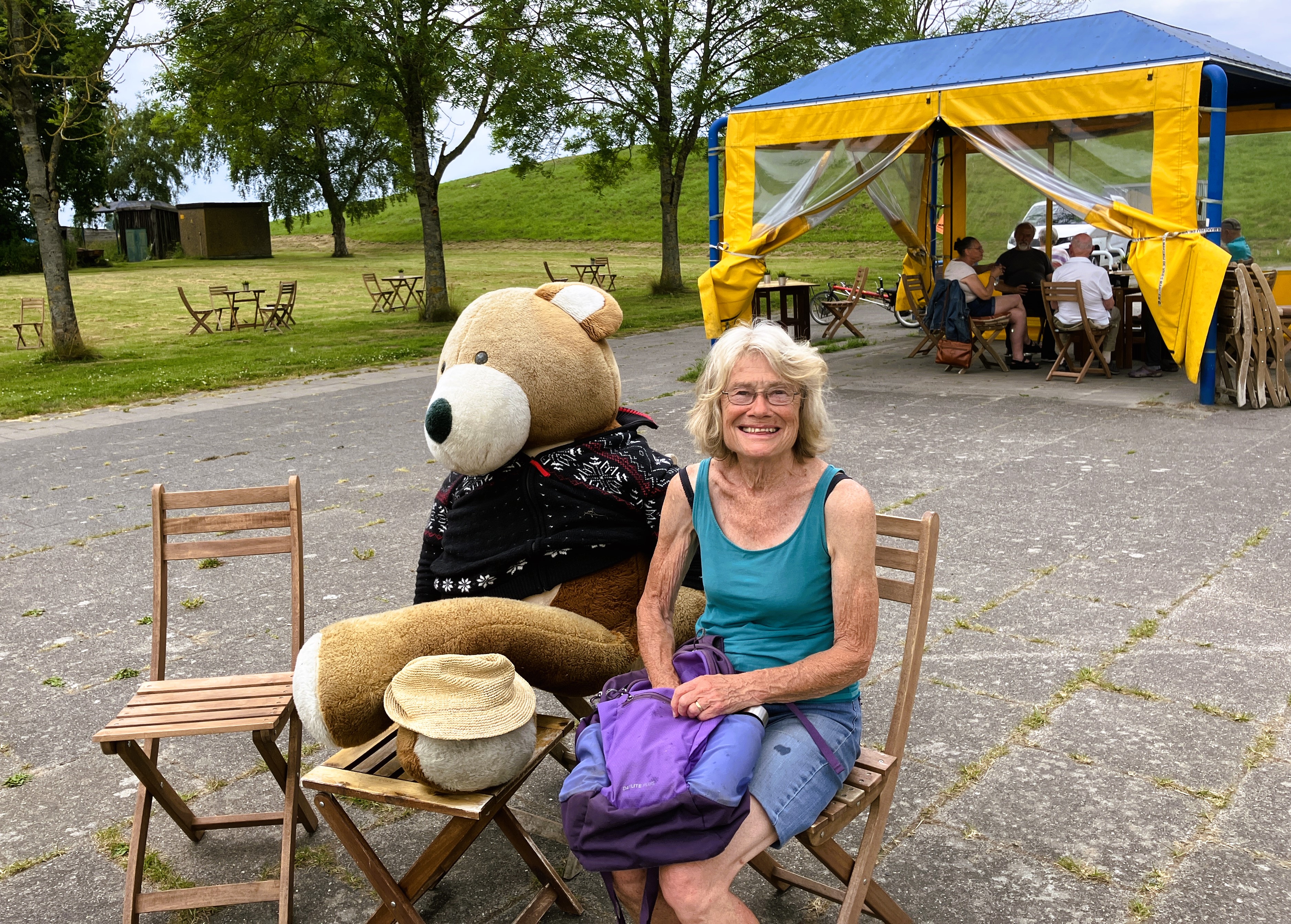

We walked back to the sluice gate where there was a café. After coffee sitting with a big teddy bear at a cafe, we had some bread and cheese in the van. The bear kept Janet’s hat on his lap as we left!
Our journey took us through the Dutch countryside. We admired its huge farm houses. Then, we went back onto the busy Dutch motorway network.
We headed west, ever homeward, looking for a place to stop for the night near Ypres. This would leave us with only a sixty-minute journey to Dunkerque in the morning.
As we travelled the warning light in the van indicated pressure loss in the front offside tyre. We stopped to check. We messed around with air pumps in various service areas for a while. We found there was no real loss of pressure. However, the rear tyres were worn.
We eventually reached our P4N spot an urban wooded car park at Houthulst.

It was well used by locals for dog walking and there was also a trim trail, a nature area and a military zone. The site included a 1944 World War 2 doodle bug flying bombs launch pad. This launch pad was aligned to target London.
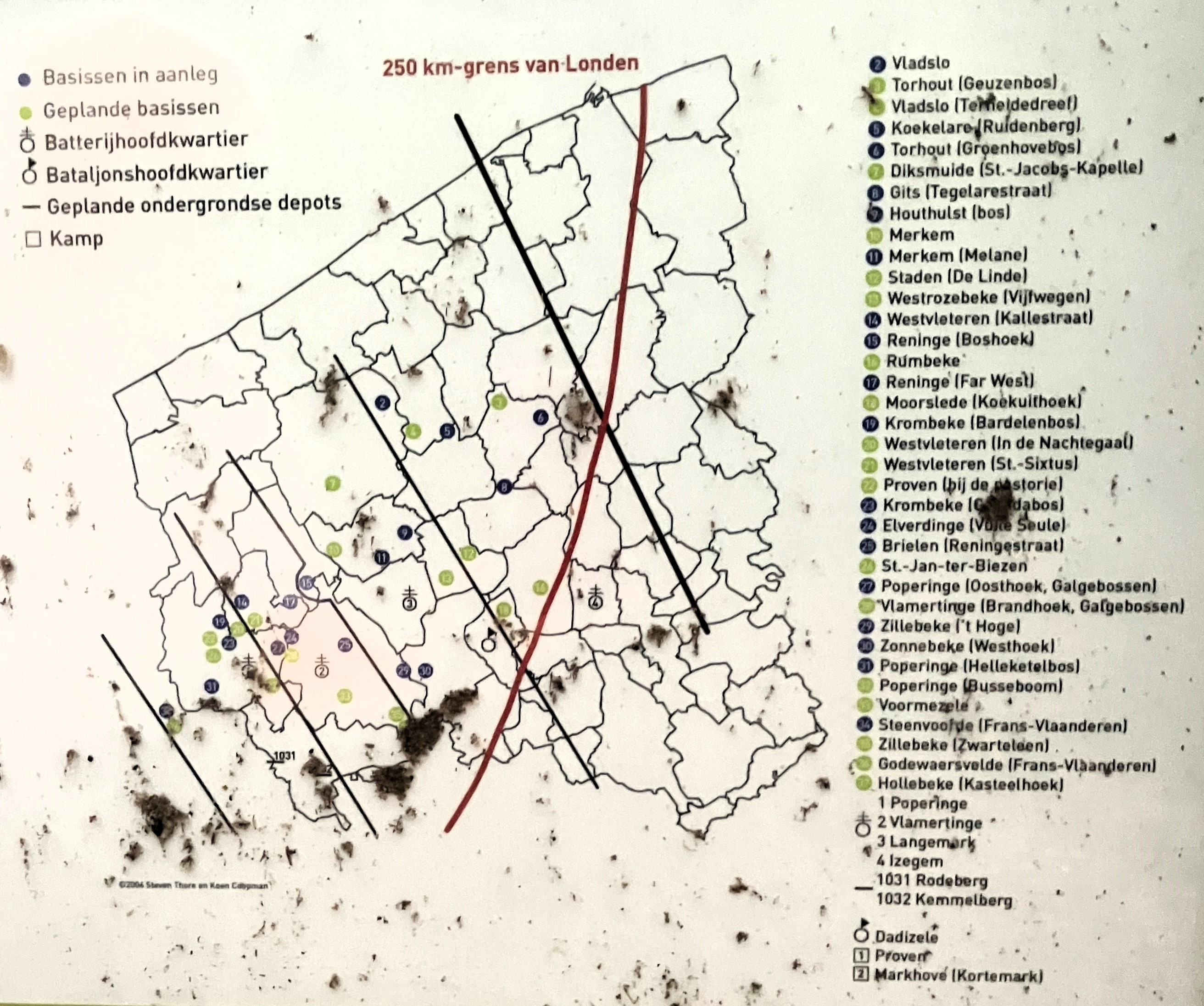

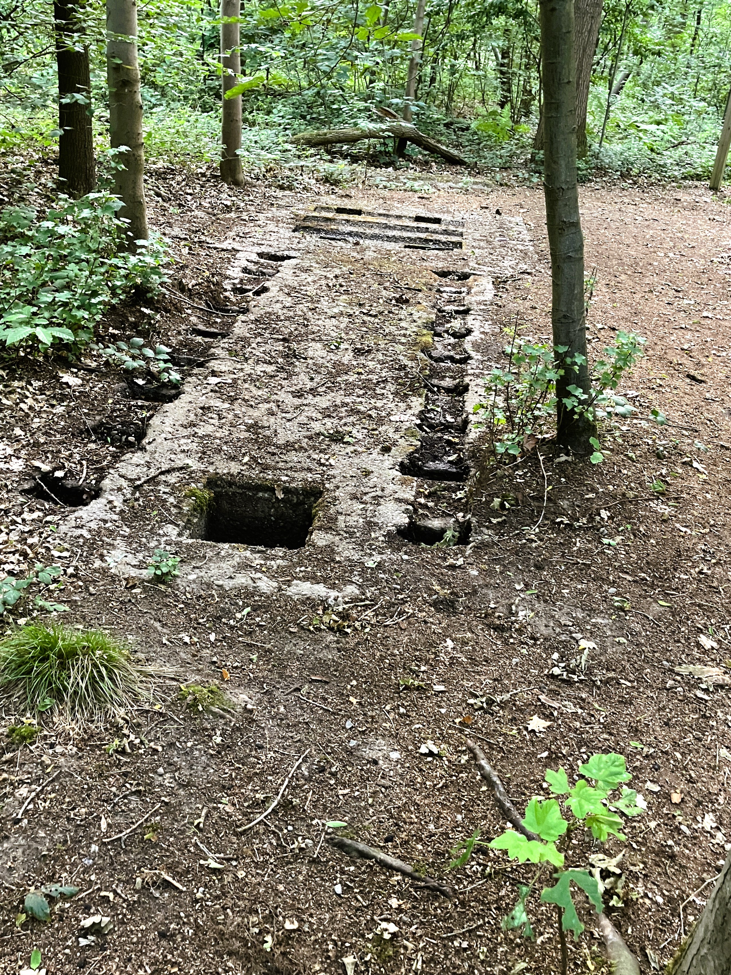
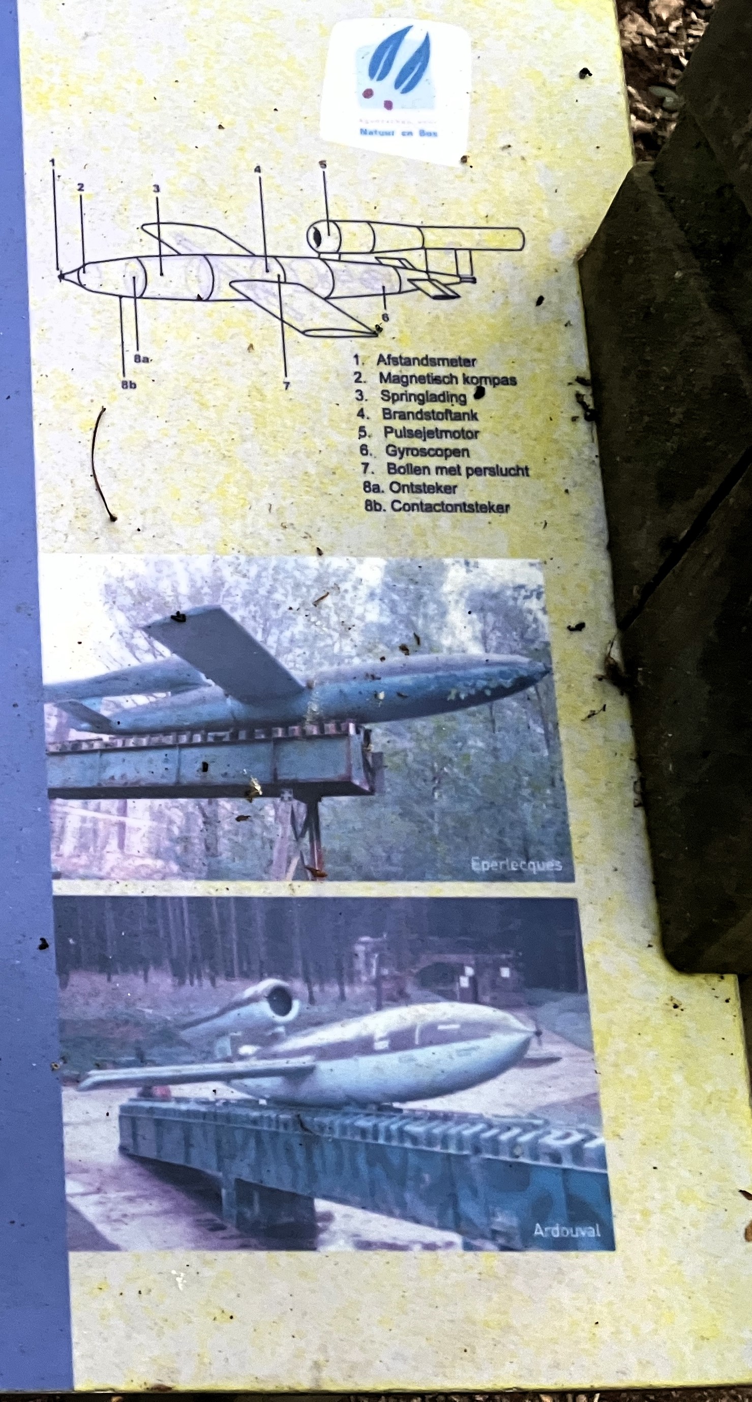
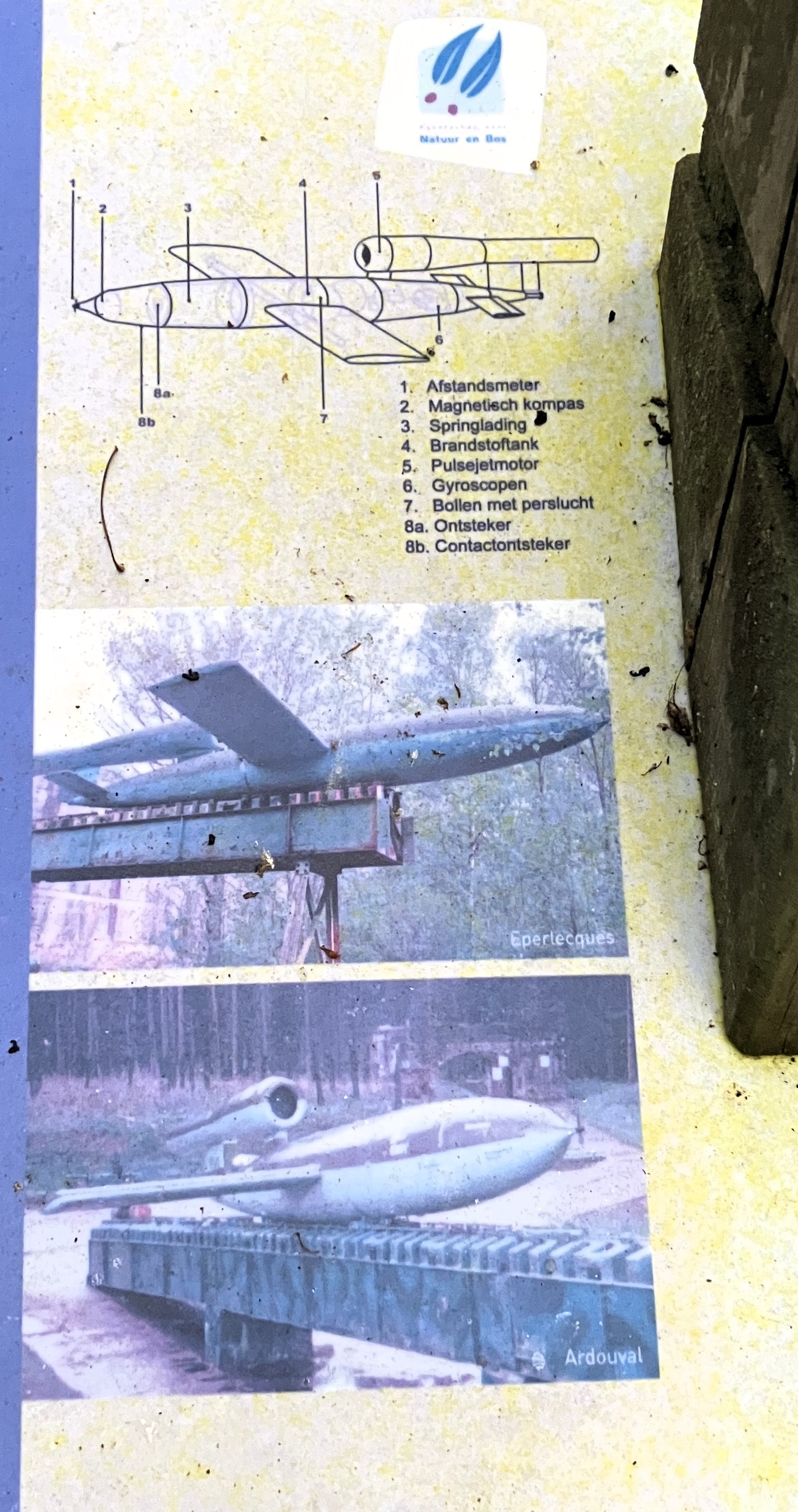
After something to eat we walked into the town and found a Grotto. It was the first cave founded in France in 1860 in honour of Our Lady of Lourdes. The open cave had statues, candles, lights and flowers and a place to purchase candles. In front of the cave there were chairs set out in arcs.
In the gloom it really stood out as somewhere special. We gathered from newspaper cuttings that a young man from the town visiting the grotto at Lourdes had somehow caused a fire. The fire damaged the grotto. The citizens of Houthoust were so mortified that they felt they had to give penance by dedicating their grotto to Our Lady.
Martin phoned us. We had been coming home early to meet Martin and Fin who had been staying in Cornwall. He said he had to get home the next day. He would be leaving Veryan in the morning but would meet us somewhere near Folkestone.
Day 38 – Houthoust to Home (UK)
Monday 23rd June
We slept badly. We knew we had to be up early to get the 8am ferry. We needed to get into the UK to meet up with Martin. We were up at 5.30 and easily caught the ferry from Dunkerque.

The ferry was full of over 100 excited French teenagers which made for a lively, happy interesting journey. We had arranged to meet Martin at 11am. To kill time, we went to the NT White Cliffs visitor centre. Then, we walked along the cliffs.
The site was spectacular. There were so many flowers and butterflies. We also had an amazing view into the port at Dover and across the Channel.

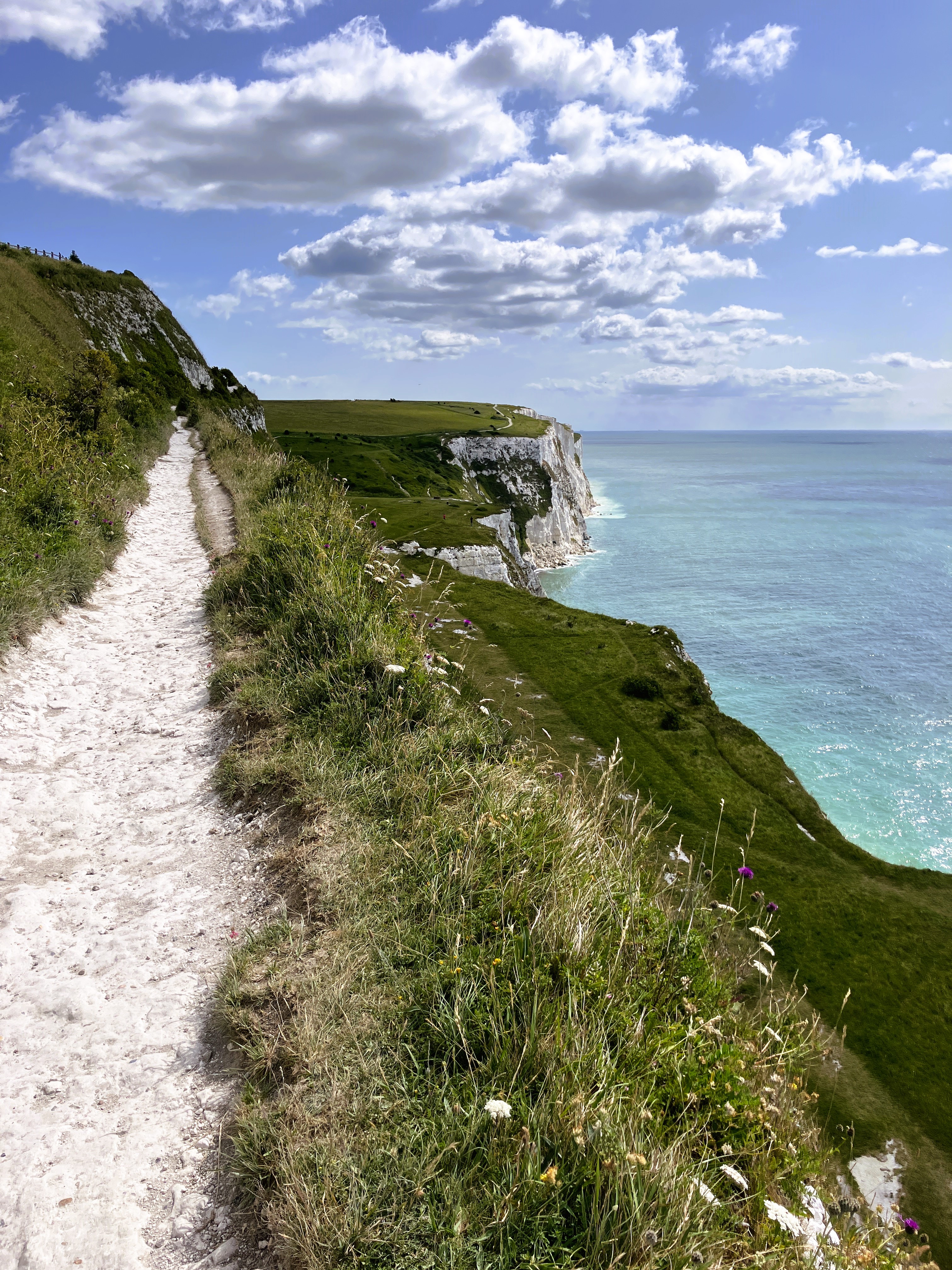
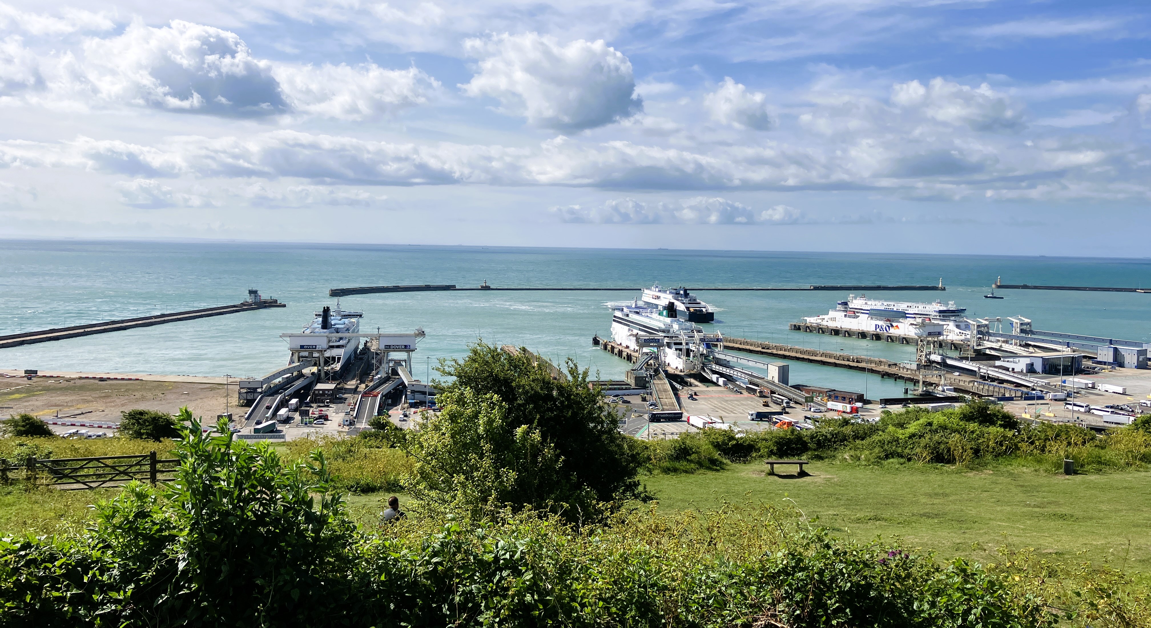
Martin and Finn were waiting for us at Brockhill Country Park a few miles west of the channel tunnel entrance. It was lovely to see them. We chatted and found out what they had and would be doing over the summer. They left us around midday to head to the Channel Tunnel on their way home. So did we.
We changed drivers at the Feathers café, which is part of the Hawk Conservation Trust. It is a fascinating place just off the A303 before Amersbury.
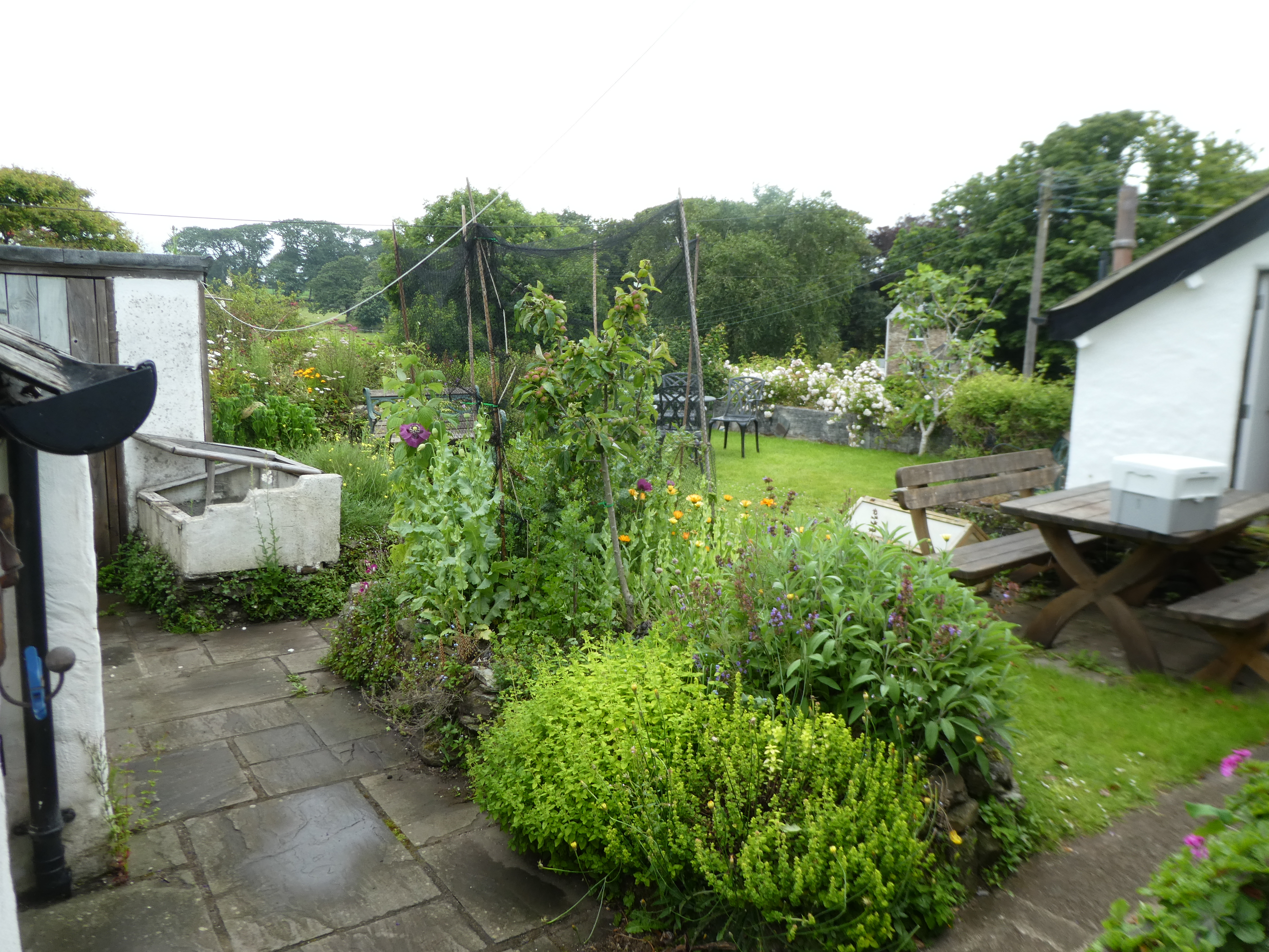
We continued travelling and realised our worn tyres would not get us home. The tyre was breaking up. We reached KwikFit in Exeter just before they closed. Luckily they had tyres and were able and willing to change them. We drove the rest of the journey in sunshine arriving home around 7.30.
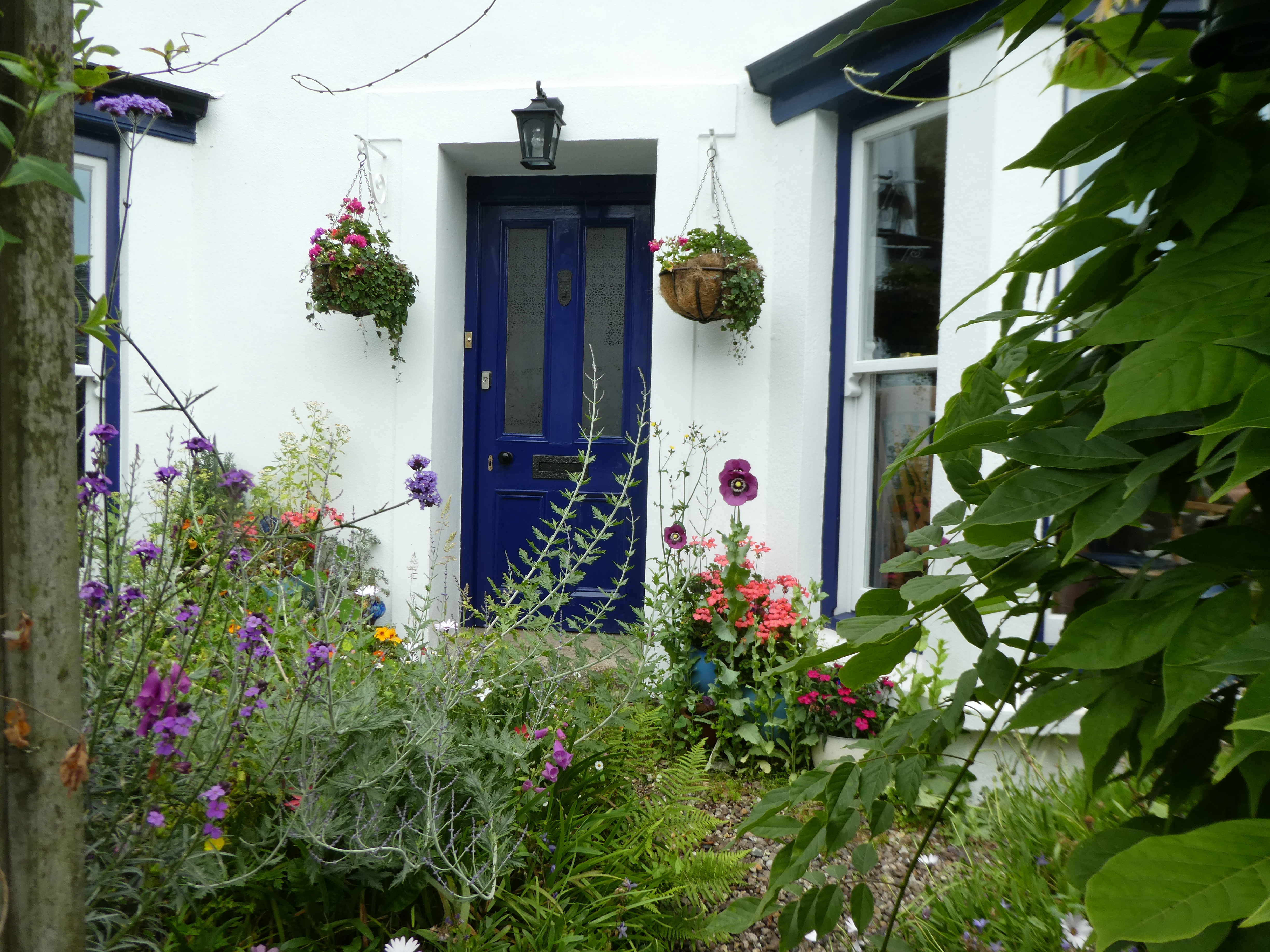
Unpacked the van and acclimatise to home and a very wild garden.
We have travelled 5484 miles through seven different countries on 9 ferries through tunnels and across bridges.
